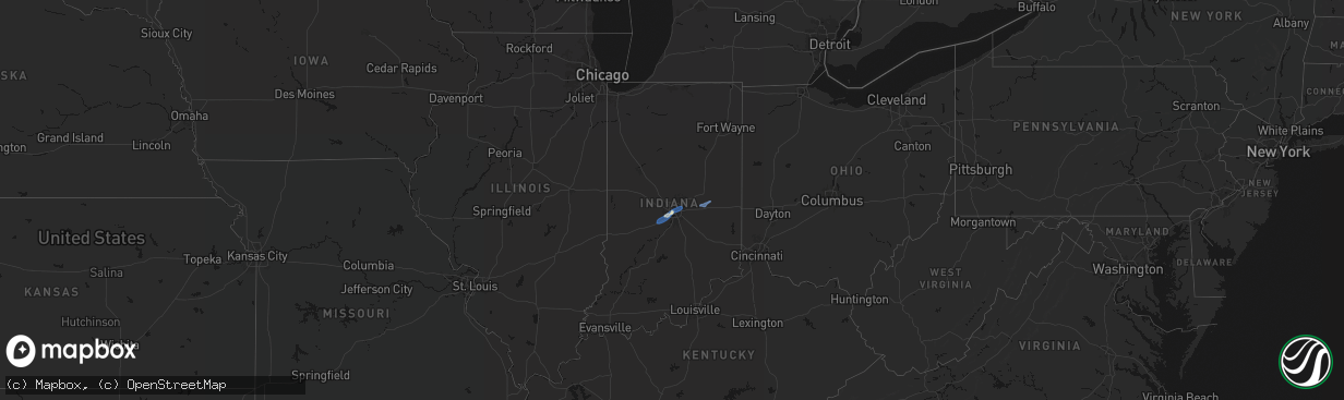
Hail Map in Indiana on April 24, 2026
The weather event in Indiana on April 24, 2026 includes Hail, Wind, and Tornado maps. 8 states and 414 cities were impacted and suffered possible damage. The total estimated number of properties impacted is 0.
Hail
Wind
Tornado
0
Estimated number of impacted properties by a 1.00" hail or larger0
Estimated number of impacted properties by a 1.75" hail or larger0
Estimated number of impacted properties by a 2.50" hail or largerStorm reports in Indiana
Indiana
| Date | Description |
|---|---|
| 04/24/20264:44 PM CDT | Multiple trees and power poles and lines down in henry county. Damage focused from shirley to kennard. Time estimated from radar. |
| 04/24/20263:45 PM CDT | Trees reported on multiple houses near northside of indianapolis. Time estimated from radar. |
| 04/24/20263:44 PM CDT | Several reports of wind damage and or downed trees from military park and iu indy campus to east side of downtown and into near northside. Time estimated from radar. |
| 04/24/20263:44 PM CDT | Tree downed at 16th street and montcalm. Time estimated from radar. |
| 04/24/20263:40 PM CDT | *** 1 inj *** numerous trees down... Multiple trees on trailer homes with one injury. Time estimated from radar. |
| 04/24/20263:40 PM CDT | Trees down on multiple homes west side of indianapolis. Time estimated from radar. |
| 04/24/20263:37 PM CDT | A local report indicates 59 MPH wind near Indianapolis Int'l Airp |
| 04/24/20263:37 PM CDT | Fedex semi trailer flipped... Numerous cargo containers lofted onto high school road. Time estimated from asos observation. |
| 04/24/20263:14 PM CDT | Semi truck blown over. |
All States Impacted by Hail Map on April 24, 2026
Cities Impacted by Hail Map on April 24, 2026
- Konawa, OK
- Lexington, OK
- Wanette, OK
- Lindsay, OK
- Byars, OK
- Elmore City, OK
- Pauls Valley, OK
- Maysville, OK
- Foster, OK
- Sasakwa, OK
- Ada, OK
- Asher, OK
- Stratford, OK
- Whitefield, OK
- Stigler, OK
- Clayton, IN
- Mooresville, IN
- Monrovia, IN
- Plainfield, IN
- Camby, IN
- Indianapolis, IN
- Allen, OK
- Holdenville, OK
- Wynnewood, OK
- Davis, OK
- Yazoo City, MS
- Kinta, OK
- Calvin, OK
- Mccurtain, OK
- McCarley, MS
- Winona, MS
- Keota, OK
- Stonewall, OK
- Stuart, OK
- Centrahoma, OK
- Bokoshe, OK
- Duck Hill, MS
- Kilmichael, MS
- Sterlington, LA
- Hartshorne, OK
- Sulphur, OK
- Webbers Falls, OK
- Porum, OK
- Vian, OK
- Wister, OK
- Fitzhugh, OK
- Coalgate, OK
- Tupelo, OK
- Roff, OK
- Shady Point, OK
- Stewart, MS
- Redwood, MS
- Tinsley, MS
- Mcalester, OK
- Sallisaw, OK
- Haileyville, OK
- Wilkinson, IN
- Greenfield, IN
- Wilburton, OK
- Charlottesville, IN
- Knightstown, IN
- Shirley, IN
- New Castle, IN
- Kennard, IN
- Flowood, MS
- Pearl, MS
- Jackson, MS
- Mill Creek, OK
- Eupora, MS
- Richland, MS
- Satartia, MS
- Wardville, OK
- Smithville, OK
- Tuskahoma, OK
- Bentonia, MS
- Kiowa, OK
- Talihina, OK
- Seminole, OK
- Tishomingo, OK
- Pittsburg, OK
- Blanco, OK
- Howe, OK
- Poteau, OK
- Muldrow, OK
- Gans, OK
- Watson, OK
- Cameron, OK
- Vicksburg, MS
- Earlsboro, OK
- Spiro, OK
- Heavener, OK
- Brandon, MS
- Milburn, OK
- Stringtown, OK
- Daisy, OK
- Wapanucka, OK
- Wewoka, OK
- Bolton, MS
- Flora, MS
- Terry, MS
- Crystal Springs, MS
- Lena, MS
- Hodgen, OK
- Pelahatchie, MS
- Clayton, OK
- Coleman, OK
- Atoka, OK
- Pocola, OK
- Fort Smith, AR
- Arkoma, OK
- Greenwood, AR
- Antlers, OK
- Emerson, AR
- Florence, MS
- Madison, MS
- Snow, OK
- Caney, OK
- Caddo, OK
- Kenefic, OK
- Hatfield, AR
- Mena, AR
- Morton, MS
- Waldron, AR
- Hope, AR
- Forest, MS
- Hartford, AR
- Edwards, MS
- Union, MS
- Carthage, MS
- Philadelphia, MS
- Walnut Grove, MS
- Sebastopol, MS
- Conehatta, MS
- Nashoba, OK
- Bennington, OK
- Lane, OK
- Ridgeland, MS
- Tougaloo, MS
- Rattan, OK
- Braxton, MS
- Mendenhall, MS
- Pulaski, MS
- Durant, OK
- Finley, OK
- Boswell, OK
- Lake, MS
- Broken Bow, OK
- Honobia, OK
- Bogue Chitto, MS
- Bokchito, OK
- Lawrence, MS
- Ringold, OK
- Soper, OK
- Hugo, OK
- Newton, MS
- Raleigh, MS
- Clinton, MS
- Brookhaven, MS
- Ruth, MS
- Rosston, AR
- Emmet, AR
- Buckner, AR
- Arthur City, TX
- Sumner, TX
- Collinsville, MS
- De Kalb, MS
- Preston, MS
- Willisville, AR
- Waldo, AR
- Bethel, OK
- Decatur, MS
- Newellton, LA
- Cache, OK
- Utica, MS
- Monticello, MS
- Valliant, OK
- Powderly, TX
- Paris, TX
- Lawton, OK
- Jayess, MS
- Faxon, OK
- Brookston, TX
- Louin, MS
- Sontag, MS
- Saint Joseph, LA
- Geronimo, OK
- Grannis, AR
- Wickes, AR
- Rose Hill, MS
- Silver Creek, MS
- Bay Springs, MS
- Taylorsville, MS
- Scooba, MS
- Pachuta, MS
- Petty, TX
- Blossom, TX
- Pattonville, TX
- Deport, TX
- Roxton, TX
- Walters, OK
- Paulding, MS
- Prentiss, MS
- Honey Grove, TX
- Newhebron, MS
- Hickory, MS
- Mount Olive, MS
- Bogata, TX
- Vossburg, MS
- Quitman, MS
- Enterprise, MS
- Magee, MS
- Port Gibson, MS
- Harrisville, MS
- Hazlehurst, MS
- Meridian, MS
- Haworth, OK
- Oak Vale, MS
- Shubuta, MS
- Stonewall, MS
- Mize, MS
- Eagletown, OK
- Detroit, TX
- Wesson, MS
- Georgetown, MS
- Cooper, TX
- Lake Creek, TX
- Ben Franklin, TX
- Enloe, TX
- Clayton, LA
- Waterproof, LA
- Ferriday, LA
- Pinola, MS
- Pattison, MS
- Liberty, MS
- Smithdale, MS
- Natchez, MS
- Sulphur Bluff, TX
- Talco, TX
- Melvin, AL
- Gilbertown, AL
- Waynesboro, MS
- Butler, AL
- Needham, AL
- Fayette, MS
- Ladonia, TX
- Pecan Gap, TX
- Commerce, TX
- Klondike, TX
- Stringer, MS
- Lorman, MS
- Foreman, AR
- Mount Vernon, TX
- Cumby, TX
- Sulphur Springs, TX
- Toxey, AL
- Ashdown, AR
- Lisman, AL
- Dike, TX
- Saltillo, TX
- Laurel, MS
- Heidelberg, MS
- Greenville, TX
- Mount Pleasant, TX
- Benton, LA
- Quinlan, TX
- Lone Oak, TX
- Campbell, TX
- Haughton, LA
- Cotton Valley, LA
- Thomasville, AL
- Campbell, AL
- Sweet Water, AL
- Jachin, AL
- York, AL
- Cuba, AL
- Toomsuba, MS
- Lauderdale, MS
- Ward, AL
- Pennington, AL
- Linden, AL
- Demopolis, AL
- Bellamy, AL
- Livingston, AL
- Winfield, TX
- Dixons Mills, AL
- Magnolia, AL
- Gallion, AL
- Thomaston, AL
- Texarkana, TX
- Point, TX
- Emory, TX
- Pittsburg, TX
- Brashear, TX
- Leesburg, TX
- Scroggins, TX
- Alba, TX
- Carson, MS
- Gilmer, TX
- Union Church, MS
- Bassfield, MS
- Yantis, TX
- Greenville, MS
- Magnolia, AR
- Edgewood, TX
- Columbia, MS
- Ore City, TX
- Big Sandy, TX
- Winnsboro, TX
- Hawkins, TX
- El Dorado, AR
- Sumrall, MS
- Longview, TX
- Gladewater, TX
- White Oak, TX
- Leland, MS
- Wills Point, TX
- Fruitvale, TX
- Quitman, TX
- Mineola, TX
- Grand Saline, TX
- Diana, TX
- Plain Dealing, LA
- Hallsville, TX
- Terrell, TX
- Winona, TX
- Tyler, TX
- Marion, LA
- Hattiesburg, MS
- Purvis, MS
- Princeton, LA
- Tatum, TX
- Marshall, TX
- Beckville, TX
- Bastrop, LA
- Kilgore, TX
- Overton, TX
- Glen Allan, MS
- Carthage, TX
- Monroe, LA
- Lindale, TX
- Van, TX
- Collinston, LA
- De Berry, TX
- Rayville, LA
- Oak Ridge, LA
- Whitehouse, TX
- Pioneer, LA
- Epps, LA
- Selman City, TX
- Troup, TX
- Rolling Fork, MS
- Canton, TX
- Mayersville, MS
- Henderson, TX
- Long Branch, TX
- Tallulah, LA
- Mount Enterprise, TX
- Gary, TX
- Garrison, TX
- Murchison, TX
- Ben Wheeler, TX
- Athens, TX
- Timpson, TX
- Brownsboro, TX
- Center, TX
- Tenaha, TX
- Larue, TX
- Chandler, TX
- Shelbyville, TX
- Canton, MS
- Palestine, TX
- Frankston, TX
- Zwolle, LA
- Many, LA
- Jacksonville, TX
- Florien, LA
- Elkhart, TX
- Seminary, MS
- Anacoco, LA
- Grapeland, TX
- Norwood, LA
- Saint Francisville, LA
- Leesville, LA
- Rusk, TX
- Crockett, TX
- Welsh, LA
- Jennings, LA
- Roanoke, LA
- Poplarville, MS
- Opelousas, LA
- Arnaudville, LA
- Sunset, LA
- Morse, LA
- Mermentau, LA
- Darrow, LA
- Gonzales, LA
- Estherwood, LA
- Saint Martinville, LA
- Saucier, MS
- Perkinston, MS
- Gulfport, MS
- Long Beach, MS
- Kenner, LA
- Destrehan, LA
- Westwego, LA
- Norco, LA
- Ama, LA
- Marrero, LA
- Saint Rose, LA
- New Orleans, LA
- Harleton, TX
- Jonesboro, AR
- State University, AR
- Beaverton, MI


