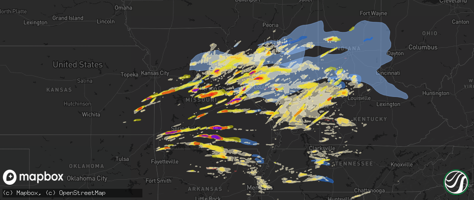
Hail Map on April 27, 2026
The weather event on April 27, 2026 includes Hail, Wind, and Tornado maps. 15 states and 2,084 cities were impacted and suffered possible damage. The total estimated number of properties impacted is 775,503.
Hail
Wind
Tornado
775,503
Estimated number of impacted properties by a 1.00" hail or larger139,002
Estimated number of impacted properties by a 1.75" hail or larger29,970
Estimated number of impacted properties by a 2.50" hail or largerStates Impacted by Hail Map on April 27, 2026
Storm reports
Iowa
| Date | Description |
|---|---|
| 04/27/20264:31 PM CDT | A local report indicates 1.00 inch wind near 1 N Lourdes |
Mississippi
| Date | Description |
|---|---|
| 04/27/20266:02 AM CDT | Quarter sized hail near paris... Ms. |
| 04/26/20269:23 PM CDT | 1 inch hail falling in hickory flat. |
Missouri
| Date | Description |
|---|---|
| 04/27/20266:58 PM CDT | Report from mping: quarter |
| 04/27/20266:58 PM CDT | Quarter size hail. |
| 04/27/20266:56 PM CDT | Report from mping quarter 1.00 in. |
| 04/27/20266:54 PM CDT | Report from mping: hen egg |
| 04/27/20266:54 PM CDT | A local report indicates 2.00 inch wind near Solo |
| 04/27/20266:51 PM CDT | A local report indicates 1.50 inch wind near 3 N Simmons |
| 04/27/20266:51 PM CDT | A local report indicates 3.00 inch wind near Elk Creek |
| 04/27/20266:50 PM CDT | Large tree limb down in ava. |
| 04/27/20266:48 PM CDT | Report from mping: half dollar |
| 04/27/20266:48 PM CDT | Estimated wind coupled with golf ball-sized hail. |
| 04/27/20266:48 PM CDT | A local report indicates 1.50 inch wind near 4 ENE Brushyknob |
| 04/27/20266:46 PM CDT | A local report indicates 1.75 inch wind near 1 ENE Gray Summit |
| 04/27/20266:45 PM CDT | A local report indicates 2.00 inch wind near Brushyknob |
| 04/27/20266:45 PM CDT | Tree completely blocking the roadway. |
| 04/27/20266:45 PM CDT | Large tree down on thornton rd. |
| 04/27/20266:45 PM CDT | 3 trees down at highway 100 and thornton rd. |
| 04/27/20266:45 PM CDT | Large tree down on bassett rd. |
| 04/27/20266:45 PM CDT | A 24-inch tree was uprooted and smashed into a pickup truck. |
| 04/27/20266:45 PM CDT | Time estimated. |
| 04/27/20266:45 PM CDT | Tree completely blocking the roadway. |
| 04/27/20266:45 PM CDT | A local report indicates 2.50 inch wind near 3 E Solo |
| 04/27/20266:44 PM CDT | Report from mping: quarter |
| 04/27/20266:42 PM CDT | A local report indicates 2.50 inch wind near 5 W Drury |
| 04/27/20266:41 PM CDT | Spotter reporting 1 inch hail in ava near hwy 14 and ff. |
| 04/27/20266:40 PM CDT | Large tree blocking the road at webber creek rd and camp mo val rd. Time estimated. |
| 04/27/20266:39 PM CDT | A local report indicates 1.25 inch wind near 2 NNE O'Fallon |
| 04/27/20266:37 PM CDT | A local report indicates 1.00 inch wind near 4 NW Saint Peters |
| 04/27/20266:36 PM CDT | Report from mping: half dollar |
| 04/27/20266:36 PM CDT | Larger size branches down and tree uprooted. |
| 04/27/20266:35 PM CDT | A local report indicates 1.25 inch wind near 1 NNE O'Fallon |
| 04/27/20266:35 PM CDT | A local report indicates 1.00 inch wind near 2 WNW O'Fallon |
| 04/27/20266:35 PM CDT | Numerous hailstones measuring 2-inches by 4-inches. |
| 04/27/20266:30 PM CDT | Near mexico road and salt lick. |
| 04/27/20266:26 PM CDT | A local report indicates 1.25 inch wind near 2 S Gerald |
| 04/27/20266:25 PM CDT | A local report indicates 1.75 inch wind near 3 NNW Leslie |
| 04/27/20266:24 PM CDT | Report from mping: quarter |
| 04/27/20266:23 PM CDT | A local report indicates 1.00 inch wind near Warrenton |
| 04/27/20266:23 PM CDT | 2+ inch hail near bourbon elementary school. |
| 04/27/20266:20 PM CDT | Report from mping: tennis ball |
| 04/27/20266:20 PM CDT | Time estimated. |
| 04/27/20266:16 PM CDT | A local report indicates 3.00 inch wind near Bourbon |
| 04/27/20266:15 PM CDT | A local report indicates 1.75 inch wind near Bourbon |
| 04/27/20266:15 PM CDT | Tree down at champion city rd and red oak rd. Time estimated. |
| 04/27/20266:15 PM CDT | Pictures received. Time and size estimated. |
| 04/27/20266:15 PM CDT | Hail varied from pea-size to quarter-size. |
| 04/27/20266:12 PM CDT | Trooper out with a downed tree on highway 28 near columbia rd in pulaski county. |
| 04/27/20266:02 PM CDT | Ham operator reported quarter-sized hail at cooper hill. |
| 04/27/20265:55 PM CDT | Quarter sized hail in copper hill. Location and time estimated. |
| 04/27/20265:50 PM CDT | Tree down near highway 32 and highway b. |
| 04/27/20265:44 PM CDT | Report from mping golf ball. |
| 04/27/20265:38 PM CDT | A local report indicates 2.50 inch wind near 3 NE Meta |
| 04/27/20265:35 PM CDT | Time estimated. |
| 04/27/20265:32 PM CDT | Report from mping quarter size 1.00 inch. |
| 04/27/20265:31 PM CDT | Report from mping quarter. 1.00 inch. |
| 04/27/20265:30 PM CDT | A local report indicates 1.00 inch wind near 1 N Winfield |
| 04/27/20265:30 PM CDT | Spotter reporting a 3 foot diameter tree down in rogersville at white oak and bobcat road. |
| 04/27/20265:30 PM CDT | Golf ball sized hail reported by fire at 17:30 at the lebanon airport. No picture. |
| 04/27/20265:29 PM CDT | Delayed hail report. |
| 04/27/20265:26 PM CDT | Several trees and limbs down in rogersville. Some limbs took down powerlines. |
| 04/27/20265:18 PM CDT | From spotter estimated 1.00 inch hail. |
| 04/27/20265:18 PM CDT | Amateur radio report 1 foot diameter pine tree down at stanford and ranch. |
| 04/27/20265:18 PM CDT | Quarter to half dollar sized hail 3000 block e. Catalpa sgf. |
| 04/27/20265:18 PM CDT | A local report indicates 1.25 inch wind near 7 S Powell |
| 04/27/20265:15 PM CDT | Report from mping quarter hail of 1.00 in. |
| 04/27/20265:14 PM CDT | Report from mping - quarter |
| 04/27/20265:12 PM CDT | Report from mping half dollar size. |
| 04/27/20265:12 PM CDT | Quarter and golf ball size hail. |
| 04/27/20265:06 PM CDT | Tree and power line down over the roadway. |
| 04/27/20265:05 PM CDT | Powerline down at westview and kansas. |
| 04/27/20265:04 PM CDT | Report from mping quarter size hail of 1.00 in. |
| 04/27/20265:02 PM CDT | Report from mping ping pong ball size hail of 1.50 in. |
| 04/27/20265:00 PM CDT | 3 reports of trees into homes... 60 -70 mph winds and pea sized hail all in monett. |
| 04/27/20264:55 PM CDT | Large tree down. |
| 04/27/20264:54 PM CDT | Republic registered 67mph gust on south and southwest portion of city. Measured hail just over 1inch on west elm. Several trees down south of elm street. Two on houses. |
| 04/27/20264:45 PM CDT | A local report indicates 2.50 inch wind near Mount Vernon |
| 04/27/20264:42 PM CDT | Report from mping golf ball size hail. |
| 04/27/20264:40 PM CDT | Third round of quarter-sized hail. |
| 04/27/20264:36 PM CDT | Numerous reports of tennis ball size hail. |
| 04/27/20264:35 PM CDT | Two reports of trees down around hill top road. |
| 04/27/20264:34 PM CDT | Tree branch on the road... Almost all of road is blocked. |
| 04/27/20264:30 PM CDT | It was bigger than a quarter and smaller than a lime. |
| 04/27/20264:28 PM CDT | Corrects previous hail report from 3 n versailles. About 3 miles north versailles. Hail ranged from versailles 1 inch to 3.5 inch. |
| 04/27/20264:28 PM CDT | About 3 miles north versailles. |
| 04/27/20264:24 PM CDT | From spotter from joplin fire that lives on highway 97... Three miles south of i-44. Had approximately 2-3” hail just now at his house. |
| 04/27/20264:22 PM CDT | Nickle to quarter sized hail reported at i44 34 mm. |
| 04/27/20264:15 PM CDT | Several trees uprooted southeast of sarcoxie. |
| 04/27/20264:15 PM CDT | Heavy rain... Pea size hail... Sporadic quarter size hail... A few strong gusts of wind. |
| 04/27/20264:13 PM CDT | Several trees and limbs down in the southeast part of sarcoxie. |
| 04/27/20264:12 PM CDT | Powerlines down. |
| 04/27/20264:10 PM CDT | Second round of quarter-sized hail. |
| 04/27/20264:10 PM CDT | Picture received of hail with a quarter for reference. Time estimated. |
| 04/27/20264:10 PM CDT | Corrects previous tstm wnd dmg report from 1 e diamond. Newton county diamond fire units out on trees down and up rooted on j highway east of diamond near deputy drive. |
| 04/27/20263:59 PM CDT | A local report indicates 1.00 inch wind near 3 NW Rush Hill |
| 04/27/20263:57 PM CDT | Report from mping: quarter |
| 04/27/20263:55 PM CDT | A local report indicates 1.50 inch wind near 1 WNW Mexico |
| 04/27/20263:54 PM CDT | A local report indicates 1.00 inch wind near Syracuse |
| 04/27/20263:42 PM CDT | A local report indicates 2.00 inch wind near Mexico |
| 04/27/20263:36 PM CDT | Report from asos. |
| 04/27/20263:32 PM CDT | Time estimated from radar. |
| 04/27/20263:19 PM CDT | Time estimated from radar. |
| 04/27/20263:10 PM CDT | Report from mping: quarter |
| 04/27/20263:08 PM CDT | Report from mping: quarter |
| 04/27/20263:00 PM CDT | Power lines down on ethlyn rd. |
| 04/27/20262:56 PM CDT | A local report indicates 1.00 inch wind near Moscow Mills |
| 04/27/20262:23 PM CDT | Report from mping. Time estimated from radar. |
| 04/27/20262:21 PM CDT | A local report indicates 1.00 inch wind near 4 SE Jonesburg |
| 04/27/20262:13 PM CDT | A local report indicates 1.00 inch wind near 5 E Amsterdam |
| 04/27/20261:48 PM CDT | At midland and i-170. |
| 04/27/20261:38 PM CDT | A local report indicates 1.25 inch wind near 1 E Clarkson Valley |
| 04/27/20261:36 PM CDT | A local report indicates 1.00 inch wind near 2 WNW Town And Country |
| 04/27/20261:35 PM CDT | A local report indicates 1.00 inch wind near 1 N Chesterfield |
| 04/27/20261:34 PM CDT | Report from mping: ping pong ball |
| 04/27/202612:25 PM CDT | Report from mping: quarter |
| 04/27/20268:35 AM CDT | A local report indicates 1.00 inch wind near 3 S Hannibal |
| 04/27/20267:51 AM CDT | A local report indicates 65 MPH wind near 3 W Granville |
| 04/27/20267:35 AM CDT | Numerous trees down and some structural damage reported in renick. Time estimated from radar. |
| 04/27/20267:35 AM CDT | Large tree branches snapped. Time estimated from radar. |
| 04/27/20267:35 AM CDT | A local report indicates 62 MPH wind near 3 N Moberly |
| 04/27/20267:33 AM CDT | Large tree split on property and partially across the road. Time estimated from radar. |
| 04/27/20267:31 AM CDT | Large tree limbs broken. Time estimated from radar. |
| 04/27/20267:31 AM CDT | Multiple limbs down. |
| 04/27/20267:30 AM CDT | Flag pole knocked over. Time estimated from radar. |
| 04/27/20267:30 AM CDT | Large branch snapped. Time estimated from radar. |
| 04/27/20267:29 AM CDT | Power pole tilted. Time estimated from radar. |
| 04/27/20267:28 AM CDT | Powerlines down on state route a. Time estimated from radar. |
| 04/27/20267:25 AM CDT | Multiple large 12+ inch tree limbs down. |
| 04/27/20267:24 AM CDT | Several power poles down in slater. |
| 04/27/20267:15 AM CDT | Trees down in roadway. Large branches broken off trees. Time estimated from radar. |
| 04/26/202611:40 PM CDT | Significant roof damage to elementary school. |
| 04/26/202610:03 PM CDT | Large tree limbs down. Time estimated from radar. |
| 04/26/20269:42 PM CDT | 50 to 60 mph wind gusts in stringtown or about 10 miles west of poplar bluff. |
| 04/26/20269:11 PM CDT | Very large live tree snapped... Numerous large branches down off multiple trees. Time estimated from radar. |
| 04/26/20268:40 PM CDT | Report from mping: half dollar |
| 04/26/20268:35 PM CDT | A local report indicates 60 MPH wind near Farmington |
| 04/26/20268:17 PM CDT | A local report indicates 1.00 inch wind near Moody |
| 04/26/20268:15 PM CDT | A local report indicates 2.00 inch wind near West Plains |
| 04/26/20268:10 PM CDT | Trees blown down in ellington. |
| 04/26/20268:00 PM CDT | A local report indicates 1.25 inch wind near Moody |
| 04/26/20267:55 PM CDT | Also reported at 160 and j hwy. |
| 04/26/20267:51 PM CDT | A local report indicates 1.00 inch wind near 1 S White Church |
| 04/26/20267:48 PM CDT | A local report indicates 2.50 inch wind near 2 SE Pomona |
| 04/26/20267:38 PM CDT | A local report indicates 2.50 inch wind near 1 E Willow Springs |
| 04/26/20267:28 PM CDT | A local report indicates 1.00 inch wind near Pomona |
| 04/26/20267:24 PM CDT | A local report indicates 1.75 inch wind near Willow Springs |
| 04/26/20267:24 PM CDT | A local report indicates 1.50 inch wind near Summersville |
| 04/26/20267:20 PM CDT | Power line down on mccausland. |
| 04/26/20267:18 PM CDT | Report from mping golf ball 1.75 inch. |
| 04/26/20267:18 PM CDT | A local report indicates 60 MPH wind near Arnold |
| 04/26/20267:17 PM CDT | On i-55 near arnold. |
| 04/26/20267:12 PM CDT | A local report indicates 2.75 inch wind near 5 SW Eunice |
| 04/26/20267:11 PM CDT | 8-inch diameter trees downed onto cars. |
| 04/26/20267:11 PM CDT | Power outage as the wind gust moved in. |
| 04/26/20267:10 PM CDT | 4 buildings collapsed in florissant. |
| 04/26/20267:00 PM CDT | Large tree branch split off of trunk. |
| 04/26/20267:00 PM CDT | Corrects previous hail report from 3 e solo time should be 7pm. |
| 04/26/20267:00 PM CDT | A local report indicates 2.00 inch wind near Yukon |
Tennessee
| Date | Description |
|---|---|
| 04/27/20265:10 AM CDT | Tree down along i-40 at mm 213. Time estimated from radar. |
| 04/27/20264:12 AM CDT | Trees down on mason road at wells lee road. |
| 04/27/20264:06 AM CDT | Trees down on old lincoln road at taylor dairy road. |
| 04/27/20264:05 AM CDT | Trees down at old lincoln road and bugger hollow road. |
| 04/27/20263:52 AM CDT | Tree down in a yard in dibrell. Time estimated from radar... Relayed via facebook. |
| 04/27/20263:40 AM CDT | Corrects previous tstm wnd dmg report from 9 n mcminnville. Tree down in a yard in dibrell. Time estimated from radar... Relayed via facebook. |
| 04/27/20263:35 AM CDT | A local report indicates 1.00 inch wind near 3 E Cordova |
| 04/27/20263:32 AM CDT | Tree struck back of house on good hope road in lawrenceburg. Several other trees in the area are down. |
| 04/27/20263:20 AM CDT | A local report indicates 1.00 inch wind near 1 W Ellendale |
| 04/27/20263:18 AM CDT | Trees down blocking crews road. |
| 04/27/20263:18 AM CDT | Tree down in parking lot off new salem highway. Time estimated from radar... Relayed via facebook. |
| 04/27/20263:16 AM CDT | Powerlines down in the area of foster avenue in ethridge. |
| 04/27/20263:16 AM CDT | Damage reported along tn-240 sw of summertown. One person trapped in camper... But not injured. |
| 04/27/20263:05 AM CDT | Report of a tree down blocking 3/4 of one lane of spring creek road. Time estimated via radar... Relayed via facebook. |
| 04/27/20263:05 AM CDT | Tree down on moss glen road in lebanon. Time estimated from radar... Relayed via facebook. |
| 04/27/20262:55 AM CDT | Tree down on power lines... Partially blocking lebanon road. Time estimated on radar... Relayed via facebook. |
| 04/27/20262:54 AM CDT | 3 reports of downed wires and 1 report of a downed tree in chattanooga area. Time estimated by radar. |
| 04/27/20262:50 AM CDT | 1 downed tree. Time estimated by radar. |
| 04/27/20262:49 AM CDT | Corrects previous tstm wnd dmg report from 2 ne berry hill. Tree down along i-40 at mm 213. Time estimated from radar. |
| 04/27/20262:41 AM CDT | Multiple trees down in the flag city mobile home community in millington. |
| 04/27/20262:39 AM CDT | Approximately 800 customers without power in the fairview area and another 800 without power from a transformer fire in grassland. |
| 04/27/20262:36 AM CDT | Tree limbs down blocking roadway. |
| 04/27/20262:33 AM CDT | Report of a large tree down on hwy 96 in fairview. Time estimated from radar... Relayed via facebook. |
| 04/27/20262:32 AM CDT | Report of a tree on a house... And a gas leak on johnny hall road. Relayed via #tspotter. |
| 04/27/20262:31 AM CDT | Powerlines down in the 3000 block of highway 412 west. Trees also blocking highway 13 south near highway 128. Time estimated. |
| 04/27/20262:29 AM CDT | Trees down on browns lake rd near the robertson/davidson county line. Minor structural damage. Damage collocated with a tornado debris signature off of kohx. |
| 04/27/20262:22 AM CDT | Large tree limbs down across highway 59. |
| 04/27/20262:19 AM CDT | Multiple trees down on tidwell switch road. |
| 04/27/20262:18 AM CDT | Report of a snapped oak tree. Time estimated from radar... Relayed via facebook. |
| 04/27/20262:18 AM CDT | 3000 customers without power in dickson county. |
| 04/27/20262:14 AM CDT | A couple trees down. Time estimated from radar. |
| 04/27/20262:13 AM CDT | Tens of trees down... 3 barns and a car destroyed. Possible tornado. Time estimated from radar. |
| 04/27/20262:00 AM CDT | Numerous trees and a few power lines down across southern benton county. |
| 04/27/20261:47 AM CDT | Powerlines reported down on dukes park road and stephenson road in summertown. Em reporting 1024 customers without power in northern lawrence county. |
| 04/27/20261:47 AM CDT | *** 1 inj *** tree down on car at summertown baptist. Driver was injured. |
| 04/27/20261:47 AM CDT | Tree down on power lines at railroad bed pike and highway 20 in summertown. |
| 04/27/20261:47 AM CDT | Tree down on house on grimes loop in summertown. |
| 04/27/20261:47 AM CDT | Power poles snapped on moore road in summertown. |
| 04/27/20261:47 AM CDT | Trees down blocking the road at barnesville road and railroad bed pike in summertown. |
| 04/27/20261:45 AM CDT | Photos of a large tree limb down in a yard. Time estimated via radar... Relayed via facebook. |
| 04/27/20261:45 AM CDT | Tree down blocking buffalo road north of buie road in summertown. |
| 04/27/20261:45 AM CDT | Trees down in the yard of a home on railroad bed pike as well as a carport blown into the middle of the road. |
| 04/27/20261:42 AM CDT | Tens of trees down... Outbuilding damage. Possible tornado. Time estimated from radar. |
| 04/27/20261:42 AM CDT | Tree down blocking highway 20 near shady street in summertown. |
| 04/27/20261:39 AM CDT | Corrects previous tstm wnd dmg report from 3 nw cumberland city. Report of structure damage to a barn roof... And lots of trees down. Time estimated from radar... Relay |
| 04/27/20261:32 AM CDT | Report of structure damage to a barn roof... And lots of trees down. Time estimated from radar... Relayed via facebook. |
| 04/27/20261:30 AM CDT | Power pole snapped and lines across roadway. |
| 04/27/20261:20 AM CDT | Numerous reports of power outages reported in the hohenwald area. |
| 04/27/20261:17 AM CDT | Large tree down on the union university campus. |
| 04/27/20261:16 AM CDT | Report from mping: half dollar |
| 04/27/20261:15 AM CDT | Trees and power lines down along joe edwards rd east of bells. |
| 04/27/20261:04 AM CDT | Tree across roadway. |
| 04/27/202612:57 AM CDT | Large tree down blocking roadway at highway 188 and friendship eaton road. |
| 04/27/202612:51 AM CDT | Report from mping: half dollar |
| 04/27/202612:49 AM CDT | Tree down across roadway. |
| 04/27/202612:36 AM CDT | Tree down across hwy 104. Radar estimated time. |
| 04/27/202612:30 AM CDT | Estimated quarter size hail fell in the dickson area. |
| 04/27/202612:29 AM CDT | Quarter size hail in se dyersburg. |
| 04/27/202612:16 AM CDT | Tree down across roadway. |
| 04/26/202611:27 PM CDT | Report from mping: quarter |
Texas
| Date | Description |
|---|---|
| 04/27/20265:00 AM CDT | Report from social media relayed by broadcast media. |
| 04/27/20265:00 AM CDT | Hail estimated slightly larger than golf balls. |
| 04/26/20268:57 PM CDT | Report from mping. |
| 04/26/20268:51 PM CDT | Report from mping. |
| 04/26/20268:50 PM CDT | Spotter network report. |
| 04/26/20268:45 PM CDT | Time estimated. |
| 04/26/20268:23 PM CDT | Report from mping. |
| 04/26/20268:22 PM CDT | Report from mping. |
| 04/26/20268:22 PM CDT | Delayed report. Trained spotter reported 2 inch hail near mclendon-chisholm. Time estimated by radar. Time estimated by radar. |
| 04/26/20268:21 PM CDT | Report from mping. |
| 04/26/20268:21 PM CDT | Report from mping. |
| 04/26/20268:12 PM CDT | A local report indicates 1.00 inch wind near Celeste |
| 04/26/20268:10 PM CDT | A local report indicates 1.75 inch wind near 1 S Rockwall |
| 04/26/20268:10 PM CDT | Exact hail size was unknown... But the hail was large enough to leave holes in a metal roof on a property near the brookshires in fate. |
| 04/26/20268:02 PM CDT | Report from mping. |
| 04/26/20268:00 PM CDT | From a received photo. Hail size estimated. Time estimated from radar. |
| 04/26/20267:57 PM CDT | Report from mping. |
| 04/26/20267:56 PM CDT | A local report indicates 1.00 inch wind near 1 NNW Commerce |
| 04/26/20267:52 PM CDT | Location estimated. |
| 04/26/20267:52 PM CDT | Time estimated. |
| 04/26/20267:47 PM CDT | Report from mping. |
| 04/26/20267:45 PM CDT | Report from mping. |
| 04/26/20267:43 PM CDT | A local report indicates 1.25 inch wind near Saint Paul |
| 04/26/20267:38 PM CDT | Report from mping. |
| 04/26/20267:37 PM CDT | Report from mping. |
| 04/26/20267:34 PM CDT | Report from mping. |
| 04/26/20267:29 PM CDT | Report from mping. |
| 04/26/20267:26 PM CDT | 1.75 inch hail measured in richardson. Via email report. |
| 04/26/20267:22 PM CDT | Report from mping. |
| 04/26/20267:20 PM CDT | Report from mping. |
| 04/26/20267:19 PM CDT | Report from mping. |
| 04/26/20267:18 PM CDT | Report from mping. |
| 04/26/20267:18 PM CDT | Report from mping. |
Arkansas
| Date | Description |
|---|---|
| 04/27/202612:48 AM CDT | Multiple reports of a rope tornado near hwy1 and cr452. Photo on social media. |
| 04/26/202611:50 PM CDT | Report from mping: quarter |
| 04/26/202611:29 PM CDT | A local report indicates 1.75 inch wind near 2 W Hickory Valley |
| 04/26/202610:55 PM CDT | Thunderstorm wind gust reported near rector. Estimated at 60 mph. |
| 04/26/202610:31 PM CDT | Radar confirmed and reported by multiple sources. |
| 04/26/202610:17 PM CDT | Report from fire department. |
| 04/26/202610:14 PM CDT | Report from mping: quarter |
Illinois
| Date | Description |
|---|---|
| 04/27/20266:59 PM CDT | Pictures of damage to several machine sheds and buildings near a grain elevator. Possible tornado. |
| 04/27/20266:59 PM CDT | Report from mping: quarter |
| 04/27/20266:56 PM CDT | A local report indicates 2.00 inch wind near 2 WNW Bethalto |
| 04/27/20266:55 PM CDT | Report from mping: ping pong ball |
| 04/27/20266:54 PM CDT | Tree fell on a building in spitler woods state park. |
| 04/27/20266:52 PM CDT | Hail from the sizes of dimes to quarters. |
| 04/27/20266:50 PM CDT | A local report indicates 1.75 inch wind near Alton |
| 04/27/20266:48 PM CDT | Power poles down and possibly a home with roof off. |
| 04/27/20266:48 PM CDT | Older tree down. |
| 04/27/20266:45 PM CDT | Tree down across south bound lane of state 119. |
| 04/27/20266:44 PM CDT | Corrects previous flash flood report from 2 wnw de land. Deland-weldon school sustained roof damage. |
| 04/27/20266:43 PM CDT | A local report indicates 80 MPH wind near 3 W Warrensburg |
| 04/27/20266:42 PM CDT | Tree on a house. |
| 04/27/20266:39 PM CDT | Estimated 70-80 mph winds. |
| 04/27/20266:38 PM CDT | A local report indicates 70 MPH wind near Warrensburg |
| 04/27/20266:36 PM CDT | 12 inch live tree with top blown off. |
| 04/27/20266:30 PM CDT | A local report indicates 1.00 inch wind near 4 WNW Mount Carmel |
| 04/27/20266:29 PM CDT | Large tree down blocking both lanes. |
| 04/27/20266:20 PM CDT | Shed collapsed. |
| 04/27/20266:17 PM CDT | Large tree uprooted. |
| 04/27/20266:17 PM CDT | Picture of tree snapped. |
| 04/27/20266:16 PM CDT | Large tree down & out building tin scattered around property. |
| 04/27/20266:15 PM CDT | A local report indicates 60 MPH wind near NWS Lincoln |
| 04/27/20266:14 PM CDT | Tree and power lines down. |
| 04/27/20266:10 PM CDT | A local report indicates 62 MPH wind near Willard Airport |
| 04/27/20266:10 PM CDT | A local report indicates 64 MPH wind near Ogden |
| 04/27/20266:00 PM CDT | A local report indicates 2.50 inch wind near Jerseyville |
| 04/27/20265:58 PM CDT | Report from mping: quarter |
| 04/27/20265:55 PM CDT | A local report indicates 1.50 inch wind near Jerseyville |
| 04/27/20265:52 PM CDT | North end of tallula. |
| 04/27/20265:48 PM CDT | A local report indicates 1.00 inch wind near Pleasant Plains |
| 04/27/20265:40 PM CDT | Power lines down. |
| 04/27/20265:36 PM CDT | A local report indicates 1.25 inch wind near 2 W Browns |
| 04/27/20265:12 PM CDT | Report from mping: ping pong ball |
| 04/27/20263:38 PM CDT | Report from mping: half dollar |
| 04/27/20263:32 PM CDT | A local report indicates 1.00 inch wind near Bridgeport |
| 04/27/20263:30 PM CDT | A local report indicates 1.00 inch wind near Bridgeport |
| 04/27/20263:19 PM CDT | A local report indicates 1.00 inch wind near 3 ESE Claremont |
| 04/27/20262:21 PM CDT | A local report indicates 1.00 inch wind near Glen Carbon |
| 04/27/20261:52 PM CDT | Shed damaged. |
| 04/27/20261:16 PM CDT | Wind gust from an automated weather station. |
| 04/27/202612:41 PM CDT | Tree blown down into a mobile home. No injuries reported. |
| 04/27/202611:55 AM CDT | Report from mping: half dollar |
| 04/27/202611:31 AM CDT | Report from mping: quarter |
| 04/27/202611:30 AM CDT | A local report indicates 1.00 inch wind near Olney |
| 04/27/202610:48 AM CDT | Tree downed across roadway... Causing a semi rollover. |
| 04/27/202610:44 AM CDT | A local report indicates 1.50 inch wind near 3 N Ridgway |
| 04/27/202610:38 AM CDT | Semi blown over onto the median. |
| 04/27/20269:55 AM CDT | Report from mping of quarter |
| 04/27/20269:36 AM CDT | A local report indicates 60 MPH wind near 1 N Marietta |
| 04/27/20269:31 AM CDT | Report of several tree branches broken off in the city of macomb. |
| 04/27/20269:25 AM CDT | Ema reports tree and powerlines downed by thunderstorm winds. |
| 04/27/20269:01 AM CDT | Report from mping: quarter |
| 04/27/20268:59 AM CDT | A local report indicates 1.50 inch wind near 1 SW Grandview |
| 04/27/20268:59 AM CDT | Southwest side of christopher. |
| 04/27/20268:59 AM CDT | Report from mping: quarter |
| 04/27/20268:58 AM CDT | Report from mping: half dollar |
| 04/27/20268:57 AM CDT | A local report indicates 1.50 inch wind near Springfield |
| 04/27/20268:56 AM CDT | Report from mping: quarter |
| 04/27/20268:56 AM CDT | A local report indicates 1.00 inch wind near 2 SE Springfield |
| 04/27/20268:55 AM CDT | A local report indicates 1.00 inch wind near 1 NE Southern View |
| 04/27/20268:50 AM CDT | Delayed report from morning storms. Picture of quarter to half dollar size hail. |
| 04/27/20268:41 AM CDT | A local report indicates 1.00 inch wind near Murphysboro |
| 04/27/20267:24 AM CDT | A local report indicates 1.25 inch wind near Goreville |
| 04/26/202610:06 PM CDT | Trees snapped and uprooted... Shingle damage to homes and outbuildings. Time estimated from radar. |
| 04/26/202610:01 PM CDT | Tree limbs down... Roof damage to homes and a an outbuilding in the forest park neighborhood of herrin. Time estimated from radar. |
| 04/26/20269:52 PM CDT | Tree down on a porch. Time estimated from radar. |
| 04/26/20269:50 PM CDT | A local report indicates 1.00 inch wind near 2 NNW Carbondale |
| 04/26/20269:48 PM CDT | A local report indicates 1.50 inch wind near Gorham |
| 04/26/20269:20 PM CDT | A local report indicates 1.00 inch wind near 2 ENE Mount Vernon |
| 04/26/20269:00 PM CDT | Corrects previous tstm wnd dmg report from xenia. Limb over the road. |
| 04/26/20269:00 PM CDT | Tree on apartments. Injuries unknown. |
| 04/26/20268:35 PM CDT | Power poles and tree damage. |
| 04/26/20268:30 PM CDT | Power lines down all over town. Time estimated. |
| 04/26/20268:08 PM CDT | Large trees down... Street signs blown down. |
| 04/26/20267:55 PM CDT | Picture of metal in a field. |
| 04/26/20267:40 PM CDT | Tree down on house. |
| 04/26/20267:35 PM CDT | Picture of tree down on a house. |
| 04/26/20267:35 PM CDT | *** 3 inj *** tree onto a house with potential injuries. |
| 04/26/20267:34 PM CDT | Measured at an ambient pws. |
| 04/26/20267:33 PM CDT | Report from mping: quarter |
| 04/26/20267:32 PM CDT | Estimated over 60 mph winds. |
| 04/26/20267:30 PM CDT | Picture of tree down in town. |
| 04/26/20267:30 PM CDT | A local report indicates 70 MPH wind near Hamel |
| 04/26/20267:30 PM CDT | A large tree was downed and blocking a driveway along il-9 southeast of elliott. |
| 04/26/20267:30 PM CDT | Large tree limb blown down onto house. |
| 04/26/20267:28 PM CDT | Trees down on sidney/st joseph rd... Near home lake rd. |
| 04/26/20267:27 PM CDT | Picture of large tree with snapped branches. |
| 04/26/20267:26 PM CDT | A tree was reported down onto a truck in buckley. Time estimated by radar. |
| 04/26/20267:25 PM CDT | A local report indicates 1.00 inch wind near 1 NW Kuhn |
| 04/26/20267:20 PM CDT | Report from mping: quarter |
| 04/26/20267:20 PM CDT | A local report indicates 1.00 inch wind near Staunton |
| 04/26/20267:18 PM CDT | Report from mping: quarter |
| 04/26/20267:16 PM CDT | Trees and power lines down near centennial park. |
| 04/26/20267:16 PM CDT | Tree limbs down. |
| 04/26/20267:15 PM CDT | Numerous large branches down 4-6 inches in diameter. Wooden fences blown over. |
| 04/26/20267:15 PM CDT | A local report indicates 1.50 inch wind near Litchfield |
| 04/26/20267:15 PM CDT | An 8-10 inch diameter tree limb was downed on east patton st between washington and college streets in paxton. Time estimated using radar. |
| 04/26/20267:15 PM CDT | Report from mping: half dollar |
| 04/26/20267:13 PM CDT | A local report indicates 1.75 inch wind near 3 SSW Prairietown |
| 04/26/20267:11 PM CDT | Report from mping: quarter |
| 04/26/20267:10 PM CDT | A local report indicates 1.00 inch wind near Dorsey |
| 04/26/20267:10 PM CDT | A local report indicates 1.25 inch wind near Bethalto |
| 04/26/20267:09 PM CDT | Report from mping: quarter |
| 04/26/20267:08 PM CDT | Report from mping: quarter |
| 04/26/20267:07 PM CDT | Report from mping: golf ball |
| 04/26/20267:07 PM CDT | A local report indicates 65 MPH wind near Mahomet |
| 04/26/20267:06 PM CDT | Numerous 4-8 inch diameter tree branches down. Fences blown down too. |
| 04/26/20267:06 PM CDT | Power lines down with road closure. |
| 04/26/20267:05 PM CDT | Tree on a house. |
| 04/26/20267:03 PM CDT | A local report indicates 1.25 inch wind near Bethalto |
| 04/26/20267:03 PM CDT | A local report indicates 65 MPH wind near Seymour |
| 04/26/20267:00 PM CDT | A local report indicates 1.25 inch wind near 2 N Wood River |
Ohio
| Date | Description |
|---|---|
| 04/27/202612:40 AM CDT | Tree fell on us73 blocking westbound lane. Time estimated from radar. |
| 04/27/202612:24 AM CDT | Multiple large trees down along mccray blvd. Time est from radar. |
| 04/27/202612:15 AM CDT | Awos station kmwo middletown hook field. |
| 04/27/202612:06 AM CDT | Tree fell on lines knocking out power. |
| 04/26/202611:22 PM CDT | Trees down. Time estimated from radar. |
| 04/26/202611:14 PM CDT | Trees down. Time estimated from radar. |
| 04/26/202611:10 PM CDT | Large branch down in neighborhood. Photo verified. Time estimated from radar. |
| 04/26/202611:02 PM CDT | Trees down. Time estimated from radar. |
Wisconsin
| Date | Description |
|---|---|
| 04/26/20268:22 PM CDT | A local report indicates 1.00 inch wind near 2 N Merrimac |
Kentucky
| Date | Description |
|---|---|
| 04/27/20266:56 PM CDT | Trees down in smithfield. Time estimated from radar. |
| 04/27/20266:50 PM CDT | Several trees down and a few uprooted in the crystal lake subdivision. |
| 04/27/20266:43 PM CDT | Several trees snapped on highpoint drive. |
| 04/27/20266:38 PM CDT | Tree down on residential structure. |
| 04/27/20261:10 PM CDT | A local report indicates 1.00 inch wind near 2 WSW Owensboro |
| 04/27/202612:50 PM CDT | A local report indicates 1.00 inch wind near 2 SSE Sebree |
| 04/27/202612:49 PM CDT | A local report indicates 1.00 inch wind near 7 E Sebree |
| 04/27/20262:59 AM CDT | Tree down on phoneline along lakeview ave. |
| 04/27/20262:37 AM CDT | Trees down blocking most of the roadway. |
| 04/27/20262:37 AM CDT | Tree down blocking the road; akersville and ridge top road. |
| 04/27/20262:23 AM CDT | Tree blocking roadway. |
| 04/27/20262:21 AM CDT | Large tree down in roadway; cumberland parkway. |
| 04/27/20262:20 AM CDT | Social media user reports downed tree at intersection of ky 1110 and ky 397. Time estimated by radar. |
| 04/27/20262:17 AM CDT | Tree down near happy church in jackson. |
| 04/27/20262:14 AM CDT | Tree down in road in front of harmon furniture blocking all of the road. |
| 04/27/20262:12 AM CDT | Power lines leaning up against a tree. |
| 04/27/20262:10 AM CDT | Tree down blocking the entire roadway. On lemon bend rd after antle ln and before stubbs rd. |
| 04/27/20262:10 AM CDT | Large tree branches had fallen and patio furniture was blown over. |
| 04/27/20262:07 AM CDT | Tree down in roadway; whitewood rd. |
| 04/27/20262:07 AM CDT | Two trees were reported down on cave branch road near bethany. The event time is radar estimated. |
| 04/27/20262:07 AM CDT | Electric pole down; hwy 68 and matney rd. |
| 04/27/20262:03 AM CDT | Residential tree damage: split trees and limb damage. |
| 04/27/20261:57 AM CDT | Tree down in roadway; new salem road. |
| 04/27/20261:56 AM CDT | The morgan county road department reported a tree down across new cummer road near the intersection of upper long branch road. |
| 04/27/20261:55 AM CDT | A few trees down next to olive hill on state route 174. Power lines were down as well. Time estimated by radar. |
| 04/27/20261:35 AM CDT | Trees down; frenchman knob rb and locust grove rd. |
| 04/27/20261:33 AM CDT | The montgomery county garage reported a several inch diameter limb down on lower spruce road about halfway between ky-1050 and ky-599. |
| 04/27/20261:28 AM CDT | The montgomery county road department reported a 12 inch limb down on reffitt road close to the intersection of ky-213. |
| 04/27/20261:27 AM CDT | Trees down along rawlings rd. Time estimated by radar. |
| 04/27/20261:27 AM CDT | Tree down along anderson branch rd. Time estimated by radar. |
| 04/27/20261:20 AM CDT | The montgomery road department reported an 18 inch limb down on quisenberry road about a 1000 feet from the intersection of us-60. |
| 04/27/20261:09 AM CDT | 3 large trees snapped along bownman mill road. |
| 04/27/20261:04 AM CDT | Large trees snapped and uprooted in the midway cemetery. |
| 04/27/202612:49 AM CDT | Damaged outdoor furniture and several trees down. Trash cans blown upside down. |
| 04/27/202612:49 AM CDT | Roof damage |
| 04/27/202612:45 AM CDT | Trailer sitting on concrete blocks tipped over. Time estimated from radar. |
| 04/27/202612:43 AM CDT | Large tree limbs down in mortons gap. |
| 04/27/202612:39 AM CDT | Multiple trees and utility lines knocked down. Time est from radar. |
| 04/27/202612:35 AM CDT | Power lines and trees down near walnut and clay streets. |
| 04/27/202612:35 AM CDT | Power lines and trees down along hamlin chapel rd. |
| 04/27/202612:35 AM CDT | Power lines and trees down along crab tree alley. |
| 04/27/202612:30 AM CDT | A national weather service storm survey confirmed an ef1 tornado touched down north of hartford during the early morning hours on april 28th. The maximum estimated wind |
| 04/27/202612:23 AM CDT | Multiple trees down. Time est from radar. |
| 04/27/202612:15 AM CDT | Power lines down on steedland drive. |
| 04/27/202612:14 AM CDT | Tree down and roof off of building. |
| 04/27/202612:14 AM CDT | Several trees uprooted north of livermore on 431 between atherton and 1080. |
| 04/27/202612:13 AM CDT | Building damage... Detached garage collapsed... Metal in field. |
| 04/27/202612:06 AM CDT | K8gk awos. |
| 04/27/202612:01 AM CDT | Tree damage on residential property off of hinkle lane. |
| 04/26/202611:59 PM CDT | Damage along ky 370 near ashbyburg. A few homes with roof damage... Large trees down... Electrical transmission lines down. Time estimated from radar. |
| 04/26/202611:56 PM CDT | Ef-0 tornado with peak winds of 85 mph. Trees were snapped and rooted and numerous large limbs were downed. Two electrical transmission line cross members were broken. |
| 04/26/202611:55 PM CDT | Trees down along ky 370 at the hopkins-webster county line. Time estimated from radar. |
| 04/26/202611:50 PM CDT | Measured at the oldham county kentucky mesonet station. |
| 04/26/202611:46 PM CDT | Tree across the roadway on state route 271 s. |
| 04/26/202611:40 PM CDT | Trees down on both hawkins and taylor. Time estimated from radar. |
| 04/26/202611:40 PM CDT | Tree down across the roadway. |
| 04/26/202611:38 PM CDT | Trees down on 2300 block of us42. Time estimated from radar. |
| 04/26/202611:35 PM CDT | Trees down on alves st. Time estimated from radar. |
| 04/26/202610:20 PM CDT | Trimble county mesonet. |
| 04/26/20268:02 PM CDT | Time estimated by radar. |
| 04/26/20267:10 PM CDT | Pictures of barn destroyed as well as bent power poles. |
Indiana
| Date | Description |
|---|---|
| 04/27/20266:57 PM CDT | Power lines down along st. Marys road just north of floyds knobs... In. |
| 04/27/20266:56 PM CDT | Several trees down around a home near the 500 block of highway 64 northeast. |
| 04/27/20266:49 PM CDT | Multiple trees down across northern harrison county. Time estimated from radar. |
| 04/27/20266:38 PM CDT | Additional tree damage along liberty view road north of milltown. Time estimated from radar. |
| 04/27/20266:38 PM CDT | Two foot diameter trees blown down near milltown. Time estimated from radar. |
| 04/27/20266:34 PM CDT | Time estimated by radar. |
| 04/27/20266:30 PM CDT | Time estimated by radar. |
| 04/27/20266:27 PM CDT | Tree down on power lines at corner of market st and 2nd st. Time estimated by radar. |
| 04/27/20266:25 PM CDT | Numerous trees down along state road 64 west of english. Time estimated from radar. |
| 04/27/20266:25 PM CDT | Numerous trees down along state road 64 west of english. Time estimated from radar. |
| 04/27/20266:24 PM CDT | Tree fell down on a home near the 300 block of myrtle st. Time estimated by radar. |
| 04/27/20266:20 PM CDT | Large tree down in yard near the 3500 block of stenger lane. |
| 04/27/20266:17 PM CDT | A local report indicates 62 MPH wind near 1 W Cementville |
| 04/27/20266:05 PM CDT | Tree on power lines on st. Marys rd... Time estimated by radar. |
| 04/27/20265:56 PM CDT | Corrects previous tstm wnd dmg report from greenville. Tree reported down on power lines at corner of pekin rd and clark st... Time estimated by radar. |
| 04/27/20265:56 PM CDT | Tree reported down on power lines... Time estimated by radar. |
| 04/27/20265:56 PM CDT | Corrects previous tstm wnd dmg report from 2 nnw greenville. Tree was reported down on blk voyles rd... Time estimated by radar. |
| 04/27/20265:31 PM CDT | Multiple trees down in the greenfield township near west county road 560 south. |
| 04/27/20265:23 PM CDT | Corrects previous tstm wnd dmg report from 1 s birdseye. Tree down blocking both lanes on sr 145 s of conservation club rd. Time estimated by radar. |
| 04/27/20265:23 PM CDT | Tree down blocking both lanes. |
| 04/27/20265:06 PM CDT | Tree down on e 125 s. |
| 04/27/20264:56 PM CDT | Corrects previous tstm wnd dmg report from 1 s thales. Tree down blocking traffic and also down across potential power lines on n hickory rd. |
| 04/27/20264:56 PM CDT | Tree down blocking traffic and also down across potential power lines. |
| 04/27/20264:54 PM CDT | Several trees and power lines down along eagle hollow road. |
| 04/27/20264:05 PM CDT | Multiple trees down just south of french lick along sr 145. |
| 04/27/20264:04 PM CDT | A local report indicates 60 MPH wind near 2 NE Seymour |
| 04/27/20264:00 PM CDT | Damage to multiple power poles and house roofs. Time based on radar. |
| 04/27/20263:52 PM CDT | 30 power poles down. Time estimated from radar. |
| 04/27/20263:44 PM CDT | An ef-1 tornado with path length of 2.16 miles and path width of 100 yards began at this location. The peak winds were 105 mph with damage including snapped trees and t |
| 04/27/20263:43 PM CDT | Tree over roadway. |
| 04/27/20263:28 PM CDT | Time estimated from radar. |
| 04/27/20263:02 PM CDT | Report from mping: quarter |
| 04/27/20262:57 PM CDT | Pea sized hail also. |
| 04/27/20262:54 PM CDT | Report from mping: half dollar |
| 04/27/20262:48 PM CDT | Report from mping: quarter |
| 04/27/20262:47 PM CDT | Report from mping: quarter |
| 04/27/20262:44 PM CDT | Report from mping: quarter |
| 04/27/20262:43 PM CDT | At kbmg. |
| 04/27/20262:31 PM CDT | Power lines down. Time estimated based on radar. |
| 04/27/20262:16 PM CDT | Time estimated from radar. |
| 04/27/20262:01 PM CDT | A local report indicates 1.00 inch wind near 2 SSE Silverville |
| 04/27/20261:55 PM CDT | Via social media. Time estimated from radar. |
| 04/27/20261:44 PM CDT | Several large tree limbs downed in town. Time estimated from radar. |
| 04/27/20261:28 PM CDT | A local report indicates 1.00 inch wind near Elnora |
| 04/27/20261:15 PM CDT | Updates previous hail report from holland. Hail damage to a couple of homes also occurred. |
| 04/27/20261:15 PM CDT | A local report indicates 1.75 inch wind near Holland |
| 04/27/20261:10 PM CDT | A local report indicates 1.00 inch wind near Washington |
| 04/27/20261:05 PM CDT | A local report indicates 1.25 inch wind near 7 WNW Dale |
| 04/27/202612:37 PM CDT | A local report indicates 1.00 inch wind near 3 NNE Newburgh |
| 04/27/202612:32 PM CDT | A local report indicates 1.00 inch wind near Oakland City |
| 04/27/202612:23 PM CDT | A local report indicates 1.00 inch wind near 2 E Princeton |
| 04/27/202612:23 PM CDT | A local report indicates 1.00 inch wind near 4 NE Melody Hill |
| 04/27/20261:30 AM CDT | Large tree down across both lanes. |
| 04/27/202612:10 AM CDT | Three barns damaged. Time estimated from radar. |
| 04/26/202611:54 PM CDT | Trees down in drewersburg. Time estimated from radar. |
| 04/26/202611:40 PM CDT | Trees down throughout batesville. Time estimated from radar. |
| 04/26/202611:25 PM CDT | Two large trees uprooted and several with snapped tops. |
| 04/26/202611:12 PM CDT | Trees down in glen miller park. Time estimated from radar. |
| 04/26/202611:05 PM CDT | Measured at kser awos. |
| 04/26/202611:02 PM CDT | Tree down reported in fountain city. Time estimated from radar. |
| 04/26/202611:01 PM CDT | 15inch diameter tree down. |
| 04/26/202611:00 PM CDT | Tree downed on a camper. Additional sporadic damage in the western and southern portions of the county. |
| 04/26/202611:00 PM CDT | Trees down just south of fayette central elementary school. Time estimated from radar. |
| 04/26/202610:52 PM CDT | Wires down. Time estimated from radar. |
| 04/26/202610:45 PM CDT | Trees downed. Time estimated from radar. |
| 04/26/202610:35 PM CDT | Late report of t-storm winds downing tree onto house. Time estimated from radar. |
| 04/26/202610:35 PM CDT | Late report of t-storm winds damaging tree onto power line. Overall dozens of trees onto roads in lawrence county from evening storms. |
| 04/26/202610:32 PM CDT | Corrects previous non-tstm late report to tstm wnd dmg at 5 sw ellettsville. T-storm winds downed tree into home which allowed rain water to flood into basement. |
| 04/26/202610:30 PM CDT | Asos station kgez shelbyville. |
| 04/26/202610:28 PM CDT | A local report indicates 61 MPH wind near Hartford City |
| 04/26/202610:22 PM CDT | 2 trees downed... One near 5th street and one near 15th street. |
| 04/26/202610:18 PM CDT | Irrigation leg knocked over by thunderstorm winds. Tree and power pole damage also reported in the area. |
| 04/26/202610:17 PM CDT | Tree down over road. Time estimated from radar. |
| 04/26/202610:10 PM CDT | 2 trees downed... One near 5th street and one near 15th street. |
| 04/26/202610:08 PM CDT | Corrects time of previous tstm wnd gst report from hartford city. Time estimated via radar. |
| 04/26/202610:02 PM CDT | 18 inch diameter tree downed. |
| 04/26/20269:59 PM CDT | 3 inch tree limb downed. |
| 04/26/20269:55 PM CDT | A local report indicates 61 MPH wind near Martinsville |
| 04/26/20269:54 PM CDT | An ef-0 tornado with path length of 0.84 miles and path width of 50 yards began at this location. The peak winds were 85 mph with most damage associated with tree damag |
| 04/26/20269:53 PM CDT | Report of damage east of eastbrook. Time estimated via radar. Damage to a shed and fence at one home and a window blown out at another. A barn in the area also has dama |
| 04/26/20269:52 PM CDT | Damage just east of eastbrook. Time estimated via radar. Damage to a shed and fence at one home and a window blown out of another. A barn was also damaged in the area. |
| 04/26/20269:52 PM CDT | Broadcast media estimates 60 mph wind gusts on i-69 at mile marker 269 |
| 04/26/20269:50 PM CDT | Report of a tree down and damage to a porch on the east side of marion. Time estimated via radar. |
| 04/26/20269:50 PM CDT | Video on facebook shows a large tree falling in gas city. Time estimated via radar. |
| 04/26/20269:50 PM CDT | Report of a 70.7 mph gust recorded on a personal weather station. Time estimated via radar. |
| 04/26/20269:50 PM CDT | An ef-1 tornado with path length of 2.73 miles and path width of 150 yards began at this location. The peak winds were 105 mph with most damage being associated with sn |
| 04/26/20269:43 PM CDT | Late report of thunderstorm winds damaging trees. Time estimated from radar. |
| 04/26/20269:30 PM CDT | A local report indicates 70 MPH wind near 4 SW Greentown |
| 04/26/20269:24 PM CDT | Semi flipped on us 31. |
| 04/26/20269:10 PM CDT | 18 inch tree downed. |
| 04/26/20269:10 PM CDT | A local report indicates 70 MPH wind near 1 NW North Terre Haute |
| 04/26/20269:04 PM CDT | Estimated 60 to 70 mph. |
| 04/26/20269:00 PM CDT | A local report indicates 60 MPH wind near 2 W Frankfort |
| 04/26/20268:57 PM CDT | 18 to 20 inch healthy tree limb downed near us 52. |
| 04/26/20268:52 PM CDT | 20 to 24 inch live tree limb downed. |
| 04/26/20268:45 PM CDT | Trees and powerlines down on n cr 600 e between logansport rd and division rd. |
| 04/26/20268:38 PM CDT | 50-55 mph winds. |
| 04/26/20268:27 PM CDT | Klaf asos. |
| 04/26/20268:27 PM CDT | Multiple trees snapped and uprooted with power lines down. |
| 04/26/20268:10 PM CDT | Late report of t-storm winds downing tree onto county road 100 west at overpass over i-74. |
| 04/26/20268:05 PM CDT | A 60 mph gust was recorded by a private weather station along us-41 southwest of fowler. |
| 04/26/20267:47 PM CDT | Trees down near reunion street. |
| 04/26/20267:47 PM CDT | Trees down across fredericksburg... In near e washington street. |
| 04/26/20267:41 PM CDT | Corrects previous late report non-tstm report from 3 s new ross to tstm wnd dmg. T-storm winds downed trees and power lines. |
| 04/26/20267:15 PM CDT | 55-65 mph. |
| 04/26/20267:14 PM CDT | Late report of t-storm winds downed tree at southwest purdue ag center. Time estimated from radar. |
| 04/26/20267:08 PM CDT | Power lines down along coopers lane in jeffersonville... In. |
| 04/26/20267:08 PM CDT | A tree was downed across hay market dr in jeffersonville... In. |
| 04/26/20267:07 PM CDT | Multiple trees down near dutch creek rd. Time estimated by radar. |
| 04/26/20267:05 PM CDT | Reported tree down on a vehicle near bradford rd and kiesler rd. |
| 04/26/20267:01 PM CDT | Corrects previous hail report from valeene. Time estimated by radar. |
Nevada
| Date | Description |
|---|---|
| 04/26/20267:30 PM CDT | A local report indicates 61 MPH wind near 11 NW Mercury |
Kansas
| Date | Description |
|---|---|
| 04/27/20264:05 PM CDT | A local report indicates 1.00 inch wind near 5 WSW Saint Paul |
| 04/27/20262:09 PM CDT | Public report of golf ball size hail in moran relayed by wfo sgf. Em also reported quarter to half-dollar size hail in moran as well. Time estimated by radar. |
| 04/27/20261:49 PM CDT | A local report indicates 2.00 inch wind near 8 SW La Cygne |
Cities Impacted by Hail Map on April 27, 2026
- Hoyleton, IL
- Centralia, IL
- Carlyle, IL
- Jonesboro, IL
- Hoffman, IL
- Macon, MO
- Excello, MO
- McLeansboro, IL
- Macedonia, IL
- Cobden, IL
- Anna, IL
- Dongola, IL
- Edwardsville, IL
- Worden, IL
- Moro, IL
- Brunswick, MO
- Makanda, IL
- Dalton, MO
- Charleston, MO
- East Prairie, MO
- Palmyra, IL
- Carlinville, IL
- Hettick, IL
- Greenfield, IL
- Sandoval, IL
- Buncombe, IL
- Bunker Hill, IL
- Staunton, IL
- Goreville, IL
- Anabel, MO
- Keytesville, MO
- Salisbury, MO
- New Douglas, IL
- Ozark, IL
- Vienna, IL
- Clarence, MO
- Novelty, MO
- Dorsey, IL
- Livingston, IL
- Odin, IL
- Cairo, MO
- Huntsville, MO
- Modesto, IL
- Clifton Hill, MO
- Girard, IL
- Creal Springs, IL
- Simpson, IL
- New Burnside, IL
- Moberly, MO
- Marion, IL
- Mount Olive, IL
- Walshville, IL
- Litchfield, IL
- Knox City, MO
- Shelbyville, MO
- Bethel, MO
- Edina, MO
- Leonard, MO
- Newark, MO
- Jacksonville, MO
- Slater, MO
- Malta Bend, MO
- Carrollton, MO
- Gilliam, MO
- Triplett, MO
- Bosworth, MO
- Marshall, MO
- De Witt, MO
- Miami, MO
- Glasgow, MO
- Mendon, MO
- Clark, MO
- Lentner, MO
- Shelbina, MO
- Callao, MO
- Armstrong, MO
- Bevier, MO
- Higbee, MO
- Harrisburg, MO
- Madison, MO
- Fayette, MO
- Marceline, MO
- New Cambria, MO
- Sturgeon, MO
- Paris, MO
- Holliday, MO
- Chesterfield, IL
- Medora, IL
- Jerseyville, IL
- Rockbridge, IL
- La Belle, MO
- Roodhouse, IL
- Virden, IL
- Burfordville, MO
- Jackson, MO
- Whitewater, MO
- Hunnewell, MO
- Centralia, MO
- Mexico, MO
- Emden, MO
- Thompson, MO
- Stoutsville, MO
- Santa Fe, MO
- Columbia, MO
- Hallsville, MO
- Broughton, IL
- Enfield, IL
- Loami, IL
- Waverly, IL
- Monroe City, MO
- Oak Ridge, MO
- Altenburg, MO
- Center, MO
- Laddonia, MO
- Philadelphia, MO
- Palmyra, MO
- Perry, MO
- Rush Hill, MO
- Farber, MO
- Grand Tower, IL
- Auburn, IL
- Hannibal, MO
- Vandalia, MO
- New London, MO
- Frohna, MO
- New Berlin, IL
- Wolf Lake, IL
- Murrayville, IL
- Curryville, MO
- Frankford, MO
- Gorham, IL
- Murphysboro, IL
- Tipton, MO
- Nokomis, IL
- Morrisonville, IL
- Carbondale, IL
- Pomona, IL
- Pinckneyville, IL
- Coulterville, IL
- Auxvasse, MO
- Chatham, IL
- McClure, IL
- Thebes, IL
- Tamms, IL
- Kinderhook, IL
- Hull, IL
- New Canton, IL
- Ashburn, MO
- Barry, IL
- Louisiana, MO
- Rockport, IL
- Bowling Green, MO
- Glenarm, IL
- Mulkeytown, IL
- Royalton, IL
- Elkville, IL
- De Soto, IL
- Springfield, IL
- Owaneco, IL
- West Frankfort, IL
- Taylorville, IL
- Benton, IL
- Christopher, IL
- Clarksville, MO
- Pleasant Hill, IL
- Griggsville, IL
- Pittsfield, IL
- Nebo, IL
- New Salem, IL
- Assumption, IL
- Rochester, IL
- Scheller, IL
- Sesser, IL
- Baylis, IL
- Waltonville, IL
- Orient, IL
- Mechanicsburg, IL
- Dawson, IL
- Ashley, IL
- Milton, IL
- Pearl, IL
- Hillview, IL
- Pawnee, IL
- Riverton, IL
- Woodlawn, IL
- Thompsonville, IL
- Logan, IL
- Mount Vernon, IL
- Winchester, IL
- Bluffs, IL
- Pleasant Plains, IL
- Athens, IL
- Sherman, IL
- Williamsville, IL
- Pittsburg, IL
- White Hall, IL
- Ashland, IL
- Alexander, IL
- Niantic, IL
- Illiopolis, IL
- Buffalo, IL
- Kampsville, IL
- Johnston City, IL
- Stonefort, IL
- Carrier Mills, IL
- Grantsburg, IL
- Warrensburg, IL
- Petersburg, IL
- Tallula, IL
- Golconda, IL
- Decatur, IL
- Mount Pulaski, IL
- Latham, IL
- Maroa, IL
- Dahlgren, IL
- Ewing, IL
- Galatia, IL
- Harrisburg, IL
- Franklin, IL
- Patterson, IL
- Woodson, IL
- Jacksonville, IL
- Carterville, IL
- Eddyville, IL
- Wrights, IL
- Herod, IL
- Greenview, IL
- Eldorado, IL
- Ingraham, IL
- Clay City, IL
- Dale, IL
- Equality, IL
- Norris City, IL
- Noble, IL
- Omaha, IL
- Cantrall, IL
- Wayne City, IL
- Argenta, IL
- Springerton, IL
- Fidelity, IL
- Junction, IL
- Ridgway, IL
- Bulpitt, IL
- Divernon, IL
- Edinburg, IL
- Waggoner, IL
- Tovey, IL
- Mount Auburn, IL
- Kincaid, IL
- Harvel, IL
- Farmersville, IL
- Thayer, IL
- Fairfield, IL
- Barnhill, IL
- Weldon, IL
- New Haven, IL
- Golden Gate, IL
- Hillsboro, IL
- Raleigh, IL
- Butler, IL
- Irving, IL
- Centertown, MO
- Witt, IL
- Carmi, IL
- Mount Vernon, IN
- Taylor Springs, IL
- Palmer, IL
- Olney, IL
- Fillmore, IL
- Pana, IL
- De Land, IL
- Bingham, IL
- New Harmony, IN
- Shawneetown, IL
- Lakewood, IL
- Tuscola, IL
- Stewardson, IL
- Boody, IL
- Moweaqua, IL
- Macon, IL
- Sadorus, IL
- La Place, IL
- Tolono, IL
- Dalton City, IL
- Mt Zion, IL
- Sullivan, IL
- Arcola, IL
- Strasburg, IL
- Blue Mound, IL
- Bement, IL
- Lovington, IL
- Pesotum, IL
- Tower Hill, IL
- Shelbyville, IL
- Findlay, IL
- Mode, IL
- Gays, IL
- Atwood, IL
- Hammond, IL
- Bethany, IL
- Rosamond, IL
- Arthur, IL
- Stonington, IL
- Windsor, IL
- Ivesdale, IL
- Cerro Gordo, IL
- Beecher City, IL
- Wadesville, IN
- Poseyville, IN
- Ramsey, IL
- Claremont, IL
- Donnellson, IL
- Mulberry Grove, IL
- Greenville, IL
- Sumner, IL
- Evansville, IN
- Cynthiana, IN
- Fredonia, KY
- Marion, KY
- Brownstown, IL
- Tebbetts, MO
- Mokane, MO
- Steedman, MO
- Fulton, MO
- Uniontown, KY
- Henderson, KY
- Corydon, KY
- Newburgh, IN
- Providence, KY
- Princeton, KY
- Saint Peters, MO
- Saint Charles, MO
- Saint Elmo, IL
- Chandler, IN
- Smithboro, IL
- Clay, KY
- Cowden, IL
- Sebree, KY
- Nebo, KY
- Slaughters, KY
- Dixon, KY
- Boonville, IN
- Sigel, IL
- Neoga, IL
- Hindsboro, IL
- Lerna, IL
- Philo, IL
- Camargo, IL
- Toledo, IL
- Sidney, IL
- Villa Grove, IL
- Trilla, IL
- Longview, IL
- Charleston, IL
- Mattoon, IL
- Humboldt, IL
- Manitou, KY
- Vandalia, IL
- Decker, IN
- Hazleton, IN
- Effingham, IL
- Earth City, MO
- Hazelwood, MO
- Bridgeton, MO
- Patoka, IN
- Montrose, IL
- Altamont, IL
- Oakland City, IN
- Francisco, IN
- Owensboro, KY
- Calhoun, KY
- Saint Ann, MO
- Saint Louis, MO
- Maryland Heights, MO
- Chesterfield, MO
- Florissant, MO
- Tennyson, IN
- Princeton, IN
- Monroe City, IN
- Westfield, IL
- Kansas, IL
- Casey, IL
- Ashmore, IL
- Vincennes, IN
- Martinsville, IL
- Marshall, IL
- Gentryville, IN
- Washington, IN
- Wheatland, IN
- Lincoln City, IN
- Chrisney, IN
- Santa Claus, IN
- Lamar, IN
- Dale, IN
- Newton, IL
- Evanston, IN
- Holland, IN
- West Union, IL
- West Liberty, IL
- Willow Hill, IL
- Augusta, MO
- Defiance, MO
- Labadie, MO
- Huntingburg, IN
- Terre Haute, IN
- Kincaid, KS
- Wildwood, MO
- Rockport, IN
- Ballwin, MO
- Salem, IL
- Loogootee, IN
- Saint Anthony, IN
- Ferdinand, IN
- Birdseye, IN
- Centerville, KS
- Blue Mound, KS
- Fairbanks, IN
- Farmersburg, IN
- West York, IL
- Farina, IL
- Kinmundy, IL
- Xenia, IL
- Parker, KS
- Mound City, KS
- Celestine, IN
- Schnellville, IN
- Taswell, IN
- Eckerty, IN
- Pleasanton, KS
- Sullivan, IN
- Jasonville, IN
- Louisville, IL
- Hermann, MO
- New Florence, MO
- Shoals, IN
- Mitchell, IN
- Bedford, IN
- Williams, IN
- Worthington, IN
- Clay City, IN
- Coal City, IN
- Freedom, IN
- La Cygne, KS
- Amoret, MO
- Adrian, MO
- Amsterdam, MO
- Butler, MO
- La Harpe, KS
- Moran, KS
- Bronson, KS
- South Roxana, IL
- Roxana, IL
- Hartford, IL
- Wood River, IL
- Dundas, IL
- Sailor Springs, IL
- Granite City, IL
- High Hill, MO
- Jonesburg, MO
- Rhineland, MO
- Truxton, MO
- Bethalto, IL
- Humboldt, KS
- Linton, IN
- Iola, KS
- Glen Carbon, IL
- Paoli, IN
- English, IN
- Marengo, IN
- Madison, IL
- Warrenton, MO
- Alhambra, IL
- Grafton, IL
- Bicknell, IN
- Rinard, IL
- Maryville, IL
- Collinsville, IL
- Edwardsport, IN
- Flora, IL
- Portage Des Sioux, MO
- Brussels, IL
- Golden Eagle, IL
- O'Fallon, MO
- Troy, IL
- Marine, IL
- Garden City, MO
- Drexel, MO
- Bloomington, IN
- Solsberry, IN
- Springville, IN
- Avoca, IN
- Oolitic, IN
- Troy, MO
- Wright City, MO
- Urich, MO
- Creighton, MO
- Carlisle, IN
- Blairstown, MO
- Chilhowee, MO
- Mapleton, KS
- Wesley, IA
- Montrose, MO
- Sorento, IL
- Hawk Point, MO
- Foristell, MO
- Clinton, MO
- Moscow Mills, MO
- Highland, IL
- Spencer, IN
- Nashville, IN
- Mount Erie, IL
- Lake Saint Louis, MO
- Wentzville, MO
- Lyons, IN
- Elnora, IN
- Newberry, IN
- Prescott, KS
- Fulton, KS
- Odon, IN
- Wooldridge, MO
- Prairie Home, MO
- Centerview, MO
- Jamestown, MO
- Switz City, IN
- Chanute, KS
- Elsmore, KS
- Odessa, MO
- Holden, MO
- Foster, MO
- Windsor, MO
- Leeton, MO
- Calhoun, MO
- Rocheport, MO
- Heltonville, IN
- Bloomfield, IN
- Norman, IN
- Crane, IN
- Concordia, MO
- Old Monroe, MO
- Rich Hill, MO
- Uniontown, KS
- Hume, MO
- Ellery, IL
- Albion, IL
- Calhoun, IL
- Parkersburg, IL
- Warrensburg, MO
- Green Ridge, MO
- Sweet Springs, MO
- West Salem, IL
- Boonville, MO
- Pilot Grove, MO
- Bridgeport, IL
- Montgomery, IN
- Lawrenceville, IL
- Flat Rock, IL
- Owensburg, IN
- Sedalia, MO
- Plainville, IN
- Bunceton, MO
- Fredonia, KS
- Smithton, MO
- Otterville, MO
- Syracuse, MO
- Florence, MO
- Brownstown, IN
- Freetown, IN
- Dow, IL
- Seymour, IN
- La Monte, MO
- Salem, IN
- Godfrey, IL
- Brighton, IL
- Saint Francisville, IL
- Houstonia, MO
- Nelson, MO
- Knob Noster, MO
- Diamond, MO
- Neosho, MO
- Joplin, MO
- Alton, IL
- West Alton, MO
- Elsah, IL
- Campbellsburg, IN
- Vallonia, IN
- Thayer, KS
- Fortuna, MO
- New Franklin, MO
- Scotland, IN
- West Baden Springs, IN
- Orleans, IN
- North Vernon, IN
- Austin, IN
- Scipio, IN
- Paris Crossing, IN
- Columbus, IN
- Crothersville, IN
- Commiskey, IN
- Deputy, IN
- Sarcoxie, MO
- Pierce City, MO
- Wentworth, MO
- Stotts City, MO
- Payson, IL
- Quincy, IL
- Mora, MO
- Cole Camp, MO
- Stover, MO
- Cottage Hills, IL
- Alta Vista, IA
- Granby, MO
- Benton City, MO
- Clarksburg, MO
- Wellsville, MO
- Osceola, MO
- Scottsburg, IN
- Franklin, MO
- Versailles, MO
- Martinsburg, MO
- California, MO
- Bone Gap, IL
- Galesburg, KS
- Saint Paul, KS
- Erie, KS
- Mount Vernon, MO
- Otwell, IN
- Mount Carmel, IL
- Allendale, IL
- Elma, IA
- Petersburg, IN
- Oblong, IL
- Ragsdale, IN
- Quincy, MO
- Latham, MO
- Camp Point, IL
- Aurora, MO
- Marionville, MO
- Billings, MO
- Ash Grove, MO
- Golden, IL
- Chambersburg, IL
- Perry, IL
- Barnett, MO
- Russellville, MO
- Noel, MO
- Kingdom City, MO
- New Hampton, IA
- Cresco, IA
- Shelburn, IN
- Monett, MO
- Clayton, IL
- Stark City, MO
- Browns, IL
- Republic, MO
- Jefferson City, MO
- Hartsburg, MO
- Everton, MO
- Cannelburg, IN
- Pineville, MO
- Ashland, MO
- Montgomery City, MO
- Williamsburg, MO
- Verona, MO
- Eldred, IL
- Gravette, AR
- Sulphur Springs, AR
- Jasper, IN
- Meredosia, IL
- Freistatt, MO
- Lohman, MO
- Gravois Mills, MO
- Eldon, MO
- Rocky Mount, MO
- Middletown, MO
- Brookline, MO
- Springfield, MO
- Rogersville, MO
- Buffalo, MO
- Elkland, MO
- Long Lane, MO
- Phillipsburg, MO
- Bella Vista, AR
- Walnut Grove, MO
- Willard, MO
- Teutopolis, IL
- Powell, MO
- Washburn, MO
- Purdy, MO
- San Jose, IL
- Atkins, IA
- Newhall, IA
- Ridgeway, IA
- Decorah, IA
- Huntsville, IL
- La Prairie, IL
- Dubois, IN
- Annada, MO
- Mason City, IL
- Beardstown, IL
- Arenzville, IL
- Tuscumbia, MO
- Eugene, MO
- Henley, MO
- Pea Ridge, AR
- Seligman, MO
- Virginia, IL
- Exeter, MO
- Cassville, MO
- Crane, MO
- Strafford, MO
- Fordland, MO
- Winfield, MO
- Foley, MO
- Olean, MO
- Nixa, MO
- Ozark, MO
- French Lick, IN
- Lebanon, MO
- Palo, IA
- Cedar Rapids, IA
- Silex, MO
- Pendleton, KY
- Bedford, KY
- Hiawatha, IA
- Shellsburg, IA
- Burnt Prairie, IL
- Grayville, IL
- Crossville, IL
- Mill Shoals, IL
- Saint Thomas, MO
- Batchtown, IL
- Dieterich, IL
- Chapin, IL
- New Bloomfield, MO
- Fairview, MO
- Stoutland, MO
- Montreal, MO
- Richland, MO
- Saint Elizabeth, MO
- Westphalia, MO
- Freeburg, MO
- Koeltztown, MO
- Meta, MO
- Holts Summit, MO
- Robins, IA
- Marion, IA
- Clever, MO
- Mackinaw, IL
- Tremont, IL
- Hopedale, IL
- Carrollton, IL
- Hardin, IL
- Fieldon, IL
- Eolia, MO
- Elsberry, MO
- Morton, IL
- Loose Creek, MO
- Hardinsburg, IN
- Milltown, IN
- Winslow, IN
- Bellmont, IL
- Seymour, MO
- Crocker, MO
- Bonnots Mill, MO
- Linn, MO
- Chamois, MO
- Bland, MO
- Argyle, MO
- Belle, MO
- Kane, IL
- Elkhart, IL
- Bellflower, MO
- Saint James, MO
- Cuba, MO
- Palmyra, IN
- Springville, IA
- Pekin, IN
- Depauw, IN
- Fredericksburg, IN
- Hamburg, IL
- Conway, MO
- Hartville, MO
- Mansfield, MO
- Marshfield, MO
- Dixon, MO
- Mount Sterling, MO
- Morrison, MO
- Owensville, MO
- Piasa, IL
- Shipman, IL
- Vichy, MO
- Truesdale, MO
- Bourbon, MO
- Leasburg, MO
- Laquey, MO
- Vienna, MO
- Velpen, IN
- Stendal, IN
- Rolla, MO
- Middletown, IL
- Oaktown, IN
- Marthasville, MO
- Mountain Grove, MO
- Norwood, MO
- Sullivan, MO
- Rosebud, MO
- Gerald, MO
- Leslie, MO
- New Haven, MO
- Chandlerville, IL
- Oakford, IL
- Lincoln, IL
- Sparta, MO
- Ava, MO
- Milmine, IL
- New Holland, IL
- Owensville, IN
- Chestnut, IL
- Beason, IL
- Bruner, MO
- Berger, MO
- Ponce De Leon, MO
- Highlandville, MO
- Galena, MO
- Clinton, IL
- Kenney, IL
- Saint Clair, MO
- Villa Ridge, MO
- Union, MO
- Robertsville, MO
- Harristown, IL
- Downs, IL
- Wapella, IL
- Waynesville, IL
- Le Roy, IL
- Atlanta, IL
- Heyworth, IL
- McLean, IL
- Catawissa, MO
- Pacific, MO
- Gray Summit, MO
- Eureka, MO
- Cabool, MO
- Graff, MO
- Monticello, IL
- Washington, MO
- Garfield, AR
- Beaufort, MO
- Farmersville, TX
- Shell Knob, MO
- Gillespie, IL
- Raymond, IL
- Edgar Springs, MO
- Reeds Spring, MO
- Rogers, AR
- Salem, MO
- Cape Fair, MO
- Lonedell, MO
- Dittmer, MO
- Grubville, MO
- Richwoods, MO
- Luebbering, MO
- Elk Creek, MO
- Houston, MO
- Solo, MO
- Drury, MO
- Hillsboro, MO
- Cook Sta, MO
- Rosedale, IN
- Clinton, IN
- Branson, MO
- Nilwood, IL
- Grand Prairie, TX
- Dallas, TX
- Irving, TX
- East Alton, IL
- Yukon, MO
- Summersville, MO
- Raymondville, MO
- Eunice, MO
- Oldfield, MO
- Montezuma, IN
- Rockville, IN
- White Heath, IL
- Vanzant, MO
- Dora, MO
- Crescent City, IL
- Arrowsmith, IL
- Farmer City, IL
- Onarga, IL
- Loda, IL
- Mahomet, IL
- Gibson City, IL
- Oreana, IL
- Saybrook, IL
- Mansfield, IL
- Forsyth, IL
- Cisco, IL
- Sibley, IL
- Buckley, IL
- Bellflower, IL
- Fisher, IL
- Foosland, IL
- Paxton, IL
- Roberts, IL
- Melvin, IL
- Elliott, IL
- Dewitt, IL
- Lane, IL
- Saunemin, IL
- Cullom, IL
- Ellsworth, IL
- Cropsey, IL
- Colfax, IL
- Forrest, IL
- Fairbury, IL
- Chenoa, IL
- Cooksville, IL
- Bloomington, IL
- Towanda, IL
- Lexington, IL
- Pontiac, IL
- Gridley, IL
- Normal, IL
- Anchor, IL
- Strawn, IL
- Chatsworth, IL
- Fenton, MO
- High Ridge, MO
- Saint Albans, MO
- Valley Park, MO
- Seymour, IL
- Hartshorn, MO
- Willow Springs, MO
- Celeste, TX
- Macomb, MO
- Rockaway Beach, MO
- Powersite, MO
- Forsyth, MO
- Kirbyville, MO
- Kissee Mills, MO
- Griffin, IN
- Taneyville, MO
- Rowlett, TX
- Richardson, TX
- Bradleyville, MO
- Rueter, MO
- Thornfield, MO
- Theodosia, MO
- Steelville, MO
- Barnhart, MO
- Imperial, MO
- Cedar Hill, MO
- Arnold, MO
- House Springs, MO
- Pevely, MO
- Garland, TX
- Bruceville, IN
- Grantsburg, IN
- Greenville, TX
- Dundee, MS
- Crenshaw, MS
- Sarah, MS
- Cherryville, MO
- Davisville, MO
- Hamel, IL
- Pomona, MO
- Mountain View, MO
- Plano, TX
- Noble, MO
- Wasola, MO
- Gainesville, MO
- Mesquite, TX
- Eminence, MO
- Potosi, MO
- Sachse, TX
- Roachdale, IN
- Russellville, IN
- Isabella, MO
- Wilsonville, IL
- Pocahontas, IL
- Urbana, IL
- Champaign, IL
- Valmeyer, IL
- Oconee, IL
- Wolfe City, TX
- Waterloo, IL
- Columbia, IL
- Millstadt, IL
- East Saint Louis, IL
- East Carondelet, IL
- Dupo, IL
- Herculaneum, MO
- Wylie, TX
- Allen, TX
- Princeton, TX
- Benld, IL
- Sawyerville, IL
- Ladoga, IN
- Viburnum, MO
- Thomasboro, IL
- Piper City, IL
- Rantoul, IL
- Dewey, IL
- Watseka, IL
- Cissna Park, IL
- Gilman, IL
- Gifford, IL
- Rankin, IL
- Thawville, IL
- Ludlow, IL
- Milford, IL
- Bondville, IL
- Potomac, IL
- Newman, IL
- Saint Joseph, IL
- Penfield, IL
- Broadlands, IL
- Savoy, IL
- Ogden, IL
- Royal, IL
- Homer, IL
- Armstrong, IL
- Herrick, IL
- Lovejoy, IL
- Venice, IL
- Belleville, IL
- New Athens, IL
- Smithton, IL
- O'Fallon, IL
- Freeburg, IL
- Fairview Heights, IL
- New Ross, IN
- Commerce, TX
- Coffeen, IL
- De Soto, MO
- Festus, MO
- Panama, IL
- Calhan, CO
- Belgrade, MO
- Pontiac, MO
- Collison, IL
- Hoopeston, IL
- Stockland, IL
- Brook, IN
- Donovan, IL
- Fithian, IL
- Sheldon, IL
- Wellington, IL
- Kentland, IN
- Rossville, IL
- Earl Park, IN
- West Plains, MO
- Hardenville, MO
- Udall, MO
- Caulfield, MO
- Tecumseh, MO
- Rockwall, TX
- Red Bud, IL
- Hecker, IL
- Trenton, IL
- Klondike, TX
- Royse City, TX
- Saint Jacob, IL
- New Baden, IL
- Scott Air Force Base, IL
- Albers, IL
- Aviston, IL
- Mascoutah, IL
- Summerfield, IL
- Breese, IL
- Germantown, IL
- Lebanon, IL
- Bartelso, IL
- Shumway, IL
- Keyesport, IL
- Lenzburg, IL
- Indianola, IL
- Oakwood, IL
- Fairmount, IL
- Allerton, IL
- Zanoni, MO
- Crystal City, MO
- Irondale, MO
- Caledonia, MO
- Cumby, TX
- Peace Valley, MO
- Birch Tree, MO
- Moody, MO
- Pottersville, MO
- Bakersfield, MO
- Ohlman, IL
- Saint Libory, IL
- Marissa, IL
- Oakdale, IL
- Nashville, IL
- Addieville, IL
- Blue Ridge, TX
- Leonard, TX
- Caseyville, IL
- Alton, MO
- Gepp, AR
- Otterbein, IN
- Boswell, IN
- Pine Village, IN
- Templeton, IN
- Catlin, IL
- Covington, IN
- Goodland, IN
- Muncie, IL
- Tilton, IL
- Henning, IL
- West Lebanon, IN
- West Lafayette, IN
- Bismarck, IL
- Ambia, IN
- State Line, IN
- Danville, IL
- Remington, IN
- Fowler, IN
- Williamsport, IN
- Westville, IL
- Brookston, IN
- Oxford, IN
- Attica, IN
- Alvin, IL
- Viola, AR
- Wolcott, IN
- Westpoint, IN
- Metcalf, IL
- Sidell, IL
- Ridge Farm, IL
- Georgetown, IL
- Perrysville, IN
- Hume, IL
- Veedersburg, IN
- Lafayette, IN
- Okawville, IL
- Beckemeyer, IL
- Patoka, IL
- Vernon, IL
- Shobonier, IL
- Koshkonong, MO
- Sturkie, AR
- Fremont, MO
- Winona, MO
- Quinlan, TX
- Terrell, TX
- Newtown, IN
- Wingate, IN
- Park Hills, MO
- Doe Run, MO
- Farmington, MO
- New Richmond, IN
- Romney, IN
- Chrisman, IL
- Bloomingdale, IN
- Kingman, IN
- Hillsboro, IN
- Mellott, IN
- Cayuga, IN
- Dana, IN
- Sulphur Springs, TX
- Bismarck, MO
- Mineral Point, MO
- Leadwood, MO
- Bonne Terre, MO
- Greenup, IL
- Jewett, IL
- Merrimac, WI
- Saint Peter, IL
- Ellington, MO
- Alma, IL
- Tilden, IL
- Sparta, IL
- Baldwin, IL
- Edgewood, IL
- Mason, IL
- Watson, IL
- Brocton, IL
- Richview, IL
- Oakland, IL
- Fults, IL
- Gamaliel, AR
- Dike, TX
- Ladonia, TX
- Crawfordsville, IN
- Waynetown, IN
- Rossville, IN
- Dayton, IN
- Delphi, IN
- Mulberry, IN
- Paris, IL
- Clarks Hill, IN
- New Market, IN
- Darlington, IN
- Alamo, IN
- Linden, IN
- Wheeler, IL
- Walnut Hill, IL
- Iuka, IL
- Hidalgo, IL
- Dix, IL
- Texico, IL
- Kell, IL
- Yale, IL
- Sainte Marie, IL
- Johnsonville, IL
- Irvington, IL
- Sainte Genevieve, MO
- Doniphan, MO
- Van Buren, MO
- Salem, AR
- Du Bois, IL
- Tamaroa, IL
- Bonham, TX
- Prairie Du Rocher, IL
- Lone Oak, TX
- Point, TX
- Sulphur Bluff, TX
- Saltillo, TX
- Frankfort, IN
- Colfax, IN
- Mount Vernon, TX
- Thorntown, IN
- Camp, AR
- Mammoth Spring, AR
- Thayer, MO
- Grandin, MO
- Saint Mary, MO
- Honey Grove, TX
- Emory, TX
- Rio, WI
- Poynette, WI
- Pardeeville, WI
- Greenville, IN
- Wills Point, TX
- Sunnyvale, TX
- Nevada, TX
- Portage, WI
- Baraboo, WI
- Mountain Home, AR
- Ironton, MO
- West Terre Haute, IN
- Dennison, IL
- Vermilion, IL
- New Goshen, IN
- Annapolis, IL
- Waterford, MS
- Potts Camp, MS
- Clarkridge, AR
- Hickory Flat, MS
- Kokomo, IN
- Cutler, IN
- Russiaville, IN
- Forest, IN
- Michigantown, IN
- Sharpsville, IN
- Jamestown, IN
- Kempton, IN
- Kirklin, IN
- Lebanon, IN
- Advance, IN
- Mecca, IN
- Universal, IN
- Perryville, MO
- Du Quoin, IL
- Bonnie, IL
- Keenes, IL
- Bluford, IL
- Dane, WI
- Cambria, WI
- Ravenden, AR
- Bloomsdale, MO
- Cutler, IL
- Brazil, IN
- Fredericktown, MO
- Patterson, MO
- Sims, IL
- Elizabeth, AR
- Myrtle, MS
- Amboy, IN
- Bunker Hill, IN
- Converse, IN
- Greentown, IN
- Blue Mountain, MS
- Waunakee, WI
- Deforest, WI
- Calico Rock, AR
- Geff, IL
- Cisne, IL
- Piedmont, MO
- Pocahontas, AR
- Belle Rive, IL
- Opdyke, IL
- Campbell, TX
- Wabash, IN
- Greenville, MO
- Silva, MO
- Marshall, AR
- Rockwood, IL
- Jacob, IL
- Ava, IL
- Greencastle, IN
- Cory, IN
- Putnamville, IN
- Centerpoint, IN
- Carbon, IN
- Staunton, IN
- Harmony, IN
- Pimento, IN
- Bridgeton, IN
- Robinson, IL
- Knightsville, IN
- Danville, IN
- Amo, IN
- Stoy, IL
- Cloverdale, IN
- Poland, IN
- Bainbridge, IN
- Coatesville, IN
- Palestine, IL
- Fillmore, IN
- Riley, IN
- Reelsville, IN
- Hutsonville, IL
- Merom, IN
- Lewis, IN
- Dolph, AR
- Bexar, AR
- Wideman, AR
- Oxford, AR
- Fairdealing, MO
- Poplar Bluff, MO
- Harviell, MO
- Windfall, IN
- Tipton, IN
- Frankton, IN
- Summitville, IN
- Whitestown, IN
- La Fontaine, IN
- Goldsmith, IN
- Atlanta, IN
- Marion, IN
- Jonesboro, IN
- Fairmount, IN
- Cicero, IN
- Alexandria, IN
- Sweetser, IN
- Arcadia, IN
- Sheridan, IN
- Elwood, IN
- Swayzee, IN
- Westfield, IN
- Noblesville, IN
- Zionsville, IN
- Gaston, IN
- Fowlerton, IN
- Gas City, IN
- Springport, IN
- Muncie, IN
- Warren, IN
- Carmel, IN
- Pendleton, IN
- Lapel, IN
- Lagro, IN
- Matthews, IN
- Shirley, IN
- Van Buren, IN
- Huntington, IN
- Yorktown, IN
- Andrews, IN
- Markleville, IN
- Indianapolis, IN
- Fortville, IN
- Fishers, IN
- Mccordsville, IN
- Middletown, IN
- Upland, IN
- Daleville, IN
- Anderson, IN
- Whittington, IL
- Ina, IL
- Camby, IN
- Gosport, IN
- Stilesville, IN
- Monrovia, IN
- Quincy, IN
- Avon, IN
- Bowling Green, IN
- West Newton, IN
- Hymera, IN
- Patricksburg, IN
- Plainfield, IN
- Clayton, IN
- Brooklyn, IN
- Martinsville, IN
- Ellettsville, IN
- Paragon, IN
- Freelandville, IN
- Mooresville, IN
- Coalmont, IN
- Sandborn, IN
- Dugger, IN
- Ash Flat, AR
- Glencoe, AR
- Horseshoe Bend, AR
- Wiseman, AR
- Neelyville, MO
- Secor, IL
- Congerville, IL
- Eureka, IL
- Goodfield, IL
- Carlock, IL
- Metamora, IL
- Warm Springs, AR
- Cherokee Village, AR
- Hardy, AR
- Armington, IL
- Minier, IL
- Old Appleton, MO
- Uniontown, MO
- Underwood, IN
- Lexington, IN
- Danvers, IL
- Farrar, MO
- Williford, AR
- Maynard, AR
- Ravenden Springs, AR
- Leslie, AR
- Pelsor, AR
- Mount Judea, AR
- Deer Creek, IL
- Washington, IL
- Alto Pass, IL
- Albany, IN
- New Castle, IN
- Eaton, IN
- Selma, IN
- Hartford City, IN
- Montpelier, IN
- Markle, IN
- Mooreland, IN
- Gipsy, MO
- Qulin, MO
- Broseley, MO
- Fisk, MO
- Vendor, AR
- Herrin, IL
- Timbo, AR
- Fox, AR
- Tilly, AR
- Witts Springs, AR
- Hector, AR
- Morgantown, KY
- Lewisburg, KY
- Energy, IL
- Freeman Spur, IL
- Hurst, IL
- Zeigler, IL
- Cambria, IL
- Buckner, IL
- Corning, AR
- Datto, AR
- Biggers, AR
- Mountain View, AR
- Parker City, IN
- Ridgeville, IN
- Farmland, IN
- Knobel, AR
- Peach Orchard, AR
- Cumberland Furnace, TN
- Cunningham, TN
- Paragould, AR
- Poughkeepsie, AR
- Delaplaine, AR
- Imboden, AR
- Bargersville, IN
- Unionville, IN
- Grammer, IN
- Beech Grove, IN
- Knightstown, IN
- Rushville, IN
- New Palestine, IN
- Arlington, IN
- Edinburgh, IN
- Boggstown, IN
- Carthage, IN
- Waldron, IN
- Lewisville, IN
- Elizabethtown, IN
- Greenfield, IN
- Franklin, IN
- Greensburg, IN
- Trafalgar, IN
- Fairland, IN
- Jonesville, IN
- Homer, IN
- Manilla, IN
- Taylorsville, IN
- Mays, IN
- Morgantown, IN
- Shelbyville, IN
- Charlottesville, IN
- Hope, IN
- Morristown, IN
- Stinesville, IN
- Maxwell, IN
- Wilkinson, IN
- Ingalls, IN
- Flat Rock, IN
- Hartsville, IN
- Spiceland, IN
- Fountaintown, IN
- Whiteland, IN
- Greenwood, IN
- Kennard, IN
- Clifford, IN
- Needham, IN
- Milroy, IN
- Saint Paul, IN
- Nineveh, IN
- Gwynneville, IN
- Westport, IN
- Fort Branch, IN
- Straughn, IN
- Venedocia, OH
- Dunkirk, IN
- Bryant, IN
- Greenville, OH
- Uniondale, IN
- Salamonia, IN
- Monroe, IN
- Saint Henry, OH
- Keystone, IN
- Coldwater, OH
- Yorkshire, OH
- Wren, OH
- Modoc, IN
- Celina, OH
- Craigville, IN
- Ansonia, OH
- Osgood, OH
- Mendon, OH
- Berne, IN
- Union City, IN
- Union City, OH
- Rossburg, OH
- Geneva, IN
- Ossian, IN
- Rockford, OH
- Pennville, IN
- Burkettsville, OH
- Willshire, OH
- Poneto, IN
- Fort Recovery, OH
- Liberty Center, IN
- Van Wert, OH
- Bluffton, IN
- Williamsburg, IN
- Petroleum, IN
- Losantville, IN
- Versailles, OH
- Decatur, IN
- Lynn, IN
- Redkey, IN
- Portland, IN
- Saratoga, IN
- Ohio City, OH
- Maria Stein, OH
- Winchester, IN
- Bradford, OH
- Montezuma, OH
- Gettysburg, OH
- New Weston, OH
- Pleasant Grove, AR
- Evening Shade, AR
- Scottsville, KY
- Spurgeon, IN
- Haubstadt, IN
- Elberfeld, IN
- Franklin, AR
- Lafe, AR
- Black Rock, AR
- Rector, AR
- Lynnville, IN
- Scott City, MO
- Miller City, IL
- Olive Branch, IL
- Morganfield, KY
- Marmaduke, AR
- Bernie, MO
- Goodlettsville, TN
- Elizabethtown, IL
- Sturgis, KY
- Cave In Rock, IL
- Smithville, AR
- Walnut Ridge, AR
- Waverly, KY
- Sage, AR
- Melbourne, AR
- Nunnelly, TN
- Eldorado, OH
- Brookville, IN
- Milan, IN
- Laurel, IN
- Metamora, IN
- Milton, IN
- Lawrenceburg, IN
- Webster, IN
- Lewisburg, OH
- Liberty, IN
- New Paris, OH
- Osgood, IN
- Butlerville, IN
- Oldenburg, IN
- Okeana, OH
- Cedar Grove, IN
- Economy, IN
- Falmouth, IN
- New Trenton, IN
- West Harrison, IN
- Batesville, IN
- West College Corner, IN
- Palestine, OH
- Camden, OH
- Fountain City, IN
- Greens Fork, IN
- Holton, IN
- New Madison, OH
- Richmond, IN
- Cambridge City, IN
- Boston, IN
- Hollansburg, OH
- Versailles, IN
- Bath, IN
- Centerville, IN
- Connersville, IN
- Eaton, OH
- Brownsville, IN
- Hagerstown, IN
- West Manchester, OH
- Glenwood, IN
- College Corner, OH
- Oxford, OH
- Arcanum, OH
- Sunman, IN
- Napoleon, IN
- Moores Hill, IN
- Guilford, IN
- Aurora, IN
- Batesville, AR
- Powhatan, AR
- Portia, AR
- Medora, IN
- Dupont, IN
- Vernon, IN
- Madison, IN
- Dillsboro, IN
- New Knoxville, OH
- Chickasaw, OH
- Botkins, OH
- Fort Loramie, OH
- Covington, OH
- Houston, OH
- Spencerville, OH
- Anna, OH
- Saint Marys, OH
- Russia, OH
- Wapakoneta, OH
- Buckland, OH
- Sidney, OH
- Minster, OH
- New Bremen, OH
- Piqua, OH
- Gallatin, TN
- Hendersonville, TN
- Reed, KY
- Charlotte, TN
- Southside, TN
- Shirley, AR
- Kennett, MO
- Senath, MO
- O'Kean, AR
- Beech Grove, AR
- Bono, AR
- Hoxie, AR
- Richland, IN
- Rosiclare, IL
- Marcella, AR
- Olmsted, IL
- Grand Chain, IL
- La Center, KY
- Villa Ridge, IL
- Alicia, AR
- Ashland City, TN
- Chapmansboro, TN
- Jonesboro, AR
- Westmoreland, TN
- Metropolis, IL
- Karnak, IL
- Kevil, KY
- Saint Meinrad, IN
- Tell City, IN
- Salem, KY
- Grandview, IN
- Ramsey, IN
- Hampton, KY
- Smithland, KY
- Borden, IN
- Clarksville, TN
- New Madrid, MO
- Locust Grove, AR
- Sulphur Rock, AR
- Desha, AR
- Steele, MO
- Hornersville, MO
- Blytheville, AR
- Ludlow Falls, OH
- Cross Plains, IN
- Pleasant Hill, OH
- Laura, OH
- Canaan, IN
- West Milton, OH
- Brookville, OH
- Pitsburg, OH
- Troy, OH
- Englewood, OH
- Verona, OH
- Greenway, AR
- Gobler, MO
- Bragg City, MO
- Lewisport, KY
- Charlotte, AR
- Newark, AR
- Madison, TN
- Nashville, TN
- Springfield, TN
- Cedar Hill, TN
- Pleasant View, TN
- Parsons, TN
- Robards, KY
- Pinson, TN
- Joelton, TN
- Cardwell, MO
- Arbyrd, MO
- Scotts Hill, TN
- Medon, TN
- Toone, TN
- Lexington, TN
- Reagan, TN
- Darden, TN
- Edgemont, AR
- Whites Creek, TN
- Vevay, IN
- Milton, KY
- Carrollton, KY
- Ghent, KY
- Bennington, IN
- Sanders, KY
- Campbellsburg, KY
- Owenton, KY
- Turners Station, KY
- Worthville, KY
- Pleasureville, KY
- Perry Park, KY
- Bethlehem, KY
- Warsaw, KY
- Lockport, KY
- Rising Sun, IN
- New Liberty, KY
- Florence, IN
- Frankfort, KY
- Sparta, KY
- Walton, KY
- Verona, KY
- Burlington, KY
- Dry Ridge, KY
- Glencoe, KY
- Union, KY
- Petersburg, KY
- Patriot, IN
- Decaturville, TN
- Brookport, IL
- Henderson, TN
- Sugar Tree, TN
- Burna, KY
- Utica, KY
- Prim, AR
- Higden, AR
- Drasco, AR
- Concord, AR
- Cord, AR
- Bethpage, TN
- Hawesville, KY
- Linden, TN
- Philpot, KY
- Whitesville, KY
- Reynolds Station, KY
- Floral, AR
- Finger, TN
- Brookland, AR
- Dickson, TN
- Tuckerman, AR
- Newport, AR
- McEwen, TN
- Castalian Springs, TN
- Mount Juliet, TN
- Tumbling Shoals, AR
- Morning View, KY
- Crittenden, KY
- Hanson, KY
- Madisonville, KY
- Seven Mile, OH
- Somerville, OH
- Middletown, OH
- Franklin, OH
- Farmersville, OH
- Miamisburg, OH
- Germantown, OH
- Trenton, OH
- Hamilton, OH
- West Alexandria, OH
- Burns, TN
- Cloverport, KY
- White Bluff, TN
- Hartford, KY
- Eddyville, KY
- Olaton, KY
- Livermore, KY
- Bon Aqua, TN
- Centertown, KY
- Hardinsburg, KY
- Falls Of Rough, KY
- Bremen, KY
- Central City, KY
- Sacramento, KY
- Magness, AR
- Williamstown, KY
- Jonesville, KY
- Bethel Springs, TN
- Monette, AR
- Hartsville, TN
- Enville, TN
- Corinth, KY
- Sadieville, KY
- Stamping Ground, KY
- Berry, KY
- Falmouth, KY
- De Mossville, KY
- Cynthiana, KY
- Mercer, TN
- Denmark, TN
- Dyersburg, TN
- Friendship, TN
- Horse Branch, KY
- Caneyville, KY
- Lobelville, TN
- Georgetown, KY
- Pleasant Plains, AR
- Bradford, AR
- Westport, KY
- Powderly, KY
- Greenville, KY
- Old Hickory, TN
- Fordsville, KY
- Butler, KY
- Kuttawa, KY
- Fairview, TN
- Wilburn, AR
- Heber Springs, AR
- Dixon Springs, TN
- Sardis, TN
- Judsonia, AR
- Lake City, AR
- Vanleer, TN
- Kingston Springs, TN
- Beaver Dam, KY
- McHenry, KY
- Alamo, TN
- Pegram, TN
- Brownsville, TN
- Dundee, KY
- Adamsville, TN
- Morris Chapel, TN
- Milledgeville, TN
- Black Oak, AR
- Leachville, AR
- Mount Olivet, KY
- Brooksville, KY
- Carlisle, KY
- Mayslick, KY
- Ewing, KY
- Millersburg, KY
- North Middletown, KY
- Paris, KY
- Moorefield, KY
- Flemingsburg, KY
- Millwood, KY
- Leitchfield, KY
- Clifton, TN
- Dawson Springs, KY
- Pleasant Shade, TN
- Carthage, TN
- Waynesboro, TN
- Hohenwald, TN
- Bath Springs, TN
- Savannah, TN
- Crofton, KY
- White Plains, KY
- Franklin, TN
- Etowah, AR
- Cromwell, KY
- Humboldt, TN
- Gadsden, TN
- Whitleyville, TN
- Gainesboro, TN
- Elkton, KY
- Trenton, TN
- Sharpsburg, KY
- Hillsboro, KY
- Owingsville, KY
- Harrisburg, AR
- Jackson, TN
- Lafayette, TN
- Clarkson, KY
- Brownsville, KY
- Caraway, AR
- Drakesboro, KY
- Browder, KY
- Red Boiling Springs, TN
- Brentwood, TN
- Dover, TN
- Tennessee Ridge, TN
- Trumann, AR
- Manila, AR
- Cumberland City, TN
- Medina, TN
- Summertown, TN
- White Mills, KY
- Sonora, KY
- Big Clifty, KY
- Woodlawn, TN
- Cedar Grove, TN
- Milan, TN
- Lavinia, TN
- Palmyra, TN
- Indian Mound, TN
- Beechmont, KY
- Belton, KY
- Beech Creek, KY
- Dunmor, KY
- Osceola, AR
- Keiser, AR
- Rochester, KY
- Oakfield, TN
- Stewart, TN
- Bee Spring, KY
- Mammoth Cave, KY
- Roundhill, KY
- Munfordville, KY
- Cub Run, KY
- Lepanto, AR
- Dyess, AR
- Marked Tree, AR
- Scottsboro, AL
- Erin, TN
- Hampshire, TN
- Waverly, TN
- Bradford, TN
- Huron, TN
- Beech Bluff, TN
- Oil Trough, AR
- Pembroke, KY
- Bonnieville, KY
- Tyronza, AR
- Joiner, AR
- Cave City, AR
- Hopkinsville, KY
- Lawrenceburg, TN
- Mount Pleasant, TN
- Lynnville, TN
- Ethridge, TN
- Culleoka, TN
- Pulaski, TN
- Belfast, TN
- Cornersville, TN
- Lewisburg, TN
- Trenton, KY
- Horse Cave, KY
- Fackler, AL
- Stevenson, AL
- Hollywood, AL
- Russellville, KY
- Guthrie, KY
- Campbellsville, KY
- Greensburg, KY
- Roby, TX
- Cave City, KY
- Magnolia, KY
- Summersville, KY
- Mount Sherman, KY
- Frenchmans Bayou, AR
- Bassett, AR
- Wilson, AR
- Flat Rock, AL
- Madison, AL
- Decatur, AL
- Only, TN
- Auburn, KY
- Drummonds, TN
- Wynne, AR
- Columbia, TN
- Bryant, AL
- Millington, TN
- Turrell, AR
- Memphis, TN
- Munford, TN
- Marion, AR
- Trenton, GA
- Chattanooga, TN
- Lookout Mountain, TN
- Lookout Mountain, GA
- Flintstone, GA
- Rossville, GA
- Wildwood, GA
- Rotan, TX
- Woodburn, KY
- Rockfield, KY
- Bowling Green, KY
- Brownsburg, IN
- Greenbrier, TN
- Somerville, AL
- Hartselle, AL
- Arlington, TN
- Cordova, TN
- Whiteville, TN
- Oakland, TN
- Eads, TN
- Rossville, TN
- Collierville, TN
- Buck Creek, IN
- Bringhurst, IN
- Southaven, MS
- Walls, MS
- Snyder, TX
- Mason, TN
- Brighton, TN
- Danville, AL
- Moulton, AL
- Trinity, AL
- Batesville, MS
- Courtland, MS
- Sardis, MS
- Aspermont, TX
- Germantown, TN
- Post, TX
- Justiceburg, TX
- Hughes, AR
- Taylor, MS
- Oxford, MS
- Olive Branch, MS
- Crosbyton, TX
- Spur, TX
- Water Valley, MS
- Jayton, TX
- Girard, TX
- Portland, TN
- Tahoka, TX
- Paducah, TX
- Paris, MS
- Banner, MS
- Randolph, MS
- Houlka, MS
- Pontotoc, MS
- Bruce, MS
- Senatobia, MS
- Coffeeville, MS
- Seymour, TX
- Huntsville, AL
- Benjamin, TX
- Thaxton, MS
- Upton, KY
- Pollard, AR