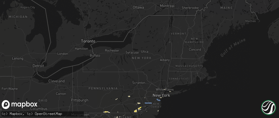
Hail Map in New York on May 20, 2026
The weather event in New York on May 20, 2026 includes Hail and Wind maps. 13 states and 218 cities were impacted and suffered possible damage. The total estimated number of properties impacted is 0.
Hail
Wind
0
Estimated number of impacted properties by a 1.00" hail or larger0
Estimated number of impacted properties by a 1.75" hail or larger0
Estimated number of impacted properties by a 2.50" hail or largerStorm reports in New York
New York
| Date | Description |
|---|---|
| 05/20/20266:10 PM CDT | Tree down on shore road and 97th street. |
| 05/20/20265:39 PM CDT | Tree reported branches down. |
| 05/20/20264:40 PM CDT | Downed tree on ny 25a at hastings drive in smithtown with all lanes closed both directions. |
| 05/20/20264:30 PM CDT | Wires reported down on jay street and beaver dam road in katonah. |
| 05/20/20264:30 PM CDT | Tree down on i-684 near saw mill river parkway exit. |
| 05/20/20263:42 PM CDT | Tree and branches down on soundview avenue in east northport with time of report estimated by radar. |
All States Impacted by Hail Map on May 20, 2026
Cities Impacted by Hail Map on May 20, 2026
- Crane, TX
- Seminole, TX
- Seagraves, TX
- Warfordsburg, PA
- Needmore, PA
- Big Cove Tannery, PA
- Mercersburg, PA
- Midland, TX
- Andrews, TX
- Stanton, TX
- Lenorah, TX
- Tarzan, TX
- Goldsmith, TX
- Greencastle, PA
- Brownfield, TX
- Lebanon, TN
- Big Lake, TX
- Midkiff, TX
- Gordonsville, TN
- Carthage, TN
- Riddleton, TN
- Millerstown, PA
- Ickesburg, PA
- Gettysburg, PA
- Sandy Hook, KY
- West Liberty, KY
- Fort Valley, VA
- Knott, TX
- Gainesboro, TN
- Pleasant Shade, TN
- Big Spring, TX
- Menlo, GA
- Albany, KY
- Elkfork, KY
- Frederick, MD
- Whitleyville, TN
- Monticello, KY
- Wayne, WV
- Winchester, VA
- Alpha, KY
- White Post, VA
- Front Royal, VA
- Valley Head, AL
- Rising Fawn, GA
- Huntington, WV
- Prichard, WV
- Boyce, VA
- Celina, TN
- Tremont, PA
- Branchdale, PA
- Pottsville, PA
- Hegins, PA
- Linden, VA
- Union Bridge, MD
- Woodsboro, MD
- New Windsor, MD
- Lavalette, WV
- New Market, MD
- Walkersville, MD
- Round Hill, VA
- Mount Airy, MD
- Branchland, WV
- Barboursville, WV
- East Lynn, WV
- Markham, VA
- Delaplane, VA
- Upperville, VA
- Paris, VA
- Westminster, MD
- Hilham, TN
- Upperco, MD
- Fort Davis, TX
- Saint Albans, WV
- Poca, WV
- Nitro, WV
- Winfield, WV
- Scott Depot, WV
- Allons, TN
- Charleston, WV
- Alpine, TX
- Parkton, MD
- Reisterstown, MD
- Monroe, TN
- Livingston, TN
- Marathon, TX
- Scarsdale, NY
- White Plains, NY
- Hartsdale, NY
- Northport, NY
- Douglassville, PA
- Birdsboro, PA
- Oxford, PA
- Boyertown, PA
- Kennett Square, PA
- West Chester, PA
- Downingtown, PA
- Coatesville, PA
- Elkview, WV
- Cochranville, PA
- West Grove, PA
- Lincoln University, PA
- Pottstown, PA
- Gilbertsville, PA
- Rosedale, MD
- West Harrison, NY
- Purchase, NY
- Malvern, PA
- Immaculata, PA
- Baltimore, MD
- Clendenin, WV
- Schwenksville, PA
- Exton, PA
- Essex, MD
- Middle River, MD
- Cheyney, PA
- Thornton, PA
- Glen Mills, PA
- Kintnersville, PA
- Riegelsville, PA
- Landenberg, PA
- Avondale, PA
- Paoli, PA
- Berwyn, PA
- Fort Stockton, TX
- Procious, WV
- Amma, WV
- Bomont, WV
- Wallback, WV
- Newton, WV
- Centerport, NY
- Ivydale, WV
- Glenside, PA
- Chadds Ford, PA
- Nebo, WV
- Duck, WV
- Frametown, WV
- Blackwood, NJ
- Woodbury, NJ
- Wayne, PA
- Harleysville, PA
- Souderton, PA
- Telford, PA
- Collegeville, PA
- Oreland, PA
- Flourtown, PA
- Philadelphia, PA
- Staten Island, NY
- Sutton, WV
- Brooklyn, NY
- Myakka City, FL
- Rockford, AL
- Sylacauga, AL
- Forked River, NJ
- Goodwater, AL
- Parrish, FL
- Wimauma, FL
- Lithia, FL
- Riverview, FL
- Glasgow, VA
- Buena Vista, VA
- Lexington, VA
- Ozona, TX
- Menard, TX
- Trinidad, CO
- Eldorado, TX
- Sonora, TX
- Estillfork, AL
- Model, CO
- Brady, TX
- Chapmanville, WV
- Hext, TX
- Fort McKavett, TX
- Junction, TX
- London, TX
- Hebbronville, TX
- Laredo, TX
- Mason, TX
- Bruni, TX
- Zapata, TX
- Roma, TX
- Rio Grande City, TX
- Realitos, TX
- Concepcion, TX
- Benavides, TX
- Uvalde, TX
- Alice, TX
- Premont, TX
- Camp Wood, TX
- Barksdale, TX
- Leakey, TX
- Roanoke, VA
- Richboro, PA
- Jamison, PA
- Lawrence Township, NJ
- Warminster, PA
- New Hope, PA
- Titusville, NJ
- Morrisville, PA
- Doylestown, PA
- Trenton, NJ
- Newtown, PA
- Chalfont, PA
- Washington Crossing, PA
- Pennington, NJ
- Warrington, PA
- Furlong, PA
- Holmdel, NJ
- Hazlet, NJ
- Parlin, NJ
- Cliffwood, NJ
- Port Monmouth, NJ
- South Amboy, NJ
- Matawan, NJ
- Keansburg, NJ
- Sayreville, NJ
- Keyport, NJ
- Belford, NJ
- Middletown, NJ


