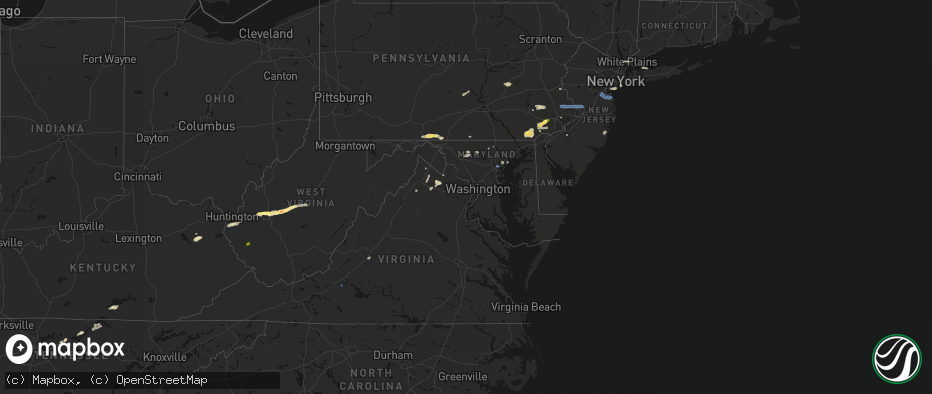
Hail Map in Maryland on May 20, 2026
The weather event in Maryland on May 20, 2026 includes Hail and Wind maps. 13 states and 218 cities were impacted and suffered possible damage. The total estimated number of properties impacted is 0.
Hail
Wind
0
Estimated number of impacted properties by a 1.00" hail or larger0
Estimated number of impacted properties by a 1.75" hail or larger0
Estimated number of impacted properties by a 2.50" hail or largerStorm reports in Maryland
Maryland
| Date | Description |
|---|---|
| 05/20/20264:25 PM CDT | There were several trees and large tree limbs blown down around conowingo. |
| 05/20/20263:54 PM CDT | Trees blew down on md-543 ady road at smithson drive. |
| 05/20/20263:39 PM CDT | A wind gust of 57 knots |
| 05/20/20263:34 PM CDT | Wind gusts of up to 57 knots |
| 05/20/20263:30 PM CDT | Several trees blew down in eastern howard county in ellicott city... Scaggsville... Ilchester... And columbia... Including one onto a car on scarecrow court in columbia |
| 05/20/20263:27 PM CDT | Multiple trees down including one that impacted a house and a car in northwest baltimore. |
| 05/20/20263:25 PM CDT | Trees blew down on md-45 york road near i-83. |
| 05/20/20263:05 PM CDT | Power poles were down around new windsor. |
| 05/20/20262:46 PM CDT | Trees and wires blew down on md-94 woodbine road at old annapolis road. |
| 05/20/20262:45 PM CDT | Several large tree branches snapped and a flagpole bent along coppermine road in union bridge. |
| 05/20/20262:42 PM CDT | Numerous powerlines down on the 3000 block of buckeystown pike. |
| 05/20/20262:19 PM CDT | Multiple trees down on monocacy blvd near south market drive. |
| 05/20/20262:18 PM CDT | Trees blew down on us-15 at md-464 point of rocks road. |
| 05/20/20262:11 PM CDT | Trees blew down on us-15 at mountville road. |
| 05/20/202612:25 PM CDT | Trees blew down on md-144 national pike northeast at frank davis road. |
All States Impacted by Hail Map on May 20, 2026
Cities Impacted by Hail Map on May 20, 2026
- Crane, TX
- Seminole, TX
- Seagraves, TX
- Warfordsburg, PA
- Needmore, PA
- Big Cove Tannery, PA
- Mercersburg, PA
- Midland, TX
- Andrews, TX
- Stanton, TX
- Lenorah, TX
- Tarzan, TX
- Goldsmith, TX
- Greencastle, PA
- Brownfield, TX
- Lebanon, TN
- Big Lake, TX
- Midkiff, TX
- Gordonsville, TN
- Carthage, TN
- Riddleton, TN
- Millerstown, PA
- Ickesburg, PA
- Gettysburg, PA
- Sandy Hook, KY
- West Liberty, KY
- Fort Valley, VA
- Knott, TX
- Gainesboro, TN
- Pleasant Shade, TN
- Big Spring, TX
- Menlo, GA
- Albany, KY
- Elkfork, KY
- Frederick, MD
- Whitleyville, TN
- Monticello, KY
- Wayne, WV
- Winchester, VA
- Alpha, KY
- White Post, VA
- Front Royal, VA
- Valley Head, AL
- Rising Fawn, GA
- Huntington, WV
- Prichard, WV
- Boyce, VA
- Celina, TN
- Tremont, PA
- Branchdale, PA
- Pottsville, PA
- Hegins, PA
- Linden, VA
- Union Bridge, MD
- Woodsboro, MD
- New Windsor, MD
- Lavalette, WV
- New Market, MD
- Walkersville, MD
- Round Hill, VA
- Mount Airy, MD
- Branchland, WV
- Barboursville, WV
- East Lynn, WV
- Markham, VA
- Delaplane, VA
- Upperville, VA
- Paris, VA
- Westminster, MD
- Hilham, TN
- Upperco, MD
- Fort Davis, TX
- Saint Albans, WV
- Poca, WV
- Nitro, WV
- Winfield, WV
- Scott Depot, WV
- Allons, TN
- Charleston, WV
- Alpine, TX
- Parkton, MD
- Reisterstown, MD
- Monroe, TN
- Livingston, TN
- Marathon, TX
- Scarsdale, NY
- White Plains, NY
- Hartsdale, NY
- Northport, NY
- Douglassville, PA
- Birdsboro, PA
- Oxford, PA
- Boyertown, PA
- Kennett Square, PA
- West Chester, PA
- Downingtown, PA
- Coatesville, PA
- Elkview, WV
- Cochranville, PA
- West Grove, PA
- Lincoln University, PA
- Pottstown, PA
- Gilbertsville, PA
- Rosedale, MD
- West Harrison, NY
- Purchase, NY
- Malvern, PA
- Immaculata, PA
- Baltimore, MD
- Clendenin, WV
- Schwenksville, PA
- Exton, PA
- Essex, MD
- Middle River, MD
- Cheyney, PA
- Thornton, PA
- Glen Mills, PA
- Kintnersville, PA
- Riegelsville, PA
- Landenberg, PA
- Avondale, PA
- Paoli, PA
- Berwyn, PA
- Fort Stockton, TX
- Procious, WV
- Amma, WV
- Bomont, WV
- Wallback, WV
- Newton, WV
- Centerport, NY
- Ivydale, WV
- Glenside, PA
- Chadds Ford, PA
- Nebo, WV
- Duck, WV
- Frametown, WV
- Blackwood, NJ
- Woodbury, NJ
- Wayne, PA
- Harleysville, PA
- Souderton, PA
- Telford, PA
- Collegeville, PA
- Oreland, PA
- Flourtown, PA
- Philadelphia, PA
- Staten Island, NY
- Sutton, WV
- Brooklyn, NY
- Myakka City, FL
- Rockford, AL
- Sylacauga, AL
- Forked River, NJ
- Goodwater, AL
- Parrish, FL
- Wimauma, FL
- Lithia, FL
- Riverview, FL
- Glasgow, VA
- Buena Vista, VA
- Lexington, VA
- Ozona, TX
- Menard, TX
- Trinidad, CO
- Eldorado, TX
- Sonora, TX
- Estillfork, AL
- Model, CO
- Brady, TX
- Chapmanville, WV
- Hext, TX
- Fort McKavett, TX
- Junction, TX
- London, TX
- Hebbronville, TX
- Laredo, TX
- Mason, TX
- Bruni, TX
- Zapata, TX
- Roma, TX
- Rio Grande City, TX
- Realitos, TX
- Concepcion, TX
- Benavides, TX
- Uvalde, TX
- Alice, TX
- Premont, TX
- Camp Wood, TX
- Barksdale, TX
- Leakey, TX
- Roanoke, VA
- Richboro, PA
- Jamison, PA
- Lawrence Township, NJ
- Warminster, PA
- New Hope, PA
- Titusville, NJ
- Morrisville, PA
- Doylestown, PA
- Trenton, NJ
- Newtown, PA
- Chalfont, PA
- Washington Crossing, PA
- Pennington, NJ
- Warrington, PA
- Furlong, PA
- Holmdel, NJ
- Hazlet, NJ
- Parlin, NJ
- Cliffwood, NJ
- Port Monmouth, NJ
- South Amboy, NJ
- Matawan, NJ
- Keansburg, NJ
- Sayreville, NJ
- Keyport, NJ
- Belford, NJ
- Middletown, NJ


