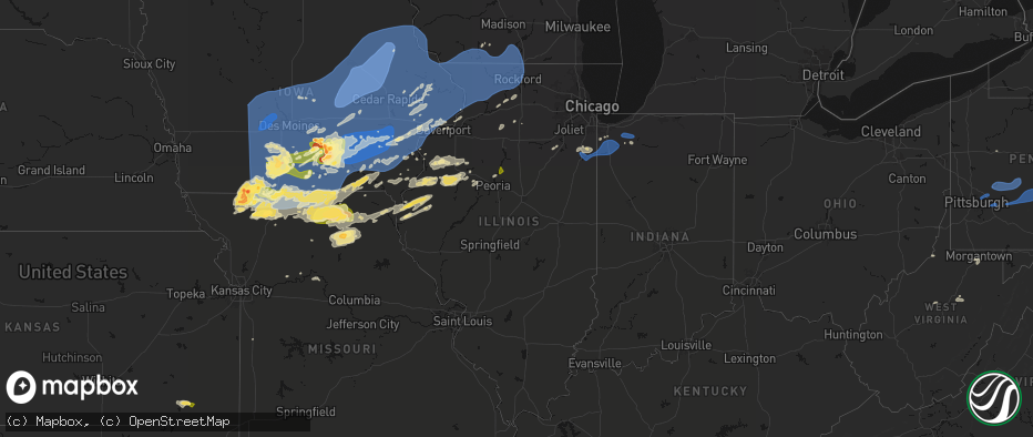
Hail Map in Illinois on June 11, 2026
The weather event in Illinois on June 11, 2026 includes Wind, Hail, and Tornado maps. 20 states and 2,417 cities were impacted and suffered possible damage. The total estimated number of properties impacted is 7,033.
Wind
Hail
Tornado
7,033
Estimated number of impacted properties by a 1.00" hail or larger1,916
Estimated number of impacted properties by a 1.75" hail or larger114
Estimated number of impacted properties by a 2.50" hail or largerStorm reports in Illinois
Illinois
| Date | Description |
|---|---|
| 06/11/20266:58 PM CDT | Report relayed by county em. |
| 06/11/20266:57 PM CDT | Large tree snapped about halfway up the base. The tree was approximately two to three feet in diameter. Time estimated by radar. A nearby personal weather station measu |
| 06/11/20266:54 PM CDT | Tree down across bardon street. |
| 06/11/20266:53 PM CDT | Public report of power lines downed near mowers road and esmond road. Relayed via broadcast media. |
| 06/11/20266:53 PM CDT | Power lines blown down on kenney street. |
| 06/11/20266:53 PM CDT | Tree down blocking highway 54. |
| 06/11/20266:52 PM CDT | Tree limbs down onto a house... Resulting in damage to the fascia and siding. Time estimated by radar. |
| 06/11/20266:50 PM CDT | Peak gust measured on private weather station. |
| 06/11/20266:50 PM CDT | Social media photo showing a tree blown down. Time estimated by radar. |
| 06/11/20266:50 PM CDT | Power line blown down... Resulting in a fire in an alley. Time estimated by radar. |
| 06/11/20266:50 PM CDT | Tree blown down across roadway. |
| 06/11/20266:50 PM CDT | Tree snapped about halfway up the base. Approximately one to two feet in diameter. Time estimated by radar. |
| 06/11/20266:50 PM CDT | Tree and power lines blown down. |
| 06/11/20266:45 PM CDT | Two power poles broken. Time estimated by radar. |
| 06/11/20266:44 PM CDT | Social media video shows a large tree split in half. Time estimated by radar. |
| 06/11/20266:44 PM CDT | Tree uprooted on north hershey road just before rainbow avenue. Time estimated by radar. |
| 06/11/20266:42 PM CDT | A local report indicates 59 MPH wind near Central Illinois Airpor |
| 06/11/20266:41 PM CDT | Tree snapped near base... Approximately one foot in diameter. |
| 06/11/20266:40 PM CDT | A tree was uprooted on the south side of the nws lincoln building. |
| 06/11/20266:40 PM CDT | Large tree down over roadway. Time estimated from radar. |
| 06/11/20266:40 PM CDT | Social media photo shows a large tree limb... Approximately two feet in diameter... Fell onto a house resulting in structural damage to a porch covering. Time estimated |
| 06/11/20266:40 PM CDT | Two large trees uprooted... And a large tree limb blown down onto the road. Time estimated by radar. |
| 06/11/20266:40 PM CDT | Social media photo showing a very large tree blown down |
| 06/11/20266:40 PM CDT | Downed tree took down a power line and has the road blocked. |
| 06/11/20266:40 PM CDT | Power lines down. |
| 06/11/20266:40 PM CDT | Large tree fell on an apartment building on clinton st. |
| 06/11/20266:40 PM CDT | Large tree down near the old courthouse. |
| 06/11/20266:40 PM CDT | Large tree down over roadway. Time estimated from radar. |
| 06/11/20266:40 PM CDT | Large tree branch down onto a fence. |
| 06/11/20266:40 PM CDT | Two large trees uprooted... And a large tree limb blown down onto the road. |
| 06/11/20266:39 PM CDT | A semi-truck was blown over near the i-74/i-55 interchange. Time estimated by radar. |
| 06/11/20266:39 PM CDT | Two large tree branches broken. |
| 06/11/20266:37 PM CDT | Power lines blown down. |
| 06/11/20266:35 PM CDT | Large tree blown down onto powerlines. Time estimated by radar. |
| 06/11/20266:35 PM CDT | Multiple tree limbs blown down... One approximately six inches in diameter. |
| 06/11/20266:33 PM CDT | Grain bin destroyed south of el paso. Time estimated by radar. |
| 06/11/20266:30 PM CDT | A local report indicates 60 MPH wind near 1 SW Eureka |
| 06/11/20266:30 PM CDT | Large tree limbs... Two feet in diameter or greater... Blown down onto house resulting in structural damage. Time estimated by radar. |
| 06/11/20266:27 PM CDT | Live video shows tornado on the ground between dwight and reddick. |
| 06/11/20266:25 PM CDT | Large tree down. |
| 06/11/20266:24 PM CDT | [delayed report] - a tree limb was blown down onto a vehicle. Time estimated by radar. |
| 06/11/20266:24 PM CDT | Outbuilding blown over... Small farm machinery blown over... Large tree uprooted. Time estimated by radar. |
| 06/11/20266:24 PM CDT | Several branches down... Some one to two feet in diameter. |
| 06/11/20266:24 PM CDT | A local report indicates 75 MPH wind near Mason City |
| 06/11/20266:24 PM CDT | Sporadic tree damage. |
| 06/11/20266:24 PM CDT | Large tree down just west of mason city near route 10 and route 29. Tree is approximately two feet in diameter. |
| 06/11/20266:24 PM CDT | Personal weather station. |
| 06/11/20266:23 PM CDT | Report of a tornado on the ground east of dwight with debris in the air. |
| 06/11/20266:22 PM CDT | A local report indicates 63 MPH wind near 4 E Washington |
| 06/11/20266:21 PM CDT | A local report indicates 70 MPH wind near 3 W Washington |
| 06/11/20266:20 PM CDT | A large branch was blown down onto a power line. |
| 06/11/20266:20 PM CDT | Large tree branches blown down... Brick sign and courtyard umbrella damaged. Time estimated by radar. |
| 06/11/20266:19 PM CDT | A local report indicates a tornado near 1 W Deer Creek |
| 06/11/20266:17 PM CDT | Time estimated by radar. |
| 06/11/20266:17 PM CDT | Social media photo showing a large tree blown down onto a chain link fence. Time estimated by radar. |
| 06/11/20266:17 PM CDT | Semi-truck blown over... Multiple vehicle in ditch. Possible tornado. Time estimated by radar. |
| 06/11/20266:16 PM CDT | A local report indicates 70 MPH wind near 1 SSW Morton |
| 06/11/20266:16 PM CDT | Several trees blown down. Estimated 70 mph gusts. |
| 06/11/20266:15 PM CDT | Trees snapped... Approximately two feet in diameter. Other branches blown down. |
| 06/11/20266:15 PM CDT | Estimated 70 mph gusts with tree damage observed. |
| 06/11/20266:15 PM CDT | [delayed report] - a tree was blown down onto a vehicle. |
| 06/11/20266:15 PM CDT | Report of a rope tornado on the ground southwest of dwight. Relayed via social media. |
| 06/11/20266:15 PM CDT | Tree damage observed. |
| 06/11/20266:13 PM CDT | Tree down blocking cr 1700n. Time estimated by radar. |
| 06/11/20266:12 PM CDT | Trees blown down. |
| 06/11/20266:12 PM CDT | A local report indicates 70 MPH wind near 1 NNW East Peoria |
| 06/11/20266:12 PM CDT | Efu tornado based on video and photos relayed to nws through emergency management and broadcast media. No damage reported by ema and local fire department. |
| 06/11/20266:11 PM CDT | Tree blown down onto power lines and roadway. Time estimate by radar. |
| 06/11/20266:11 PM CDT | [delayed report] - multiple trees were blown down in this area. Time estimated by radar. |
| 06/11/20266:11 PM CDT | Tree down on roadway. Time estimate by radar. |
| 06/11/20266:08 PM CDT | [delayed report] - power pole snapped at the base. A tree was also snapped in this area... About halfway up the trunk. Time estimated by radar. |
| 06/11/20266:08 PM CDT | Power poles snapped. Time estimated by radar. |
| 06/11/20266:07 PM CDT | [delayed report] - a large tree was blown down onto a power line. |
| 06/11/20266:06 PM CDT | A local report indicates 63 MPH wind near Peoria Intl Airport |
| 06/11/20266:05 PM CDT | [delayed report] - trees uprooted at richard morrissey park. |
| 06/11/20266:05 PM CDT | Trees down in havana. |
| 06/11/20266:05 PM CDT | Trees and power lines down on 2nd and 3rd street. |
| 06/11/20266:05 PM CDT | Report from mping: quarter |
| 06/11/20266:05 PM CDT | [delayed report] - trees uprooted on lincoln boulevard near everett mckinley dirksen park. |
| 06/11/20266:05 PM CDT | [delayed report] - large tree blown down onto a car. |
| 06/11/20266:04 PM CDT | Photo shows a tornado near ransom. |
| 06/11/20266:04 PM CDT | Tree limbs blown down... Four to six inches in diameter. Time estimated by radar. |
| 06/11/20266:03 PM CDT | Tree limbs blown down... Approximately 2 to 6 inches in diameter. Time estimate by radar. |
| 06/11/20266:03 PM CDT | Six inch diameter tree limb blown down. |
| 06/11/20266:03 PM CDT | Large tree branches down on glen view ct. |
| 06/11/20266:02 PM CDT | [delayed report] - two large trees were uprooted. |
| 06/11/20266:02 PM CDT | [delayed report] - several instances of six inch tree limbs broken in this area. |
| 06/11/20266:01 PM CDT | Tree limbs blown down. Time estimated by radar. |
| 06/11/20266:01 PM CDT | [delayed report] - multiple buildings sustained roof damage... Including loss of shingles... Metal paneling... And one instance of roof uplift. |
| 06/11/20266:01 PM CDT | Large tree snapped. |
| 06/11/20266:00 PM CDT | Large branches broken near fleming road and thompson road. Time estimated by radar. |
| 06/11/20266:00 PM CDT | 14 inch diameter tree blown down. |
| 06/11/20265:56 PM CDT | Multiple reports of a tornado on the ground on the east side of streator. |
| 06/11/20265:55 PM CDT | Report from mping: quarter |
| 06/11/20265:51 PM CDT | Illinois state police reports damage to structures on the south side of streator. Time estimated by radar. |
| 06/11/20265:50 PM CDT | 18 inch diameter tree blown down. |
| 06/11/20265:48 PM CDT | A local report indicates 70 MPH wind near Lewistown |
| 06/11/20265:47 PM CDT | Multiple large tree branches were blown down. Time estimated by radar. |
| 06/11/20265:45 PM CDT | Several power poles snapped along dickson mounds road. Time estimated by radar. |
| 06/11/20265:45 PM CDT | Three inch tree limb blown down. |
| 06/11/20265:42 PM CDT | Multiple reports of a large tornado near streator. |
| 06/11/20265:40 PM CDT | A local report indicates 65 MPH wind near Lewistown |
| 06/11/20265:38 PM CDT | Large tree branch broken and fell on a car. Time estimated from radar. |
| 06/11/20265:37 PM CDT | Trained spotter reports tornado on the ground southwest of streator. |
| 06/11/20265:34 PM CDT | Peak gust measured on personal weather station. |
| 06/11/20265:34 PM CDT | Photo shared to social media shows large branch broken blocking part of shaw road between state street and newburg road. Time estimated by radar. |
| 06/11/20265:25 PM CDT | A local report indicates 1.75 inch wind near 1 N Toluca |
| 06/11/20265:25 PM CDT | Hail just shy of tennis ball size. |
| 06/11/20265:22 PM CDT | A local report indicates a tornado near Ipava |
| 06/11/20265:15 PM CDT | Large tree limb blown down onto powerlines and the road. Time estimated by radar. |
| 06/11/20264:59 PM CDT | Social media photos showing large tornado in progress. |
| 06/11/20264:54 PM CDT | Chaser video of short lived condensation funnel on the ground. No known damage... Rated as an efu. |
| 06/11/20264:48 PM CDT | Branches down. |
| 06/11/20264:40 PM CDT | Tree blown down. |
| 06/11/20264:15 PM CDT | Multiple chasers and spotter reported a brief tornado in this approximate location. No damage was found... So the tornado will be rated an ef-u. |
| 06/11/20263:54 PM CDT | A local report indicates 1.00 inch wind near 2 NNE Elvaston |
| 06/11/202610:09 AM CDT | A few larger branches downed... Including one that downed a power line. Time estimated. |
| 06/10/202610:01 PM CDT | Tree damage in kansas... And a garage with structural damage. Time estimated by radar. |
| 06/10/20269:29 PM CDT | Personal weather station. |
| 06/10/20269:19 PM CDT | Tree damage in mattoon. |
| 06/10/20269:11 PM CDT | Personal weather station. |
| 06/10/20269:10 PM CDT | One healthy tree blown down... And three additional large tree limbs also blown down. |
| 06/10/20269:05 PM CDT | Powerlines blown down near arthur. |
| 06/10/20269:05 PM CDT | Tree limbs blown down onto power lines. Time estimated by radar. |
| 06/10/20268:54 PM CDT | Three to six inch diameter tree limbs blown down. Time estimated by radar. |
| 06/10/20268:50 PM CDT | A local report indicates 70 MPH wind near 1 E Bethany |
| 06/10/20268:50 PM CDT | Sheet metal blown off the roof of an outbuilding. |
| 06/10/20268:48 PM CDT | Personal weather station. |
| 06/10/20268:43 PM CDT | A local report indicates 85 MPH wind near 1 W Oak Lawn |
| 06/10/20268:40 PM CDT | A local report indicates 60 MPH wind near Stonington |
| 06/10/20268:38 PM CDT | Tress snapped in half and large tree branches down. |
| 06/10/20268:34 PM CDT | 20 foot tall tree blown over into roadway. |
| 06/10/20268:30 PM CDT | Many trees down here in my neighborhood also. |
| 06/10/20268:30 PM CDT | Trees blown down. Time estimated by radar. |
| 06/10/20268:30 PM CDT | Trees and powerlines down on west kemp street. Time estimated by radar. |
| 06/10/20268:27 PM CDT | A local report indicates 60 MPH wind near Arcola |
| 06/10/20268:27 PM CDT | Shingle damage from thunderstorm winds. |
| 06/10/20268:18 PM CDT | Peak wind gust. Downed tree limbs and power outage... As well. |
| 06/10/20268:18 PM CDT | Local broadcast media reports several apartments lose their entire roof structure. Time estimated by radar. |
| 06/10/20268:10 PM CDT | Tree blown down into an alleyway. Time estimated by radar. |
| 06/10/20268:10 PM CDT | Tree limb down onto a house... Breaking the sunroof. Limbs also down onto a vehicle at this location. Time estimated by radar. |
| 06/10/20268:09 PM CDT | Tree snapped on intersection of pinecrest and briarcliff road. |
| 06/10/20268:09 PM CDT | Large tree branch downed near the intersection of lemont road and 75th street. |
| 06/10/20268:08 PM CDT | Several large tree branches downed on lemont road near central avenue. |
| 06/10/20268:07 PM CDT | Peak gust measured on personal weather station. |
| 06/10/20268:02 PM CDT | 60-70 mph winds estimated southwest of downtown naperville. |
| 06/10/20268:00 PM CDT | Social media photo of a large tree limb blown down. Time estimated by radar. |
| 06/10/20267:57 PM CDT | Roof damage to school on the east side of danville. Time estimated by radar. |
| 06/10/20267:56 PM CDT | Social media photo showing a large tree blown down onto a structure. Possible tornado. Time estimated by radar. |
| 06/10/20267:55 PM CDT | Social media photo showing large tree uprooted near the intersection of buchanan and perryville. Time estimated by radar. |
| 06/10/20267:55 PM CDT | Private weather station reported 78 mph gust at watseka. |
| 06/10/20267:55 PM CDT | Multiple trees down along the i-74 corridor through vermilion county. Some power lines also blown down. |
| 06/10/20267:54 PM CDT | Tree blown onto house. Time estimated by radar. |
| 06/10/20267:54 PM CDT | Two large trees blown down. |
| 06/10/20267:54 PM CDT | Multiple photos shared to social media show damage to trees and structures near il-59 and stearns road. Possible tornado. |
| 06/10/20267:54 PM CDT | Social media photo showing several tree limbs blown down onto a vehicle. Time estimated by radar. |
| 06/10/20267:54 PM CDT | A tree was blown down. Time estimated by radar. |
| 06/10/20267:53 PM CDT | A local report indicates 65 MPH wind near 2 N Danville |
| 06/10/20267:53 PM CDT | Delayed report. Large tree fell onto a house near lincoln park. Time estimated from radar. |
| 06/10/20267:53 PM CDT | Heavy damage to a farm business on il-9 just west of the il-in state line. Possible tornado. |
| 06/10/20267:52 PM CDT | Social media photo showing a large tree limb blown down onto main street. Time estimated by radar. |
| 06/10/20267:49 PM CDT | Public report of damage to trees southeast of norway. Time estimated by radar. |
| 06/10/20267:48 PM CDT | Social media photo shows a power pole snapped northeast of oakwood. Possible tornado. Time estimated by radar. |
| 06/10/20267:48 PM CDT | Social media photo shows numerous trees blown down onto a road in kickapoo state park northeast of oakwood. Possible tornado. Time estimated by radar. |
| 06/10/20267:47 PM CDT | Metal debris blown into high school softball field fencing. Metal bleachers pushed 10 to 20 feet onto the field. |
| 06/10/20267:47 PM CDT | Damage occurred to small outbuildings near the high school with debris strewn through the field. Possible tornado. |
| 06/10/20267:47 PM CDT | Tornado reported south of hoopeston. Report relayed by county em. |
| 06/10/20267:46 PM CDT | Social media photo showing a large tree down just off newtown road north of oakwood. Possible tornado. Time estimated by radar. |
| 06/10/20267:46 PM CDT | Iroquois county ema reports 82 mph wind gust at iroquois memorial hospital. |
| 06/10/20267:46 PM CDT | A local report indicates 75 MPH wind near 4 SW Henning |
| 06/10/20267:45 PM CDT | Business has a hole in its roof as the result of the storms. Possible tornado. Time estimated by radar. |
| 06/10/20267:45 PM CDT | Personal weather station. |
| 06/10/20267:42 PM CDT | Large tree limb blown down onto house. Time estimated by radar. |
| 06/10/20267:42 PM CDT | Large portion of a tree broken off at comer cox park. |
| 06/10/20267:42 PM CDT | Social media photo shows part of a large tree blown down onto the hood of a car near the abraham lincoln historical home. Time estimated by radar. |
| 06/10/20267:42 PM CDT | Structural damage north of fithian. Possible tornado. Time estimated by radar. |
| 06/10/20267:40 PM CDT | A local report indicates 60 MPH wind near Warrensburg |
| 06/10/20267:40 PM CDT | Tree blown down onto power line. Time estimated by radar. |
| 06/10/20267:39 PM CDT | Large tree limbs blown down in ogden. Time estimated by radar. |
| 06/10/20267:37 PM CDT | Several tree branches blown down. |
| 06/10/20267:35 PM CDT | A local report indicates 68 MPH wind near Capital Airport |
| 06/10/20267:35 PM CDT | Social media photo showing a tree blown down near st. Thomas school in philo. Time estimated by radar. |
| 06/10/20267:35 PM CDT | Numerous tree branches and a few trees blown down... Some blocking roadways. |
| 06/10/20267:35 PM CDT | Large tree branches blown down. |
| 06/10/20267:35 PM CDT | Several tree limbs blown down. Time estimated by radar. |
| 06/10/20267:33 PM CDT | A local report indicates 60 MPH wind near 1 WNW Springfield |
| 06/10/20267:33 PM CDT | Webcam photo showing damage at the top of a tall building. |
| 06/10/20267:31 PM CDT | A local report indicates 68 MPH wind near Willard Airport |
| 06/10/20267:30 PM CDT | Social media photo showing a tree limb through the roof of a house. The house also has damage to its siding. Time estimated by radar. |
| 06/10/20267:30 PM CDT | Damage to the side of a warehouse and two powerlines were snapped. Other small outdoor objects scattered around. |
| 06/10/20267:30 PM CDT | Numerous trees and limbs blown down all over tolono... But no property damage reported. Time estimated by radar. |
| 06/10/20267:30 PM CDT | Private weather station kilpaxto3 reported 60 mph gust. |
| 06/10/20267:30 PM CDT | Tree damage noted on the west side of springfield. |
| 06/10/20267:30 PM CDT | Trees blown down onto houses and roadways. |
| 06/10/20267:30 PM CDT | Several tree limbs blown down west of willard airport. Time estimated by radar. |
| 06/10/20267:29 PM CDT | Large tree limb blown down blocking part of murray road. Time estimated by radar. |
| 06/10/20267:29 PM CDT | Part of a tree was blown down. Time estimated by radar. |
| 06/10/20267:29 PM CDT | Numerous trees down onto a house. Time estimated by radar. |
| 06/10/20267:29 PM CDT | Private weather station kilpaxto240 reported 62 mph gust. Site located at paxton emergency response services. |
| 06/10/20267:29 PM CDT | Delayed report. Large limbs down at intersection of east walnut and sherry and on n east street just south of walnut. Time estimated from radar. |
| 06/10/20267:28 PM CDT | Private weather station kilgilma12 reported 59 mph gust. |
| 06/10/20267:28 PM CDT | Six power poles snapped west of rantoul. Time estimated by radar. |
| 06/10/20267:28 PM CDT | A local report indicates 61 MPH wind near 3 S Urbana |
| 06/10/20267:26 PM CDT | Radio tower collapsed. Time estimated by radar. |
| 06/10/20267:26 PM CDT | Large tree blown down and portions of a wooden fence also blown over. |
| 06/10/20267:26 PM CDT | Tree blown down at corner of victor street and park avenue. Time estimated by radar. |
| 06/10/20267:26 PM CDT | Roof damage to a store on north cunningham avenue. Time estimated by radar. Possible tornado. |
| 06/10/20267:26 PM CDT | Numerous trees down across champaign... Including one blocking prospect avenue. Time estimated by radar. |
| 06/10/20267:26 PM CDT | Power pole bent near centennial park. |
| 06/10/20267:25 PM CDT | Trees blown down at hessel park. Time estimated by radar. |
| 06/10/20267:25 PM CDT | Social media photo showing multiple tree limbs down... Some of which fell onto vehicles. Time estimated by radar. Possible tornado. |
| 06/10/20267:25 PM CDT | A large tree was blown down and landed on top of a car. |
| 06/10/20267:25 PM CDT | Private weather station reports 59 mph gust east of piper city. |
| 06/10/20267:25 PM CDT | Photo of a large tree limb more than a foot in diameter that was snapped. |
| 06/10/20267:25 PM CDT | Delayed report. Time estimated from radar. 72 by 80 machine shed lost sliding door and part of roof which hit a solar array. Large tree branches were down. Small outbui |
| 06/10/20267:24 PM CDT | Quite a lot of tree damage across paxton with multiple roads impassable. Also some trucks blown over on i-57. Time estimated from radar. |
| 06/10/20267:23 PM CDT | Social media photo shows roofing damage to a large apartment complex north of i-74 and west of prospect avenue. Time estimated by radar. Possible tornado. |
| 06/10/20267:23 PM CDT | Social media photo shows a large tree... Approximately two feet in diameter... Blown onto a wooden fence. Time estimated by radar. |
| 06/10/20267:22 PM CDT | Iroquois county ema relays report of multiple trees and powerlines downed in piper city. |
| 06/10/20267:22 PM CDT | Personal weather station. |
| 06/10/20267:22 PM CDT | Damage to the roof of a large apartment complex... With numerous chunks of shingles pulled up or removed. Possible tornado. Time estimated by radar. |
| 06/10/20267:22 PM CDT | Damage reported in the ashland park neighborhood... Including signs bent over. Possible tornado. Time estimated by radar. |
| 06/10/20267:20 PM CDT | Estimated gusts of 50-60 mph. |
| 06/10/20267:20 PM CDT | Estimating 55-60 mph gusts. Report relayed by county em. |
| 06/10/20267:19 PM CDT | Power lines down at intersection of 1900n and 200e. |
| 06/10/20267:19 PM CDT | Large tree branch blown down. Time estimated by radar. |
| 06/10/20267:19 PM CDT | Social media photo shows a short tree snapped near the base... Which was approximately one foot in diameter. Time estimated by radar. |
| 06/10/20267:15 PM CDT | Extensive tree damage across monticello. Several streets blocked... Power poles also damage. |
| 06/10/20267:15 PM CDT | Social media photo shows multiple large tree limbs |
| 06/10/20267:15 PM CDT | Social media photo shows tree blown down onto chain link fence... Destroying the fence. Time estimated by radar. |
| 06/10/20267:15 PM CDT | Social media photo showing multiple large tree limbs down onto a vehicle. Time estimated by radar. |
| 06/10/20267:15 PM CDT | Wooden outdoor playset was destroyed. Time estimated by radar. |
| 06/10/20267:13 PM CDT | Report of multiple damaged campers at campground near 200 north road and 400 east road south of gibson city. Relayed by broadcast media. Time estimated by radar. |
| 06/10/20267:10 PM CDT | A tree was blown down. Time estimated by radar. |
| 06/10/20267:09 PM CDT | Trees down on broadway street. Time estimated by radar. |
| 06/10/20267:09 PM CDT | Power poles blown down blocking the road. |
| 06/10/20267:08 PM CDT | Public report of multiple tree branches broken... Power lines downed... Damage to garage... And damage to a barn southwest of gibson city. One large tree fell on a hous |
| 06/10/20267:06 PM CDT | A few four inch diameter tree limbs were blown down onto the front porch of a house. Time estimated by radar. |
| 06/10/20267:06 PM CDT | Tree blown down blocking route 48. |
| 06/10/20267:06 PM CDT | Tree limbs blown down. |
| 06/10/20267:06 PM CDT | A local report indicates 60 MPH wind near Saybrook |
| 06/10/20267:05 PM CDT | Tree blown down blocking roadway in farmer city. Time estimated by radar. |
| 06/10/20267:03 PM CDT | Delayed report. 3 inch tree limbs down. 20 pound aluminum fenders blown around the truck yard. |
| 06/10/20267:00 PM CDT | A local report indicates 75 MPH wind near Latham |
| 06/10/20267:00 PM CDT | Personal weather station. |
All States Impacted by Hail Map on June 11, 2026
Cities Impacted by Hail Map on June 11, 2026
- Shannon City, IA
- Tingley, IA
- Greenfield, IA
- Mount Ayr, IA
- Afton, IA
- Guthrie Center, IA
- Diagonal, IA
- Panora, IA
- Menlo, IA
- Bagley, IA
- Creston, IA
- Stuart, IA
- Orient, IA
- Yale, IA
- Kellerton, IA
- Dexter, IA
- Macksburg, IA
- Ellston, IA
- Grand River, IA
- Thayer, IA
- Murray, IA
- Worth, MO
- Lenox, IA
- Redding, IA
- Denver, MO
- Blockton, IA
- Benton, IA
- Grant City, MO
- Hatfield, MO
- Casey, IA
- Martinsville, MO
- Winterset, IA
- Linden, IA
- Jamaica, IA
- Rippey, IA
- Perry, IA
- Earlham, IA
- Dawson, IA
- Jefferson, IA
- Adel, IA
- Grand Junction, IA
- Redfield, IA
- Lorimor, IA
- Dallas Center, IA
- Woodward, IA
- Minburn, IA
- Ogden, IA
- Bouton, IA
- Beaver, IA
- Gentry, MO
- Albany, MO
- Unionville, MO
- Green Castle, MO
- Parnell, MO
- Bedford, IA
- Sheridan, MO
- Clearfield, IA
- Osceola, IA
- Peru, IA
- Ravenwood, MO
- Granger, IA
- Van Meter, IA
- De Soto, IA
- Luther, IA
- Boone, IA
- Waukee, IA
- Madrid, IA
- Eagleville, MO
- Booneville, IA
- Ridgeway, MO
- Bethany, MO
- Van Wert, IA
- Weldon, IA
- New Virginia, IA
- Woodburn, IA
- Lucas, IA
- Humeston, IA
- Truro, IA
- Saint Charles, IA
- Livonia, MO
- Derby, IA
- Chariton, IA
- Lacona, IA
- Leon, IA
- Grimes, IA
- Davis City, IA
- Prole, IA
- Blythedale, MO
- Urbandale, IA
- Patterson, IA
- West Des Moines, IA
- Cainsville, MO
- Lamoni, IA
- Clive, IA
- Cumming, IA
- Decatur, IA
- Johnston, IA
- Ames, IA
- Bevington, IA
- Kelley, IA
- Norwalk, IA
- Polk City, IA
- Pleasantville, IA
- Sheldahl, IA
- Runnells, IA
- Knoxville, IA
- Saint Marys, IA
- Garden Grove, IA
- Slater, IA
- Berwick, IA
- Alleman, IA
- Martensdale, IA
- Bondurant, IA
- Ackworth, IA
- Indianola, IA
- Melcher Dallas, IA
- Des Moines, IA
- Altoona, IA
- Elkhart, IA
- Lineville, IA
- Windsor Heights, IA
- Allerton, IA
- Milo, IA
- Carlisle, IA
- Cambridge, IA
- Hartford, IA
- Swan, IA
- Williamson, IA
- Liberty Center, IA
- Corydon, IA
- Pleasant Hill, IA
- Huxley, IA
- Ankeny, IA
- Columbia, IA
- Princeton, MO
- Stanberry, MO
- Conception Junction, MO
- Clyde, MO
- Moulton, IA
- Coatsville, MO
- Wildorado, TX
- Vega, TX
- Russell, IA
- Hamilton, IA
- Lovilia, IA
- Story City, IA
- Gilbert, IA
- Nevada, IA
- Monroe, IA
- Maxwell, IA
- Colfax, IA
- Mitchellville, IA
- Prairie City, IA
- Collins, IA
- Mingo, IA
- Harvey, IA
- Tracy, IA
- Bussey, IA
- Melrose, IA
- Albia, IA
- Oskaloosa, IA
- Eddyville, IA
- Leighton, IA
- Pella, IA
- Beacon, IA
- Pulaski, IA
- Douds, IA
- Bloomfield, IA
- Milton, IA
- Mercer, MO
- Clio, IA
- New Hampton, MO
- Colo, IA
- Memphis, MO
- McFall, MO
- Friona, TX
- Darlington, MO
- Saint Anthony, IA
- Newton, IA
- Baxter, IA
- State Center, IA
- Ira, IA
- McCallsburg, IA
- Zearing, IA
- Roland, IA
- Rhodes, IA
- Blakesburg, IA
- Ottumwa, IA
- University Park, IA
- New Sharon, IA
- Millerton, IA
- Promise City, IA
- Clemons, IA
- Melbourne, IA
- Union, IA
- New Providence, IA
- Albion, IA
- Marshalltown, IA
- Haverhill, IA
- Conrad, IA
- Liscomb, IA
- Laurel, IA
- Beaman, IA
- Garwin, IA
- Ferguson, IA
- Gilman, IA
- Gladbrook, IA
- Montour, IA
- Malcom, IA
- Otley, IA
- Toledo, IA
- Grinnell, IA
- Killduff, IA
- Searsboro, IA
- Kellogg, IA
- Reasnor, IA
- Sully, IA
- Le Grand, IA
- Lynnville, IA
- Tama, IA
- Cedar, IA
- Fremont, IA
- Mystic, IA
- What Cheer, IA
- Montezuma, IA
- Unionville, IA
- Chillicothe, IA
- Lucerne, MO
- Centerville, IA
- Powersville, MO
- Barnes City, IA
- Plano, IA
- Kirkville, IA
- Rose Hill, IA
- Moravia, IA
- Seymour, IA
- Brooklyn, IA
- Cincinnati, IA
- Udell, IA
- Newtown, MO
- Keosauqua, IA
- Hedrick, IA
- Birmingham, IA
- Drakesville, IA
- Exline, IA
- Pollock, MO
- Batavia, IA
- Delta, IA
- Agency, IA
- Deep River, IA
- Gibson, IA
- Eldon, IA
- Floris, IA
- Grundy Center, IA
- Lincoln, IA
- Reinbeck, IA
- Whitten, IA
- Eldora, IA
- Elberon, IA
- Chelsea, IA
- Vining, IA
- Clutier, IA
- Dysart, IA
- Traer, IA
- Buckingham, IA
- Stockport, IA
- Sigourney, IA
- Gilman City, MO
- Cedar Falls, IA
- Morrison, IA
- Hudson, IA
- Dike, IA
- Hartwick, IA
- Guernsey, IA
- Marengo, IA
- Martinsburg, IA
- Belle Plaine, IA
- Hayesville, IA
- Keswick, IA
- Webster, IA
- Victor, IA
- Harper, IA
- South English, IA
- Spickard, MO
- Keota, IA
- Jameson, MO
- Harris, MO
- Fairfield, IA
- Packwood, IA
- Ollie, IA
- Millersburg, IA
- North English, IA
- Richland, IA
- Libertyville, IA
- Williamsburg, IA
- Ladora, IA
- Janesville, IA
- Waverly, IA
- Waterloo, IA
- Keystone, IA
- New Hartford, IA
- La Porte City, IA
- Shellsburg, IA
- Van Horne, IA
- Vinton, IA
- Garrison, IA
- Mount Auburn, IA
- Evansdale, IA
- Brighton, IA
- Fairfax, IA
- Palo, IA
- Parnell, IA
- Blairstown, IA
- Norway, IA
- Wellman, IA
- Luzerne, IA
- Atkins, IA
- Jesup, IA
- Homestead, IA
- South Amana, IA
- Conroy, IA
- Middle Amana, IA
- Amana, IA
- Newhall, IA
- Gilbertville, IA
- Watkins, IA
- Swisher, IA
- Iowa City, IA
- North Liberty, IA
- Kalona, IA
- West Chester, IA
- Walford, IA
- Tiffin, IA
- Cedar Rapids, IA
- Washington, IA
- Oxford, IA
- Coralville, IA
- Riverside, IA
- Mount Pleasant, IA
- Ainsworth, IA
- Wayland, IA
- Lockridge, IA
- Olds, IA
- Crawfordsville, IA
- Columbus City, IA
- Winfield, IA
- Wapello, IA
- Mount Union, IA
- Hills, IA
- Conesville, IA
- Lone Tree, IA
- Columbus Junction, IA
- Morning Sun, IA
- Walker, IA
- Center Point, IA
- Denver, IA
- Hazleton, IA
- Brandon, IA
- Oran, IA
- Dewar, IA
- Sumner, IA
- Dunkerton, IA
- Urbana, IA
- Fairbank, IA
- Readlyn, IA
- Oelwein, IA
- Tripoli, IA
- Westgate, IA
- Raymond, IA
- Independence, IA
- Rowley, IA
- Hawkeye, IA
- Milan, MO
- Humphreys, MO
- Galt, MO
- Marion, IA
- Robins, IA
- Solon, IA
- Hiawatha, IA
- Maynard, IA
- Toddville, IA
- Green City, MO
- Yarmouth, IA
- Letts, IA
- Nichols, IA
- Muscatine, IA
- Grandview, IA
- New Boston, IL
- Moscow, IA
- West Branch, IA
- Tipton, IA
- West Liberty, IA
- Lisbon, IA
- Alburnett, IA
- Fruitland, IA
- Illinois City, IL
- Atalissa, IA
- Mount Vernon, IA
- Ely, IA
- Wilton, IA
- Farmersburg, IA
- Masonville, IA
- Dundee, IA
- Winthrop, IA
- Lamont, IA
- Randalia, IA
- Stanley, IA
- West Union, IA
- Aurora, IA
- Monona, IA
- Volga, IA
- Quasqueton, IA
- Wadena, IA
- Coggon, IA
- Fayette, IA
- Elkader, IA
- Luana, IA
- Saint Olaf, IA
- Elgin, IA
- Strawberry Point, IA
- Postville, IA
- Arlington, IA
- Clermont, IA
- Anamosa, IA
- Ryan, IA
- Olin, IA
- Monticello, IA
- Clarence, IA
- Elkport, IA
- Center Junction, IA
- Wyoming, IA
- Prairieburg, IA
- Stanwood, IA
- Bennett, IA
- Earlville, IA
- Mechanicsville, IA
- Durant, IA
- Edgewood, IA
- Delhi, IA
- Manchester, IA
- Langworthy, IA
- Martelle, IA
- Morley, IA
- Central City, IA
- Hopkinton, IA
- Springville, IA
- Delaware, IA
- Greeley, IA
- Worthington, MO
- Novinger, MO
- Glenwood, MO
- Lancaster, MO
- Monmouth, IA
- Oxford Junction, IA
- Queen City, MO
- Kirksville, MO
- Greentop, MO
- Brashear, MO
- Downing, MO
- McGregor, IA
- Garber, IA
- Guttenberg, IA
- Garnavillo, IA
- Marquette, IA
- Maquoketa, IA
- Baldwin, IA
- Glen Haven, WI
- New Vienna, IA
- Lowden, IA
- Epworth, IA
- Wheatland, IA
- Bernard, IA
- Cascade, IA
- Bagley, WI
- Farley, IA
- North Buena Vista, IA
- Holy Cross, IA
- Luxemburg, IA
- Onslow, IA
- Dyersville, IA
- Cassville, WI
- Bloomington, WI
- Colesburg, IA
- Worthington, IA
- Prairie Du Chien, WI
- New Liberty, IA
- Blue Grass, IA
- Potosi, WI
- Dubuque, IA
- La Motte, IA
- Walcott, IA
- Grand Mound, IA
- Delmar, IA
- Sherrill, IA
- Bellevue, IA
- Durango, IA
- Stockton, IA
- Zwingle, IA
- Dixon, IA
- Peosta, IA
- Calamus, IA
- Lost Nation, IA
- Oakville, IA
- Patch Grove, WI
- Baring, MO
- Hurdland, MO
- De Witt, IA
- Fulton, IL
- Davenport, IA
- Low Moor, IA
- Clinton, IA
- Andrew, IA
- Charlotte, IA
- Goose Lake, IA
- Princeton, IA
- McCausland, IA
- Eldridge, IA
- Donahue, IA
- Welton, IA
- Spragueville, IA
- Miles, IA
- Teeds Grove, IA
- Preston, IA
- Long Grove, IA
- Bryant, IA
- Camanche, IA
- East Dubuque, IL
- Elizabeth, IL
- Scales Mound, IL
- Sabula, IA
- Hanover, IL
- Savanna, IL
- Galena, IL
- Chadwick, IL
- Mount Carroll, IL
- Thomson, IL
- Morrison, IL
- Stockton, IL
- Milledgeville, IL
- Lanark, IL
- Gratiot, WI
- Pearl City, IL
- Darlington, WI
- Warren, IL
- Apple River, IL
- Cuba City, WI
- Shullsburg, WI
- Kent, IL
- Benton, WI
- Hazel Green, WI
- Lena, IL
- Keithsburg, IL
- Seaton, IL
- Mediapolis, IA
- Joy, IL
- Polo, IL
- Forreston, IL
- Shannon, IL
- Winslow, IL
- Nora, IL
- Freeport, IL
- South Wayne, WI
- Baileyville, IL
- Argyle, WI
- McConnell, IL
- Browntown, WI
- Bonaparte, IA
- Mount Sterling, IA
- Aledo, IL
- Alexis, IL
- Edina, MO
- Little York, IL
- Monroe, WI
- Cedarville, IL
- Orangeville, IL
- Dakota, IL
- Woodford, WI
- Ridott, IL
- Davis, IL
- Rock City, IL
- Brodhead, WI
- Juda, WI
- German Valley, IL
- Oregon, IL
- Byron, IL
- Mount Morris, IL
- Pecatonica, IL
- Winnebago, IL
- Durand, IL
- Leaf River, IL
- Rockford, IL
- Stillman Valley, IL
- Gorin, MO
- Donnellson, IA
- West Point, IA
- Farmington, IA
- Hillsboro, IA
- Knox City, MO
- La Belle, MO
- Rutledge, MO
- Shirland, IL
- Rockton, IL
- Janesville, WI
- Orfordville, WI
- Beloit, WI
- Evansville, WI
- Saint Paul, IA
- Kahoka, MO
- Danville, IA
- Monticello, WI
- New Glarus, WI
- Williamstown, MO
- Wyaconda, MO
- Monmouth, IL
- Blanchardville, WI
- Ohio, IL
- Princeton, IL
- South Beloit, IL
- Machesney Park, IL
- Loves Park, IL
- Roscoe, IL
- Caledonia, IL
- Footville, WI
- La Moille, IL
- Gerlaw, IL
- Rio, IL
- Galesburg, IL
- North Henderson, IL
- Viola, IL
- Oquawka, IL
- Wever, IA
- West Burlington, IA
- Burlington, IA
- Saint Patrick, MO
- Afton, WI
- Clinton, WI
- Stronghurst, IL
- Lomax, IL
- Carman, IL
- Wataga, IL
- Mendota, IL
- West Brooklyn, IL
- Gladstone, IL
- Media, IL
- Smithshire, IL
- Raritan, IL
- Roseville, IL
- Biggsville, IL
- Earlville, IL
- Oneida, IL
- Henderson, IL
- Avon, IL
- Berwick, IL
- Kirkwood, IL
- Gilson, IL
- Maquon, IL
- Saint Augustine, IL
- London Mills, IL
- Abingdon, IL
- Cameron, IL
- Altona, IL
- Knoxville, IL
- Victoria, IL
- Yates City, IL
- Elmwood, IL
- Williamsfield, IL
- Sardis, OH
- Mazon, IL
- Farmington, IL
- Trivoli, IL
- Hudson, NY
- Germantown, NY
- Elizaville, NY
- Craryville, NY
- Catskill, NY
- Trenton, MO
- Ancram, NY
- New Martinsville, WV
- Paden City, WV
- Coal City, IL
- Brimfield, IL
- Lore City, OH
- Salesville, OH
- Freeport, PA
- Leechburg, PA
- Vandergrift, PA
- Ford City, PA
- Hyde Park, PA
- Pine Plains, NY
- Peotone, IL
- Manteno, IL
- Cedar Lake, IN
- Lima, NY
- Honeoye Falls, NY
- Avon, NY
- Cordova, IL
- Quaker City, OH
- Apollo, PA
- Kittanning, PA
- Spring Church, PA
- Shelocta, PA
- Trafford, PA
- Export, PA
- Irwin, PA
- Jeannette, PA
- Murrysville, PA
- Harrison City, PA
- Claridge, PA
- Grant Park, IL
- Crown Point, IN
- Albany, IL
- Bourbonnais, IL
- Momence, IL
- Millbrook, NY
- Salt Point, NY
- Clinton Corners, NY
- Delmont, PA
- Indiana, PA
- Avonmore, PA
- Elderton, PA
- Rural Valley, PA
- Creekside, PA
- Sagamore, PA
- Home, PA
- Knox, PA
- Roxbury, CT
- Verbank, NY
- Lagrangeville, NY
- Dover Plains, NY
- Lakeside, CT
- Bethlehem, CT
- Valparaiso, IN
- Wanatah, IN
- New Alexandria, PA
- Blairsville, PA
- Black Lick, PA
- Homer City, PA
- Josephine, PA
- New Florence, PA
- Armagh, PA
- Derry, PA
- Brush Valley, PA
- Seward, PA
- Union Mills, IN
- Hanna, IN
- Pawling, NY
- Poughquag, NY
- Wingdale, NY
- Alexandria, MO
- Pittsburgh, PA
- Oakmont, PA
- Verona, PA
- New Kensington, PA
- Harwick, PA
- Springdale, PA
- Cheswick, PA
- Tarentum, PA
- Creighton, PA
- Albion, NY
- Glenville, WV
- Morgantown, WV
- Fairmont, WV
- Norborne, MO
- Kouts, IN
- Linneus, MO
- Sherman, CT
- Carrollton, MO
- Wayland, MO
- Hamilton, IL
- Warsaw, IL
- Keokuk, IA
- La Crosse, IN
- Bucklin, MO
- New Boston, MO
- Ethel, MO
- Sand Fork, WV
- Marion Center, PA
- Vintondale, PA
- Dilltown, PA
- Nanty Glo, PA
- Johnstown, PA
- Penn Run, PA
- Northern Cambria, PA
- Twin Rocks, PA
- Clymer, PA
- Belsano, PA
- Ebensburg, PA
- Strongstown, PA
- Nicktown, PA
- Heilwood, PA
- Alverda, PA
- Marsteller, PA
- Saint Benedict, PA
- Patton, PA
- Colver, PA
- Carrolltown, PA
- Elmora, PA
- Spangler, PA
- Patterson, NY
- Sublette, IL
- Sutter, IL
- West Point, IL
- Monroe, CT
- Sandy Hook, CT
- Oxford, CT
- Adrian, WV
- Buckhannon, WV
- Horner, WV
- Elmer, MO
- Carthage, IL
- Basco, IL
- Elvaston, IL
- Dixon, IL
- Reynoldsville, PA
- Du Bois, PA
- Rockton, PA
- Penfield, PA
- Chana, IL
- Brewster, NY
- New Fairfield, CT
- Gibbs, MO
- La Plata, MO
- Atlanta, MO
- Bevier, MO
- Callao, MO
- Spring Hope, NC
- Rochelle, IL
- New Cambria, MO
- Bradley, IL
- Kankakee, IL
- Rocky Mount, NC
- Pinetops, NC
- Watertown, CT
- Woodbury, CT
- Saint Anne, IL
- Elk City, KS
- Schneider, IN
- Lowell, IN
- Lake Village, IN
- Pembroke Township, IL
- Hebron, IN
- Morocco, IN
- Shelby, IN
- Demotte, IN
- Thayer, IN
- Wheatfield, IN
- Stormville, NY
- Carmel, NY
- Novelty, MO
- Cornwall Bridge, CT
- New Preston Marble Dale, CT
- Nashville, NC
- Dallas City, IL
- Tennessee, IL
- Blandinsville, IL
- La Harpe, IL
- Colchester, IL
- Independence, KS
- Neodesha, KS
- Macon, MO
- Miami, MO
- Plymouth, IL
- Bowen, IL
- Mendon, IL
- Leonard, MO
- Ursa, IL
- Cherryvale, KS
- Kent, CT
- Sharon, CT
- Middlesex, NC
- Zebulon, NC
- Edenton, NC
- Holmes, NY
- Anabel, MO
- Clarence, MO
- Okarche, OK
- Calumet, OK
- Butler, MO
- Litchfield, CT
- Slater, MO
- Castalia, NC
- Peoria, IL
- Metamora, IL
- Chillicothe, IL
- East Peoria, IL
- Mossville, IL
- Bettendorf, IA
- Sciota, IL
- Macomb, IL
- Danbury, CT
- Port Byron, IL
- Perry, OK
- Morrison, OK
- Lowpoint, IL
- Lacon, IL
- Washburn, IL
- Varna, IL
- Terra Alta, WV
- Oakland, MD
- Kitzmiller, MD
- Elk Garden, WV
- Newark, MO
- Gilliam, MO
- Glasgow, MO
- Tyner, NC
- Balmorhea, TX
- Monticello, MO
- Shelbyville, MO
- Lewistown, MO
- Ewing, MO
- Bethel, MO
- Keyser, WV
- Rawlings, MD
- Westernport, MD
- Swanton, MD
- New Creek, WV
- Burlington, WV
- Romney, WV
- Toluca, IL
- La Rose, IL
- El Reno, OK
- Dennis, KS
- Parsons, KS
- Mound Valley, KS
- Montrose, MO
- Urich, MO
- Clinton, MO
- Rushville, IL
- Vermont, IL
- Canton, MO
- Lynn Center, IL
- Clayton, IL
- Glencoe, OK
- Wenona, IL
- Lentner, MO
- Woodhull, IL
- Cambridge, IL
- Durham, MO
- La Grange, MO
- Armstrong, MO
- Augusta, IL
- Walnut, KS
- Washington Depot, CT
- New Windsor, IL
- Magnolia, IL
- Streator, IL
- Lostant, IL
- Camden, IL
- Pawnee, OK
- Industry, IL
- Shelbina, MO
- Chenoa, IL
- Gridley, IL
- Flanagan, IL
- Coffeyville, KS
- Stantonsburg, NC
- Wilson, NC
- Lewistown, IL
- Ipava, IL
- Fairview, IL
- Rutland, IL
- Lockwood, NY
- Waverly, NY
- Liberty, KS
- Altamont, KS
- Dana, IL
- Minonk, IL
- Higbee, MO
- Fayette, MO
- Battleboro, NC
- Osco, IL
- Adair, IL
- Marietta, IL
- Cuba, IL
- Ellisville, IL
- Smithfield, IL
- Pontiac, IL
- Graymont, IL
- Odell, IL
- Cornell, IL
- Littleton, IL
- Table Grove, IL
- Mount Sterling, IL
- Huntsville, IL
- Timewell, IL
- Golden, IL
- La Prairie, IL
- Barton, NY
- Ancona, IL
- Long Point, IL
- Tonica, IL
- Vinton, VA
- Goodview, VA
- Hunnewell, MO
- Emden, MO
- Canton, IL
- Hannibal, MO
- Davis Junction, IL
- Bryant, IL
- Saint David, IL
- Madison, MO
- Edna, KS
- Glasford, IL
- Astoria, IL
- Frederick, IL
- Hanna City, IL
- Browning, IL
- Sound Beach, NY
- Mount Sinai, NY
- Miller Place, NY
- Yaphank, NY
- Middle Island, NY
- Coram, NY
- Shirley, NY
- Rocky Point, NY
- Ridge, NY
- Shoreham, NY
- Medford, NY
- Maramec, OK
- Oswego, KS
- Bath, IL
- Havana, IL
- Beardstown, IL
- Liverpool, IL
- Mapleton, IL
- Topeka, IL
- Chandlerville, IL
- Manito, IL
- Kingston Mines, IL
- Pekin, IL
- Yale, OK
- Liberty, IL
- Camp Point, IL
- Lindenwood, IL
- Monroe Center, IL
- Esmond, IL
- Cherry Valley, IL
- Kirkland, IL
- Pecos, TX
- Sparland, IL
- Henry, IL
- McNabb, IL
- Hull, IL
- Burlington, WI
- Moneta, VA
- Deepwater, MO
- Colony, OK
- Easton, IL
- Kilbourne, IL
- Oakford, IL
- Monroe City, MO
- Paris, MO
- Holcomb, IL
- Kingston, IL
- Belvidere, IL
- Versailles, IL
- Dwight, IL
- Raleigh, NC
- Center, MO
- Ransom, IL
- Sturgeon, MO
- Harrisburg, MO
- Clark, MO
- Rocheport, MO
- Chambersburg, IL
- Griggsville, IL
- Bedford, VA
- Forest City, IL
- South Pekin, IL
- Tremont, IL
- Green Valley, IL
- San Jose, IL
- Delavan, IL
- Mason City, IL
- Arenzville, IL
- Virginia, IL
- Kenosha, WI
- Union Grove, WI
- Union City, OK
- Columbia, MO
- Hallsville, MO
- Thompson, MO
- Centralia, MO
- Verona, IL
- Seneca, IL
- Bartlett, KS
- Garden Prairie, IL
- Lookeba, OK
- Matador, TX
- Meredosia, IL
- Stillwater, OK
- Marengo, IL
- Galesburg, KS
- Chetopa, KS
- Sims, NC
- Saint Paul, KS
- Edwards, IL
- Louisiana, MO
- Rome, PA
- Quincy, IL
- Payson, IL
- Palmyra, MO
- Chebanse, IL
- Welch, OK
- Hinton, OK
- New London, MO
- Lenapah, OK
- S Coffeyville, OK
- Racine, WI
- Pleasant Prairie, WI
- Twin Lakes, WI
- Spring Grove, IL
- Kansasville, WI
- Bristol, WI
- Salem, WI
- Genoa City, WI
- Hebron, IL
- Wonder Lake, IL
- Richmond, IL
- Silver Lake, WI
- Sturtevant, WI
- Lake Geneva, WI
- Springfield, WI
- Elkhorn, WI
- Mexico, MO
- Harvard, IL
- Capron, IL
- Woodstock, IL
- Poplar Grove, IL
- Creve Coeur, IL
- Groveland, IL
- Washington, IL
- Morton, IL
- Jacksonville, IL
- Petersburg, IL
- Ashland, IL
- Tallula, IL
- Genoa, IL
- Hampshire, IL
- Jennings, OK
- New Canton, IL
- Rockport, IL
- Warsaw, MO
- Childress, TX
- Tell, TX
- Kinderhook, IL
- Rock Falls, IL
- Gotebo, OK
- Cordell, OK
- Wilmington, IL
- Duke, OK
- Barstow, TX
- Benton City, MO
- Martinsburg, MO
- Laddonia, MO
- Rush Hill, MO
- Deer Creek, IL
- Eureka, IL
- Essex, IL
- Braidwood, IL
- Herscher, IL
- Bonfield, IL
- Gardner, IL
- Buckingham, IL
- Reddick, IL
- Minco, OK
- Hartsburg, IL
- Emden, IL
- New Holland, IL
- Pleasant Plains, IL
- Drumright, OK
- Osceola, MO
- Pittsfield, IL
- Barry, IL
- Ochelata, OK
- Bartlesville, OK
- Barnsdall, OK
- Binger, OK
- Auxvasse, MO
- Middletown, IL
- Chapin, IL
- Concord, IL
- Perry, IL
- Jamestown, MO
- Delaware, OK
- Vinita, OK
- Carlock, IL
- Goodfield, IL
- Danvers, IL
- Lexington, IL
- Greenview, IL
- Roanoke, IL
- Hudson, IL
- Minier, IL
- Mackinaw, IL
- Stanford, IL
- Armington, IL
- Congerville, IL
- Benson, IL
- El Paso, IL
- Hopedale, IL
- Secor, IL
- Bloomington, IL
- Wapella, IL
- McLean, IL
- Lawndale, IL
- Cantrall, IL
- Waynesville, IL
- Lincoln, IL
- Sherman, IL
- Atlanta, IL
- Mount Pulaski, IL
- Kenney, IL
- Williamsville, IL
- Towanda, IL
- Clinton, IL
- Normal, IL
- Shirley, IL
- Chestnut, IL
- Elkhart, IL
- Athens, IL
- Beason, IL
- Heyworth, IL
- Springfield, IL
- Granite, OK
- Fulton, MO
- Ashland, MO
- Hartsburg, MO
- Paducah, TX
- Cushing, OK
- Gould, OK
- Fort Cobb, OK
- Martinton, IL
- Beaverville, IL
- Papineau, IL
- Miami, OK
- New Salem, IL
- Levelland, TX
- Bluffs, IL
- Winchester, IL
- Mountain View, OK
- Saint John, IN
- Dyer, IN
- Schererville, IN
- Bluejacket, OK
- Cee Vee, TX
- Anadarko, OK
- Lone Wolf, OK
- Manhattan, IL
- Alexander, IL
- New Bloomfield, MO
- Monee, IL
- Beecher, IL
- Gracemont, OK
- Floydada, TX
- Edwards, MO
- North Miami, OK
- Buffalo, IL
- Illiopolis, IL
- Riverton, IL
- Maroa, IL
- Latham, IL
- Niantic, IL
- Downs, IL
- Warrensburg, IL
- Cooksville, IL
- Decatur, IL
- De Land, IL
- Cisco, IL
- Le Roy, IL
- Hammond, IL
- Forsyth, IL
- Bement, IL
- Monticello, IL
- Farmer City, IL
- Dewitt, IL
- Colfax, IL
- Oreana, IL
- Lane, IL
- Ellsworth, IL
- Argenta, IL
- Milmine, IL
- Weldon, IL
- Arrowsmith, IL
- Cerro Gordo, IL
- Saybrook, IL
- White Heath, IL
- Forrest, IL
- Chatsworth, IL
- Fairbury, IL
- Melvin, IL
- Mansfield, IL
- Fisher, IL
- Seymour, IL
- Piper City, IL
- Danforth, IL
- Kempton, IL
- Saunemin, IL
- Ashkum, IL
- Roberts, IL
- Sibley, IL
- Cullom, IL
- Anchor, IL
- Gibson City, IL
- Mahomet, IL
- Strawn, IL
- Clifton, IL
- Foosland, IL
- Bellflower, IL
- Cropsey, IL
- Merrillville, IN
- Modesto, IL
- Unionville, VA
- Rapidan, VA
- White Hall, IL
- Roodhouse, IL
- Mangum, OK
- New Berlin, IL
- Loami, IL
- Shannon, NC
- Raeford, NC
- Griffith, IN
- Thawville, IL
- Dewey, IL
- Onarga, IL
- Paxton, IL
- Loda, IL
- Elliott, IL
- Gilman, IL
- Tolono, IL
- Sadorus, IL
- Champaign, IL
- Ivesdale, IL
- Buckley, IL
- Atwood, IL
- Bondville, IL
- Rantoul, IL
- Ludlow, IL
- Hobart, IN
- Fairland, OK
- Afton, OK
- Niota, IL
- Commerce, OK
- Mokane, MO
- Steedman, MO
- Pocasset, OK
- Morris, IL
- Virden, IL
- Waverly, IL
- Crete, IL
- Dawson, IL
- Murrayville, IL
- Chatham, IL
- Fort Madison, IA
- Roaring Springs, TX
- Rockbridge, IL
- Carrollton, IL
- Franklin, IL
- La Place, IL
- Mt Zion, IL
- Dalton City, IL
- Mount Auburn, IL
- Blue Mound, IL
- Macon, IL
- Harristown, IL
- Boody, IL
- Mechanicsburg, IL
- Edinburg, IL
- Rochester, IL
- Lovington, IL
- Wyandotte, OK
- Macatawa, MI
- Holland, MI
- West Olive, MI
- Zeeland, MI
- Hudsonville, MI
- Donovan, IL
- Crescent City, IL
- Watseka, IL
- Milford, IL
- Thomasboro, IL
- Bethany, IL
- Cissna Park, IL
- Moweaqua, IL
- Amber, OK
- Baxter Springs, KS
- Hettick, IL
- Greenfield, IL
- Portland, MO
- Rhineland, MO
- Auburn, IL
- Palmyra, IL
- Rich Hill, MO
- Williamsburg, MO
- Quapaw, OK
- Galena, KS
- Grandville, MI
- Jenison, MI
- Joplin, MO
- Bartlett, IL
- Ralls, TX
- Rankin, IL
- Gifford, IL
- Kentland, IN
- Iroquois, IL
- Sheldon, IL
- Fair Oaks, IN
- Brook, IN
- Saint Joseph, IL
- Tuscola, IL
- Wellington, IL
- Potomac, IL
- Hoopeston, IL
- Savoy, IL
- Arthur, IL
- Penfield, IL
- Urbana, IL
- Philo, IL
- Findlay, IL
- Sullivan, IL
- Pesotum, IL
- Grand Rapids, MI
- Wyoming, MI
- Byron Center, MI
- Jerseyville, IL
- Rockville, MO
- Kane, IL
- Taylorville, IL
- Roosevelt, OK
- Treece, KS
- Crosbyton, TX
- Appleton City, MO
- Kaiser, MO
- Brumley, MO
- Linn Creek, MO
- Chesterton, IN
- Quanah, TX
- Boone Grove, IN
- Caledonia, MI
- Yorkville, IL
- Lorenzo, TX
- Oswego, IL
- Romeoville, IL
- Plainfield, IL
- Bolingbrook, IL
- Naperville, IL
- Aurora, IL
- Mcadoo, TX
- Montgomery, IL
- Woodridge, IL
- Lemont, IL
- Lockport, IL
- Willowbrook, IL
- Robbins, IL
- Orland Park, IL
- Palos Heights, IL
- Willow Springs, IL
- Downers Grove, IL
- Markham, IL
- Darien, IL
- Midlothian, IL
- Crestwood, IL
- Palos Park, IL
- Lisle, IL
- Homer Glen, IL
- Oak Forest, IL
- Harvey, IL
- Posen, IL
- Blue Island, IL
- South Holland, IL
- Worth, IL
- Dolton, IL
- Alsip, IL
- Calumet City, IL
- Palos Hills, IL
- Riverdale, IL
- Brighton, IL
- Pawnee, IL
- Kincaid, IL
- Seneca, MO
- Cement, OK
- Medora, IL
- Columbus, KS
- Picher, OK
- Morrison, MO
- Warrenton, MO
- Divernon, IL
- Glenarm, IL
- Chamois, MO
- Claremore, OK
- Bridgeview, IL
- Riverside, IL
- Evergreen Park, IL
- Clarendon Hills, IL
- Oak Lawn, IL
- Westmont, IL
- Western Springs, IL
- Westchester, IL
- Hinsdale, IL
- Chicago Ridge, IL
- Broadview, IL
- Cicero, IL
- Maywood, IL
- La Grange, IL
- Berwyn, IL
- Brookfield, IL
- Forest Park, IL
- Hometown, IL
- Oak Brook, IL
- Chicago, IL
- Hickory Hills, IL
- Lyons, IL
- Justice, IL
- La Grange Park, IL
- Burbank, IL
- Summit Argo, IL
- Freeport, MI
- Wayland, MI
- Middleville, MI
- Alto, MI
- Newman, IL
- Longview, IL
- Humboldt, IL
- Armstrong, IL
- Earl Park, IN
- Broadlands, IL
- Ogden, IL
- Muncie, IL
- Charleston, IL
- Fairmount, IL
- Mattoon, IL
- Henning, IL
- Hindsboro, IL
- Oakwood, IL
- Rossville, IL
- Arcola, IL
- Murdock, IL
- Oakland, IL
- Danville, IL
- Collison, IL
- Fowler, IN
- Royal, IL
- Villa Grove, IL
- Sidney, IL
- Allerton, IL
- Fithian, IL
- Stockland, IL
- Homer, IL
- Camargo, IL
- Bismarck, IL
- Catlin, IL
- Ambia, IN
- Goodland, IN
- Reynolds, IN
- Georgetown, IL
- Tilton, IL
- Attica, IN
- Rensselaer, IN
- Indianola, IL
- Metcalf, IL
- Remington, IN
- Sidell, IL
- Brocton, IL
- Williamsport, IN
- State Line, IN
- Alvin, IL
- Monon, IN
- Oxford, IN
- Wolcott, IN
- Pine Village, IN
- Chalmers, IN
- Boswell, IN
- Westville, IL
- West Lebanon, IN
- Covington, IN
- Brookston, IN
- Hume, IL
- Mount Ayr, IN
- West Lafayette, IN
- Otterbein, IN
- Templeton, IN
- Francesville, IN
- Medaryville, IN
- North Judson, IN
- Winamac, IN
- Clarksville, MI
- Lake Odessa, MI
- Ashmore, IL
- Gary, IN
- Hammond, IN
- Whiting, IN
- East Chicago, IN
- Wright City, MO
- Crocker, MO
- Iberia, MO
- Westville, IN
- Shipman, IL
- Piasa, IL
- Fidelity, IL
- La Porte, IN
- Lawton, OK
- Ulman, MO
- Morrisonville, IL
- Palmer, IL
- Yeoman, IN
- Westpoint, IN
- Idaville, IN
- Star City, IN
- Logansport, IN
- Lafayette, IN
- Buffalo, IN
- Kewanna, IN
- Rochester, IN
- Lucerne, IN
- Ridge Farm, IL
- Delphi, IN
- Royal Center, IN
- Veedersburg, IN
- Monticello, IN
- Perrysville, IN
- Burnettsville, IN
- Cayuga, IN
- Battle Ground, IN
- Chrisman, IL
- Kansas, IL
- Sunfield, MI
- Portland, MI
- Wingate, IN
- San Pierre, IN
- Knox, IN
- Monterey, IN
- Nashville, MI
- Vermontville, MI
- Mulliken, MI
- Charlotte, MI
- Woodland, MI
- Kingman, IN
- Redmon, IL
- Dana, IN
- Paris, IL
- Grand Ledge, MI
- Grove, OK
- Dickens, TX
- Dixon, MO
- Carlinville, IL
- Gillespie, IL
- Calhoun, MO
- Chickasha, OK
- Pryor, OK
- Potterville, MI
- Eagle, MI
- Niles, MI
- Edwardsburg, MI
- Cassopolis, MI
- Mason, MI
- Williamston, MI
- Holt, MI
- Dimondale, MI
- Okemos, MI
- East Lansing, MI
- Haslett, MI
- Lansing, MI
- Dewitt, MI
- Bath, MI
- Laingsburg, MI
- Dowagiac, MI
- Walkerton, IN
- North Liberty, IN
- Mill Creek, IN
- Windsor, MO
- Medicine Park, OK
- Cyril, OK
- Fletcher, OK
- Olustee, OK
- Altus, OK
- Rockville, IN
- Plymouth, IN
- Culver, IN
- Ora, IN
- Grovertown, IN
- Hillsdale, IN
- Clinton, IN
- Argos, IN
- Newtown, IN
- Mellott, IN
- Bremen, IN
- Hillsboro, IN
- Bourbon, IN
- New Richmond, IN
- Westfield, IL
- Gays, IL
- Lerna, IL
- Windsor, IL
- Assumption, IL
- Shelbyville, IL
- Stonington, IL
- Lincoln, MO
- Sawyer, MI
- Bridgman, MI
- Portage, IN
- South Bend, IN
- Beverly Shores, IN
- Michigan City, IN
- Harbert, MI
- Three Oaks, MI
- Lakeside, MI
- Union Pier, MI
- New Buffalo, MI
- Ramsey, IL
- Oconee, IL
- Herrick, IL
- Cowden, IL
- Galien, MI
- Rolling Prairie, IN
- New Carlisle, IN
- Fort Sill, OK
- New Troy, MI
- Buchanan, MI
- Baroda, MI
- Berrien Springs, MI
- Elgin, OK
- Vermilion, IL
- Romney, IN
- Dennison, IL
- Montezuma, IN
- Waynetown, IN
- Marshall, IL
- West Terre Haute, IN
- Bloomingdale, IN
- Martinsville, IL
- Vandalia, MI
- Jones, MI
- Warsaw, IN
- Claypool, IN
- Syracuse, IN
- Linden, IN
- Crawfordsville, IN
- Flora, IN
- Camden, IN
- Buck Creek, IN
- Milford, IN
- Akron, IN
- Nappanee, IN
- Atwood, IN
- Leesburg, IN
- Twelve Mile, IN
- Mentone, IN
- Marshall, IN
- Etna Green, IN
- Macy, IN
- Dayton, IN
- Tippecanoe, IN
- Universal, IN
- Roachdale, IN
- Greencastle, IN
- Mulberry, IN
- Young America, IN
- Bringhurst, IN
- Bridgeton, IN
- Denver, IN
- Mecca, IN
- Frankfort, IN
- Reelsville, IN
- Kokomo, IN
- Peru, IN
- Ladoga, IN
- Rosedale, IN
- Galveston, IN
- New Waverly, IN
- Rossville, IN
- Darlington, IN
- Burlington, IN
- Russellville, IN
- Cutler, IN
- Alamo, IN
- Walton, IN
- Terre Haute, IN
- New Market, IN
- Silver Lake, IN
- Waveland, IN
- New Goshen, IN
- Bainbridge, IN
- Brazil, IN
- Clarks Hill, IN
- Thorntown, IN
- Jamestown, IN
- Burket, IN
- Russiaville, IN
- Carbon, IN
- Colfax, IN
- New Ross, IN
- Onward, IN
- Mexico, IN
- Advance, IN
- Michigantown, IN
- Lebanon, IN
- Roann, IN
- Forest, IN
- North Salem, IN
- Pierceton, IN
- Miami, IN
- Fairmount, IN
- Amboy, IN
- North Manchester, IN
- Sheridan, IN
- Windfall, IN
- Sharpsville, IN
- La Fontaine, IN
- Elwood, IN
- Urbana, IN
- Marion, IN
- Kirklin, IN
- Winona Lake, IN
- Goldsmith, IN
- Converse, IN
- Wabash, IN
- Swayzee, IN
- Laketon, IN
- Greentown, IN
- Bunker Hill, IN
- Tipton, IN
- Grissom Arb, IN
- Kempton, IN
- Carmel, IN
- Atlanta, IN
- Lizton, IN
- Sweetser, IN
- Lagro, IN
- Cicero, IN
- Frankton, IN
- Lapel, IN
- Noblesville, IN
- Alexandria, IN
- Zionsville, IN
- Summitville, IN
- Brownsburg, IN
- Jonesboro, IN
- Whitestown, IN
- Anderson, IN
- Westfield, IN
- Pittsboro, IN
- Arcadia, IN
- Geronimo, OK
- Jasper, MO
- Oronogo, MO
- Spur, TX
- Lanagan, MO
- Noel, MO
- South West City, MO
- Salina, OK
- Headrick, OK
- Altus Afb, OK
- Anderson, MO
- Mishawaka, IN
- Beecher City, IL
- Ballwin, MO
- Goshen, IN
- Liberty Mills, IN
- Servia, IN
- Millersburg, IN
- Middlebury, IN
- New Paris, IN
- Cromwell, IN
- Larwill, IN
- North Webster, IN
- Walters, OK
- Columbia City, IN
- Ligonier, IN
- Kimmell, IN
- Huntington, IN
- South Whitley, IN
- Van Buren, IN
- Fowlerton, IN
- Gas City, IN
- Roanoke, IN
- Andrews, IN
- Warren, IN
- Upland, IN
- Matthews, IN
- Gaston, IN
- Hartford City, IN
- Markle, IN
- Daleville, IN
- Yorktown, IN
- Muncie, IN
- Middletown, IN
- Albion, IN
- Montpelier, IN
- Effingham, IL
- Shumway, IL
- Eaton, IN
- Bluffton, IN
- Poneto, IN
- Pennville, IN
- Keystone, IN
- Dunkirk, IN
- Liberty Center, IN
- Valley Park, MO
- Shipshewana, IN
- Topeka, IN
- Lagrange, IN
- Wawaka, IN
- Uniondale, IN
- Ossian, IN
- Yoder, IN
- Zanesville, IN
- Petroleum, IN
- Bryant, IN
- Casey, IL
- Webberville, MI
- Howell, MI
- Corunna, MI
- Gaines, MI
- Swartz Creek, MI
- Lennon, MI
- Bancroft, MI
- Linden, MI
- Byron, MI
- Vernon, MI
- Fowlerville, MI
- Owosso, MI
- Morrice, MI
- Durand, MI
- Perry, MI
- Elkhart, IN
- Rome City, IN
- Wolcottville, IN
- Howe, IN
- Kendallville, IN
- Bristol, IN
- Labadie, MO
- Saint Louis, MO
- White Pigeon, MI
- Constantine, MI
- Three Rivers, MI
- Centreville, MI
- Sturgis, MI
- Carthage, MO
- Lubbock, TX
- Fenton, MO
- Camby, IN
- Greenfield, IN
- Stilesville, IN
- New Palestine, IN
- Fillmore, IN
- Mooresville, IN
- Mccordsville, IN
- Greenwood, IN
- Ingalls, IN
- Coatesville, IN
- Danville, IN
- Amo, IN
- Clayton, IN
- Fortville, IN
- Plainfield, IN
- Wilkinson, IN
- Markleville, IN
- Pendleton, IN
- West Newton, IN
- Beech Grove, IN
- Fishers, IN
- Avon, IN
- Indianapolis, IN
- Maxwell, IN
- Avilla, IN
- Golden City, MO
- Sigel, IL
- Duncan, OK
- Comanche, OK
- Rose, OK
- Tipton, OK
- Bella Vista, AR
- Sulphur Springs, AR
- Idalou, TX
- Loveland, OK
- Chattanooga, OK
- Cache, OK
- Scammon, KS
- Ashley, IN
- Burr Oak, MI
- Angola, IN
- Corunna, IN
- Waterloo, IN
- Hudson, IN
- Orland, IN
- Auburn, IN
- Pleasant Lake, IN
- South Milford, IN
- Fountaintown, IN
- Fairland, IN
- Albany, IN
- Springport, IN
- Mays, IN
- Straughn, IN
- Falmouth, IN
- Arlington, IN
- Monroe, IN
- Selma, IN
- Parker City, IN
- Mooreland, IN
- Morristown, IN
- Spiceland, IN
- Charlottesville, IN
- Fort Wayne, IN
- New Castle, IN
- Craigville, IN
- Ridgeville, IN
- Decatur, IN
- Gwynneville, IN
- Shirley, IN
- Carthage, IN
- Losantville, IN
- Redkey, IN
- Farmland, IN
- Kennard, IN
- Shelbyville, IN
- Portland, IN
- Berne, IN
- Lewisville, IN
- Knightstown, IN
- Rushville, IN
- Geneva, IN
- Robertsville, MO
- Pacific, MO
- Catawissa, MO
- Wildwood, MO
- Cedar Hill, MO
- East Carondelet, IL
- Strang, OK
- Slaton, TX
- Chouteau, OK
- Locust Grove, OK
- Colcord, OK
- Faxon, OK
- Dupo, IL
- Spavinaw, OK
- Hastings, OK
- Waurika, OK
- Temple, OK
- Hoagland, IN
- New Haven, IN
- Monroeville, IN
- Woodburn, IN
- Ansonia, OH
- Paulding, OH
- Modoc, IN
- Wren, OH
- Saint Henry, OH
- Celina, OH
- Lynn, IN
- Rockford, OH
- Fort Recovery, OH
- Convoy, OH
- Rossburg, OH
- Spencerville, OH
- Milton, IN
- Saint Marys, OH
- Union City, OH
- Cambridge City, IN
- Coldwater, OH
- Maria Stein, OH
- Richmond, IN
- Fountain City, IN
- Montezuma, OH
- Economy, IN
- Payne, OH
- Haviland, OH
- Hagerstown, IN
- Mendon, OH
- Saratoga, IN
- Connersville, IN
- Delphos, OH
- Van Wert, OH
- Salamonia, IN
- Willshire, OH
- Union City, IN
- Winchester, IN
- Centerville, IN
- Scott, OH
- Williamsburg, IN
- Antwerp, OH
- Venedocia, OH
- Greens Fork, IN
- New Weston, OH
- Burkettsville, OH
- Grover Hill, OH
- Ohio City, OH
- Middle Point, OH
- Pioneer, OH
- Montgomery, MI
- Camden, MI
- Montpelier, OH
- Coldwater, MI
- Bronson, MI
- Fremont, IN
- Bryan, OH
- Edgerton, OH
- Hamilton, IN
- West Unity, OH
- Butler, IN
- Reading, MI
- Quincy, MI
- Edon, OH
- Post, TX
- Belleville, IL
- Millstadt, IL
- Kansas, OK
- High Ridge, MO
- Bentonville, AR
- Arcanum, OH
- Versailles, OH
- Boston, IN
- Webster, IN
- New Madison, OH
- Brownsville, IN
- Yorkshire, OH
- West Manchester, OH
- Hollansburg, OH
- Eaton, OH
- Camden, OH
- Palestine, OH
- New Bremen, OH
- College Corner, OH
- New Paris, OH
- Liberty, IN
- Greenville, OH
- Chickasaw, OH
- Eldorado, OH
- Fort Jennings, OH
- Randlett, OK
- Wilson, TX
- Tahoka, TX
- Hulbert, OK
- Cloverdale, OH
- Ottoville, OH
- Columbus Grove, OH
- Ottawa, OH
- Lima, OH
- Kalida, OH
- Fayette, OH
- Hillsdale, MI
- Alvordton, OH
- Morenci, MI
- Osseo, MI
- Pittsford, MI
- Archbold, OH
- Waldron, MI
- Hudson, MI
- Allen, MI
- Pineville, MO
- Columbia, IL
- Wagoner, OK
- Lyons, OH
- Adrian, MI
- Jasper, MI
- Clayton, MI
- Stryker, OH
- Tecumseh, MI
- Sand Creek, MI
- Wauseon, OH
- Manitou Beach, MI
- Tipton, MI
- Onsted, MI
- Addison, MI
- North Adams, MI
- Watts, OK
- Wichita Falls, TX
- Jonesville, MI
- Cement City, MI
- Jerome, MI
- Brooklyn, MI
- Tahlequah, OK
- Aldrich, MO
- Bolivar, MO
- Fair Play, MO
- Metamora, OH
- Riga, MI
- Ottawa Lake, MI
- Swanton, OH
- Milan, MI
- Clinton, MI
- Berkey, OH
- Manchester, MI
- Palmyra, MI
- Blissfield, MI
- Delta, OH
- Britton, MI
- Saline, MI
- Deerfield, MI
- Troy, OH
- Pitsburg, OH
- Bluffton, OH
- Harrod, OH
- Cairo, OH
- Houston, OH
- Anna, OH
- Brookville, OH
- Lafayette, OH
- Botkins, OH
- New Hampshire, OH
- Tipp City, OH
- Russia, OH
- Wapakoneta, OH
- Vandalia, OH
- Gomer, OH
- Jackson Center, OH
- Dayton, OH
- De Graff, OH
- Sidney, OH
- Piqua, OH
- Phillipsburg, OH
- Minster, OH
- Buckland, OH
- Waynesfield, OH
- Lakeview, OH
- West Alexandria, OH
- Covington, OH
- West Milton, OH
- Vaughnsville, OH
- New Lebanon, OH
- Quincy, OH
- Ludlow Falls, OH
- Fletcher, OH
- Uniopolis, OH
- Beaverdam, OH
- Farmersville, OH
- Englewood, OH
- Laura, OH
- Pleasant Hill, OH
- Fort Loramie, OH
- Osgood, OH
- New Knoxville, OH
- Clayton, OH
- Bradford, OH
- Pandora, OH
- Maplewood, OH
- Pemberton, OH
- Lewistown, OH
- Verona, OH
- Lewisburg, OH
- Gettysburg, OH
- Port Jefferson, OH
- Mount Cory, OH
- Findlay, OH
- McComb, OH
- Benton Ridge, OH
- Rawson, OH
- Odonnell, TX
- Reeds, MO
- Summers, AR
- Alger, OH
- Jenera, OH
- Ada, OH
- Arlington, OH
- Forest, OH
- Welling, OK
- Sainte Genevieve, MO
- Duenweg, MO
- Holliday, TX
- Muskogee, OK
- Fort Gibson, OK
- Siloam Springs, AR
- Cisne, IL
- Mount Erie, IL
- Scotland, TX
- McCutchenville, OH
- Fostoria, OH
- Arcadia, OH
- Carey, OH
- Tiffin, OH
- Vanlue, OH
- New Riegel, OH
- Upper Sandusky, OH
- Mount Blanchard, OH
- Alvada, OH
- Sycamore, OH
- Perryville, MO
- Saint Mary, MO
- Lamesa, TX
- Park Hill, OK
- Bunch, OK
- Stilwell, OK
- Proctor, OK
- Bloomville, OH
- Republic, OH
- Braggs, OK
- Maybee, MI
- Dundee, MI
- Petersburg, MI
- Webbers Falls, OK
- Gore, OK
- Frohna, MO
- Farrar, MO
- Vian, OK
- Ellington, MO
- Checotah, OK
- Porum, OK
- Stigler, OK
- Van Buren, MO
- Grandin, MO
- Ellsinore, MO
- Marion, KY
- Owensboro, KY
- Smithville, OK
- Doniphan, MO
- Mcalester, OK
- Beaver Dam, KY
- Cromwell, KY
- Harviell, MO
- Oxly, MO
- Naylor, MO
- Broken Bow, OK
- Horse Branch, KY
- Murray, KY
- Hayti, MO
- Bragg City, MO
- Greensburg, KY
- Whitefield, OK
- Andrews Air Force Base, MD
- Huntly, VA
- Linden, VA
- Washington, DC
- Reston, VA
- Delaplane, VA
- Fort Washington, MD
- Vienna, VA
- Hume, VA
- Ashburn, VA
- Leesburg, VA
- Dunkirk, MD
- Churchton, MD
- Middleburg, VA
- West River, MD
- Friendship, MD
- Chester Gap, VA
- The Plains, VA
- Fairfax, VA
- Naval Anacost Annex, DC
- Oakton, VA
- Haymarket, VA
- Centreville, VA
- Catharpin, VA
- Lanham, MD
- Arlington, VA
- McLean, VA
- Lothian, MD
- Alexandria, VA
- Chantilly, VA
- Front Royal, VA
- Markham, VA
- Hyattsville, MD
- Shady Side, MD
- Harwood, MD
- Capitol Heights, MD
- Falls Church, VA
- Tracys Landing, MD
- Bowie, MD
- Deale, MD
- Clinton, MD
- Upper Marlboro, MD
- Brentwood, MD
- Sterling, VA
- District Heights, MD
- Marshall, VA
- Owings, MD
- Galesville, MD
- Davidsonville, MD
- Bethesda, MD
- Herndon, VA
- Upperville, VA
- Suitland, MD
- Oxon Hill, MD
- Annandale, VA
- Temple Hills, MD
- Edgewater, MD
- Mount Rainier, MD
- Dunn Loring, VA
- Aldie, VA
- Fort Myer, VA
- Springfield, VA
- Gambrills, MD
- Crownsville, MD
- Riva, MD
- Stevensville, MD
- Annapolis, MD
- Carmichaels, PA
- Algonac, MI
- Clinton Township, MI
- Harsens Island, MI
- Harper Woods, MI
- Harrison Township, MI
- Saint Clair Shores, MI
- Eastpointe, MI
- Sterling Heights, MI
- New Baltimore, MI
- Fair Haven, MI
- Marine City, MI
- Roseville, MI
- Macomb, MI
- Warren, MI
- Grosse Pointe, MI
- Fraser, MI
- Detroit, MI
- Mount Clemens, MI
- Union, MI
- Berrien Center, MI
- Granger, IN
- Osceola, IN
- Kingsford Heights, IN
- Notre Dame, IN
- Lakeville, IN
- Hamlet, IN
- Taylor Ridge, IL
- Montpelier, IA
- Andalusia, IL
- Buffalo, IA
- Le Claire, IA