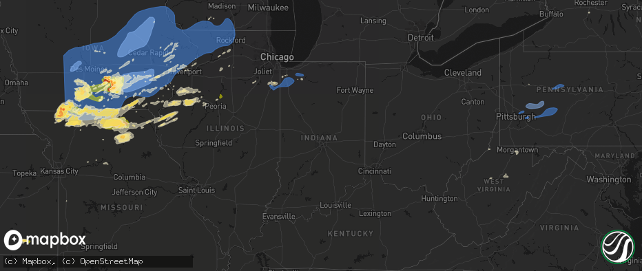
Hail Map in Indiana on June 11, 2026
The weather event in Indiana on June 11, 2026 includes Wind, Hail, and Tornado maps. 20 states and 2,417 cities were impacted and suffered possible damage. The total estimated number of properties impacted is 0.
Wind
Hail
Tornado
0
Estimated number of impacted properties by a 1.00" hail or larger0
Estimated number of impacted properties by a 1.75" hail or larger0
Estimated number of impacted properties by a 2.50" hail or largerStorm reports in Indiana
Indiana
| Date | Description |
|---|---|
| 06/10/202610:53 PM CDT | Tree downed along mcminn road. Time estimated by radar. |
| 06/10/202610:53 PM CDT | Tree downed in richmond. Time estimated by radar. |
| 06/10/202610:40 PM CDT | Tree in the roadway on state road 44 near the west county line. |
| 06/10/202610:30 PM CDT | Thunderstorm winds caused significant roof damage to east side of 2 story building. Time estimated from radar. |
| 06/10/202610:30 PM CDT | Trees down north of state road 44 and east of 500 east. Time estimated. |
| 06/10/202610:25 PM CDT | Tree into house. |
| 06/10/202610:25 PM CDT | Trees down. |
| 06/10/202610:20 PM CDT | Numerous 6-8 diameter or less limbs downed... A couple of uprooted pines between wall lake and the greenlawn cemetery areas near orland... In. |
| 06/10/202610:20 PM CDT | Thunderstorm winds destroyed metal barn on county road 550 east. Time estimated from radar. |
| 06/10/202610:20 PM CDT | Corrects previous non-tstm wnd gst report from 4 wsw woodburn. |
| 06/10/202610:17 PM CDT | Ef0 tornado with max winds 70 mph tracked 0.32 miles to ese creating a clear circulation pattern within corn field. Minor damage to an vehicle and awning and propane ta |
| 06/10/202610:15 PM CDT | A local report indicates 70 MPH wind near Mahon |
| 06/10/202610:13 PM CDT | Multiple trees and power lines down in muncie. |
| 06/10/202610:12 PM CDT | A shed was destroyed from a nearby trailer park. |
| 06/10/202610:10 PM CDT | Numerous 6-8 inch diameter or less limbs downed around the area between brighton and howe... In. Pine tree snapped halfway |
| 06/10/202610:10 PM CDT | Thunderstorm winds caused significant tree damage in south franklin area with roof damage on knapp and mitthoeffer roads. Time estimated from radar. |
| 06/10/202610:08 PM CDT | A local report indicates 70 MPH wind near 2 ENE Nine Mile |
| 06/10/202610:08 PM CDT | House crushed by tree. Time estimated via radar. |
| 06/10/202610:05 PM CDT | Large mature white pine snapped off 15 feet above ground... Large locust tree uprooted... Large limbs stripped from mature oak and maple trees. |
| 06/10/202610:03 PM CDT | 30 ft long live tree branch 7 to 8 inches diameter is down across peterman road. |
| 06/10/202610:00 PM CDT | Along sr-120... Especially near/west of n 450 w through approximately sr-5. Structural damage to a silo... Barns... And some shingle and siding damage on several homes. |
| 06/10/202610:00 PM CDT | Numerous reports of damage. |
| 06/10/202610:00 PM CDT | A local report indicates 66 MPH wind near 1 S Bluffton |
| 06/10/202610:00 PM CDT | Tree snapped. |
| 06/10/20269:58 PM CDT | Thunderstorm winds downed tree limb and power lines onto building roof resulting in arcing wires from a light pole which caused a fire in apartment attic. Time estimate |
| 06/10/20269:55 PM CDT | A local report indicates 59 MPH wind near 2 NNW Elkhart |
| 06/10/20269:55 PM CDT | Several trees and large branches down. |
| 06/10/20269:52 PM CDT | 18 inch diameter tree uprooted. Time estimated via radar. |
| 06/10/20269:50 PM CDT | Reports of power lines down in the lapel and anderson areas. |
| 06/10/20269:50 PM CDT | Corrects time of previous tstm wnd gst report from mahon. |
| 06/10/20269:45 PM CDT | Several homes damaged and trees down. |
| 06/10/20269:44 PM CDT | Several trees down. |
| 06/10/20269:43 PM CDT | A local report indicates 75 MPH wind near 2 N North Webster |
| 06/10/20269:42 PM CDT | Damage to a house. |
| 06/10/20269:42 PM CDT | Thunderstorm winds caused significant wind damage in cartersburg. Time estimated from radar. |
| 06/10/20269:42 PM CDT | Large tree and numerous branches down. |
| 06/10/20269:35 PM CDT | Roof ripped off house. |
| 06/10/20269:35 PM CDT | A local report indicates 60 MPH wind near 3 WNW Jonesboro |
| 06/10/20269:32 PM CDT | Several trees down. |
| 06/10/20269:31 PM CDT | Large tree branch snapped... Laying across a road. |
| 06/10/20269:30 PM CDT | *** 1 inj *** one injury due to downed tree at white river campground. |
| 06/10/20269:30 PM CDT | Siding ripped off the house. 2 trees down. Part of the roof of the barn is across the road in the woods stuck in trees. |
| 06/10/20269:30 PM CDT | Tree down across road. From social media. Time estimated from radar. |
| 06/10/20269:30 PM CDT | Large pine trees topped... Wood picket fence snapped... Grass and dirt plastered to buildings. |
| 06/10/20269:30 PM CDT | Numerous trees down in the south bend area. |
| 06/10/20269:30 PM CDT | Tree damage. |
| 06/10/20269:27 PM CDT | Tree on house and multiple broken limbs. |
| 06/10/20269:25 PM CDT | Multiple trees and power lines throughout howard county. |
| 06/10/20269:24 PM CDT | A local report indicates 60 MPH wind near 5 W Atlanta |
| 06/10/20269:22 PM CDT | House shifted off foundation and windows blown out. Several trees down in the area. |
| 06/10/20269:22 PM CDT | Multiple structures impacted. |
| 06/10/20269:20 PM CDT | A local report indicates 67 MPH wind near 2 ENE Cecil Harden Lake |
| 06/10/20269:19 PM CDT | Measured from personal weather station. |
| 06/10/20269:15 PM CDT | Tree on powerlines. |
| 06/10/20269:15 PM CDT | Trees and power lines down in the county... Especially along the 331 corridor and across 10 to argos. |
| 06/10/20269:10 PM CDT | Thunderstorm winds downed numerous trees on to roads and power lines. |
| 06/10/20269:07 PM CDT | A local report indicates 65 MPH wind near Peru |
| 06/10/20269:04 PM CDT | A local report indicates 64 MPH wind near Grissom Afb |
| 06/10/20269:02 PM CDT | Four large trees down. |
| 06/10/20269:00 PM CDT | 8 healthy trees down... 12 to 14 inches in diameter. |
| 06/10/20269:00 PM CDT | Trees down across the street from church. Branches estimated 2-4 in. Diameter. |
| 06/10/20269:00 PM CDT | Measured from personal weather station. |
| 06/10/20269:00 PM CDT | Large trees damaged in a straight line. |
| 06/10/20268:59 PM CDT | Measured from personal weather station. |
| 06/10/20268:55 PM CDT | Tree down. |
| 06/10/20268:52 PM CDT | Numerous trees down. |
| 06/10/20268:51 PM CDT | Measured from personal weather station. |
| 06/10/20268:47 PM CDT | Tree downed onto truck. |
| 06/10/20268:35 PM CDT | Thunderstorm winds downed large tree onto 9th street. Time estimated from radar. |
| 06/10/20268:30 PM CDT | Several large trees down. |
| 06/10/20268:30 PM CDT | 2 semis blown over on i-65. |
| 06/10/20268:28 PM CDT | Confirmed touchdown via ema. |
| 06/10/20268:24 PM CDT | Peak gust measured on personal weather station before data stopped being reported. |
| 06/10/20268:20 PM CDT | Thunderstorm winds downed trees in fountain county. Time estimated from radar. |
| 06/10/20268:20 PM CDT | Thunderstorm winds downed trees and affected barns in warren county. Time estimated from radar. |
| 06/10/20268:15 PM CDT | Tornado on the ground north of kouts. Time estimated by radar. |
| 06/10/20268:05 PM CDT | Peak gust measured on personal weather station. |
| 06/10/20268:05 PM CDT | Report of snapped corn and flipped over irrigation system. Time estimated by radar. |
| 06/10/20268:02 PM CDT | Trained spotter report of tornado near 900 south road and 200 west road with debris in the air. |
| 06/10/20268:00 PM CDT | Private weather station kinkentl6 reported 69 mph wind gust just prior to gauge outage. |
| 06/10/20267:58 PM CDT | Storm chaser video shows tornado southeast of hebron. |
| 06/10/20267:57 PM CDT | Public report of damage to trees and outbuildings southwest of kentland. Time estimated by radar. |
| 06/10/20267:51 PM CDT | Public report of tornado on the grand east of lowell near i-65. |
| 06/10/20267:33 PM CDT | Public report of roof damage and fence damage on drummond street in southwest cedar lake. Time estimated by radar. |
| 06/10/20267:25 PM CDT | Roof damage to andrean high school in merrillville. Multiple large branches broken in the vicinity. Possible tornado. Relayed via broadcast media. |
| 06/10/20267:16 PM CDT | Multiple large branches broken... Tree branches on house... Near 93rd avenue and northcote avenue. |
All States Impacted by Hail Map on June 11, 2026
Cities Impacted by Hail Map on June 11, 2026
- Shannon City, IA
- Tingley, IA
- Greenfield, IA
- Mount Ayr, IA
- Afton, IA
- Guthrie Center, IA
- Diagonal, IA
- Panora, IA
- Menlo, IA
- Bagley, IA
- Creston, IA
- Stuart, IA
- Orient, IA
- Yale, IA
- Kellerton, IA
- Dexter, IA
- Macksburg, IA
- Ellston, IA
- Grand River, IA
- Thayer, IA
- Murray, IA
- Worth, MO
- Lenox, IA
- Redding, IA
- Denver, MO
- Blockton, IA
- Benton, IA
- Grant City, MO
- Hatfield, MO
- Casey, IA
- Martinsville, MO
- Winterset, IA
- Linden, IA
- Jamaica, IA
- Rippey, IA
- Perry, IA
- Earlham, IA
- Dawson, IA
- Jefferson, IA
- Adel, IA
- Grand Junction, IA
- Redfield, IA
- Lorimor, IA
- Dallas Center, IA
- Woodward, IA
- Minburn, IA
- Ogden, IA
- Bouton, IA
- Beaver, IA
- Gentry, MO
- Albany, MO
- Unionville, MO
- Green Castle, MO
- Parnell, MO
- Bedford, IA
- Sheridan, MO
- Clearfield, IA
- Osceola, IA
- Peru, IA
- Ravenwood, MO
- Granger, IA
- Van Meter, IA
- De Soto, IA
- Luther, IA
- Boone, IA
- Waukee, IA
- Madrid, IA
- Eagleville, MO
- Booneville, IA
- Ridgeway, MO
- Bethany, MO
- Van Wert, IA
- Weldon, IA
- New Virginia, IA
- Woodburn, IA
- Lucas, IA
- Humeston, IA
- Truro, IA
- Saint Charles, IA
- Livonia, MO
- Derby, IA
- Chariton, IA
- Lacona, IA
- Leon, IA
- Grimes, IA
- Davis City, IA
- Prole, IA
- Blythedale, MO
- Urbandale, IA
- Patterson, IA
- West Des Moines, IA
- Cainsville, MO
- Lamoni, IA
- Clive, IA
- Cumming, IA
- Decatur, IA
- Johnston, IA
- Ames, IA
- Bevington, IA
- Kelley, IA
- Norwalk, IA
- Polk City, IA
- Pleasantville, IA
- Sheldahl, IA
- Runnells, IA
- Knoxville, IA
- Saint Marys, IA
- Garden Grove, IA
- Slater, IA
- Berwick, IA
- Alleman, IA
- Martensdale, IA
- Bondurant, IA
- Ackworth, IA
- Indianola, IA
- Melcher Dallas, IA
- Des Moines, IA
- Altoona, IA
- Elkhart, IA
- Lineville, IA
- Windsor Heights, IA
- Allerton, IA
- Milo, IA
- Carlisle, IA
- Cambridge, IA
- Hartford, IA
- Swan, IA
- Williamson, IA
- Liberty Center, IA
- Corydon, IA
- Pleasant Hill, IA
- Huxley, IA
- Ankeny, IA
- Columbia, IA
- Princeton, MO
- Stanberry, MO
- Conception Junction, MO
- Clyde, MO
- Moulton, IA
- Coatsville, MO
- Wildorado, TX
- Vega, TX
- Russell, IA
- Hamilton, IA
- Lovilia, IA
- Story City, IA
- Gilbert, IA
- Nevada, IA
- Monroe, IA
- Maxwell, IA
- Colfax, IA
- Mitchellville, IA
- Prairie City, IA
- Collins, IA
- Mingo, IA
- Harvey, IA
- Tracy, IA
- Bussey, IA
- Melrose, IA
- Albia, IA
- Oskaloosa, IA
- Eddyville, IA
- Leighton, IA
- Pella, IA
- Beacon, IA
- Pulaski, IA
- Douds, IA
- Bloomfield, IA
- Milton, IA
- Mercer, MO
- Clio, IA
- New Hampton, MO
- Colo, IA
- Memphis, MO
- McFall, MO
- Friona, TX
- Darlington, MO
- Saint Anthony, IA
- Newton, IA
- Baxter, IA
- State Center, IA
- Ira, IA
- McCallsburg, IA
- Zearing, IA
- Roland, IA
- Rhodes, IA
- Blakesburg, IA
- Ottumwa, IA
- University Park, IA
- New Sharon, IA
- Millerton, IA
- Promise City, IA
- Clemons, IA
- Melbourne, IA
- Union, IA
- New Providence, IA
- Albion, IA
- Marshalltown, IA
- Haverhill, IA
- Conrad, IA
- Liscomb, IA
- Laurel, IA
- Beaman, IA
- Garwin, IA
- Ferguson, IA
- Gilman, IA
- Gladbrook, IA
- Montour, IA
- Malcom, IA
- Otley, IA
- Toledo, IA
- Grinnell, IA
- Killduff, IA
- Searsboro, IA
- Kellogg, IA
- Reasnor, IA
- Sully, IA
- Le Grand, IA
- Lynnville, IA
- Tama, IA
- Cedar, IA
- Fremont, IA
- Mystic, IA
- What Cheer, IA
- Montezuma, IA
- Unionville, IA
- Chillicothe, IA
- Lucerne, MO
- Centerville, IA
- Powersville, MO
- Barnes City, IA
- Plano, IA
- Kirkville, IA
- Rose Hill, IA
- Moravia, IA
- Seymour, IA
- Brooklyn, IA
- Cincinnati, IA
- Udell, IA
- Newtown, MO
- Keosauqua, IA
- Hedrick, IA
- Birmingham, IA
- Drakesville, IA
- Exline, IA
- Pollock, MO
- Batavia, IA
- Delta, IA
- Agency, IA
- Deep River, IA
- Gibson, IA
- Eldon, IA
- Floris, IA
- Grundy Center, IA
- Lincoln, IA
- Reinbeck, IA
- Whitten, IA
- Eldora, IA
- Elberon, IA
- Chelsea, IA
- Vining, IA
- Clutier, IA
- Dysart, IA
- Traer, IA
- Buckingham, IA
- Stockport, IA
- Sigourney, IA
- Gilman City, MO
- Cedar Falls, IA
- Morrison, IA
- Hudson, IA
- Dike, IA
- Hartwick, IA
- Guernsey, IA
- Marengo, IA
- Martinsburg, IA
- Belle Plaine, IA
- Hayesville, IA
- Keswick, IA
- Webster, IA
- Victor, IA
- Harper, IA
- South English, IA
- Spickard, MO
- Keota, IA
- Jameson, MO
- Harris, MO
- Fairfield, IA
- Packwood, IA
- Ollie, IA
- Millersburg, IA
- North English, IA
- Richland, IA
- Libertyville, IA
- Williamsburg, IA
- Ladora, IA
- Janesville, IA
- Waverly, IA
- Waterloo, IA
- Keystone, IA
- New Hartford, IA
- La Porte City, IA
- Shellsburg, IA
- Van Horne, IA
- Vinton, IA
- Garrison, IA
- Mount Auburn, IA
- Evansdale, IA
- Brighton, IA
- Fairfax, IA
- Palo, IA
- Parnell, IA
- Blairstown, IA
- Norway, IA
- Wellman, IA
- Luzerne, IA
- Atkins, IA
- Jesup, IA
- Homestead, IA
- South Amana, IA
- Conroy, IA
- Middle Amana, IA
- Amana, IA
- Newhall, IA
- Gilbertville, IA
- Watkins, IA
- Swisher, IA
- Iowa City, IA
- North Liberty, IA
- Kalona, IA
- West Chester, IA
- Walford, IA
- Tiffin, IA
- Cedar Rapids, IA
- Washington, IA
- Oxford, IA
- Coralville, IA
- Riverside, IA
- Mount Pleasant, IA
- Ainsworth, IA
- Wayland, IA
- Lockridge, IA
- Olds, IA
- Crawfordsville, IA
- Columbus City, IA
- Winfield, IA
- Wapello, IA
- Mount Union, IA
- Hills, IA
- Conesville, IA
- Lone Tree, IA
- Columbus Junction, IA
- Morning Sun, IA
- Walker, IA
- Center Point, IA
- Denver, IA
- Hazleton, IA
- Brandon, IA
- Oran, IA
- Dewar, IA
- Sumner, IA
- Dunkerton, IA
- Urbana, IA
- Fairbank, IA
- Readlyn, IA
- Oelwein, IA
- Tripoli, IA
- Westgate, IA
- Raymond, IA
- Independence, IA
- Rowley, IA
- Hawkeye, IA
- Milan, MO
- Humphreys, MO
- Galt, MO
- Marion, IA
- Robins, IA
- Solon, IA
- Hiawatha, IA
- Maynard, IA
- Toddville, IA
- Green City, MO
- Yarmouth, IA
- Letts, IA
- Nichols, IA
- Muscatine, IA
- Grandview, IA
- New Boston, IL
- Moscow, IA
- West Branch, IA
- Tipton, IA
- West Liberty, IA
- Lisbon, IA
- Alburnett, IA
- Fruitland, IA
- Illinois City, IL
- Atalissa, IA
- Mount Vernon, IA
- Ely, IA
- Wilton, IA
- Farmersburg, IA
- Masonville, IA
- Dundee, IA
- Winthrop, IA
- Lamont, IA
- Randalia, IA
- Stanley, IA
- West Union, IA
- Aurora, IA
- Monona, IA
- Volga, IA
- Quasqueton, IA
- Wadena, IA
- Coggon, IA
- Fayette, IA
- Elkader, IA
- Luana, IA
- Saint Olaf, IA
- Elgin, IA
- Strawberry Point, IA
- Postville, IA
- Arlington, IA
- Clermont, IA
- Anamosa, IA
- Ryan, IA
- Olin, IA
- Monticello, IA
- Clarence, IA
- Elkport, IA
- Center Junction, IA
- Wyoming, IA
- Prairieburg, IA
- Stanwood, IA
- Bennett, IA
- Earlville, IA
- Mechanicsville, IA
- Durant, IA
- Edgewood, IA
- Delhi, IA
- Manchester, IA
- Langworthy, IA
- Martelle, IA
- Morley, IA
- Central City, IA
- Hopkinton, IA
- Springville, IA
- Delaware, IA
- Greeley, IA
- Worthington, MO
- Novinger, MO
- Glenwood, MO
- Lancaster, MO
- Monmouth, IA
- Oxford Junction, IA
- Queen City, MO
- Kirksville, MO
- Greentop, MO
- Brashear, MO
- Downing, MO
- McGregor, IA
- Garber, IA
- Guttenberg, IA
- Garnavillo, IA
- Marquette, IA
- Maquoketa, IA
- Baldwin, IA
- Glen Haven, WI
- New Vienna, IA
- Lowden, IA
- Epworth, IA
- Wheatland, IA
- Bernard, IA
- Cascade, IA
- Bagley, WI
- Farley, IA
- North Buena Vista, IA
- Holy Cross, IA
- Luxemburg, IA
- Onslow, IA
- Dyersville, IA
- Cassville, WI
- Bloomington, WI
- Colesburg, IA
- Worthington, IA
- Prairie Du Chien, WI
- New Liberty, IA
- Blue Grass, IA
- Potosi, WI
- Dubuque, IA
- La Motte, IA
- Walcott, IA
- Grand Mound, IA
- Delmar, IA
- Sherrill, IA
- Bellevue, IA
- Durango, IA
- Stockton, IA
- Zwingle, IA
- Dixon, IA
- Peosta, IA
- Calamus, IA
- Lost Nation, IA
- Oakville, IA
- Patch Grove, WI
- Baring, MO
- Hurdland, MO
- De Witt, IA
- Fulton, IL
- Davenport, IA
- Low Moor, IA
- Clinton, IA
- Andrew, IA
- Charlotte, IA
- Goose Lake, IA
- Princeton, IA
- McCausland, IA
- Eldridge, IA
- Donahue, IA
- Welton, IA
- Spragueville, IA
- Miles, IA
- Teeds Grove, IA
- Preston, IA
- Long Grove, IA
- Bryant, IA
- Camanche, IA
- East Dubuque, IL
- Elizabeth, IL
- Scales Mound, IL
- Sabula, IA
- Hanover, IL
- Savanna, IL
- Galena, IL
- Chadwick, IL
- Mount Carroll, IL
- Thomson, IL
- Morrison, IL
- Stockton, IL
- Milledgeville, IL
- Lanark, IL
- Gratiot, WI
- Pearl City, IL
- Darlington, WI
- Warren, IL
- Apple River, IL
- Cuba City, WI
- Shullsburg, WI
- Kent, IL
- Benton, WI
- Hazel Green, WI
- Lena, IL
- Keithsburg, IL
- Seaton, IL
- Mediapolis, IA
- Joy, IL
- Polo, IL
- Forreston, IL
- Shannon, IL
- Winslow, IL
- Nora, IL
- Freeport, IL
- South Wayne, WI
- Baileyville, IL
- Argyle, WI
- McConnell, IL
- Browntown, WI
- Bonaparte, IA
- Mount Sterling, IA
- Aledo, IL
- Alexis, IL
- Edina, MO
- Little York, IL
- Monroe, WI
- Cedarville, IL
- Orangeville, IL
- Dakota, IL
- Woodford, WI
- Ridott, IL
- Davis, IL
- Rock City, IL
- Brodhead, WI
- Juda, WI
- German Valley, IL
- Oregon, IL
- Byron, IL
- Mount Morris, IL
- Pecatonica, IL
- Winnebago, IL
- Durand, IL
- Leaf River, IL
- Rockford, IL
- Stillman Valley, IL
- Gorin, MO
- Donnellson, IA
- West Point, IA
- Farmington, IA
- Hillsboro, IA
- Knox City, MO
- La Belle, MO
- Rutledge, MO
- Shirland, IL
- Rockton, IL
- Janesville, WI
- Orfordville, WI
- Beloit, WI
- Evansville, WI
- Saint Paul, IA
- Kahoka, MO
- Danville, IA
- Monticello, WI
- New Glarus, WI
- Williamstown, MO
- Wyaconda, MO
- Monmouth, IL
- Blanchardville, WI
- Ohio, IL
- Princeton, IL
- South Beloit, IL
- Machesney Park, IL
- Loves Park, IL
- Roscoe, IL
- Caledonia, IL
- Footville, WI
- La Moille, IL
- Gerlaw, IL
- Rio, IL
- Galesburg, IL
- North Henderson, IL
- Viola, IL
- Oquawka, IL
- Wever, IA
- West Burlington, IA
- Burlington, IA
- Saint Patrick, MO
- Afton, WI
- Clinton, WI
- Stronghurst, IL
- Lomax, IL
- Carman, IL
- Wataga, IL
- Mendota, IL
- West Brooklyn, IL
- Gladstone, IL
- Media, IL
- Smithshire, IL
- Raritan, IL
- Roseville, IL
- Biggsville, IL
- Earlville, IL
- Oneida, IL
- Henderson, IL
- Avon, IL
- Berwick, IL
- Kirkwood, IL
- Gilson, IL
- Maquon, IL
- Saint Augustine, IL
- London Mills, IL
- Abingdon, IL
- Cameron, IL
- Altona, IL
- Knoxville, IL
- Victoria, IL
- Yates City, IL
- Elmwood, IL
- Williamsfield, IL
- Sardis, OH
- Mazon, IL
- Farmington, IL
- Trivoli, IL
- Hudson, NY
- Germantown, NY
- Elizaville, NY
- Craryville, NY
- Catskill, NY
- Trenton, MO
- Ancram, NY
- New Martinsville, WV
- Paden City, WV
- Coal City, IL
- Brimfield, IL
- Lore City, OH
- Salesville, OH
- Freeport, PA
- Leechburg, PA
- Vandergrift, PA
- Ford City, PA
- Hyde Park, PA
- Pine Plains, NY
- Peotone, IL
- Manteno, IL
- Cedar Lake, IN
- Lima, NY
- Honeoye Falls, NY
- Avon, NY
- Cordova, IL
- Quaker City, OH
- Apollo, PA
- Kittanning, PA
- Spring Church, PA
- Shelocta, PA
- Trafford, PA
- Export, PA
- Irwin, PA
- Jeannette, PA
- Murrysville, PA
- Harrison City, PA
- Claridge, PA
- Grant Park, IL
- Crown Point, IN
- Albany, IL
- Bourbonnais, IL
- Momence, IL
- Millbrook, NY
- Salt Point, NY
- Clinton Corners, NY
- Delmont, PA
- Indiana, PA
- Avonmore, PA
- Elderton, PA
- Rural Valley, PA
- Creekside, PA
- Sagamore, PA
- Home, PA
- Knox, PA
- Roxbury, CT
- Verbank, NY
- Lagrangeville, NY
- Dover Plains, NY
- Lakeside, CT
- Bethlehem, CT
- Valparaiso, IN
- Wanatah, IN
- New Alexandria, PA
- Blairsville, PA
- Black Lick, PA
- Homer City, PA
- Josephine, PA
- New Florence, PA
- Armagh, PA
- Derry, PA
- Brush Valley, PA
- Seward, PA
- Union Mills, IN
- Hanna, IN
- Pawling, NY
- Poughquag, NY
- Wingdale, NY
- Alexandria, MO
- Pittsburgh, PA
- Oakmont, PA
- Verona, PA
- New Kensington, PA
- Harwick, PA
- Springdale, PA
- Cheswick, PA
- Tarentum, PA
- Creighton, PA
- Albion, NY
- Glenville, WV
- Morgantown, WV
- Fairmont, WV
- Norborne, MO
- Kouts, IN
- Linneus, MO
- Sherman, CT
- Carrollton, MO
- Wayland, MO
- Hamilton, IL
- Warsaw, IL
- Keokuk, IA
- La Crosse, IN
- Bucklin, MO
- New Boston, MO
- Ethel, MO
- Sand Fork, WV
- Marion Center, PA
- Vintondale, PA
- Dilltown, PA
- Nanty Glo, PA
- Johnstown, PA
- Penn Run, PA
- Northern Cambria, PA
- Twin Rocks, PA
- Clymer, PA
- Belsano, PA
- Ebensburg, PA
- Strongstown, PA
- Nicktown, PA
- Heilwood, PA
- Alverda, PA
- Marsteller, PA
- Saint Benedict, PA
- Patton, PA
- Colver, PA
- Carrolltown, PA
- Elmora, PA
- Spangler, PA
- Patterson, NY
- Sublette, IL
- Sutter, IL
- West Point, IL
- Monroe, CT
- Sandy Hook, CT
- Oxford, CT
- Adrian, WV
- Buckhannon, WV
- Horner, WV
- Elmer, MO
- Carthage, IL
- Basco, IL
- Elvaston, IL
- Dixon, IL
- Reynoldsville, PA
- Du Bois, PA
- Rockton, PA
- Penfield, PA
- Chana, IL
- Brewster, NY
- New Fairfield, CT
- Gibbs, MO
- La Plata, MO
- Atlanta, MO
- Bevier, MO
- Callao, MO
- Spring Hope, NC
- Rochelle, IL
- New Cambria, MO
- Bradley, IL
- Kankakee, IL
- Rocky Mount, NC
- Pinetops, NC
- Watertown, CT
- Woodbury, CT
- Saint Anne, IL
- Elk City, KS
- Schneider, IN
- Lowell, IN
- Lake Village, IN
- Pembroke Township, IL
- Hebron, IN
- Morocco, IN
- Shelby, IN
- Demotte, IN
- Thayer, IN
- Wheatfield, IN
- Stormville, NY
- Carmel, NY
- Novelty, MO
- Cornwall Bridge, CT
- New Preston Marble Dale, CT
- Nashville, NC
- Dallas City, IL
- Tennessee, IL
- Blandinsville, IL
- La Harpe, IL
- Colchester, IL
- Independence, KS
- Neodesha, KS
- Macon, MO
- Miami, MO
- Plymouth, IL
- Bowen, IL
- Mendon, IL
- Leonard, MO
- Ursa, IL
- Cherryvale, KS
- Kent, CT
- Sharon, CT
- Middlesex, NC
- Zebulon, NC
- Edenton, NC
- Holmes, NY
- Anabel, MO
- Clarence, MO
- Okarche, OK
- Calumet, OK
- Butler, MO
- Litchfield, CT
- Slater, MO
- Castalia, NC
- Peoria, IL
- Metamora, IL
- Chillicothe, IL
- East Peoria, IL
- Mossville, IL
- Bettendorf, IA
- Sciota, IL
- Macomb, IL
- Danbury, CT
- Port Byron, IL
- Perry, OK
- Morrison, OK
- Lowpoint, IL
- Lacon, IL
- Washburn, IL
- Varna, IL
- Terra Alta, WV
- Oakland, MD
- Kitzmiller, MD
- Elk Garden, WV
- Newark, MO
- Gilliam, MO
- Glasgow, MO
- Tyner, NC
- Balmorhea, TX
- Monticello, MO
- Shelbyville, MO
- Lewistown, MO
- Ewing, MO
- Bethel, MO
- Keyser, WV
- Rawlings, MD
- Westernport, MD
- Swanton, MD
- New Creek, WV
- Burlington, WV
- Romney, WV
- Toluca, IL
- La Rose, IL
- El Reno, OK
- Dennis, KS
- Parsons, KS
- Mound Valley, KS
- Montrose, MO
- Urich, MO
- Clinton, MO
- Rushville, IL
- Vermont, IL
- Canton, MO
- Lynn Center, IL
- Clayton, IL
- Glencoe, OK
- Wenona, IL
- Lentner, MO
- Woodhull, IL
- Cambridge, IL
- Durham, MO
- La Grange, MO
- Armstrong, MO
- Augusta, IL
- Walnut, KS
- Washington Depot, CT
- New Windsor, IL
- Magnolia, IL
- Streator, IL
- Lostant, IL
- Camden, IL
- Pawnee, OK
- Industry, IL
- Shelbina, MO
- Chenoa, IL
- Gridley, IL
- Flanagan, IL
- Coffeyville, KS
- Stantonsburg, NC
- Wilson, NC
- Lewistown, IL
- Ipava, IL
- Fairview, IL
- Rutland, IL
- Lockwood, NY
- Waverly, NY
- Liberty, KS
- Altamont, KS
- Dana, IL
- Minonk, IL
- Higbee, MO
- Fayette, MO
- Battleboro, NC
- Osco, IL
- Adair, IL
- Marietta, IL
- Cuba, IL
- Ellisville, IL
- Smithfield, IL
- Pontiac, IL
- Graymont, IL
- Odell, IL
- Cornell, IL
- Littleton, IL
- Table Grove, IL
- Mount Sterling, IL
- Huntsville, IL
- Timewell, IL
- Golden, IL
- La Prairie, IL
- Barton, NY
- Ancona, IL
- Long Point, IL
- Tonica, IL
- Vinton, VA
- Goodview, VA
- Hunnewell, MO
- Emden, MO
- Canton, IL
- Hannibal, MO
- Davis Junction, IL
- Bryant, IL
- Saint David, IL
- Madison, MO
- Edna, KS
- Glasford, IL
- Astoria, IL
- Frederick, IL
- Hanna City, IL
- Browning, IL
- Sound Beach, NY
- Mount Sinai, NY
- Miller Place, NY
- Yaphank, NY
- Middle Island, NY
- Coram, NY
- Shirley, NY
- Rocky Point, NY
- Ridge, NY
- Shoreham, NY
- Medford, NY
- Maramec, OK
- Oswego, KS
- Bath, IL
- Havana, IL
- Beardstown, IL
- Liverpool, IL
- Mapleton, IL
- Topeka, IL
- Chandlerville, IL
- Manito, IL
- Kingston Mines, IL
- Pekin, IL
- Yale, OK
- Liberty, IL
- Camp Point, IL
- Lindenwood, IL
- Monroe Center, IL
- Esmond, IL
- Cherry Valley, IL
- Kirkland, IL
- Pecos, TX
- Sparland, IL
- Henry, IL
- McNabb, IL
- Hull, IL
- Burlington, WI
- Moneta, VA
- Deepwater, MO
- Colony, OK
- Easton, IL
- Kilbourne, IL
- Oakford, IL
- Monroe City, MO
- Paris, MO
- Holcomb, IL
- Kingston, IL
- Belvidere, IL
- Versailles, IL
- Dwight, IL
- Raleigh, NC
- Center, MO
- Ransom, IL
- Sturgeon, MO
- Harrisburg, MO
- Clark, MO
- Rocheport, MO
- Chambersburg, IL
- Griggsville, IL
- Bedford, VA
- Forest City, IL
- South Pekin, IL
- Tremont, IL
- Green Valley, IL
- San Jose, IL
- Delavan, IL
- Mason City, IL
- Arenzville, IL
- Virginia, IL
- Kenosha, WI
- Union Grove, WI
- Union City, OK
- Columbia, MO
- Hallsville, MO
- Thompson, MO
- Centralia, MO
- Verona, IL
- Seneca, IL
- Bartlett, KS
- Garden Prairie, IL
- Lookeba, OK
- Matador, TX
- Meredosia, IL
- Stillwater, OK
- Marengo, IL
- Galesburg, KS
- Chetopa, KS
- Sims, NC
- Saint Paul, KS
- Edwards, IL
- Louisiana, MO
- Rome, PA
- Quincy, IL
- Payson, IL
- Palmyra, MO
- Chebanse, IL
- Welch, OK
- Hinton, OK
- New London, MO
- Lenapah, OK
- S Coffeyville, OK
- Racine, WI
- Pleasant Prairie, WI
- Twin Lakes, WI
- Spring Grove, IL
- Kansasville, WI
- Bristol, WI
- Salem, WI
- Genoa City, WI
- Hebron, IL
- Wonder Lake, IL
- Richmond, IL
- Silver Lake, WI
- Sturtevant, WI
- Lake Geneva, WI
- Springfield, WI
- Elkhorn, WI
- Mexico, MO
- Harvard, IL
- Capron, IL
- Woodstock, IL
- Poplar Grove, IL
- Creve Coeur, IL
- Groveland, IL
- Washington, IL
- Morton, IL
- Jacksonville, IL
- Petersburg, IL
- Ashland, IL
- Tallula, IL
- Genoa, IL
- Hampshire, IL
- Jennings, OK
- New Canton, IL
- Rockport, IL
- Warsaw, MO
- Childress, TX
- Tell, TX
- Kinderhook, IL
- Rock Falls, IL
- Gotebo, OK
- Cordell, OK
- Wilmington, IL
- Duke, OK
- Barstow, TX
- Benton City, MO
- Martinsburg, MO
- Laddonia, MO
- Rush Hill, MO
- Deer Creek, IL
- Eureka, IL
- Essex, IL
- Braidwood, IL
- Herscher, IL
- Bonfield, IL
- Gardner, IL
- Buckingham, IL
- Reddick, IL
- Minco, OK
- Hartsburg, IL
- Emden, IL
- New Holland, IL
- Pleasant Plains, IL
- Drumright, OK
- Osceola, MO
- Pittsfield, IL
- Barry, IL
- Ochelata, OK
- Bartlesville, OK
- Barnsdall, OK
- Binger, OK
- Auxvasse, MO
- Middletown, IL
- Chapin, IL
- Concord, IL
- Perry, IL
- Jamestown, MO
- Delaware, OK
- Vinita, OK
- Carlock, IL
- Goodfield, IL
- Danvers, IL
- Lexington, IL
- Greenview, IL
- Roanoke, IL
- Hudson, IL
- Minier, IL
- Mackinaw, IL
- Stanford, IL
- Armington, IL
- Congerville, IL
- Benson, IL
- El Paso, IL
- Hopedale, IL
- Secor, IL
- Bloomington, IL
- Wapella, IL
- McLean, IL
- Lawndale, IL
- Cantrall, IL
- Waynesville, IL
- Lincoln, IL
- Sherman, IL
- Atlanta, IL
- Mount Pulaski, IL
- Kenney, IL
- Williamsville, IL
- Towanda, IL
- Clinton, IL
- Normal, IL
- Shirley, IL
- Chestnut, IL
- Elkhart, IL
- Athens, IL
- Beason, IL
- Heyworth, IL
- Springfield, IL
- Granite, OK
- Fulton, MO
- Ashland, MO
- Hartsburg, MO
- Paducah, TX
- Cushing, OK
- Gould, OK
- Fort Cobb, OK
- Martinton, IL
- Beaverville, IL
- Papineau, IL
- Miami, OK
- New Salem, IL
- Levelland, TX
- Bluffs, IL
- Winchester, IL
- Mountain View, OK
- Saint John, IN
- Dyer, IN
- Schererville, IN
- Bluejacket, OK
- Cee Vee, TX
- Anadarko, OK
- Lone Wolf, OK
- Manhattan, IL
- Alexander, IL
- New Bloomfield, MO
- Monee, IL
- Beecher, IL
- Gracemont, OK
- Floydada, TX
- Edwards, MO
- North Miami, OK
- Buffalo, IL
- Illiopolis, IL
- Riverton, IL
- Maroa, IL
- Latham, IL
- Niantic, IL
- Downs, IL
- Warrensburg, IL
- Cooksville, IL
- Decatur, IL
- De Land, IL
- Cisco, IL
- Le Roy, IL
- Hammond, IL
- Forsyth, IL
- Bement, IL
- Monticello, IL
- Farmer City, IL
- Dewitt, IL
- Colfax, IL
- Oreana, IL
- Lane, IL
- Ellsworth, IL
- Argenta, IL
- Milmine, IL
- Weldon, IL
- Arrowsmith, IL
- Cerro Gordo, IL
- Saybrook, IL
- White Heath, IL
- Forrest, IL
- Chatsworth, IL
- Fairbury, IL
- Melvin, IL
- Mansfield, IL
- Fisher, IL
- Seymour, IL
- Piper City, IL
- Danforth, IL
- Kempton, IL
- Saunemin, IL
- Ashkum, IL
- Roberts, IL
- Sibley, IL
- Cullom, IL
- Anchor, IL
- Gibson City, IL
- Mahomet, IL
- Strawn, IL
- Clifton, IL
- Foosland, IL
- Bellflower, IL
- Cropsey, IL
- Merrillville, IN
- Modesto, IL
- Unionville, VA
- Rapidan, VA
- White Hall, IL
- Roodhouse, IL
- Mangum, OK
- New Berlin, IL
- Loami, IL
- Shannon, NC
- Raeford, NC
- Griffith, IN
- Thawville, IL
- Dewey, IL
- Onarga, IL
- Paxton, IL
- Loda, IL
- Elliott, IL
- Gilman, IL
- Tolono, IL
- Sadorus, IL
- Champaign, IL
- Ivesdale, IL
- Buckley, IL
- Atwood, IL
- Bondville, IL
- Rantoul, IL
- Ludlow, IL
- Hobart, IN
- Fairland, OK
- Afton, OK
- Niota, IL
- Commerce, OK
- Mokane, MO
- Steedman, MO
- Pocasset, OK
- Morris, IL
- Virden, IL
- Waverly, IL
- Crete, IL
- Dawson, IL
- Murrayville, IL
- Chatham, IL
- Fort Madison, IA
- Roaring Springs, TX
- Rockbridge, IL
- Carrollton, IL
- Franklin, IL
- La Place, IL
- Mt Zion, IL
- Dalton City, IL
- Mount Auburn, IL
- Blue Mound, IL
- Macon, IL
- Harristown, IL
- Boody, IL
- Mechanicsburg, IL
- Edinburg, IL
- Rochester, IL
- Lovington, IL
- Wyandotte, OK
- Macatawa, MI
- Holland, MI
- West Olive, MI
- Zeeland, MI
- Hudsonville, MI
- Donovan, IL
- Crescent City, IL
- Watseka, IL
- Milford, IL
- Thomasboro, IL
- Bethany, IL
- Cissna Park, IL
- Moweaqua, IL
- Amber, OK
- Baxter Springs, KS
- Hettick, IL
- Greenfield, IL
- Portland, MO
- Rhineland, MO
- Auburn, IL
- Palmyra, IL
- Rich Hill, MO
- Williamsburg, MO
- Quapaw, OK
- Galena, KS
- Grandville, MI
- Jenison, MI
- Joplin, MO
- Bartlett, IL
- Ralls, TX
- Rankin, IL
- Gifford, IL
- Kentland, IN
- Iroquois, IL
- Sheldon, IL
- Fair Oaks, IN
- Brook, IN
- Saint Joseph, IL
- Tuscola, IL
- Wellington, IL
- Potomac, IL
- Hoopeston, IL
- Savoy, IL
- Arthur, IL
- Penfield, IL
- Urbana, IL
- Philo, IL
- Findlay, IL
- Sullivan, IL
- Pesotum, IL
- Grand Rapids, MI
- Wyoming, MI
- Byron Center, MI
- Jerseyville, IL
- Rockville, MO
- Kane, IL
- Taylorville, IL
- Roosevelt, OK
- Treece, KS
- Crosbyton, TX
- Appleton City, MO
- Kaiser, MO
- Brumley, MO
- Linn Creek, MO
- Chesterton, IN
- Quanah, TX
- Boone Grove, IN
- Caledonia, MI
- Yorkville, IL
- Lorenzo, TX
- Oswego, IL
- Romeoville, IL
- Plainfield, IL
- Bolingbrook, IL
- Naperville, IL
- Aurora, IL
- Mcadoo, TX
- Montgomery, IL
- Woodridge, IL
- Lemont, IL
- Lockport, IL
- Willowbrook, IL
- Robbins, IL
- Orland Park, IL
- Palos Heights, IL
- Willow Springs, IL
- Downers Grove, IL
- Markham, IL
- Darien, IL
- Midlothian, IL
- Crestwood, IL
- Palos Park, IL
- Lisle, IL
- Homer Glen, IL
- Oak Forest, IL
- Harvey, IL
- Posen, IL
- Blue Island, IL
- South Holland, IL
- Worth, IL
- Dolton, IL
- Alsip, IL
- Calumet City, IL
- Palos Hills, IL
- Riverdale, IL
- Brighton, IL
- Pawnee, IL
- Kincaid, IL
- Seneca, MO
- Cement, OK
- Medora, IL
- Columbus, KS
- Picher, OK
- Morrison, MO
- Warrenton, MO
- Divernon, IL
- Glenarm, IL
- Chamois, MO
- Claremore, OK
- Bridgeview, IL
- Riverside, IL
- Evergreen Park, IL
- Clarendon Hills, IL
- Oak Lawn, IL
- Westmont, IL
- Western Springs, IL
- Westchester, IL
- Hinsdale, IL
- Chicago Ridge, IL
- Broadview, IL
- Cicero, IL
- Maywood, IL
- La Grange, IL
- Berwyn, IL
- Brookfield, IL
- Forest Park, IL
- Hometown, IL
- Oak Brook, IL
- Chicago, IL
- Hickory Hills, IL
- Lyons, IL
- Justice, IL
- La Grange Park, IL
- Burbank, IL
- Summit Argo, IL
- Freeport, MI
- Wayland, MI
- Middleville, MI
- Alto, MI
- Newman, IL
- Longview, IL
- Humboldt, IL
- Armstrong, IL
- Earl Park, IN
- Broadlands, IL
- Ogden, IL
- Muncie, IL
- Charleston, IL
- Fairmount, IL
- Mattoon, IL
- Henning, IL
- Hindsboro, IL
- Oakwood, IL
- Rossville, IL
- Arcola, IL
- Murdock, IL
- Oakland, IL
- Danville, IL
- Collison, IL
- Fowler, IN
- Royal, IL
- Villa Grove, IL
- Sidney, IL
- Allerton, IL
- Fithian, IL
- Stockland, IL
- Homer, IL
- Camargo, IL
- Bismarck, IL
- Catlin, IL
- Ambia, IN
- Goodland, IN
- Reynolds, IN
- Georgetown, IL
- Tilton, IL
- Attica, IN
- Rensselaer, IN
- Indianola, IL
- Metcalf, IL
- Remington, IN
- Sidell, IL
- Brocton, IL
- Williamsport, IN
- State Line, IN
- Alvin, IL
- Monon, IN
- Oxford, IN
- Wolcott, IN
- Pine Village, IN
- Chalmers, IN
- Boswell, IN
- Westville, IL
- West Lebanon, IN
- Covington, IN
- Brookston, IN
- Hume, IL
- Mount Ayr, IN
- West Lafayette, IN
- Otterbein, IN
- Templeton, IN
- Francesville, IN
- Medaryville, IN
- North Judson, IN
- Winamac, IN
- Clarksville, MI
- Lake Odessa, MI
- Ashmore, IL
- Gary, IN
- Hammond, IN
- Whiting, IN
- East Chicago, IN
- Wright City, MO
- Crocker, MO
- Iberia, MO
- Westville, IN
- Shipman, IL
- Piasa, IL
- Fidelity, IL
- La Porte, IN
- Lawton, OK
- Ulman, MO
- Morrisonville, IL
- Palmer, IL
- Yeoman, IN
- Westpoint, IN
- Idaville, IN
- Star City, IN
- Logansport, IN
- Lafayette, IN
- Buffalo, IN
- Kewanna, IN
- Rochester, IN
- Lucerne, IN
- Ridge Farm, IL
- Delphi, IN
- Royal Center, IN
- Veedersburg, IN
- Monticello, IN
- Perrysville, IN
- Burnettsville, IN
- Cayuga, IN
- Battle Ground, IN
- Chrisman, IL
- Kansas, IL
- Sunfield, MI
- Portland, MI
- Wingate, IN
- San Pierre, IN
- Knox, IN
- Monterey, IN
- Nashville, MI
- Vermontville, MI
- Mulliken, MI
- Charlotte, MI
- Woodland, MI
- Kingman, IN
- Redmon, IL
- Dana, IN
- Paris, IL
- Grand Ledge, MI
- Grove, OK
- Dickens, TX
- Dixon, MO
- Carlinville, IL
- Gillespie, IL
- Calhoun, MO
- Chickasha, OK
- Pryor, OK
- Potterville, MI
- Eagle, MI
- Niles, MI
- Edwardsburg, MI
- Cassopolis, MI
- Mason, MI
- Williamston, MI
- Holt, MI
- Dimondale, MI
- Okemos, MI
- East Lansing, MI
- Haslett, MI
- Lansing, MI
- Dewitt, MI
- Bath, MI
- Laingsburg, MI
- Dowagiac, MI
- Walkerton, IN
- North Liberty, IN
- Mill Creek, IN
- Windsor, MO
- Medicine Park, OK
- Cyril, OK
- Fletcher, OK
- Olustee, OK
- Altus, OK
- Rockville, IN
- Plymouth, IN
- Culver, IN
- Ora, IN
- Grovertown, IN
- Hillsdale, IN
- Clinton, IN
- Argos, IN
- Newtown, IN
- Mellott, IN
- Bremen, IN
- Hillsboro, IN
- Bourbon, IN
- New Richmond, IN
- Westfield, IL
- Gays, IL
- Lerna, IL
- Windsor, IL
- Assumption, IL
- Shelbyville, IL
- Stonington, IL
- Lincoln, MO
- Sawyer, MI
- Bridgman, MI
- Portage, IN
- South Bend, IN
- Beverly Shores, IN
- Michigan City, IN
- Harbert, MI
- Three Oaks, MI
- Lakeside, MI
- Union Pier, MI
- New Buffalo, MI
- Ramsey, IL
- Oconee, IL
- Herrick, IL
- Cowden, IL
- Galien, MI
- Rolling Prairie, IN
- New Carlisle, IN
- Fort Sill, OK
- New Troy, MI
- Buchanan, MI
- Baroda, MI
- Berrien Springs, MI
- Elgin, OK
- Vermilion, IL
- Romney, IN
- Dennison, IL
- Montezuma, IN
- Waynetown, IN
- Marshall, IL
- West Terre Haute, IN
- Bloomingdale, IN
- Martinsville, IL
- Vandalia, MI
- Jones, MI
- Warsaw, IN
- Claypool, IN
- Syracuse, IN
- Linden, IN
- Crawfordsville, IN
- Flora, IN
- Camden, IN
- Buck Creek, IN
- Milford, IN
- Akron, IN
- Nappanee, IN
- Atwood, IN
- Leesburg, IN
- Twelve Mile, IN
- Mentone, IN
- Marshall, IN
- Etna Green, IN
- Macy, IN
- Dayton, IN
- Tippecanoe, IN
- Universal, IN
- Roachdale, IN
- Greencastle, IN
- Mulberry, IN
- Young America, IN
- Bringhurst, IN
- Bridgeton, IN
- Denver, IN
- Mecca, IN
- Frankfort, IN
- Reelsville, IN
- Kokomo, IN
- Peru, IN
- Ladoga, IN
- Rosedale, IN
- Galveston, IN
- New Waverly, IN
- Rossville, IN
- Darlington, IN
- Burlington, IN
- Russellville, IN
- Cutler, IN
- Alamo, IN
- Walton, IN
- Terre Haute, IN
- New Market, IN
- Silver Lake, IN
- Waveland, IN
- New Goshen, IN
- Bainbridge, IN
- Brazil, IN
- Clarks Hill, IN
- Thorntown, IN
- Jamestown, IN
- Burket, IN
- Russiaville, IN
- Carbon, IN
- Colfax, IN
- New Ross, IN
- Onward, IN
- Mexico, IN
- Advance, IN
- Michigantown, IN
- Lebanon, IN
- Roann, IN
- Forest, IN
- North Salem, IN
- Pierceton, IN
- Miami, IN
- Fairmount, IN
- Amboy, IN
- North Manchester, IN
- Sheridan, IN
- Windfall, IN
- Sharpsville, IN
- La Fontaine, IN
- Elwood, IN
- Urbana, IN
- Marion, IN
- Kirklin, IN
- Winona Lake, IN
- Goldsmith, IN
- Converse, IN
- Wabash, IN
- Swayzee, IN
- Laketon, IN
- Greentown, IN
- Bunker Hill, IN
- Tipton, IN
- Grissom Arb, IN
- Kempton, IN
- Carmel, IN
- Atlanta, IN
- Lizton, IN
- Sweetser, IN
- Lagro, IN
- Cicero, IN
- Frankton, IN
- Lapel, IN
- Noblesville, IN
- Alexandria, IN
- Zionsville, IN
- Summitville, IN
- Brownsburg, IN
- Jonesboro, IN
- Whitestown, IN
- Anderson, IN
- Westfield, IN
- Pittsboro, IN
- Arcadia, IN
- Geronimo, OK
- Jasper, MO
- Oronogo, MO
- Spur, TX
- Lanagan, MO
- Noel, MO
- South West City, MO
- Salina, OK
- Headrick, OK
- Altus Afb, OK
- Anderson, MO
- Mishawaka, IN
- Beecher City, IL
- Ballwin, MO
- Goshen, IN
- Liberty Mills, IN
- Servia, IN
- Millersburg, IN
- Middlebury, IN
- New Paris, IN
- Cromwell, IN
- Larwill, IN
- North Webster, IN
- Walters, OK
- Columbia City, IN
- Ligonier, IN
- Kimmell, IN
- Huntington, IN
- South Whitley, IN
- Van Buren, IN
- Fowlerton, IN
- Gas City, IN
- Roanoke, IN
- Andrews, IN
- Warren, IN
- Upland, IN
- Matthews, IN
- Gaston, IN
- Hartford City, IN
- Markle, IN
- Daleville, IN
- Yorktown, IN
- Muncie, IN
- Middletown, IN
- Albion, IN
- Montpelier, IN
- Effingham, IL
- Shumway, IL
- Eaton, IN
- Bluffton, IN
- Poneto, IN
- Pennville, IN
- Keystone, IN
- Dunkirk, IN
- Liberty Center, IN
- Valley Park, MO
- Shipshewana, IN
- Topeka, IN
- Lagrange, IN
- Wawaka, IN
- Uniondale, IN
- Ossian, IN
- Yoder, IN
- Zanesville, IN
- Petroleum, IN
- Bryant, IN
- Casey, IL
- Webberville, MI
- Howell, MI
- Corunna, MI
- Gaines, MI
- Swartz Creek, MI
- Lennon, MI
- Bancroft, MI
- Linden, MI
- Byron, MI
- Vernon, MI
- Fowlerville, MI
- Owosso, MI
- Morrice, MI
- Durand, MI
- Perry, MI
- Elkhart, IN
- Rome City, IN
- Wolcottville, IN
- Howe, IN
- Kendallville, IN
- Bristol, IN
- Labadie, MO
- Saint Louis, MO
- White Pigeon, MI
- Constantine, MI
- Three Rivers, MI
- Centreville, MI
- Sturgis, MI
- Carthage, MO
- Lubbock, TX
- Fenton, MO
- Camby, IN
- Greenfield, IN
- Stilesville, IN
- New Palestine, IN
- Fillmore, IN
- Mooresville, IN
- Mccordsville, IN
- Greenwood, IN
- Ingalls, IN
- Coatesville, IN
- Danville, IN
- Amo, IN
- Clayton, IN
- Fortville, IN
- Plainfield, IN
- Wilkinson, IN
- Markleville, IN
- Pendleton, IN
- West Newton, IN
- Beech Grove, IN
- Fishers, IN
- Avon, IN
- Indianapolis, IN
- Maxwell, IN
- Avilla, IN
- Golden City, MO
- Sigel, IL
- Duncan, OK
- Comanche, OK
- Rose, OK
- Tipton, OK
- Bella Vista, AR
- Sulphur Springs, AR
- Idalou, TX
- Loveland, OK
- Chattanooga, OK
- Cache, OK
- Scammon, KS
- Ashley, IN
- Burr Oak, MI
- Angola, IN
- Corunna, IN
- Waterloo, IN
- Hudson, IN
- Orland, IN
- Auburn, IN
- Pleasant Lake, IN
- South Milford, IN
- Fountaintown, IN
- Fairland, IN
- Albany, IN
- Springport, IN
- Mays, IN
- Straughn, IN
- Falmouth, IN
- Arlington, IN
- Monroe, IN
- Selma, IN
- Parker City, IN
- Mooreland, IN
- Morristown, IN
- Spiceland, IN
- Charlottesville, IN
- Fort Wayne, IN
- New Castle, IN
- Craigville, IN
- Ridgeville, IN
- Decatur, IN
- Gwynneville, IN
- Shirley, IN
- Carthage, IN
- Losantville, IN
- Redkey, IN
- Farmland, IN
- Kennard, IN
- Shelbyville, IN
- Portland, IN
- Berne, IN
- Lewisville, IN
- Knightstown, IN
- Rushville, IN
- Geneva, IN
- Robertsville, MO
- Pacific, MO
- Catawissa, MO
- Wildwood, MO
- Cedar Hill, MO
- East Carondelet, IL
- Strang, OK
- Slaton, TX
- Chouteau, OK
- Locust Grove, OK
- Colcord, OK
- Faxon, OK
- Dupo, IL
- Spavinaw, OK
- Hastings, OK
- Waurika, OK
- Temple, OK
- Hoagland, IN
- New Haven, IN
- Monroeville, IN
- Woodburn, IN
- Ansonia, OH
- Paulding, OH
- Modoc, IN
- Wren, OH
- Saint Henry, OH
- Celina, OH
- Lynn, IN
- Rockford, OH
- Fort Recovery, OH
- Convoy, OH
- Rossburg, OH
- Spencerville, OH
- Milton, IN
- Saint Marys, OH
- Union City, OH
- Cambridge City, IN
- Coldwater, OH
- Maria Stein, OH
- Richmond, IN
- Fountain City, IN
- Montezuma, OH
- Economy, IN
- Payne, OH
- Haviland, OH
- Hagerstown, IN
- Mendon, OH
- Saratoga, IN
- Connersville, IN
- Delphos, OH
- Van Wert, OH
- Salamonia, IN
- Willshire, OH
- Union City, IN
- Winchester, IN
- Centerville, IN
- Scott, OH
- Williamsburg, IN
- Antwerp, OH
- Venedocia, OH
- Greens Fork, IN
- New Weston, OH
- Burkettsville, OH
- Grover Hill, OH
- Ohio City, OH
- Middle Point, OH
- Pioneer, OH
- Montgomery, MI
- Camden, MI
- Montpelier, OH
- Coldwater, MI
- Bronson, MI
- Fremont, IN
- Bryan, OH
- Edgerton, OH
- Hamilton, IN
- West Unity, OH
- Butler, IN
- Reading, MI
- Quincy, MI
- Edon, OH
- Post, TX
- Belleville, IL
- Millstadt, IL
- Kansas, OK
- High Ridge, MO
- Bentonville, AR
- Arcanum, OH
- Versailles, OH
- Boston, IN
- Webster, IN
- New Madison, OH
- Brownsville, IN
- Yorkshire, OH
- West Manchester, OH
- Hollansburg, OH
- Eaton, OH
- Camden, OH
- Palestine, OH
- New Bremen, OH
- College Corner, OH
- New Paris, OH
- Liberty, IN
- Greenville, OH
- Chickasaw, OH
- Eldorado, OH
- Fort Jennings, OH
- Randlett, OK
- Wilson, TX
- Tahoka, TX
- Hulbert, OK
- Cloverdale, OH
- Ottoville, OH
- Columbus Grove, OH
- Ottawa, OH
- Lima, OH
- Kalida, OH
- Fayette, OH
- Hillsdale, MI
- Alvordton, OH
- Morenci, MI
- Osseo, MI
- Pittsford, MI
- Archbold, OH
- Waldron, MI
- Hudson, MI
- Allen, MI
- Pineville, MO
- Columbia, IL
- Wagoner, OK
- Lyons, OH
- Adrian, MI
- Jasper, MI
- Clayton, MI
- Stryker, OH
- Tecumseh, MI
- Sand Creek, MI
- Wauseon, OH
- Manitou Beach, MI
- Tipton, MI
- Onsted, MI
- Addison, MI
- North Adams, MI
- Watts, OK
- Wichita Falls, TX
- Jonesville, MI
- Cement City, MI
- Jerome, MI
- Brooklyn, MI
- Tahlequah, OK
- Aldrich, MO
- Bolivar, MO
- Fair Play, MO
- Metamora, OH
- Riga, MI
- Ottawa Lake, MI
- Swanton, OH
- Milan, MI
- Clinton, MI
- Berkey, OH
- Manchester, MI
- Palmyra, MI
- Blissfield, MI
- Delta, OH
- Britton, MI
- Saline, MI
- Deerfield, MI
- Troy, OH
- Pitsburg, OH
- Bluffton, OH
- Harrod, OH
- Cairo, OH
- Houston, OH
- Anna, OH
- Brookville, OH
- Lafayette, OH
- Botkins, OH
- New Hampshire, OH
- Tipp City, OH
- Russia, OH
- Wapakoneta, OH
- Vandalia, OH
- Gomer, OH
- Jackson Center, OH
- Dayton, OH
- De Graff, OH
- Sidney, OH
- Piqua, OH
- Phillipsburg, OH
- Minster, OH
- Buckland, OH
- Waynesfield, OH
- Lakeview, OH
- West Alexandria, OH
- Covington, OH
- West Milton, OH
- Vaughnsville, OH
- New Lebanon, OH
- Quincy, OH
- Ludlow Falls, OH
- Fletcher, OH
- Uniopolis, OH
- Beaverdam, OH
- Farmersville, OH
- Englewood, OH
- Laura, OH
- Pleasant Hill, OH
- Fort Loramie, OH
- Osgood, OH
- New Knoxville, OH
- Clayton, OH
- Bradford, OH
- Pandora, OH
- Maplewood, OH
- Pemberton, OH
- Lewistown, OH
- Verona, OH
- Lewisburg, OH
- Gettysburg, OH
- Port Jefferson, OH
- Mount Cory, OH
- Findlay, OH
- McComb, OH
- Benton Ridge, OH
- Rawson, OH
- Odonnell, TX
- Reeds, MO
- Summers, AR
- Alger, OH
- Jenera, OH
- Ada, OH
- Arlington, OH
- Forest, OH
- Welling, OK
- Sainte Genevieve, MO
- Duenweg, MO
- Holliday, TX
- Muskogee, OK
- Fort Gibson, OK
- Siloam Springs, AR
- Cisne, IL
- Mount Erie, IL
- Scotland, TX
- McCutchenville, OH
- Fostoria, OH
- Arcadia, OH
- Carey, OH
- Tiffin, OH
- Vanlue, OH
- New Riegel, OH
- Upper Sandusky, OH
- Mount Blanchard, OH
- Alvada, OH
- Sycamore, OH
- Perryville, MO
- Saint Mary, MO
- Lamesa, TX
- Park Hill, OK
- Bunch, OK
- Stilwell, OK
- Proctor, OK
- Bloomville, OH
- Republic, OH
- Braggs, OK
- Maybee, MI
- Dundee, MI
- Petersburg, MI
- Webbers Falls, OK
- Gore, OK
- Frohna, MO
- Farrar, MO
- Vian, OK
- Ellington, MO
- Checotah, OK
- Porum, OK
- Stigler, OK
- Van Buren, MO
- Grandin, MO
- Ellsinore, MO
- Marion, KY
- Owensboro, KY
- Smithville, OK
- Doniphan, MO
- Mcalester, OK
- Beaver Dam, KY
- Cromwell, KY
- Harviell, MO
- Oxly, MO
- Naylor, MO
- Broken Bow, OK
- Horse Branch, KY
- Murray, KY
- Hayti, MO
- Bragg City, MO
- Greensburg, KY
- Whitefield, OK
- Andrews Air Force Base, MD
- Huntly, VA
- Linden, VA
- Washington, DC
- Reston, VA
- Delaplane, VA
- Fort Washington, MD
- Vienna, VA
- Hume, VA
- Ashburn, VA
- Leesburg, VA
- Dunkirk, MD
- Churchton, MD
- Middleburg, VA
- West River, MD
- Friendship, MD
- Chester Gap, VA
- The Plains, VA
- Fairfax, VA
- Naval Anacost Annex, DC
- Oakton, VA
- Haymarket, VA
- Centreville, VA
- Catharpin, VA
- Lanham, MD
- Arlington, VA
- McLean, VA
- Lothian, MD
- Alexandria, VA
- Chantilly, VA
- Front Royal, VA
- Markham, VA
- Hyattsville, MD
- Shady Side, MD
- Harwood, MD
- Capitol Heights, MD
- Falls Church, VA
- Tracys Landing, MD
- Bowie, MD
- Deale, MD
- Clinton, MD
- Upper Marlboro, MD
- Brentwood, MD
- Sterling, VA
- District Heights, MD
- Marshall, VA
- Owings, MD
- Galesville, MD
- Davidsonville, MD
- Bethesda, MD
- Herndon, VA
- Upperville, VA
- Suitland, MD
- Oxon Hill, MD
- Annandale, VA
- Temple Hills, MD
- Edgewater, MD
- Mount Rainier, MD
- Dunn Loring, VA
- Aldie, VA
- Fort Myer, VA
- Springfield, VA
- Gambrills, MD
- Crownsville, MD
- Riva, MD
- Stevensville, MD
- Annapolis, MD
- Carmichaels, PA
- Algonac, MI
- Clinton Township, MI
- Harsens Island, MI
- Harper Woods, MI
- Harrison Township, MI
- Saint Clair Shores, MI
- Eastpointe, MI
- Sterling Heights, MI
- New Baltimore, MI
- Fair Haven, MI
- Marine City, MI
- Roseville, MI
- Macomb, MI
- Warren, MI
- Grosse Pointe, MI
- Fraser, MI
- Detroit, MI
- Mount Clemens, MI
- Union, MI
- Berrien Center, MI
- Granger, IN
- Osceola, IN
- Kingsford Heights, IN
- Notre Dame, IN
- Lakeville, IN
- Hamlet, IN
- Taylor Ridge, IL
- Montpelier, IA
- Andalusia, IL
- Buffalo, IA
- Le Claire, IA


