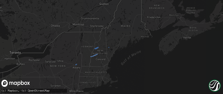
Hail Map in Maine on June 18, 2026
The weather event in Maine on June 18, 2026 includes Tornado, Hail, and Wind maps. 15 states and 157 cities were impacted and suffered possible damage. The total estimated number of properties impacted is 0.
Tornado
Hail
Wind
0
Estimated number of impacted properties by a 1.00" hail or larger0
Estimated number of impacted properties by a 1.75" hail or larger0
Estimated number of impacted properties by a 2.50" hail or largerStorm reports in Maine
Maine
| Date | Description |
|---|---|
| 06/18/20264:15 PM CDT | Tree down on wires on brattle street. Time estimated by radar. |
| 06/18/20264:12 PM CDT | Tree down blocking the intersection of line road and quaker ridge road. Time estimated by radar. |
| 06/18/20263:50 PM CDT | Tree down blocking gore rd in oxford. Time estimated by radar. |
| 06/18/20263:38 PM CDT | Multiple trees and wires down. Time estimated from radar. |
| 06/18/20263:37 PM CDT | Multiple trees and powerlines down completely blocking east main street in denmark. Time estimated by radar. |
| 06/18/20263:37 PM CDT | Multiple trees down blocking youngs ridge road in acton... Me. Time estimated by radar. |
All States Impacted by Hail Map on June 18, 2026
Cities Impacted by Hail Map on June 18, 2026
- Slidell, LA
- Medford, OK
- Piqua, KS
- Iola, KS
- Maple City, KS
- Wichita, KS
- Piedmont, KS
- Oxford, KS
- Shidler, OK
- Lamont, OK
- Deer Creek, OK
- Yates Center, KS
- Neosho Falls, KS
- Winfield, KS
- Tonkawa, OK
- Nash, OK
- Arkansas City, KS
- Pass Christian, MS
- Saucier, MS
- Wiggins, MS
- Pond Creek, OK
- Derby, KS
- Douglass, KS
- Mulvane, KS
- Ponca City, OK
- Marland, OK
- Dexter, KS
- Rock, KS
- Hunter, OK
- Rose Hill, KS
- Burden, KS
- Atlanta, KS
- Pawhuska, OK
- Bluff City, KS
- Belle Plaine, KS
- Wellington, KS
- Augusta, KS
- Caldwell, KS
- Haysville, KS
- Peck, KS
- Billings, OK
- Wakita, OK
- Amorita, OK
- Udall, KS
- Red Rock, OK
- Kingman, KS
- Cherokee, OK
- Spivey, KS
- Burlington, OK
- Copan, OK
- Manchester, OK
- Vinita, OK
- Delaware, OK
- Anthony, KS
- Lenapah, OK
- Wann, OK
- Nardin, OK
- S Coffeyville, OK
- Cambridge, KS
- Leon, KS
- Harper, KS
- Argonia, KS
- Jet, OK
- Conway Springs, KS
- Norwich, KS
- Cedar Vale, KS
- Mayfield, KS
- Blackwell, OK
- Milton, KS
- Milan, KS
- Clifton Park, NY
- Rexford, NY
- Mechanicville, NY
- Waterford, NY
- Sawyer, KS
- Isabel, KS
- Medicine Lodge, KS
- Dryden, VA
- Zenda, KS
- Nashville, KS
- Attica, KS
- Sharon, KS
- Ludowici, GA
- Glennville, GA
- Ocala, FL
- Waldron, KS
- Silver Springs, FL
- Danville, KS
- Springfield, VT
- Claremont, NH
- Windsor, VT
- Ascutney, VT
- Newport, NH
- South Haven, KS
- Burbank, OK
- Jeffersonville, GA
- Eatonton, GA
- Kaw City, OK
- Geuda Springs, KS
- Columbia, SC
- Ridgeland, SC
- Greensboro, GA
- Hardeeville, SC
- Sedan, KS
- Purlear, NC
- West Jefferson, NC
- Traphill, NC
- Millers Creek, NC
- McGrady, NC
- Hays, NC
- North Wilkesboro, NC
- Bartlesville, OK
- Grantham, NH
- Sunapee, NH
- New London, NH
- Springfield, NH
- Wilmot, NH
- Danbury, NH
- Grafton, NH
- Hill, NH
- Orford, NH
- Piermont, NH
- Wentworth, NH
- Warren, NH
- North Woodstock, NH
- Sumter, SC
- Viola, KS
- Pierson, FL
- Denmark, ME
- Bridgton, ME
- Bishopville, SC
- Clearwater, KS
- Pinnacle, NC
- Tobaccoville, NC
- Stapleton, GA
- Wrens, GA
- Blythe, GA
- Hephzibah, GA
- Matthews, GA
- Augusta, GA
- Smoaks, SC
- Daytona Beach, FL
- Van Buren, AR
- Fort Smith, AR
- McLain, MS
- Murdock, KS
- King, NC
- Johnson City, TN
- Cheney, KS
- Wallace, SC
- Bennettsville, SC
- Mount Airy, NC
- Ararat, NC
- Watauga, TN
- Piney Flats, TN
- Rockingham, NC
- Hamlet, NC


