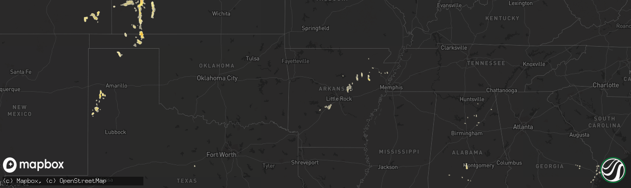
Hail Map in Kansas on July 31, 2013
The weather event in Kansas on July 31, 2013 includes Hail map. 17 states and 211 cities were impacted and suffered possible damage. The total estimated number of properties impacted is 52.
Hail
52
Estimated number of impacted properties by a 1.00" hail or larger76
Estimated number of impacted properties by a 1.75" hail or larger0
Estimated number of impacted properties by a 2.50" hail or largerStorm reports in Kansas
Kansas
| Date | Description |
|---|---|
| 07/31/20136:00 PM CDT | A local report indicates 1.00 inch wind near 4 S SUBLETTE |
| 07/31/20135:52 PM CDT | Golf ball to hen egg size hail in oakley. |
| 07/31/20135:50 PM CDT | Two reports within two blocks of each other. Time estimated from radar. Reports relayed via em. |
| 07/31/20135:48 PM CDT | A local report indicates 1.25 inch wind near OAKLEY |
| 07/31/20135:47 PM CDT | A local report indicates 1.50 inch wind near OAKLEY |
| 07/31/20135:45 PM CDT | A roof was partially torn off an office of a motel. Several large limbs were down as well. The wind speed was estimated at 70 mph. |
| 07/31/20135:37 PM CDT | A local report indicates 65 MPH wind near 10 NNW TICE |
| 07/31/20135:20 PM CDT | A local report indicates 1.25 inch wind near 4 W OAKLEY |
| 07/31/20135:12 PM CDT | This report was collected by the nssl shave program. |
| 07/31/20134:58 PM CDT | This report was collected by the nssl shave program. |
| 07/31/20134:54 PM CDT | Numerous reports of large tree limbs blocking streets within the city limits |
| 07/31/20134:54 PM CDT | A local report indicates 1.50 inch wind near 2 E GARDEN CITY |
| 07/31/20134:45 PM CDT | A local report indicates 60 MPH wind near 5 N DEERFIELD |
| 07/31/20134:40 PM CDT | A local report indicates 60 MPH wind near 5 N DEERFIELD |
| 07/31/20134:38 PM CDT | This report was collected by the nssl shave program. |
| 07/31/20134:35 PM CDT | This report was collected by the nssl shave program. |
| 07/31/20134:27 PM CDT | This report was collected by the nssl shave program. |
| 07/31/20134:27 PM CDT | This report was collected by the nssl shave program. |
| 07/31/20134:27 PM CDT | Significant blowing dust was reported with the estimated wind gust producing one quarter mile visibility or less |
| 07/31/20134:27 PM CDT | The spotter was located on the northeast side of garden city |
| 07/31/20134:20 PM CDT | A local report indicates 1.75 inch wind near 12 SE FRIEND |
| 07/31/20134:20 PM CDT | A local report indicates 60 MPH wind near 11 SSE CIMARRON |
| 07/31/20134:15 PM CDT | A local report indicates 1.00 inch wind near 3 W ENSIGN |
| 07/31/20134:08 PM CDT | This report was from the nssl shave program. |
| 07/31/20134:04 PM CDT | A few roof shingles were blown off a house and a one inch tree limb was down. |
| 07/31/20134:04 PM CDT | Hail stone was 3 inches by 1.25 inches but was found 45 minutes after the storm. |
| 07/31/20134:00 PM CDT | A local report indicates 67 MPH wind near 4 WSW FRIEND |
| 07/31/20134:00 PM CDT | This report was collected by the nssl shave program. |
| 07/31/20133:40 PM CDT | A local report indicates 1.00 inch wind near 1 NE SHALLOW WATER |
| 07/31/20133:36 PM CDT | A local report indicates 1.00 inch wind near 2 N HOWELL |
| 07/31/20133:35 PM CDT | This report was collected by the nssl shave program. |
| 07/31/20133:26 PM CDT | A local report indicates 1.00 inch wind near SCOTT CITY |
| 07/31/20133:12 PM CDT | Quarter sized hail and 50 to 60 mph winds |
| 07/30/20139:00 PM CDT | Late report from last night |
| 07/30/20139:00 PM CDT | A local report indicates 1.75 inch wind near 8 NW ST. FRANCIS |
| 07/30/20139:00 PM CDT | A local report indicates 1.50 inch wind near 4 NW ST. FRANCIS |
| 07/30/20138:45 PM CDT | Hail broke a window. |
All States Impacted by Hail Map on July 31, 2013
Cities Impacted by Hail Map on July 31, 2013
- Akron, CO
- Harrison, NE
- Marsland, NE
- Crenshaw, MS
- Wray, CO
- Saint Francis, KS
- Liberal, KS
- Kismet, KS
- Forgan, OK
- Turpin, OK
- Hugoton, KS
- Garden City, KS
- Scott City, KS
- Grinnell, KS
- Oakley, KS
- Monument, KS
- Ingalls, KS
- Hanceville, AL
- Cheyenne, WY
- Meriden, WY
- Roy, NM
- Sublette, KS
- Yoder, WY
- Burwell, NE
- Batesland, SD
- Lake City, FL
- Tribune, KS
- Cimarron, KS
- Grenville, NM
- Moscow, KS
- Tucumcari, NM
- Ensign, KS
- Bradford, AR
- Springfield, CO
- Garner, AR
- Beebe, AR
- Ward, AR
- Searcy, AR
- McRae, AR
- Ainsworth, NE
- Johnstown, NE
- Friona, TX
- Muleshoe, TX
- Des Moines, NM
- Springer, NM
- Gladstone, NM
- Fisher, AR
- Weiner, AR
- Hereford, TX
- Balko, OK
- Bennett, CO
- Nara Visa, NM
- Mosquero, NM
- Madison, FL
- Traskwood, AR
- Vernon, CO
- Morrill, NE
- Clayton, NM
- Bassett, NE
- Long Pine, NE
- Farwell, TX
- Counce, TN
- Marienthal, KS
- Holcomb, KS
- Metter, GA
- Conchas Dam, NM
- Elida, NM
- Wheatland, WY
- Chugwater, WY
- Guymon, OK
- Manville, WY
- Mitchell, NE
- Raton, NM
- Hickory Ridge, AR
- Amagon, AR
- Limon, CO
- Idalia, CO
- Eads, TN
- Germantown, TN
- Collierville, TN
- Kim, CO
- Savannah, GA
- Hooker, OK
- Healy, KS
- Broadwater, NE
- Bald Knob, AR
- Oil Trough, AR
- Pleasant Plains, AR
- Thida, AR
- Yemassee, SC
- Ridgeland, SC
- Coosawhatchie, SC
- Lamar, CO
- Hardesty, OK
- Crawford, NE
- Blountsville, AL
- Alachua, FL
- Gainesville, FL
- Punta Gorda, FL
- Deerfield, KS
- Kendall, KS
- Lakin, KS
- Satanta, KS
- Shingleton, MI
- Munising, MI
- Gruver, TX
- Deer Trail, CO
- Agate, CO
- Medon, TN
- Mercer, TN
- Yulee, FL
- Callahan, FL
- Newport, AR
- Hayneville, AL
- Tyler, AL
- Portales, NM
- Hemingford, NE
- Byers, CO
- Pep, NM
- Causey, NM
- Torrington, WY
- Syracuse, KS
- Beaver, OK
- Jetmore, KS
- Lyman, NE
- Dundee, MS
- Crescent, OR
- Higden, AR
- Melrose, NM
- Olney Springs, CO
- Mayo, FL
- Ellsworth, NE
- Lowndesboro, AL
- Selma, AL
- Green Cove Springs, FL
- Folsom, NM
- Hardeeville, SC
- Rincon, GA
- Martin, SD
- Gordon, NE
- Jonesboro, AR
- Bridgeport, NE
- Lusk, WY
- Richmond Hill, GA
- Malvern, AR
- Tavares, FL
- Douglas, WY
- Pritchett, CO
- Boaz, AL
- Altoona, AL
- Horton, AL
- Otis, CO
- Bismarck, AR
- Pine Apple, AL
- Maxwell, NM
- Lake Butler, FL
- Sarah, MS
- Hudson, CO
- Trumann, AR
- Sardis, MS
- Toone, TN
- Leoti, KS
- Dunnellon, FL
- Lecanto, FL
- Early Branch, SC
- Benton, AR
- San Jon, NM
- Port Wentworth, GA
- Pooler, GA
- Claxton, GA
- Pine Hill, AL
- Dublin, TX
- Midway, GA
- Fort Payne, AL
- Scottsbluff, NE
- Hawthorne, FL
- Lexington, TN
- Cash, AR
- Kit Carson, CO
- Dodge City, KS
- Walnut Ridge, AR
- Register, GA
- Osceola, AR
- Dyess, AR
- Warrior, AL
- Hayden, AL
- Loving, NM
- Ashville, AL
- Riceboro, GA
- Eads, CO
- Eckley, CO
- Wetmore, MI
- Saint Marys, GA
- Greenville, AL
- Hugo, CO
- Strasburg, CO
- Woodville, AL
- Amistad, NM
- Parsons, TN
- Tallahassee, FL
- Judsonia, AR
- Lepanto, AR
- Steele, AL
- Clarksdale, MS
- Lyon, MS
- Desdemona, TX
- Loveland, CO
- Franklin, TN
- Sumterville, FL
- Lawrenceburg, TN
- Leoma, TN


