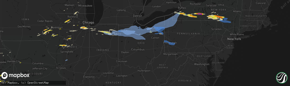
Hail Map in Ohio on March 31, 2026
The weather event in Ohio on March 31, 2026 includes Hail, Wind, and Tornado maps. 15 states and 881 cities were impacted and suffered possible damage. The total estimated number of properties impacted is 5,236.
Hail
Wind
Tornado
5,236
Estimated number of impacted properties by a 1.00" hail or larger0
Estimated number of impacted properties by a 1.75" hail or larger0
Estimated number of impacted properties by a 2.50" hail or largerStorm reports in Ohio
Ohio
| Date | Description |
|---|---|
| 03/31/20266:54 PM CDT | Healthy pine tree snapped. |
| 03/31/20266:50 PM CDT | Power lines downed. |
| 03/31/20266:38 PM CDT | Tree down at sr 18 and township rd 15. Time estimated via radar. |
| 03/31/20266:28 PM CDT | Dispatch reports roof blown off in independence. Time estimated via radar. |
| 03/31/20266:27 PM CDT | Very large tree fell onto car in defiance. Unknown if any injuries. Time estimated via radar. |
| 03/31/20266:26 PM CDT | Several reports of powerlines down in and around scott. Time estimated via radar. |
| 03/31/20266:26 PM CDT | Power poles down on dutch-john road east of scott. Reported by van wert county emergency manager. |
| 03/31/20266:25 PM CDT | Large tree uprooted onto home at the intersection of cromley rd and sr 111. Time estimated via radar. |
| 03/31/20266:24 PM CDT | Trees down at sr 127 and sr 18. Time estimated via radar. |
| 03/31/20266:23 PM CDT | Dispatch reports roof blown off. |
| 03/31/20266:22 PM CDT | A grain bin was destroyed on fountain street west of us 127 in sherwood. Time estimated via radar. |
| 03/31/20266:22 PM CDT | Multiple power poles and lines down in sherwood. Time estimated via radar. |
| 03/31/20266:20 PM CDT | Tree down on sr 127. Time estimated via radar. |
| 03/31/20266:12 PM CDT | Barn damaged near jericho and roselawn roads. Time estimated via radar. |
| 03/31/20266:10 PM CDT | Photo relayed by broadcast media of metal roofing thrown into a nearby field in hicksville. Time estimated via radar. |
| 03/31/20266:10 PM CDT | Corrects previous report from 3 se hicksville. Mesonet station dvi11214 hicksville. |
| 03/31/20266:10 PM CDT | Mesonet station dvi11214 hicksville. |
| 03/31/20266:09 PM CDT | A brief tornado |
| 03/31/20266:03 PM CDT | Dispatch reports roof blown off and barn blown down. |
| 03/31/20265:46 PM CDT | Part of roof torn off of southeast high school. |
| 03/31/20265:18 PM CDT | Asos station khzy ashtabula. |
| 03/31/20264:55 PM CDT | 65 mph gust and dime size hail. |
| 03/31/20264:52 PM CDT | Trees and powerlines down on hopkins road. |
| 03/31/20264:50 PM CDT | Wires down on road. |
| 03/31/20264:45 PM CDT | Awos station kcgf. |
| 03/31/20264:44 PM CDT | Large tree down on beachwood drive. |
| 03/31/20264:42 PM CDT | Buoy station faio1 fairport... Oh. |
| 03/31/20264:40 PM CDT | Large tree down on powerlines leading to a road closure. Time estimated via radar. |
| 03/31/20264:32 PM CDT | Asos station kbkl cleveland. |
| 03/31/20264:31 PM CDT | Windows of a high rise office building at east 9th st and st. Clair ave blown out due to thunderstorm wind gusts. |
| 03/31/20264:30 PM CDT | Large portion of roof came off an apartment building on fulton road. |
| 03/31/20264:28 PM CDT | Tree uprooted. |
| 03/31/20264:26 PM CDT | Social media report of a large tree downed in cleveland. Time estimated via radar. |
| 03/31/20264:24 PM CDT | Asos station kcle cleveland. |
| 03/31/20264:18 PM CDT | 3 very large trees down near the intersection of canterbury and detroit roads. |
| 03/31/20264:14 PM CDT | Trained weather spotter reports 74 mph gust on personal weather station. |
| 03/31/20264:09 PM CDT | Asos station klpr lorain elyria. |
| 03/31/20264:04 PM CDT | Tree down across north main street. |
| 03/31/20264:04 PM CDT | Very large tree down on a house on north main street. Time estimated via radar. |
| 03/31/20263:53 PM CDT | Power lines and poles down in collins. Time estimated via radar. |
| 03/31/20263:47 PM CDT | Social media report of trees down... Power poles down... And outdoor playset tossed on state route 4... South of attica. Time estimated via radar. |
| 03/31/20263:17 PM CDT | Multiple power poles down near buchanan rd and oak dr. Time estimated via radar. |
| 03/31/20263:04 PM CDT | 66 mph wind gust measured on personal weather station. |
| 03/31/20262:47 PM CDT | K1g0 reports 51 knot wind gust. |
| 03/31/20262:39 PM CDT | Tree and powerlines down on roachton rd. Time estimated via radar. |
| 03/31/20262:38 PM CDT | Semi truck flipped over on us-24 near hertzfeld rd. Time estimated via radar. |
| 03/30/20268:56 PM CDT | Tree through a house on honeytown road. Residents trapped in the basement. Time estimated via radar. |
| 03/30/20268:56 PM CDT | A brief ef0 tornado touched down just west of honeytown road near apple creek and moved east across three residential properties before lifting east of honeytown road. |
| 03/30/20268:45 PM CDT | Social media report for a large tree down in big prairie. |
| 03/30/20268:26 PM CDT | Tree downed in bellville. |
| 03/30/20268:25 PM CDT | Tree and power-lines down in lucas. |
| 03/30/20268:20 PM CDT | Multiple trees and power-lines downed along route 430 east of mansfield. |
| 03/30/20268:00 PM CDT | Social media report of a large tree down in stevens park. Time estimated via radar. |
| 03/30/20267:53 PM CDT | Tree downed on leesville road. |
| 03/30/20267:49 PM CDT | Ema relayed a report of up to 27 transmission lines down on sr 4 south of carrothers in northern crawford county. Time estimated via radar. |
| 03/30/20267:34 PM CDT | Social media photo of hail as big as one inch in brunswick. Time estimated via radar. |
| 03/30/20267:34 PM CDT | Report from mping: quarter |
All States Impacted by Hail Map on March 31, 2026
Cities Impacted by Hail Map on March 31, 2026
- Tomah, WI
- Warrens, WI
- Oakville, IA
- Brighton, IA
- Wayland, IA
- Mount Pleasant, IA
- Oquawka, IL
- Seaton, IL
- Biggsville, IL
- Gladstone, IL
- Monmouth, IL
- Camp Douglas, WI
- Batavia, IA
- Burlington, IA
- Necedah, WI
- Nekoosa, WI
- Galesburg, IL
- Alexis, IL
- Gerlaw, IL
- Columbus Junction, IA
- Compton, IL
- Paw Paw, IL
- Arkdale, WI
- Little York, IL
- Friendship, WI
- Ottumwa, IA
- Bloomfield, IA
- Letts, IA
- Earlville, IL
- Crawfordsville, IA
- Coloma, WI
- Bancroft, WI
- Westfield, WI
- Hancock, WI
- Wapello, IA
- Muscatine, IA
- Eldon, IA
- Agency, IA
- Leland, IL
- Hedrick, IA
- Wautoma, WI
- Montello, WI
- Hennepin, IL
- Princeton, IL
- Wild Rose, WI
- Bradford, IL
- Princeton, WI
- Astoria, IL
- Oglesby, IL
- Peru, IL
- Standard, IL
- Mark, IL
- Cedar Point, IL
- Granville, IL
- Tonica, IL
- Green Lake, WI
- Markesan, WI
- Washington, IA
- Fairfield, IA
- Ottawa, IL
- Marseilles, IL
- Ripon, WI
- Minooka, IL
- Havana, IL
- Bath, IL
- Oshkosh, WI
- Grand Ridge, IL
- Brandon, WI
- Sandwich, IL
- Plano, IL
- Shorewood, IL
- Joliet, IL
- Kilbourne, IL
- Easton, IL
- Washington, IL
- East Peoria, IL
- Metamora, IL
- Eldorado, WI
- Rosendale, WI
- Peoria, IL
- Chillicothe, IL
- Eureka, IL
- Pickett, WI
- Malone, WI
- Fond Du Lac, WI
- New Lenox, IL
- Mokena, IL
- Frankfort, IL
- West Chester, IA
- Lone Tree, IA
- Ainsworth, IA
- Conesville, IA
- Riverside, IA
- Roanoke, IL
- Channahon, IL
- Wallace, MI
- Mason City, IL
- Mount Calvary, WI
- Saint Cloud, WI
- Redgranite, WI
- Winfield, IA
- Manhattan, IL
- Sterling, IL
- Homer Glen, IL
- Lockport, IL
- Elwood, IL
- Matteson, IL
- New Holland, IL
- Chilton, WI
- San Jose, IL
- Elkhart Lake, WI
- Monee, IL
- University Park, IL
- Pekin, IL
- Ipava, IL
- Columbus City, IA
- Steger, IL
- Richton Park, IL
- Park Forest, IL
- Crete, IL
- Cleveland, WI
- Plymouth, WI
- Sheboygan Falls, WI
- Sheboygan, WI
- Lincoln, IL
- Elburn, IL
- Maple Park, IL
- Milledgeville, IL
- Romeoville, IL
- Plainfield, IL
- Emden, IL
- Cole Camp, MO
- Polo, IL
- Orland Park, IL
- Oregon, IL
- Atlanta, IL
- Woodridge, IL
- Franklin Grove, IL
- Ashton, IL
- Mount Morris, IL
- Lake Geneva, WI
- Fontana, WI
- Peotone, IL
- Stillman Valley, IL
- Capron, IL
- New Boston, IL
- Morning Sun, IA
- Wilton, IA
- Olds, IA
- Fruitland, IA
- Grandview, IA
- Nichols, IA
- Illinois City, IL
- Lockridge, IA
- Harvard, IL
- Dixon, IL
- Moscow, IA
- Byron, IL
- Poplar Grove, IL
- Caledonia, IL
- Clinton, WI
- Roscoe, IL
- Sharon, WI
- South Beloit, IL
- Delavan, WI
- Darien, WI
- Iowa City, IA
- Hills, IA
- West Liberty, IA
- Walworth, WI
- Argyle, WI
- Atalissa, IA
- New Glarus, WI
- Belleville, WI
- Oconomowoc, WI
- Ixonia, WI
- Watertown, WI
- Silver Creek, NY
- Dunkirk, NY
- Antwerp, OH
- Hicksville, OH
- Cecil, OH
- Mark Center, OH
- Sherwood, OH
- Ney, OH
- Defiance, OH
- Irving, NY
- Forestville, NY
- South Dayton, NY
- Perrysburg, NY
- Gowanda, NY
- Collins, NY
- Lawtons, NY
- Valders, WI
- Kiel, WI
- Manitowoc, WI
- Reedsville, WI
- Sheridan, NY
- North Collins, NY
- Angola, NY
- Saint Nazianz, WI
- Holgate, OH
- New Bavaria, OH
- Napoleon, OH
- Oakwood, OH
- Cattaraugus, NY
- East Otto, NY
- Springville, NY
- Geneseo, IL
- Osco, IL
- Continental, OH
- Hamler, OH
- Leipsic, OH
- Malinta, OH
- Liberty Center, OH
- Grelton, OH
- Grand Rapids, OH
- McClure, OH
- West Valley, NY
- Waterville, OH
- Deshler, OH
- Bowling Green, OH
- Whitehouse, OH
- Delevan, NY
- Machias, NY
- Ottawa, OH
- Weston, OH
- Miller City, OH
- Custar, OH
- Perrysburg, OH
- Tontogany, OH
- Haskins, OH
- Rudolph, OH
- Dunbridge, OH
- Milton Center, OH
- Andalusia, IL
- Taylor Ridge, IL
- Orion, IL
- Colona, IL
- Coal Valley, IL
- Crest Hill, IL
- McComb, OH
- North Baltimore, OH
- Pandora, OH
- Hoytville, OH
- Mount Cory, OH
- Cygnet, OH
- Portage, OH
- Findlay, OH
- Northwood, OH
- Walbridge, OH
- Millbury, OH
- Rossford, OH
- Maumee, OH
- Toledo, OH
- Franklinville, NY
- Rushford, NY
- Cuba, NY
- Farmersville Station, NY
- Houghton, NY
- Fillmore, NY
- Ellicottville, NY
- Swain, NY
- Dalton, NY
- Jerry City, OH
- Van Buren, OH
- Luckey, OH
- Pemberville, OH
- Arcadia, OH
- Fostoria, OH
- Bloomdale, OH
- Stony Ridge, OH
- Bradner, OH
- Risingsun, OH
- West Millgrove, OH
- Wayne, OH
- Gibsonburg, OH
- Helena, OH
- Genoa, OH
- Woodville, OH
- Williston, OH
- Curtice, OH
- Martin, OH
- Kansas, OH
- Clay Center, OH
- Dansville, NY
- Arkport, NY
- Wayland, NY
- Caneadea, NY
- Belfast, NY
- Cohocton, NY
- Burgoon, OH
- Tiffin, OH
- Fremont, OH
- Bettsville, OH
- Graytown, OH
- Elmore, OH
- Lindsey, OH
- Rocky Ridge, OH
- Oak Harbor, OH
- Angelica, NY
- Belmont, NY
- Canaseraga, NY
- Eden, NY
- Hunt, NY
- Tinley Park, IL
- Avoca, NY
- Bascom, OH
- Alvada, OH
- Almond, NY
- Prattsburgh, NY
- Bath, NY
- Country Club Hills, IL
- Friendship, NY
- Black Creek, NY
- Alfred Station, NY
- Ozark, AL
- Clopton, AL
- Skipperville, AL
- Alfred, NY
- Hornell, NY
- Hammondsport, NY
- Pulteney, NY
- Green Springs, OH
- New Riegel, OH
- Bloomville, OH
- Republic, OH
- Old Fort, OH
- Lacarne, OH
- Clyde, OH
- Milan, OH
- Castalia, OH
- Sandusky, OH
- Lakeside Marblehead, OH
- Attica, OH
- Vickery, OH
- Port Clinton, OH
- Monroeville, OH
- Bellevue, OH
- Huron, OH
- Canisteo, NY
- Newville, AL
- Andover, NY
- Scio, NY
- Saint John, IN
- Cedar Lake, IN
- Crown Point, IN
- Coffee Springs, AL
- Chancellor, AL
- Morris, IL
- Bradford, NY
- Dundee, NY
- Keuka Park, NY
- Penn Yan, NY
- Cameron, NY
- Rock Stream, NY
- Watkins Glen, NY
- New Washington, OH
- Willard, OH
- Norwalk, OH
- Plymouth, OH
- North Fairfield, OH
- Amherst, OH
- Wakeman, OH
- Lorain, OH
- Vermilion, OH
- Collins, OH
- Berlin Heights, OH
- Lowpoint, IL
- Washburn, IL
- Beecher, IL
- Merrillville, IN
- Burdett, NY
- Oberlin, OH
- Kipton, OH
- New London, OH
- Wellington, OH
- Greenwich, OH
- Elyria, OH
- Avon Lake, OH
- Sheffield Lake, OH
- Avon, OH
- North Ridgeville, OH
- Bay Village, OH
- Minonk, IL
- Valparaiso, IN
- Grafton, OH
- Lagrange, OH
- Rocky River, OH
- Olmsted Falls, OH
- North Olmsted, OH
- Columbia Station, OH
- Westlake, OH
- Lakewood, OH
- Cleveland, OH
- Brookpark, OH
- Berea, OH
- Valley City, OH
- Litchfield, OH
- Strongsville, OH
- Brunswick, OH
- Independence, OH
- Medina, OH
- North Royalton, OH
- Trumansburg, NY
- Odessa, NY
- Alpine, NY
- Abbeville, AL
- McGraw, NY
- Marathon, NY
- Cortland, NY
- Hebron, IN
- Lowell, IN
- Mclean, TX
- Cincinnatus, NY
- Broadview Heights, OH
- Hinckley, OH
- Euclid, OH
- Eastlake, OH
- Wickliffe, OH
- Kouts, IN
- Knox, IN
- Wellington, TX
- Quail, TX
- Culver, IN
- Ithaca, NY
- Plymouth, IN
- Shamrock, TX
- Hudson, OH
- Richfield, OH
- Akron, OH
- Maple Heights, OH
- Beachwood, OH
- Brecksville, OH
- Bedford, OH
- Macedonia, OH
- Northfield, OH
- Peninsula, OH
- Grand River, OH
- Solon, OH
- Mentor, OH
- Painesville, OH
- Chagrin Falls, OH
- Willoughby, OH
- Gates Mills, OH
- Twinsburg, OH
- Chesterland, OH
- Argos, IN
- Rochester, IN
- Tippecanoe, IN
- Aurora, OH
- Chardon, OH
- Novelty, OH
- Streetsboro, OH
- Cuyahoga Falls, OH
- Geneva, OH
- Madison, OH
- Thompson, OH
- Austinburg, OH
- Huntsburg, OH
- Montville, OH
- Ashtabula, OH
- Rock Creek, OH
- Mantua, OH
- Newbury, OH
- Perry, OH
- Burton, OH
- Richford, NY
- Berkshire, NY
- Mentone, IN
- Bourbon, IN
- Etna Green, IN
- Claypool, IN
- Wanatah, IN
- Ravenna, OH
- Middlefield, OH
- Windsor, OH
- West Farmington, OH
- Hiram, OH
- Rome, OH
- Garrettsville, OH
- Windham, OH
- Orwell, OH
- Jefferson, OH
- Southington, OH
- North Bloomfield, OH
- Bristolville, OH
- Conneaut, OH
- Dorset, OH
- Kingsville, OH
- North Kingsville, OH
- Burket, IN
- Silver Lake, IN
- Akron, IN
- Warsaw, IN
- Willseyville, NY
- Candor, NY
- Brooktondale, NY
- Newark Valley, NY
- Williamsfield, OH
- Cortland, OH
- Pierpont, OH
- Andover, OH
- Farmdale, OH
- Kinsman, OH
- North Springfield, PA
- West Springfield, PA
- Albion, PA
- Conneautville, PA
- Linesville, PA
- Lake City, PA
- Cranesville, PA
- Fairview, PA
- East Springfield, PA
- Girard, PA
- Springboro, PA
- Memphis, TX
- Childress, TX
- Spencer, NY
- Whitney Point, NY
- Maine, NY
- Lisle, NY
- Newfield, NY
- Greenwood, MS
- Kimmell, IN
- Albion, IN
- Pierceton, IN
- Winona Lake, IN
- Atwood, IN
- South Whitley, IN
- Larwill, IN
- Columbia City, IN
- Churubusco, IN
- Port Crane, NY
- Greene, NY
- Chenango Forks, NY
- Harpursville, NY
- Laotto, IN
- Avilla, IN
- McDonough, NY
- Castle Creek, NY
- Glen Aubrey, NY
- Binghamton, NY
- Owego, NY
- Barton, NY
- Johnson City, NY
- Atlantic, PA
- Hartstown, PA
- Conneaut Lake, PA
- Edinboro, PA
- Meadville, PA
- Harmonsburg, PA
- Adamsville, PA
- Jamestown, PA
- Greenville, PA
- Erie, PA
- Venango, PA
- Cochranton, PA
- Harborcreek, PA
- Cambridge Springs, PA
- North East, PA
- Saegertown, PA
- Waterford, PA
- McKean, PA
- Fort Wayne, IN
- Huntertown, IN
- Auburn, IN
- Garrett, IN
- Leo, IN
- Spencerville, IN
- Grabill, IN
- Harlan, IN
- Bainbridge, NY
- Afton, NY
- Endicott, NY
- Oxford, NY
- Carrollton, MS
- Sidney, NY
- Masonville, NY
- Unadilla, NY
- Hollis, OK
- Woodburn, IN
- Monroeville, IN
- New Haven, IN
- Hoagland, IN
- Payne, OH
- Paulding, OH
- Convoy, OH
- Tell, TX
- Vestal, NY
- Windsor, NY
- Kirkwood, NY
- Ouaquaga, NY
- Grenada, MS
- Sidney Center, NY
- Walton, NY
- Grover Hill, OH
- Latty, OH
- Scott, OH
- Haviland, OH
- Van Wert, OH
- Melrose, OH
- Cloverdale, OH
- Franklin, NY
- Erick, OK
- Coffeeville, MS
- Nineveh, NY
- Conklin, NY
- Fort Jennings, OH
- Middle Point, OH
- Ottoville, OH
- Delphos, OH
- Kalida, OH
- Hamden, NY
- Delhi, NY
- Delancey, NY
- Deposit, NY
- North Manchester, IN
- Guilford, NY
- Winamac, IN
- Medaryville, IN
- Vinson, OK
- Gould, OK
- South Plymouth, NY
- Norwich, NY
- North Judson, IN
- Paducah, TX
- Columbus Grove, OH
- Vaughnsville, OH
- Huntington, IN
- East Branch, NY
- Derby, NY
- Hancock, NY
- Ashkum, IL
- Francesville, IN
- Liberty Mills, IN
- Mount Olive, IL
- Litchfield, IL
- Butler, IL
- Hillsboro, IL
- Wattsburg, PA
- Guys Mills, PA
- Corry, PA
- Centerville, PA
- Townville, PA
- Spartansburg, PA
- Union City, PA
- Spring Creek, PA
- Bear Lake, PA
- Columbus, PA
- Sugar Grove, PA
- Clymer, NY
- Pittsfield, PA
- Westfield, NY
- Mayville, NY
- Stockton, NY
- Stow, NY
- Ripley, NY
- Cassadaga, NY
- Fredonia, NY
- Lakewood, NY
- Bemus Point, NY
- Van Buren Point, NY
- Sherman, NY
- Sinclairville, NY
- Brocton, NY
- Chautauqua, NY
- Ashville, NY
- Portland, NY
- Panama, NY
- Dewittville, NY
- Jamestown, NY
- Findley Lake, NY
- Susquehanna, PA
- Downsville, NY
- Roanoke, IN
- Cherry Creek, NY
- Lily Dale, NY
- Celoron, NY
- Gerry, NY
- Titusville, PA
- Hydetown, PA
- Grand Valley, PA
- Cooperstown, PA
- Youngsville, PA
- Garland, PA
- Andes, NY
- Roscoe, NY
- Margaretville, NY
- Livingston Manor, NY
- Arkville, NY
- Fleischmanns, NY
- Cromwell, IN
- Yoder, IN
- North Webster, IN
- Warren, OH
- Leavittsburg, OH
- Fowler, OH
- Burghill, OH
- Bluffton, OH
- Rawson, OH
- Benton Ridge, OH
- Jenera, OH
- Forest, OH
- Carey, OH
- Arlington, OH
- Mount Blanchard, OH
- Vanlue, OH
- Kewanna, IN
- Mangum, OK
- Leesburg, IN
- Kirby, OH
- Sycamore, OH
- Wharton, OH
- Upper Sandusky, OH
- McCutchenville, OH
- Fishs Eddy, NY
- Long Eddy, NY
- Neversink, NY
- Woodbourne, NY
- Liberty, NY
- Grahamsville, NY
- Parksville, NY
- Claryville, NY
- Toronto, KS
- Fredonia, KS
- Napanoch, NY
- Kerhonkson, NY
- West Shokan, NY
- Olivebridge, NY
- Newton Falls, OH
- North Jackson, OH
- Youngstown, OH
- Mineral Ridge, OH
- Niles, OH
- McDonald, OH
- Girard, OH
- Blair, OK
- Granite, OK
- Wadsworth, OH
- Lone Wolf, OK
- Yates Center, KS
- Canfield, OH
- Crowell, TX
- Bucyrus, OH
- Nevada, OH
- Harpster, OH
- Morral, OH
- Crestline, OH
- Shelby, OH
- Tiro, OH
- Caledonia, OH
- Chatfield, OH
- Galion, OH
- Marion, OH
- Mansfield, OH
- Shiloh, OH
- Nova, OH
- Ashland, OH
- Lucas, OH
- Quanah, TX
- Demotte, IN
- Struthers, OH
- Campbell, OH
- Piedmont, KS
- Lake Milton, OH
- Diamond, OH
- Berlin Center, OH
- Howard, KS
- Chillicothe, TX
- Severy, KS
- Fall River, KS
- Atlanta, KS
- Leon, KS
- Latham, KS
- Niantic, IL
- Spur, TX
- Benedict, KS
- Dickens, TX
- Cambridge, KS
- Burden, KS
- Beaumont, KS
- Buffalo, KS
- Gridley, KS
- Le Roy, KS
- Burlington, KS
- Chanute, KS
- Seymour, TX
- Altoona, KS
- Old Glory, TX
- Aspermont, TX
- Westphalia, KS
- Holton, KS
- Munday, TX
- Pittsburgh, PA
- Monroeville, PA
- Coraopolis, PA
- Bulger, PA
- East Pittsburgh, PA
- Buena Vista, PA
- New Stanton, PA
- Imperial, PA
- Claridge, PA
- East McKeesport, PA
- Herminie, PA
- Bethel Park, PA
- Crescent, PA
- Sewickley, PA
- Harrison City, PA
- Wilmerding, PA
- Darragh, PA
- Greensburg, PA
- Mckeesport, PA
- Turtle Creek, PA
- Glassport, PA
- Murrysville, PA
- Dravosburg, PA
- Aliquippa, PA
- Elizabeth, PA
- Pitcairn, PA
- West Mifflin, PA
- Westmoreland City, PA
- Duquesne, PA
- Oakdale, PA
- South Park, PA
- Delmont, PA
- North Versailles, PA
- McKees Rocks, PA
- Greenock, PA
- Trafford, PA
- Carnegie, PA
- Clairton, PA
- Ardara, PA
- Georgetown, PA
- Manor, PA
- Clinton, PA
- Hookstown, PA
- Export, PA
- Penn, PA
- Larimer, PA
- Braddock, PA
- Adamsburg, PA
- Irwin, PA
- Rillton, PA
- Jeannette, PA
- Burgettstown, PA
- Homestead, PA
- Arona, PA
- Grapeville, PA
- Muscotah, KS
- Erie, KS
- Thayer, KS
- Goree, TX
- Walnut, KS
- New Alexandria, PA
- Forbes Road, PA
- Green Valley, IL
- Littleton, IL
- McLean, IL
- Wathena, KS
- Waynesville, IL
- Saint Joseph, MO
- Hartsburg, IL
- Atchison, KS
- Elwood, KS
- Powhattan, KS
- Netawaka, KS
- Wetmore, KS
- Saint Paul, KS
- Horton, KS
- Corunna, IN
- Petersburg, IL
- Odessa, MO
- Arcola, IN
- Perrysville, OH
- Loudonville, OH
- Tallmadge, OH
- Atwater, OH
- Kent, OH
- Mogadore, OH
- Rootstown, OH


