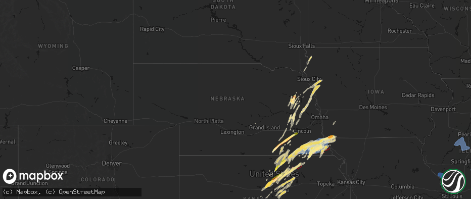
Hail Map in Nebraska on May 18, 2026
The weather event in Nebraska on May 18, 2026 includes Wind, Hail, and Tornado maps. 19 states and 1,691 cities were impacted and suffered possible damage. The total estimated number of properties impacted is 35,569.
Wind
Hail
Tornado
35,569
Estimated number of impacted properties by a 1.00" hail or larger10,094
Estimated number of impacted properties by a 1.75" hail or larger0
Estimated number of impacted properties by a 2.50" hail or largerStorm reports in Nebraska
Nebraska
| Date | Description |
|---|---|
| 05/18/20266:40 PM CDT | Mix of dimes with a few quarters. |
| 05/18/20266:30 PM CDT | Report from mping: ping pong ball |
| 05/18/20266:21 PM CDT | A local report indicates 1.00 inch wind near 5 NNW Valparaiso |
| 05/18/20266:19 PM CDT | Public report of half dollar size hail. |
| 05/18/20266:15 PM CDT | Rainfall so far this evening has only been 0.25 inch... But the sky looked like heavier and hail fell to the southeast closer to ponca. |
| 05/18/20266:12 PM CDT | Trained spotter reported half dollar size hail. |
| 05/18/20266:10 PM CDT | Some quarter sized hail stones... But mostly dime sized. Heavy rain... No wind... And no damage. |
| 05/18/20266:02 PM CDT | A local report indicates 1.50 inch wind near Allen |
| 05/18/20265:52 PM CDT | Report from mping: quarter |
| 05/18/20265:50 PM CDT | A local report indicates 1.00 inch wind near 1 E Wayne |
| 05/18/20265:46 PM CDT | Report relayed by nws employee via nwschat. |
| 05/18/20265:39 PM CDT | Mix of peas and quarters. |
| 05/18/20265:30 PM CDT | Dime to golf ball size hail. |
| 05/18/20265:15 PM CDT | Multi-vortex tornado reported north of falls city. |
| 05/18/20265:08 PM CDT | Report from mping: ping pong ball |
| 05/18/20265:04 PM CDT | Trained spotter reported golf ball sized hail 7.5 miles south of friend. |
| 05/18/20265:00 PM CDT | Photo of a cone tornado ongoing south of dawson. |
| 05/18/20264:52 PM CDT | A local report indicates 1.75 inch wind near Milligan |
| 05/18/20264:45 PM CDT | Report of multi-vortex tornado east of hwy 99 and hwy 8. |
| 05/18/20264:45 PM CDT | Personal weather station. |
| 05/18/20264:43 PM CDT | Public report of golf ball size hail north of auburn. Location and time are estimated from radar. |
| 05/18/20264:40 PM CDT | A local report indicates 1.00 inch wind near Strang |
| 05/18/20264:34 PM CDT | Personal weather station gusted to 62 mph. |
| 05/18/20264:27 PM CDT | Reports of extensive damage in auburn. Possible people trapped in homes. Possible tornado damage. Time is estimated. |
| 05/18/20264:27 PM CDT | Video from broadcast media showed a small... Rain-wrapped tornado moving generally eastward just south of road 733a and highway 75. Damage consisted of a small cluster |
| 05/18/20264:26 PM CDT | Hail the size of quarters to ping pong balls... Most were smaller. |
| 05/18/20264:20 PM CDT | A tornado developed just south of highway 136 and west of 636 avenue... And moved east northeast to the area near highway 136 and just east of 637 avenue. This tornado |
| 05/18/20264:12 PM CDT | Corrects previous tstm wnd gst report from 5 ssw johnson. Personal weather station. |
| 05/18/20264:11 PM CDT | Report from mping: quarter |
| 05/18/20264:08 PM CDT | Downed trees... Damage to grain bins... And damaged farm outbuildings. Possible tornado damage. Time estimated from radar. |
| 05/18/20264:05 PM CDT | A tornado developed in open fields near the intersection of 625 avenue and 725 road... And moved quickly east. The tornado damaged many trees... Flipped pivots... And d |
| 05/18/20264:01 PM CDT | Lots of large tree limbs down. Time is estimated. |
| 05/18/20263:56 PM CDT | Personal weather station. |
| 05/18/20263:49 PM CDT | A local report indicates 1.75 inch wind near 4 N Clarkson |
| 05/18/20263:47 PM CDT | Caller reported an 81 mph wind gust measured from a personal weather station. Also reported 6 to 8 inch diameter tree limbs broken. |
| 05/18/20263:27 PM CDT | Spotter report driving on hwy 77 south toward beatrice. |
| 05/18/20263:27 PM CDT | Corrects previous non-tstm wnd gst report from 2 n blue springs. Personal weather station. |
| 05/18/20263:22 PM CDT | Personal weather station gusted to 70 mph. |
| 05/18/20263:20 PM CDT | A local report indicates 1.00 inch wind near Beatrice |
| 05/18/20262:58 PM CDT | Wynmore fire dept. Reports tornado on the ground near odell. |
| 05/18/20262:48 PM CDT | Chaser stream of a brief cone tornado. |
| 05/17/20267:15 PM CDT | Report from mping: quarter |
All States Impacted by Hail Map on May 18, 2026
Cities Impacted by Hail Map on May 18, 2026
- Nebo, IL
- Kampsville, IL
- Hamburg, IL
- Eldred, IL
- Pearl, IL
- White Hall, IL
- Boelus, NE
- Canton, IL
- Lewistown, IL
- Liverpool, IL
- Topeka, IL
- Havana, IL
- Manito, IL
- Glasford, IL
- Forest City, IL
- Pekin, IL
- Green Valley, IL
- Kingston Mines, IL
- Mapleton, IL
- Peoria, IL
- San Jose, IL
- Mason City, IL
- Easton, IL
- Hartsburg, IL
- New Holland, IL
- South Pekin, IL
- Emden, IL
- Delavan, IL
- Roanoke, IL
- Clinton, IL
- Waynesville, IL
- Wapella, IL
- Dewitt, IL
- Farmer City, IL
- Le Roy, IL
- Taylorville, IL
- Palmer, IL
- Centralia, IL
- Odin, IL
- Salem, IL
- Morris, IL
- Minooka, IL
- Catawissa, MO
- Robertsville, MO
- Pacific, MO
- Cedar Hill, MO
- House Springs, MO
- Collinsville, IL
- Imperial, MO
- Fenton, MO
- New Lenox, IL
- Mokena, IL
- Oak Lawn, IL
- Chicago Ridge, IL
- Tinley Park, IL
- Hometown, IL
- Orland Park, IL
- Alsip, IL
- Evergreen Park, IL
- Chicago, IL
- Palos Heights, IL
- Palos Park, IL
- Bridgeview, IL
- Palos Hills, IL
- Worth, IL
- Burbank, IL
- Cicero, IL
- Riverside, IL
- Hickory Hills, IL
- La Grange, IL
- Justice, IL
- Berwyn, IL
- Summit Argo, IL
- Lyons, IL
- Willow Springs, IL
- Oak Park, IL
- Highland, IN
- Calumet City, IL
- Markham, IL
- Midlothian, IL
- Dolton, IL
- Country Club Hills, IL
- Gary, IN
- Homewood, IL
- Whiting, IN
- Thornton, IL
- Frankfort, IL
- Munster, IN
- Olympia Fields, IL
- Flossmoor, IL
- Hazel Crest, IL
- Chicago Heights, IL
- South Holland, IL
- East Chicago, IN
- Oak Forest, IL
- Harvey, IL
- Hammond, IN
- Crestwood, IL
- Robbins, IL
- Matteson, IL
- Glenwood, IL
- Lansing, IL
- Blue Island, IL
- Posen, IL
- Riverdale, IL
- Homer Glen, IL
- Griffith, IN
- Park Forest, IL
- Steger, IL
- Richton Park, IL
- University Park, IL
- Monee, IL
- Arnold, MO
- Saint Louis, MO
- Schererville, IN
- Dyer, IN
- Saint John, IN
- Crete, IL
- Merrillville, IN
- Cedar Lake, IN
- Lowell, IN
- Crown Point, IN
- Momence, IL
- Grant Park, IL
- Bradley, IL
- Bourbonnais, IL
- Pembroke Township, IL
- Manteno, IL
- Saint Anne, IL
- Kankakee, IL
- Beecher, IL
- Aroma Park, IL
- Chebanse, IL
- Lake Village, IN
- Schneider, IN
- Hebron, IN
- Hobart, IN
- Lake Station, IN
- Portage, IN
- Valparaiso, IN
- Westville, IN
- Chesterton, IN
- Union Mills, IN
- Wanatah, IN
- Kouts, IN
- Boone Grove, IN
- Kingsford Heights, IN
- La Porte, IN
- Hamlet, IN
- Michigan City, IN
- La Crosse, IN
- Hanna, IN
- Knox, IN
- Beverly Shores, IN
- Noel, MO
- New Buffalo, MI
- Lakeside, MI
- Rolling Prairie, IN
- Union Pier, MI
- Three Oaks, MI
- Bridgman, MI
- Sawyer, MI
- Walkerton, IN
- Mill Creek, IN
- Harbert, MI
- New Carlisle, IN
- Galien, MI
- New Troy, MI
- Baroda, MI
- Stevensville, MI
- Buchanan, MI
- North Liberty, IN
- Grovertown, IN
- South Bend, IN
- Saint Joseph, MI
- Berrien Springs, MI
- Niles, MI
- Clay City, IN
- Centerpoint, IN
- Benton Harbor, MI
- Sodus, MI
- Coloma, MI
- Eau Claire, MI
- Berrien Center, MI
- Notre Dame, IN
- Liberal, MO
- Granger, IN
- Mishawaka, IN
- Louisburg, MO
- Urbana, MO
- Half Way, MO
- Dowagiac, MI
- Watervliet, MI
- Bangor, MI
- Decatur, MI
- Covert, MI
- Hartford, MI
- South Haven, MI
- Edwardsburg, MI
- Cassopolis, MI
- Bourbon, IN
- Mentone, IN
- Tippecanoe, IN
- Rochester, IN
- Akron, IN
- Claypool, IN
- Etna Green, IN
- Warsaw, IN
- Lawton, MI
- Lawrence, MI
- Marcellus, MI
- Paw Paw, MI
- Vandalia, MI
- Kingsley, MI
- Traverse City, MI
- Williamsburg, MI
- South Boardman, MI
- Kalkaska, MI
- Grand Junction, MI
- Allegan, MI
- Bloomingdale, MI
- Pullman, MI
- Fennville, MI
- Leesburg, IN
- Atwood, IN
- Gobles, MI
- Jones, MI
- Schoolcraft, MI
- Mattawan, MI
- Kalamazoo, MI
- Simpson, KS
- Vanderbilt, MI
- Elmira, MI
- Hamilton, MI
- Otsego, MI
- Hopkins, MI
- Marco Island, FL
- Jamestown, KS
- Gaylord, MI
- Dorr, MI
- Martin, MI
- Shelbyville, MI
- Wayland, MI
- Wilson, KS
- Sylvan Grove, KS
- Ashmore, IL
- Concordia, KS
- Scandia, KS
- Norway, KS
- Bolivar, MO
- Aldrich, MO
- Walnut Grove, MO
- Morrisville, MO
- Plainwell, MI
- Portage, MI
- Vicksburg, MI
- Lincoln, KS
- Hastings, MI
- Claflin, KS
- Mendon, MI
- Leonidas, MI
- Milan, MI
- Colon, MI
- Sherwood, MI
- Richland, MI
- Grandville, MI
- Rockford, MI
- Grand Rapids, MI
- Caledonia, MI
- Belmont, MI
- Wyoming, MI
- Byron Center, MI
- Cedar Springs, MI
- Middleville, MI
- Ada, MI
- Comstock Park, MI
- Hudsonville, MI
- Allendale, MI
- Zeeland, MI
- Marne, MI
- Jenison, MI
- Lake Odessa, MI
- Dowling, MI
- Climax, MI
- Ceresco, MI
- Galesburg, MI
- Bellevue, MI
- Scotts, MI
- Lowell, MI
- Augusta, MI
- Freeport, MI
- Nashville, MI
- Delton, MI
- Alto, MI
- Battle Creek, MI
- Hickory Corners, MI
- East Leroy, MI
- Clarksville, MI
- Marshall, MI
- Holyrood, KS
- Hebron, NE
- Deshler, NE
- Washington, KS
- Fenwick, MI
- Saranac, MI
- Olivet, MI
- Sheridan, MI
- Sidney, MI
- Gowen, MI
- Woodland, MI
- Vermontville, MI
- Stanton, MI
- Greenville, MI
- Orleans, MI
- Ionia, MI
- Belding, MI
- Sand Lake, MI
- Trufant, MI
- Homer, MI
- Albion, MI
- Charlotte, MI
- Sunfield, MI
- Tekonsha, MI
- Burlington, MI
- Coldwater, MI
- Kendallville, IN
- Howe, IN
- Athens, MI
- Auburn, IN
- Pleasant Lake, IN
- Lagrange, IN
- Huntertown, IN
- Angola, IN
- Hudson, IN
- Bronson, MI
- Avilla, IN
- Garrett, IN
- Fremont, IN
- Fort Wayne, IN
- Corunna, IN
- Quincy, MI
- Laotto, IN
- Ashley, IN
- Wolcottville, IN
- Union City, MI
- Orland, IN
- Waterloo, IN
- Montgomery, MI
- New Haven, IN
- Antwerp, OH
- Harlan, IN
- Convoy, OH
- Saint Joe, IN
- Leo, IN
- Reading, MI
- Hamilton, IN
- Spencerville, IN
- Hoagland, IN
- Woodburn, IN
- Hicksville, OH
- Grabill, IN
- Monroeville, IN
- Butler, IN
- Payne, OH
- Edon, OH
- Paulding, OH
- Scott, OH
- Cecil, OH
- Montpelier, OH
- Haviland, OH
- Defiance, OH
- Grover Hill, OH
- Bryan, OH
- Litchfield, MI
- Mark Center, OH
- Fort Jennings, OH
- Camden, MI
- Van Wert, OH
- Ney, OH
- Ottoville, OH
- Hillsdale, MI
- Oakwood, OH
- Melrose, OH
- Pioneer, OH
- Sherwood, OH
- Latty, OH
- Cloverdale, OH
- Edgerton, OH
- Allen, MI
- Middle Point, OH
- Willis, MI
- Rome City, IN
- Burr Oak, MI
- Albion, IN
- Arcola, IN
- South Milford, IN
- Churubusco, IN
- Fulton, MI
- Sturgis, MI
- Three Rivers, MI
- Centreville, MI
- Wawaka, IN
- Columbia City, IN
- Kimmell, IN
- Topeka, IN
- Shipshewana, IN
- Goshen, IN
- Millersburg, IN
- Constantine, MI
- Middlebury, IN
- Ligonier, IN
- White Pigeon, MI
- Belvidere, NE
- Hollenberg, KS
- Morrowville, KS
- Belleville, KS
- Barnard, KS
- Haddam, KS
- Cromwell, IN
- Mahaska, KS
- Pierceton, IN
- Larwill, IN
- Zionsville, IN
- Sheridan, IN
- Westfield, IN
- Carleton, NE
- Beloit, KS
- Stryker, OH
- Archbold, OH
- Evansport, OH
- Endicott, NE
- Steele City, NE
- Diller, NE
- Lyons, OH
- Hillman, MI
- Lyons, MI
- Portland, MI
- Agenda, KS
- Mulliken, MI
- Atlanta, MI
- Clifton, KS
- Napoleon, OH
- Minneapolis, KS
- Eaton Rapids, MI
- West Unity, OH
- Concord, MI
- Muir, MI
- Springport, MI
- Hanover, MI
- Grand Ledge, MI
- Osseo, MI
- Jonesville, MI
- Carson City, MI
- Onondaga, MI
- Dimondale, MI
- Okemos, MI
- Spring Arbor, MI
- Eagle, MI
- Clarklake, MI
- Fowler, MI
- Rives Junction, MI
- Parma, MI
- Jerome, MI
- Haslett, MI
- Potterville, MI
- North Adams, MI
- Horton, MI
- East Lansing, MI
- Hubbardston, MI
- Jackson, MI
- Westphalia, MI
- Saint Johns, MI
- Bath, MI
- Dewitt, MI
- Laingsburg, MI
- Lansing, MI
- Pewamo, MI
- Alvordton, OH
- Pittsford, MI
- Waldron, MI
- Mason, MI
- Holt, MI
- Leslie, MI
- Jasper, MI
- Fairbury, NE
- Cuba, KS
- Lachine, MI
- Fort Stockton, TX
- Delphos, KS
- Beverly, KS
- Iraan, TX
- Glasco, KS
- Jansen, NE
- Beatrice, NE
- Odell, NE
- Delta, OH
- Alpena, MI
- Narka, KS
- Blue Springs, NE
- Aurora, KS
- Miltonvale, KS
- Eldridge, MO
- Dixon, MO
- Meta, MO
- Brinktown, MO
- Camdenton, MO
- Linn Creek, MO
- Clyde, KS
- Filley, NE
- Burton, MI
- Flint, MI
- Lorraine, KS
- Wymore, NE
- Mathias, WV
- Baker, WV
- Tescott, KS
- Pickrell, NE
- Adams, NE
- Crab Orchard, NE
- Tecumseh, NE
- Offerle, KS
- Davison, MI
- Spearville, KS
- Kinsley, KS
- Mount Vernon, IN
- Virginia, NE
- Kanopolis, KS
- Ellsworth, KS
- Morganville, KS
- Bucklin, KS
- Schuyler, NE
- Bee, NE
- Valparaiso, NE
- Howells, NE
- Clarkson, NE
- Lewis, KS
- Sterling, NE
- Steinauer, NE
- Leigh, NE
- Lewiston, NE
- Garfield, KS
- Larned, KS
- Fairmont, NE
- Ford, KS
- De Witt, NE
- Brookville, KS
- Clay Center, KS
- Hanover, KS
- Wisner, NE
- Pilger, NE
- Stanton, NE
- Liberty, NE
- Burchard, NE
- Pawnee City, NE
- Wright, KS
- Dodge City, KS
- Beemer, NE
- Dodge, NE
- West Point, NE
- Ortonville, MI
- Hamburg, MI
- White Lake, MI
- Grand Blanc, MI
- Hadley, MI
- Bancroft, MI
- Linden, MI
- Brighton, MI
- Swartz Creek, MI
- Perry, MI
- Davisburg, MI
- Stockbridge, MI
- Clarkston, MI
- Highland, MI
- Norvell, MI
- Lapeer, MI
- Pleasant Lake, MI
- Gaines, MI
- Whitmore Lake, MI
- Grass Lake, MI
- Hudson, MI
- Webberville, MI
- Hartland, MI
- Napoleon, MI
- Clayton, MI
- Byron, MI
- Gregory, MI
- Munith, MI
- Goodrich, MI
- Dexter, MI
- Cement City, MI
- Michigan Center, MI
- Somerset Center, MI
- Manitou Beach, MI
- Dansville, MI
- Williamston, MI
- Pinckney, MI
- Howell, MI
- Milford, MI
- Attica, MI
- Adrian, MI
- Addison, MI
- Atlas, MI
- Fenton, MI
- Morrice, MI
- Owosso, MI
- Manchester, MI
- Ann Arbor, MI
- Durand, MI
- Fowlerville, MI
- Tipton, MI
- Onsted, MI
- Chelsea, MI
- Lennon, MI
- Metamora, MI
- Holly, MI
- Brooklyn, MI
- Beattie, KS
- Cook, NE
- Elk Creek, NE
- Burr, NE
- Table Rock, NE
- Auburn, NE
- Humboldt, NE
- Brock, NE
- Johnson, NE
- Vernon, MI
- Ovid, MI
- Corunna, MI
- Elsie, MI
- Columbiaville, MI
- Flushing, MI
- Du Bois, NE
- Talmage, NE
- Dawson, NE
- Stella, NE
- Staplehurst, NE
- Seward, NE
- Superior, NE
- Summerfield, KS
- Home, KS
- Weston, NE
- Dwight, NE
- Salina, KS
- McCool Junction, NE
- Waco, NE
- York, NE
- Oketo, KS
- Star Tannery, VA
- Clinton, MI
- Northville, MI
- Sand Creek, MI
- Wixom, MI
- New Hudson, MI
- Morenci, MI
- Tecumseh, MI
- Commerce Township, MI
- Fayette, OH
- Saline, MI
- Waterford, MI
- Britton, MI
- Palmyra, MI
- South Lyon, MI
- Oxford, MI
- Oak, NE
- Davenport, NE
- Livonia, MI
- Plymouth, MI
- Oakland, MI
- Dearborn Heights, MI
- Canton, MI
- Farmington, MI
- Blissfield, MI
- Newport, MI
- Detroit, MI
- Southfield, MI
- Westland, MI
- Pontiac, MI
- Redford, MI
- Taylor, MI
- Rockwood, MI
- Lake Orion, MI
- Dryden, MI
- Maybee, MI
- Petersburg, MI
- Keego Harbor, MI
- Auburn Hills, MI
- Birmingham, MI
- Carleton, MI
- Dearborn, MI
- Monroe, MI
- Rochester, MI
- Inkster, MI
- Ida, MI
- Garden City, MI
- Flat Rock, MI
- Romulus, MI
- West Bloomfield, MI
- Ypsilanti, MI
- Franklin, MI
- Novi, MI
- Wayne, MI
- Dundee, MI
- Belleville, MI
- Bloomfield Hills, MI
- Deerfield, MI
- Walled Lake, MI
- South Rockwood, MI
- New Boston, MI
- Nelson, NE
- Greenleaf, KS
- Palmer, KS
- Winchester, VA
- Strasburg, VA
- Courtland, KS
- Hubbell, NE
- Munden, KS
- Morse Bluff, NE
- Cedar Bluffs, NE
- Almont, MI
- Lindsborg, KS
- Brainard, NE
- David City, NE
- North Bend, NE
- Prague, NE
- Malmo, NE
- Bennington, KS
- Metamora, OH
- Riga, MI
- Ames, NE
- Ruskin, NE
- Ottawa Lake, MI
- Berkey, OH
- Surprise, NE
- Quanah, TX
- Swanton, OH
- Ulysses, NE
- Chester, NE
- Bancroft, NE
- Pender, NE
- Gresham, NE
- Falun, KS
- Bruno, NE
- Shickley, NE
- Eldorado, OK
- Gould, OK
- Duke, OK
- Bern, KS
- Sabetha, KS
- Brownville, NE
- Peru, NE
- Julian, NE
- Walthill, NE
- Solomon, KS
- Rising City, NE
- Strang, NE
- Bruning, NE
- Green, KS
- Hooper, NE
- Winslow, NE
- Fremont, NE
- Stephens City, VA
- Middletown, VA
- Geneva, NE
- Reynolds, NE
- Nebraska City, NE
- Rock Port, MO
- Linwood, NE
- La Salle, MI
- Shubert, NE
- Watson, MO
- Nemaha, NE
- Temperance, MI
- Ohiowa, NE
- Tobias, NE
- Milligan, NE
- River Rouge, MI
- Imlay City, MI
- Sterling Heights, MI
- Ferndale, MI
- Washington, MI
- Ecorse, MI
- Trenton, MI
- Romeo, MI
- Madison Heights, MI
- Pleasant Ridge, MI
- Royal Oak, MI
- Highland Park, MI
- Wyandotte, MI
- Grosse Ile, MI
- Lincoln Park, MI
- Warren, MI
- Hazel Park, MI
- Southgate, MI
- Utica, MI
- Center Line, MI
- Melvindale, MI
- Huntington Woods, MI
- Leonard, MI
- Riverview, MI
- Oak Park, MI
- Clawson, MI
- Hamtramck, MI
- Allen Park, MI
- Berkley, MI
- Troy, MI
- Coldwater, KS
- Belpre, KS
- St John, KS
- Hamburg, IA
- Alexandria, NE
- Herman, NE
- Craig, NE
- Tekamah, NE
- Oakland, NE
- Bellwood, NE
- Macksville, KS
- Columbus, NE
- Abilene, KS
- New Cambria, KS
- Longford, KS
- Hudson, KS
- Gerrardstown, WV
- Rogers, NE
- Verdon, NE
- Farragut, IA
- Riverton, IA
- Northboro, IA
- Shenandoah, IA
- Creston, NE
- Newburg, MO
- Duke, MO
- Hawarden, IA
- Hornick, IA
- Salix, IA
- Bronson, IA
- Sloan, IA
- Winnebago, NE
- Assaria, KS
- Onawa, IA
- Whiting, IA
- Decatur, NE
- Friend, NE
- Westboro, MO
- Barnes, KS
- Gypsum, KS
- Linn, KS
- Waterville, KS
- Western, NE
- Daykin, NE
- Tarkio, MO
- Marysville, KS
- Wakefield, KS
- Capac, MI
- Emmett, MI
- Allenton, MI
- Yale, MI
- Scribner, NE
- Dorchester, NE
- Greensburg, KS
- Akron, IA
- Westfield, IA
- Hastings, IA
- Emerson, IA
- Brown City, MI
- Melvin, MI
- Avoca, MI
- Coin, IA
- Randolph, KS
- Falls City, NE
- Crete, NE
- Pleasant Dale, NE
- Milford, NE
- Denton, NE
- Mangum, OK
- Haviland, KS
- Raymond, KS
- Alden, KS
- Sylvia, KS
- Rock Valley, IA
- Exeter, NE
- Climbing Hill, IA
- Smithland, IA
- Correctionville, IA
- Anthon, IA
- Moville, IA
- Oto, IA
- Lyons, NE
- Blanchard, IA
- Snyder, NE
- Stafford, KS
- Talmage, KS
- Red Oak, IA
- Armada, MI
- Sterling, KS
- Ellinwood, KS
- Byers, KS
- Blue Rapids, KS
- Rodney, IA
- Fairfax, MO
- Beaver Crossing, NE
- Carter, OK
- Dill City, OK
- Elk City, OK
- Quimby, IA
- Washta, IA
- Pierson, IA
- Holstein, IA
- Cushing, IA
- Macy, NE
- Uehling, NE
- Cherokee, IA
- Aurelia, IA
- Wayne, NE
- Clarinda, IA
- Elmo, MO
- Wakefield, NE
- College Springs, IA
- Utica, NE
- Goehner, NE
- Lyons, KS
- Chase, KS
- Plevna, KS
- Junction City, KS
- Milford, KS
- Chapman, KS
- Elliott, IA
- Griswold, IA
- Rosalie, NE
- Syracuse, NE
- Alton, IA
- Hospers, IA
- Gilead, NE
- Garland, NE
- Braddyville, IA
- Kingsley, IA
- Shambaugh, IA
- Clearmont, MO
- Burlington Junction, MO
- New Market, IA
- Abbyville, KS
- Bedford, IA
- Partridge, KS
- Hutchinson, KS
- Nickerson, KS
- Inman, KS
- South Hutchinson, KS
- Allen, NE
- Concord, NE
- Ceresco, NE
- Unadilla, NE
- Douglas, NE
- Riley, KS
- Iuka, KS
- Canute, OK
- Pratt, KS
- Frankfort, KS
- Leonardville, KS
- Junction, IL
- Turon, KS
- Sullivan, MO
- Craig, MO
- Dixon, NE
- Little River, KS
- Shawneetown, IL
- Enterprise, KS
- Arlington, KS
- Buhler, KS
- Haven, KS
- Sanborn, IA
- Ponca, NE
- Waterbury, NE
- Corning, IA
- Cumberland, IA
- Sheldon, IA
- Hope, KS
- Fort Riley, KS
- Skidmore, MO
- Wiota, IA
- Sidney, IA
- Archer, IA
- Wahoo, NE
- Windom, KS
- Ocheyedan, IA
- Harris, IA
- Union, NE
- Mcpherson, KS
- Massena, IA
- Sturgis, KY
- Vermillion, KS
- Dunbar, NE
- Morganfield, KY
- Hartley, IA
- Matthews, MO
- Weeping Water, NE
- Avoca, NE
- Butler, OK
- Hopkins, MO
- Axtell, KS
- Lonedell, MO
- Richwoods, MO
- Otoe, NE
- Burrton, KS
- Raymond, NE
- Plymouth, NE
- Elk Point, SD
- Redding, IA
- Sheridan, MO
- Clearfield, IA
- Pickering, MO
- Gravity, IA
- Blockton, IA
- Bridgewater, IA
- Randolph, IA
- Lake Park, IA
- Wilber, NE
- Swanton, NE
- Bertrand, MO
- Lincoln, NE
- Ogden, KS
- Maryville, MO
- Nehawka, NE
- Manhattan, KS
- Woodbine, KS
- Baileyville, KS
- Jefferson, SD
- Marianna, AR
- Seneca, KS
- Uniontown, KY
- Colon, NE
- Fort Calhoun, NE
- Omaha, NE
- Parnell, MO
- Moundridge, KS
- Prescott, IA
- Fontanelle, IA
- Canton, KS
- Galva, KS
- Westmoreland, KS
- Saint George, KS
- Oneida, KS
- Olsburg, KS
- Ong, NE
- Miller City, IL
- Plattsmouth, NE
- Greenfield, IA
- Spirit Lake, IA
- Milford, IA
- Murray, NE
- Malvern, IA
- Tabor, IA
- Glenwood, IA
- Benton, IA
- Grant City, MO
- Ithaca, NE
- Armstrong, IA
- Swea City, IA
- Wamego, KS
- Alma, KS
- Cairo, IL
- Mounds, IL
- Davey, NE
- Onaga, KS
- Herington, KS
- Pretty Prairie, KS
- Waverly, NE
- Centralia, KS
- Durham, KS
- Clatonia, NE
- Earlham, IA
- Bennington, NE
- Dwight, KS
- Alta Vista, KS
- Halstead, KS
- White City, KS
- Hillsboro, KS
- Hesston, KS
- Ledyard, IA
- Havensville, KS
- Corning, KS
- Goff, KS
- Soldier, KS
- Edgar, NE
- Cunningham, KS
- Diagonal, IA
- Blue Earth, MN
- Ashland, NE
- Greenwood, NE
- Salem, NE
- Newton, KS
- Goessel, KS
- Marion, KS
- Afton, IA
- Thayer, IA
- Shannon City, IA
- Ellston, IA
- Tingley, IA
- Mount Ayr, IA
- Persia, IA
- Neola, IA
- Logan, IA
- Ramona, KS
- Lincolnville, KS
- Tampa, KS
- Lost Springs, KS
- Elkhorn, NE
- Missouri Valley, IA
- Honey Creek, IA
- Van Meter, IA
- Winterset, IA
- De Soto, IA
- Belvue, KS
- Mount Hope, KS
- Bremen, KS
- Circleville, KS
- Holton, KS
- Portsmouth, IA
- Emmett, KS
- Saint Marys, KS
- Paxico, KS
- Delia, KS
- Fairview, KS
- Hiawatha, KS
- Blanchard, PA
- Beech Creek, PA
- Howard, PA
- Sedgwick, KS
- Burdick, KS
- Wilsey, KS
- Council Grove, KS
- Walton, KS
- Peabody, KS
- Isabel, KS
- Sun City, KS
- Coats, KS
- Percival, IA
- Prole, IA
- Ida Grove, IA
- Battle Creek, IA
- Mayetta, KS
- Cumming, IA
- West Des Moines, IA
- Norwalk, IA
- Netawaka, KS
- Sawyer, KS
- Wetmore, KS
- Strong City, KS
- Whiting, KS
- Rossville, KS
- Eskridge, KS
- Maple Hill, KS
- Topeka, KS
- McFarland, KS
- Harveyville, KS
- Allen, KS
- Kellerton, IA
- Hatfield, MO
- Grand River, IA
- Americus, KS
- Silver Lake, KS
- White Cloud, KS
- Robinson, KS
- Rulo, NE
- Horton, KS
- Powhattan, KS
- Muscotah, KS
- Kingman, KS
- North Newton, KS
- Nashville, KS
- Cedar Point, KS
- Indianola, IA
- Colwich, KS
- Lancaster, KS
- Everest, KS
- Denison, KS
- Carbondale, KS
- Burlingame, KS
- Reading, KS
- Hoyt, KS
- Wakarusa, KS
- Auburn, KS
- Mound City, MO
- Maitland, MO
- Oregon, MO
- Valley Falls, KS
- Spivey, KS
- Florence, KS
- Elmdale, KS
- Denton, KS
- Effingham, KS
- Highland, KS
- Forest City, MO
- Bendena, KS
- Troy, KS
- Andale, KS
- Zenda, KS
- Bentley, KS
- Ravenwood, MO
- Valley Center, KS
- Meriden, KS
- Berryton, KS
- Atchison, KS
- Wathena, KS
- Saint Joseph, MO
- Elwood, KS
- Cottonwood Falls, KS
- Amazonia, MO
- Fillmore, MO
- Savannah, MO
- Admire, KS
- Emporia, KS
- Bolckow, MO
- Graham, MO
- Barnard, MO
- Scranton, KS
- Nortonville, KS
- Matfield Green, KS
- Burns, KS
- Union Star, MO
- Osage City, KS
- Cosby, MO
- Helena, MO
- Whitewater, KS
- Isanti, MN
- Saint Francis, MN
- Zimmerman, MN
- Rea, MO
- Rosendale, MO
- State Center, IA
- Worth, MO
- Potwin, KS
- Murdock, KS
- Cheney, KS
- Garden Plain, KS
- Tecumseh, KS
- Grantville, KS
- Quenemo, KS
- Overbrook, KS
- Cummings, KS
- King City, MO
- Winchester, KS
- Attica, KS
- McLouth, KS
- El Dorado, KS
- Cassoday, KS
- Oskaloosa, KS
- Ozawkie, KS
- Lawrence, KS
- Lecompton, KS
- Perry, KS
- Easton, KS
- Leavenworth, KS
- Tonganoxie, KS
- Eudora, KS
- Baldwin City, KS
- Lansing, KS
- Pomona, KS
- Bonner Springs, KS
- Ottawa, KS
- De Soto, KS
- Linwood, KS
- Basehor, KS
- Wellsville, KS
- Conception Junction, MO
- Stanberry, MO
- Albany, MO
- Martinsville, MO
- Eagleville, MO
- Ridgeway, MO
- Denver, MO
- New Hampton, MO
- Bethany, MO
- Gentry, MO
- Clyde, MO
- Conception, MO
- Darlington, MO
- Lamoni, IA
- Davis City, IA
- Cainsville, MO
- Blythedale, MO
- Decatur, IA
- Leon, IA
- Gilman City, MO
- Chatsworth, IA
- Princeton, MO
- Wichita, KS
- Maize, KS
- Goddard, KS
- Haysville, KS
- Clearwater, KS
- Jamesport, MO
- Shawnee, KS
- Gardner, KS
- Paola, KS
- Spring Hill, KS
- Edgerton, KS
- New Century, KS
- Olathe, KS
- Platte City, MO
- Rantoul, KS
- Lenexa, KS
- Kansas City, KS
- Harper, KS
- Olpe, KS
- Amity, MO
- Maysville, MO
- Clarksdale, MO
- Pattonsburg, MO
- McFall, MO
- Weatherby, MO
- Coffey, MO
- Jameson, MO
- Kechi, KS
- Mcconnell Afb, KS
- Derby, KS
- Mercer, MO
- Spickard, MO
- Lineville, IA
- Osceola, IA
- Garden Grove, IA
- Weldon, IA
- Van Wert, IA
- Murray, IA
- Humeston, IA
- Trenton, MO
- Madison, KS
- Chariton, IA
- Norwich, KS
- Eureka, KS
- Mondovi, WI
- Easton, MO
- Stewartsville, MO
- Altamont, MO
- Winston, MO
- Gallatin, MO
- Cameron, MO
- Osborn, MO
- Stilwell, KS
- Independence, MO
- Waldron, MO
- Farley, MO
- Liberty, MO
- Bucyrus, KS
- Overland Park, KS
- Prairie Village, KS
- Kansas City, MO
- Mission, KS
- Leawood, KS
- Riverside, MO
- Louisburg, KS
- Rose Hill, KS
- Greenwich, KS
- Towanda, KS
- Andover, KS
- Benton, KS
- Hartford, KS
- Gridley, KS
- Neosho Rapids, KS
- Burlington, KS
- Lebo, KS
- Waverly, KS
- Smithville, MO
- Kearney, MO
- Holt, MO
- Excelsior Springs, MO
- Corydon, IA
- Woodburn, IA
- Allerton, IA
- Clio, IA
- Derby, IA
- Lucas, IA
- Lucerne, MO
- Seymour, IA
- Powersville, MO
- Augusta, KS
- Douglass, KS
- Brooklyn, IA
- Eleva, WI
- Milton, KS
- Plattsburg, MO
- Orrick, MO
- Rayville, MO
- Conway Springs, KS
- Argonia, KS
- Anthony, KS
- Danville, KS
- Viola, KS
- Cleveland, MO
- Blue Springs, MO
- Freeman, MO
- Pleasant Hill, MO
- Missouri City, MO
- Grandview, MO
- Lees Summit, MO
- Peculiar, MO
- Belton, MO
- Raymore, MO
- Harrisonville, MO
- Greenwood, MO
- Oak Grove, MO
- Richmond, MO
- Levasy, MO
- Lawson, MO
- Buckner, MO
- Grain Valley, MO
- Sibley, MO
- Leon, KS
- Rosalia, KS
- Westphalia, KS
- Le Roy, KS
- Unionville, MO
- Promise City, IA
- Millerton, IA
- Russell, IA
- Plano, IA
- Melrose, IA
- Centerville, IA
- Moravia, IA
- Mystic, IA
- Laredo, MO
- Chula, MO
- Chillicothe, MO
- Galt, MO
- Milan, MO
- Humphreys, MO
- Harris, MO
- Browning, MO
- Hamilton, KS
- Milan, KS
- Henrietta, MO
- Hardin, MO
- Camden, MO
- Bates City, MO
- Napoleon, MO
- Odessa, MO
- Wellington, MO
- Lone Jack, MO
- Kingsville, MO
- Lexington, MO
- Dover, MO
- Higginsville, MO
- Holden, MO
- Norborne, MO
- Carrollton, MO
- Mayview, MO
- East Lynne, MO
- Waverly, MO
- Garden City, MO
- Strasburg, MO
- Centerview, MO
- Corder, MO
- Pollock, MO
- Newtown, MO
- Green City, MO
- Warrens, WI
- Black River Falls, WI
- Freeport, KS
- Mayfield, KS
- Wellington, KS
- Virgil, KS
- Peck, KS
- Caldwell, KS
- Laredo, TX
- Belle Plaine, KS
- Mulvane, KS
- Yates Center, KS
- Concordia, MO
- Urich, MO
- Blairstown, MO
- Warrensburg, MO
- Chilhowee, MO
- Creighton, MO
- Leeton, MO
- Knob Noster, MO
- Alma, MO
- Malta Bend, MO
- Udall, KS
- Windsor, MO
- La Monte, MO
- Whiteman Air Force Base, MO
- Sedalia, MO
- Green Ridge, MO
- Calhoun, MO
- Clinton, MO
- Princeton, KS
- Welda, KS
- Richmond, KS
- Garnett, KS
- Colony, KS
- Williamsburg, KS
- South Haven, KS
- Osawatomie, KS
- Greeley, KS
- Lane, KS
- Kincaid, KS
- Montfort, WI
- Cobb, WI
- Friendship, WI
- Arkdale, WI
- Oxford, KS
- Medford, OK
- Ionia, MO
- Lincoln, MO
- Centerville, KS
- Parker, KS
- Fontana, KS
- La Cygne, KS
- Nekoosa, WI
- Atlanta, KS
- Salisbury, MO
- Clifton Hill, MO
- Latham, KS
- Braman, OK
- Cantril, IA
- Piedmont, KS
- Encinal, TX
- Geuda Springs, KS
- Keosauqua, IA
- Burden, KS
- Winfield, KS
- Arkansas City, KS
- Blackwell, OK
- Newkirk, OK
- Ponca City, OK
- Howard, KS
- Grenola, KS
- Bonaparte, IA
- Nardin, OK
- La Belle, MO
- Knox City, MO
- Severy, KS
- Freer, TX
- Realitos, TX
- Cotulla, TX
- Tilden, TX
- Hillsboro, IA
- Farmington, IA
- Rock, KS
- Hunter, OK
- Dexter, KS
- Maple City, KS
- Cambridge, KS
- Lamont, OK
- Cheyenne, OK
- Sayre, OK
- Kaw City, OK
- Cedar Vale, KS
- Wever, IA
- Dallas City, IL
- Fort Madison, IA
- Burbank, OK
- Shidler, OK
- Sedan, KS
- Elk Falls, KS
- Longton, KS
- Moline, KS
- Concepcion, TX
- San Diego, TX
- Oilton, TX
- Mirando City, TX
- Bruni, TX
- Tonkawa, OK
- Benavides, TX
- Clinton, OK
- Hammon, OK
- Odem, TX
- Sinton, TX
- Macomb, IL
- Pawhuska, OK
- Elk City, KS
- Peru, KS
- Alice, TX
- Orange Grove, TX
- Foss, OK
- Robstown, TX
- Agua Dulce, TX
- Bishop, TX
- Mathis, TX
- Taft, TX
- Woodsboro, TX
- Sandia, TX
- Welch, OK
- Nowata, OK
- Gonzales, TX
- Harwood, TX
- Waelder, TX
- Bluejacket, OK
- Miami, OK
- Ingleside, TX
- Haskell, OK
- Bixby, OK
- Coweta, OK
- Broken Arrow, OK
- Council Hill, OK
- Vinita, OK
- Morrill, KS
- Guilford, MO
- Alma, MI
- Ashley, MI
- Ithaca, MI
- Elwell, MI
- Middleton, MI
- Crystal, MI
- Maple Rapids, MI
- Sumner, MI
- Perrinton, MI
- Riverdale, MI
- Pompeii, MI
- North Star, MI
- Brant, MI
- Bannister, MI
- Saint Louis, MI
- Wheeler, MI
- Breckenridge, MI
- Henderson, MI
- Merrill, MI
- Montrose, MI
- New Lothrop, MI
- Chesaning, MI
- Burt, MI
- Mount Morris, MI
- Oakley, MI
- Saginaw, MI
- Hemlock, MI
- Saint Charles, MI
- Otisville, MI
- Genesee, MI
- Frankenmuth, MI
- North Branch, MI
- Birch Run, MI
- Vassar, MI
- Midland, MI
- Clio, MI
- Munger, MI
- Otter Lake, MI
- Bay City, MI
- University Center, MI
- Fostoria, MI
- Millington, MI
- Auburn, MI
- Freeland, MI
- Bridgeport, MI
- Carrollton, MI
- Reese, MI
- Kawkawlin, MI
- Litchfield, IL
- Butler, IL
- Linwood, MI
- Mayville, MI
- Essexville, MI
- Fairgrove, MI
- Akron, MI
- Caro, MI
- Silverwood, MI
- Sebewaing, MI
- Unionville, MI
- Tremont, IL
- Virginia, IL
- Ashland, IL
- Kingston, MI
- Cass City, MI
- Deford, MI
- Clifford, MI
- Stendal, IN
- Huntingburg, IN
- Velpen, IN
- Winslow, IN
- Holland, IN
- Marlette, MI
- Jasper, IN
- Dubois, IN
- Saint Anthony, IN
- French Lick, IN
- Celestine, IN
- Birdseye, IN
- Schnellville, IN
- Eckerty, IN
- English, IN
- Paoli, IN
- Taswell, IN
- Hardinsburg, IN
- Orleans, IN
- Campbellsburg, IN
- Salem, IN
- Decker, MI
- Mill Hall, PA
- Lock Haven, PA
- Elkhart, IN
- Reelsville, IN
- Poland, IN
- Bowling Green, IN
- Cloverdale, IN


