Hail Map in Colorado on June 3, 2015
The weather event in Colorado on June 3, 2015 includes Hail map. 18 states and 565 cities were impacted and suffered possible damage. The total estimated number of properties impacted is 131,004.
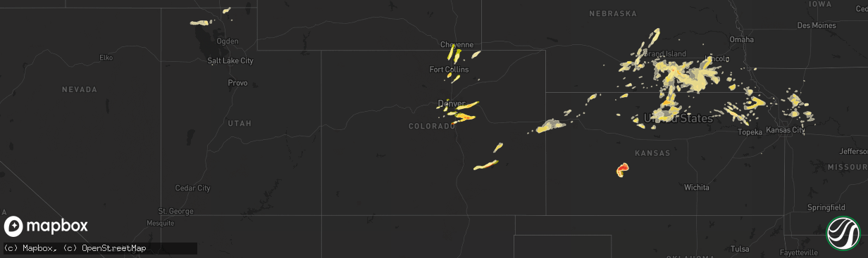
Hail
131,004
Estimated number of impacted properties by a 1.00" hail or larger9,699
Estimated number of impacted properties by a 1.75" hail or larger292
Estimated number of impacted properties by a 2.50" hail or largerStorm reports in Colorado
Colorado
| Date | Description |
|---|---|
| 06/03/20156:45 PM CDT | A local report indicates 1.00 inch wind near SW ARVADA |
| 06/03/20156:22 PM CDT | E470 and chambers |
| 06/03/20156:12 PM CDT | A local report indicates 1.50 inch wind near 5 SE FRANKTOWN |
| 06/03/20156:10 PM CDT | A local report indicates 1.00 inch wind near 4 E ELIZABETH |
| 06/03/20156:08 PM CDT | A local report indicates 1.75 inch wind near 5 SE FRANKTOWN |
| 06/03/20156:06 PM CDT | A local report indicates 1.25 inch wind near 3 SSW ELIZABETH |
| 06/03/20156:05 PM CDT | A local report indicates 1.25 inch wind near 1 NW LOUVIERS |
| 06/03/20156:03 PM CDT | A local report indicates 1.75 inch wind near ELIZABETH |
| 06/03/20155:59 PM CDT | A local report indicates 1.00 inch wind near 1 S AGATE |
| 06/03/20155:48 PM CDT | A local report indicates 1.00 inch wind near ELIZABETH |
| 06/03/20154:56 PM CDT | A local report indicates 1.00 inch wind near 3 NNE LARKSPUR |
| 06/03/20154:35 PM CDT | A local report indicates 1.25 inch wind near 3 ESE PERRY PARK |
| 06/03/20154:30 PM CDT | A local report indicates 1.75 inch wind near 4 NNW LARKSPUR |
| 06/03/201512:33 AM CDT | A local report indicates 1.75 inch wind near 3 N ORDWAY |
| 06/02/201510:18 PM CDT | A local report indicates 1.00 inch wind near BENNETT |
| 06/02/201510:07 PM CDT | A local report indicates 1.25 inch wind near 5 S BENNETT |
| 06/02/201510:07 PM CDT | A local report indicates 1.25 inch wind near 5 W COUNTRY GARDENS |
| 06/02/201510:02 PM CDT | A local report indicates 1.50 inch wind near 5 S BENNETT |
| 06/02/20159:33 PM CDT | Hail busted the windshield of the chase vehicle. |
| 06/02/20158:54 PM CDT | A local report indicates 1.00 inch wind near SE AURORA |
| 06/02/20158:51 PM CDT | A local report indicates 1.25 inch wind near CENTENNIAL |
| 06/02/20158:45 PM CDT | A local report indicates 1.00 inch wind near 5 ENE CENTENNIAL |
| 06/02/20158:45 PM CDT | Siding to home was damaged and screens torn up. |
| 06/02/20158:38 PM CDT | A local report indicates 1.25 inch wind near LOVELAND |
| 06/02/20158:25 PM CDT | A local report indicates 1.00 inch wind near 14 SSE FORT COLLINS |
| 06/02/20157:48 PM CDT | A local report indicates 1.50 inch wind near 2 N KIOWA |
| 06/02/20157:45 PM CDT | A local report indicates 1.75 inch wind near 3 ENE ELIZABETH |
| 06/02/20157:42 PM CDT | A local report indicates 2.50 inch wind near 3 ENE ELIZABETH |
| 06/02/20157:40 PM CDT | A local report indicates 1.00 inch wind near 2 N ELIZABETH |
| 06/02/20157:38 PM CDT | A local report indicates 2.00 inch wind near ELIZABETH |
| 06/02/20157:28 PM CDT | Golfball hail was breaking windows. |
| 06/02/20157:28 PM CDT | A local report indicates 1.75 inch wind near ELIZABETH |
| 06/02/20157:25 PM CDT | A local report indicates 1.50 inch wind near 4 N ELIZABETH |
| 06/02/20157:20 PM CDT | A local report indicates 1.00 inch wind near 3 WNW EVERGREEN |
| 06/02/20157:16 PM CDT | Golfball hail from 611-616 mdt |
| 06/02/20157:15 PM CDT | A local report indicates 1.00 inch wind near 5 E PARKER |
| 06/02/20157:12 PM CDT | A local report indicates 1.50 inch wind near 3 WSW PONDEROSA PARK |
| 06/02/20157:09 PM CDT | A local report indicates 1.25 inch wind near 3 SSE THE PINERY |
| 06/02/20157:05 PM CDT | Some cars dented by hail... Leaves shredded from trees. |
| 06/02/20157:05 PM CDT | Some pine trees damaged and deciduous trees shredded with severe plant damage also reported. |
All States Impacted by Hail Map on June 3, 2015
Cities Impacted by Hail Map on June 3, 2015
- Lumber City, GA
- Uvalda, GA
- Hazlehurst, GA
- Hiawatha, KS
- Troy, KS
- Everest, KS
- Robinson, KS
- Denton, KS
- Aurora, CO
- Watkins, CO
- Bennett, CO
- Byers, CO
- Strasburg, CO
- Downs, KS
- Osborne, KS
- Dry Branch, GA
- Macon, GA
- Scotia, NE
- Wolbach, NE
- Rockville, NE
- Greeley, NE
- Ashton, NE
- Farwell, NE
- Boelus, NE
- Elba, NE
- Lexington, GA
- Carlton, GA
- Midwest, WY
- Waldo, KS
- Luray, KS
- West Union, SC
- Walhalla, SC
- Pawnee City, NE
- Steinauer, NE
- Burchard, NE
- Hamilton, MO
- Jeffrey City, WY
- Hortense, GA
- Screven, GA
- Jesup, GA
- Lusk, WY
- Manville, WY
- Lawrence, NE
- Tifton, GA
- Jetmore, KS
- Ness City, KS
- Larned, KS
- Spearville, KS
- Burdett, KS
- Hanston, KS
- Nelson, NE
- Hardy, NE
- Ruskin, NE
- Superior, NE
- Mankato, KS
- Edgar, NE
- Sundance, WY
- Decker, MT
- Lodge Grass, MT
- Milford, NE
- Bristol, GA
- Odum, GA
- McCormick, SC
- Clarkesville, GA
- Sautee Nacoochee, GA
- Oelrichs, SD
- Hot Springs, SD
- Smithwick, SD
- Edgemont, SD
- Glenrock, WY
- Tellico Plains, TN
- Seneca, SC
- Salem, SC
- Augusta, GA
- Grovetown, GA
- Kaycee, WY
- Edson, KS
- Goodland, KS
- Barnesville, GA
- Grand Island, NE
- Gillette, WY
- Riverdale, NE
- Pleasanton, NE
- Burlington, CO
- Weskan, KS
- Kanorado, KS
- Plattsburg, MO
- Glen Elder, KS
- Tipton, KS
- Kiowa, CO
- Elizabeth, CO
- Franktown, CO
- Castle Rock, CO
- Parker, CO
- Long Island, KS
- Prairie View, KS
- Almena, KS
- Oberlin, KS
- Canon, GA
- Royston, GA
- Bowersville, GA
- Grafton, NE
- Sutton, NE
- Fairmont, NE
- Lincoln, NE
- Crete, NE
- Denton, NE
- Dorchester, NE
- Pleasant Dale, NE
- Morrison, CO
- Littleton, CO
- De Witt, NE
- Clatonia, NE
- Wilber, NE
- Western, NE
- Cortland, NE
- Plainville, KS
- Stockton, KS
- Jamestown, KS
- Jewell, KS
- Onaga, KS
- Wellington, CO
- Casper, WY
- Kearney, NE
- Axtell, NE
- Montrose, GA
- Danville, GA
- Havensville, KS
- Westmoreland, KS
- Frankfort, KS
- Moreland, GA
- Newnan, GA
- Plum Branch, SC
- Stephens, GA
- Palmetto, GA
- Clay Center, NE
- Bertrand, NE
- Porcupine, SD
- Wanblee, SD
- Kyle, SD
- Arlington, GA
- Hiawassee, GA
- Hayesville, NC
- Vermillion, KS
- Evergreen, CO
- Golden, CO
- Trenton, UT
- Clarkston, UT
- Cornish, UT
- Plymouth, UT
- Hallam, NE
- Glendo, WY
- Powhattan, KS
- Fairview, KS
- Larkspur, CO
- Colman, SD
- Flandreau, SD
- Jeffersonville, GA
- Fairbury, NE
- Daykin, NE
- Alexandria, NE
- Carleton, NE
- Jansen, NE
- Hebron, NE
- Belvidere, NE
- Hubbell, NE
- Davenport, NE
- Gilead, NE
- Reynolds, NE
- Bruning, NE
- Tobias, NE
- Plymouth, NE
- Esbon, KS
- Burr Oak, KS
- Valdosta, GA
- Green, KS
- Randolph, KS
- Rebecca, GA
- Westminster, SC
- Cheyenne, WY
- Lathrop, MO
- Greensboro, GA
- Eatonton, GA
- Buckhead, GA
- Keysville, GA
- Karval, CO
- Sugar City, CO
- Minden, NE
- Enigma, GA
- Alapaha, GA
- Grover, CO
- Hastings, NE
- Big Timber, MT
- Corinne, UT
- Snowville, UT
- Kidder, MO
- Cameron, MO
- Harrison, NE
- Roseland, NE
- Bladen, NE
- Loomis, NE
- Holt, MO
- Kearney, MO
- Lawson, MO
- Table Rock, NE
- Doniphan, NE
- Arapahoe, CO
- Sharon Springs, KS
- Lexington, NE
- Smithfield, NE
- Elwood, NE
- Overton, NE
- Elm Creek, NE
- Holton, KS
- Townville, SC
- Anderson, SC
- Odessa, NE
- Wood River, NE
- Dubois, WY
- Centralia, KS
- Moorcroft, WY
- Bogue, KS
- Hill City, KS
- Hugo, CO
- Shickley, NE
- Inland, NE
- Saronville, NE
- Milligan, NE
- Ong, NE
- Deweese, NE
- Harvard, NE
- Fairfield, NE
- Jackson, GA
- Portis, KS
- Carr, CO
- Nunn, CO
- Horton, KS
- Winston, MO
- Maysville, MO
- Weatherby, MO
- Osborn, MO
- Smithville, GA
- Turney, MO
- Trimble, MO
- Hephzibah, GA
- Blythe, GA
- Register, GA
- Statesboro, GA
- Amherst, NE
- Ault, CO
- Randall, KS
- Arvada, CO
- Wheat Ridge, CO
- Mayetta, KS
- Hoyt, KS
- Delia, KS
- Beatrice, NE
- Lenox, GA
- Six Mile, SC
- Central, SC
- Louviers, CO
- Sedalia, CO
- Lone Tree, CO
- Camden, MO
- Richmond, MO
- Beloit, KS
- Americus, GA
- Plains, GA
- Matthews, GA
- Wrens, GA
- Nashville, GA
- Munden, KS
- Olney Springs, CO
- Shawnee, WY
- Lance Creek, WY
- Aurora, KS
- Braymer, MO
- Norborne, MO
- Cowgill, MO
- Polo, MO
- Buffalo, WY
- Locust Grove, GA
- Milner, GA
- Jenkinsburg, GA
- Cleveland, GA
- Netawaka, KS
- Whiting, KS
- Oxford, NE
- Northboro, IA
- Riverton, NE
- Olsburg, KS
- Hodges, SC
- Guide Rock, NE
- Grantsville, UT
- White Cloud, KS
- Murphy, NC
- Colby, KS
- Loveland, CO
- Cawker City, KS
- Providence, UT
- Logan, UT
- Alma, NE
- Orleans, NE
- Agate, CO
- Iva, SC
- Calhoun Falls, SC
- Abbeville, SC
- Falls City, NE
- Morrill, KS
- Salem, NE
- Milliken, CO
- Greeley, CO
- Saint Joseph, MO
- Tremonton, UT
- Ordway, CO
- Forsyth, GA
- Sterling, NE
- Evans, CO
- Platteville, CO
- Johnstown, CO
- Mead, CO
- Lakeland, GA
- Pine Ridge, SD
- Franklin, NC
- Edgerton, MO
- Juniata, NE
- Blue Hill, NE
- Glenvil, NE
- Strang, NE
- Trumbull, NE
- Kenesaw, NE
- Ohiowa, NE
- Lost Springs, WY
- Geneva, NE
- Swanton, NE
- McCool Junction, NE
- Friend, NE
- Ayr, NE
- Henderson, NE
- Douglas, WY
- Oral, SD
- Stewartsville, MO
- Amity, MO
- Pavillion, WY
- Bendena, KS
- Atchison, KS
- Chula, GA
- Savannah, GA
- Richmond Hill, GA
- Wilcox, NE
- Dublin, GA
- Palmyra, NE
- Busby, MT
- Whitesburg, GA
- Swainsboro, GA
- Clarks, NE
- Levant, KS
- Timnath, CO
- Fort Collins, CO
- Waynesville, GA
- Waverly, GA
- White Oak, GA
- Rabun Gap, GA
- Otto, NC
- Boone, CO
- Fowler, CO
- Sabetha, KS
- Deshler, NE
- Soldier, KS
- Goff, KS
- Edgefield, SC
- Modoc, SC
- Clarks Hill, SC
- Troy, SC
- Bradley, SC
- Ninety Six, SC
- Litchfield, NE
- Formoso, KS
- Webber, KS
- Bloomington, NE
- Mauk, GA
- Rupert, GA
- Hardin, MO
- Holstein, NE
- Lincolnton, GA
- Worland, WY
- Thermopolis, WY
- Preston, ID
- Natoma, KS
- Starr, SC
- East Dublin, GA
- Wyola, MT
- Leonardville, KS
- Coolidge, GA
- Lucas, KS
- Seneca, KS
- Manderson, SD
- Sheridan, WY
- Clayton, GA
- Pattonsburg, MO
- Copperhill, TN
- Brooklet, GA
- Schuyler, NE
- Thomaston, GA
- Knoxville, GA
- Fort Valley, GA
- Lizella, GA
- Adrian, GA
- Helen, GA
- Breckenridge, MO
- Buena Vista, GA
- Crowheart, WY
- Bonaire, GA
- Belleville, KS
- Concordia, KS
- Funk, NE
- Hazard, NE
- Ravenna, NE
- Holdrege, NE
- Loup City, NE
- Reed Point, MT
- Surrency, GA
- Statenville, GA
- Fargo, GA
- Two Dot, MT
- Red Cloud, NE
- Chester, NE
- Filley, NE
- Exeter, NE
- Giltner, NE
- Oak, NE
- Aurora, NE
- Endicott, NE
- Pickrell, NE
- Clarinda, IA
- Lewiston, UT
- Shelton, NE
- Adams, NE
- Senoia, GA
- Sharpsburg, GA
- Rayville, MO
- King City, MO
- Omega, GA
- Alcova, WY
- Bozeman, MT
- Phillipsburg, KS
- Humboldt, NE
- Dawson, NE
- Gibbon, NE
- Excelsior Springs, MO
- Hanna, WY
- Blue Ridge, GA
- Epworth, GA
- Conifer, CO
- Buffalo Creek, CO
- Fort Stewart, GA
- Dover, MO
- Waverly, MO
- Folkston, GA
- Nahunta, GA
- Greenwood, SC
- Wetmore, KS
- Kinsley, KS
- Corning, KS
- Du Pont, GA
- Malcolm, NE
- Ellaville, GA
- Damascus, GA
- Colquitt, GA
- Lake Park, GA
- Demorest, GA
- Tecumseh, NE
- Crab Orchard, NE
- Hartville, WY
- Farnam, NE
- Leesburg, GA
- Courtland, KS
- Seward, NE
- Norway, KS
- Scandia, KS
- Hickman, NE
- Firth, NE
- Martell, NE
- Mahaska, KS
- Elmwood, NE
- New London, MN
- Westboro, MO
- Rock Port, MO
- Odessa, MO
- Luthersville, GA
- Elk Creek, NE
- Republican City, NE
- Stockton, GA
- Naylor, GA
- Beaver City, NE
- Tyrone, GA
- McRae Helena, GA
- Lavonia, GA
- Jennings, FL
- Pansey, AL
- Cordele, GA
- Garryowen, MT
- Gordon, GA
- Irwinton, GA
- Ocilla, GA
- Bethany, MO
- Wiggins, CO
- Bethune, CO
- Verdon, NE
- Reliance, TN
- Narka, KS
- Elberton, GA
- Ten Sleep, WY
- Princeton, KS
- Talmage, NE
- Nebraska City, NE
- Sauk Rapids, MN
- Sweetwater, TN
- Ely, NV
- Montevideo, MN
- Topeka, KS
- Emmett, KS
- Wamego, KS
- Ashburn, GA
- Beaver Crossing, NE
- Donalds, SC
- Coin, IA
- Douglasville, GA
- Atwood, KS
- Denver, CO
- Meigs, GA
- Sale City, GA
- Hartsfield, GA
- Guernsey, WY
- Wellington, MO
- David City, NE
- Alda, NE
- Wathena, KS
- Amazonia, MO
- Berthoud, CO
- Norton, KS
- Blue Rapids, KS
- Waterville, KS
- Cornelia, GA
- Union Point, GA
- Pine, CO
- Orrick, MO
- Marble, NC
- Franklin, NE
- Harrison, MT
- Moultrie, GA
- Nunda, SD
- Rutland, SD
- Ludowici, GA
- Kit Carson, CO
- Cochran, GA
- Gower, MO
- Easton, MO
- Clarksdale, MO
- Cosby, MO
- Valley Falls, KS
- Miller, NE
- Englewood, CO
- Ramah, CO
- Shoshoni, WY


