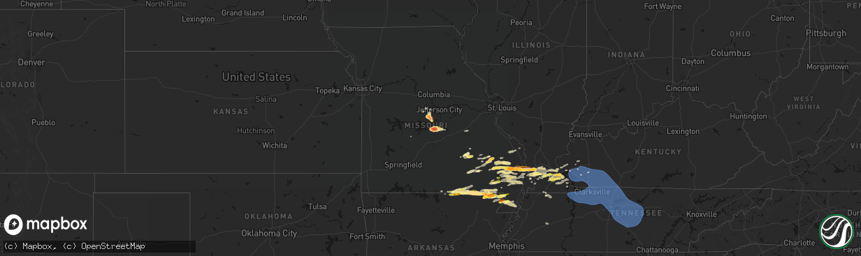
Hail Map in Missouri on April 16, 2026
The weather event in Missouri on April 16, 2026 includes Hail, Wind, and Tornado maps. 11 states and 357 cities were impacted and suffered possible damage. The total estimated number of properties impacted is 27,940.
Hail
Wind
Tornado
27,940
Estimated number of impacted properties by a 1.00" hail or larger10,827
Estimated number of impacted properties by a 1.75" hail or larger1,611
Estimated number of impacted properties by a 2.50" hail or largerStorm reports in Missouri
Missouri
| Date | Description |
|---|---|
| 04/16/20266:57 PM CDT | A local report indicates 1.00 inch wind near 3 E Naylor |
| 04/16/20265:44 PM CDT | Pictures of tennis ball size hail near eugene. |
| 04/16/20265:32 PM CDT | Corrects previous hail report from 2 n eugene. |
| 04/16/20265:26 PM CDT | A local report indicates 1.00 inch wind near 2 N Eugene |
| 04/16/20265:25 PM CDT | Delayed report... Time estimated from radar. Emergency management estimated hail between golf ball and tennis ball size... Though photo was representative of tennis bal |
| 04/16/20265:20 PM CDT | Multiple reports of golf ball size hail reported by the public... Relayed by regional skywarn ham operator. |
| 04/16/20265:18 PM CDT | Report from mping of quarter size hail. |
| 04/16/20265:05 PM CDT | A local report indicates 1.00 inch wind near 3 S Wappapello |
| 04/16/20265:04 PM CDT | A local report indicates 1.00 inch wind near Olean |
| 04/16/20264:41 PM CDT | A local report indicates 1.00 inch wind near 1 SE Poplar Bluff |
| 04/16/20264:29 PM CDT | A local report indicates 1.00 inch wind near 4 W Poplar Bluff |
| 04/16/20264:01 PM CDT | Hail from quarters to golf balls in size fell for more than 25 minutes. |
| 04/16/20263:58 PM CDT | Delayed report... Time estimated from radar. A lot of small hail with a few ping pong sized pieces. |
| 04/16/20263:24 PM CDT | A local report indicates 1.75 inch wind near 1 ESE Oran |
| 04/16/20263:09 PM CDT | A local report indicates 1.50 inch wind near 2 SSW New Hamburg |
| 04/16/20263:08 PM CDT | Multiple social media reports show hail in benton. |
| 04/16/20263:00 PM CDT | Lots of limbs down in area of leopold... Some larger branches. |
| 04/16/20262:48 PM CDT | Powerlines down. |
| 04/16/20262:45 PM CDT | Part of a barn roof torn off along highway pp south of hwy ff. |
| 04/16/20262:45 PM CDT | A local report indicates 3.00 inch wind near 2 ENE Iberia |
| 04/16/20262:45 PM CDT | A local report indicates 1.00 inch wind near Myrtle |
| 04/16/20262:44 PM CDT | Tree down across roadway. |
| 04/16/20262:41 PM CDT | A local report indicates 1.75 inch wind near Iberia |
| 04/16/20262:41 PM CDT | A local report indicates 2.00 inch wind near Advance |
| 04/16/20262:39 PM CDT | Image of hailstone. |
| 04/16/20262:33 PM CDT | A local report indicates 2.75 inch wind near Advance |
| 04/16/20262:30 PM CDT | Social media images and videos. |
| 04/16/20262:30 PM CDT | A local report indicates 2.00 inch wind near Iberia |
| 04/16/20262:27 PM CDT | A local report indicates 1.25 inch wind near Iberia |
| 04/16/20262:03 PM CDT | A local report indicates 1.25 inch wind near 3 WSW Zalma |
| 04/16/20261:52 PM CDT | Hail to quarters in size reported. |
| 04/15/20267:05 PM CDT | Corrects previous hail report from 2 n kennett. Delayed report of quarter size hail 2 miles north of kennett. |
All States Impacted by Hail Map on April 16, 2026
Cities Impacted by Hail Map on April 16, 2026
- Salem, MO
- Bunker, MO
- Ellington, MO
- Bixby, MO
- Boss, MO
- Greenville, MO
- Caulfield, MO
- Bakersfield, MO
- Lesterville, MO
- Lowndes, MO
- West Plains, MO
- Koshkonong, MO
- Thayer, MO
- Gipsy, MO
- Zalma, MO
- Des Arc, MO
- Patterson, MO
- Mammoth Spring, AR
- Salem, AR
- Sturkie, AR
- Macks Creek, MO
- Couch, MO
- Iberia, MO
- Camp, AR
- Viola, AR
- Marble Hill, MO
- Ravenden, AR
- Myrtle, MO
- Advance, MO
- Warren, OH
- Cortland, OH
- Sturdivant, MO
- Crocker, MO
- Clubb, MO
- Marquand, MO
- Oran, MO
- Pocahontas, AR
- Warm Springs, AR
- Chaffee, MO
- Glenallen, MO
- Brownwood, MO
- Dixon, MO
- Ulman, MO
- Brumley, MO
- Winona, MO
- Patton, MO
- Sedgewickville, MO
- Vienna, OH
- Fowler, OH
- Gatewood, MO
- Fremont, MO
- Doniphan, MO
- Leopold, MO
- Daisy, MO
- Friedheim, MO
- Van Buren, MO
- Perryville, MO
- Benton, MO
- Scott City, MO
- Oak Ridge, MO
- Piedmont, MO
- Altenburg, MO
- Frohna, MO
- Kalamazoo, MI
- Galesburg, MI
- Portage, MI
- Brinktown, MO
- Charleston, MO
- Cairo, IL
- Miller City, IL
- Thebes, IL
- Olive Branch, IL
- Vulcan, MO
- Maynard, AR
- Success, AR
- Ellsinore, MO
- Silva, MO
- Wappapello, MO
- Naylor, MO
- Oxly, MO
- Leasburg, MO
- Cuba, MO
- Corning, AR
- Neelyville, MO
- Bloomfield, MO
- Dexter, MO
- Olean, MO
- Russellville, MO
- McGee, MO
- Vienna, MO
- Datto, AR
- Biggers, AR
- Sikeston, MO
- Bertrand, MO
- Mounds, IL
- Puxico, MO
- Essex, MO
- Barlow, KY
- La Center, KY
- Mound City, IL
- Knobel, AR
- Cunningham, KY
- Bardwell, KY
- Kevil, KY
- Pollard, AR
- Latham, MO
- Qulin, MO
- Annapolis, MO
- Wickliffe, KY
- Paducah, KY
- Melber, KY
- Eldon, MO
- Bell City, MO
- Boaz, KY
- Villa Ridge, IL
- California, MO
- Broseley, MO
- Poplar Bluff, MO
- Hickory, KY
- East Prairie, MO
- Piggott, AR
- West Paducah, KY
- Rector, AR
- Symsonia, KY
- Smithland, KY
- Mill Spring, MO
- Fredericktown, MO
- Calvert City, KY
- Centerville, MO
- Arlington, KY
- Benton, KY
- Mayfield, KY
- Campbell, MO
- Grand Rivers, KY
- Tiline, KY
- Redford, MO
- Fisk, MO
- Clinton, KY
- Brookport, IL
- Ledbetter, KY
- Eugene, MO
- Gilbertsville, KY
- Princeton, KY
- Marion, KY
- Salem, KY
- Kuttawa, KY
- Williamsville, MO
- Marathon, TX
- South Fulton, TN
- Martin, TN
- Fulton, KY
- Providence, KY
- Dawson Springs, KY
- Henley, MO
- Hardin, KY
- Dexter, KY
- Murray, KY
- Almo, KY
- Kirksey, KY
- Dudley, MO
- Fredonia, KY
- Nebo, KY
- Centertown, MO
- Lohman, MO
- Eddyville, KY
- Dresden, TN
- Palmersville, TN
- Woodgate, NY
- Forestport, NY
- Boonville, NY
- Fort Stockton, TX
- Cerulean, KY
- Snyder, TX
- Dryden, TX
- Crofton, KY
- Cadiz, KY
- Lafe, AR
- Hopkinsville, KY
- Gracey, KY
- Saint Charles, KY
- Nortonville, KY
- Pembroke, KY
- Trenton, KY
- Elkton, KY
- Cold Brook, NY
- Hoffmeister, NY
- Sanderson, TX
- Greenway, AR
- Matthews, MO
- Bernie, MO
- Oak Grove, KY
- Clarksville, TN
- Greenville, KY
- Lewisburg, KY
- Belton, KY
- Dunmor, KY
- White Plains, KY
- Guthrie, KY
- Russellville, KY
- Sharon Grove, KY
- Olmstead, KY
- Allensville, KY
- Springfield, TN
- Cedar Hill, TN
- Ashland City, TN
- Pleasant View, TN
- Adairville, KY
- Chapmansboro, TN
- Adams, TN
- Charlotte, TN
- Camden, TN
- Cumberland Furnace, TN
- Westport, TN
- Erin, TN
- Cumberland City, TN
- Holladay, TN
- McEwen, TN
- Cunningham, TN
- Hurricane Mills, TN
- White Bluff, TN
- Southside, TN
- New Johnsonville, TN
- Waverly, TN
- Dickson, TN
- Vanleer, TN
- Indian Mound, TN
- Dover, TN
- Woodlawn, TN
- Palmyra, TN
- Stewart, TN
- Buchanan, TN
- Tennessee Ridge, TN
- Big Rock, TN
- Fort Campbell, KY
- Big Sandy, TN
- Joelton, TN
- Auburn, KY
- Piseco, NY
- Lake Pleasant, NY
- Speculator, NY
- Canalou, MO
- Kennett, MO
- Holcomb, MO
- Franklin, KY
- Cross Plains, TN
- Greenbrier, TN
- Portland, TN
- Orlinda, TN
- Bragg City, MO
- White House, TN
- Goodlettsville, TN
- Parma, MO
- Gibson, MO
- Nashville, TN
- Hayti, MO
- Steele, MO
- Hermitage, TN
- Bethpage, TN
- Whites Creek, TN
- Franklin, TN
- Antioch, TN
- Smyrna, TN
- La Vergne, TN
- Mount Juliet, TN
- Madison, TN
- Castalian Springs, TN
- Hendersonville, TN
- Arrington, TN
- Nolensville, TN
- Lebanon, TN
- Old Hickory, TN
- Cottontown, TN
- Brentwood, TN
- Gallatin, TN
- Caruthersville, MO
- Warren, VT
- Granville, VT
- Bradyville, TN
- Beechgrove, TN
- Auburntown, TN
- Christiana, TN
- Milton, TN
- Gordonsville, TN
- Watertown, TN
- Alexandria, TN
- Readyville, TN
- Woodbury, TN
- Carthage, TN
- Rockvale, TN
- Brush Creek, TN
- Riddleton, TN
- Murfreesboro, TN
- Hickman, TN
- College Grove, TN
- Hartsville, TN
- Liberty, TN
- Lascassas, TN
- Bell Buckle, TN
- Eagleville, TN
- Randolph, VT
- Brookfield, VT
- Williamstown, VT
- Northfield, VT
- Roxbury, VT
- Johnstown, NY
- Gloversville, NY
- Mayfield, NY
- Waitsfield, VT
- Washington, VT
- West Topsham, VT
- Topsham, VT
- Barre, VT
- East Barre, VT
- Graniteville, VT
- Corinth, VT
- Chelsea, VT
- Mcminnville, TN
- Manchester, TN
- Buffalo Valley, TN
- Chestnut Mound, TN
- Lancaster, TN
- Smithville, TN
- Elmwood, TN
- Baxter, TN
- Morrison, TN
- Silver Point, TN
- Dowelltown, TN
- East Corinth, VT
- Newbury, VT
- Wells River, VT
- Bradford, VT
- Pike, NH
- Haverhill, NH
- North Haverhill, NH
- Oakfield, TN
- Jackson, TN
- Alton, MO
- Bath, NH
- South Ryegate, VT
- Woodsville, NH
- Groton, VT
- Milan, NH
- Cornish, NH
- Scotts, MI
- Lisbon, NH
- Caroga Lake, NY
- Broadalbin, NY
- Saint Francis, AR
- Clarkton, MO
- Woodburn, KY
- Westmoreland, TN
- Fancy Farm, KY
- North Stratford, NH
- Groveton, NH
- Northville, NY
- Warrenton, MO
- Troy, MO


