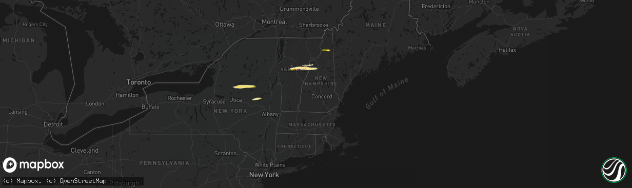
Hail Map in New Hampshire on April 16, 2026
The weather event in New Hampshire on April 16, 2026 includes Hail, Wind, and Tornado maps. 11 states and 357 cities were impacted and suffered possible damage. The total estimated number of properties impacted is 1,079.
Hail
Wind
Tornado
1,079
Estimated number of impacted properties by a 1.00" hail or larger236
Estimated number of impacted properties by a 1.75" hail or larger0
Estimated number of impacted properties by a 2.50" hail or largerStorm reports in New Hampshire
New Hampshire
| Date | Description |
|---|---|
| 04/15/20269:05 PM CDT | Delayed report. Trees and several large branches partially blocking sections of lost river road... Stretching from nh hwy 116 east to the wildwood campground. |
| 04/15/20268:58 PM CDT | Delayed report. Trees downed on power lines in lisbon. Power outages also reported. |
| 04/15/20268:53 PM CDT | Delayed report. Multiple trees down on sawyer hill road between goose lane and nh hwy 112. Largest tree diameter between 12 and 18 inches. |
| 04/15/20268:50 PM CDT | Delayed report. Social media photos of hail up to 1.25 inches in diameter in center haverhill near intersection of route 116 and french pond rd. Wind damage reports str |
| 04/15/20268:48 PM CDT | Hail up to 1.5 inches in north haverhill on route 10. Spotter id: hl590. |
| 04/15/20267:20 PM CDT | Off-duty ems observed hail measured 1.5 inches in dummer. Hail began at 8:20. |
| 04/15/20267:20 PM CDT | Off-duty ems |
| 04/15/20267:05 PM CDT | Quarter-sized hail in groveton near intersection of main street and us highway 3. |
All States Impacted by Hail Map on April 16, 2026
Cities Impacted by Hail Map on April 16, 2026
- Salem, MO
- Bunker, MO
- Ellington, MO
- Bixby, MO
- Boss, MO
- Greenville, MO
- Caulfield, MO
- Bakersfield, MO
- Lesterville, MO
- Lowndes, MO
- West Plains, MO
- Koshkonong, MO
- Thayer, MO
- Gipsy, MO
- Zalma, MO
- Des Arc, MO
- Patterson, MO
- Mammoth Spring, AR
- Salem, AR
- Sturkie, AR
- Macks Creek, MO
- Couch, MO
- Iberia, MO
- Camp, AR
- Viola, AR
- Marble Hill, MO
- Ravenden, AR
- Myrtle, MO
- Advance, MO
- Warren, OH
- Cortland, OH
- Sturdivant, MO
- Crocker, MO
- Clubb, MO
- Marquand, MO
- Oran, MO
- Pocahontas, AR
- Warm Springs, AR
- Chaffee, MO
- Glenallen, MO
- Brownwood, MO
- Dixon, MO
- Ulman, MO
- Brumley, MO
- Winona, MO
- Patton, MO
- Sedgewickville, MO
- Vienna, OH
- Fowler, OH
- Gatewood, MO
- Fremont, MO
- Doniphan, MO
- Leopold, MO
- Daisy, MO
- Friedheim, MO
- Van Buren, MO
- Perryville, MO
- Benton, MO
- Scott City, MO
- Oak Ridge, MO
- Piedmont, MO
- Altenburg, MO
- Frohna, MO
- Kalamazoo, MI
- Galesburg, MI
- Portage, MI
- Brinktown, MO
- Charleston, MO
- Cairo, IL
- Miller City, IL
- Thebes, IL
- Olive Branch, IL
- Vulcan, MO
- Maynard, AR
- Success, AR
- Ellsinore, MO
- Silva, MO
- Wappapello, MO
- Naylor, MO
- Oxly, MO
- Leasburg, MO
- Cuba, MO
- Corning, AR
- Neelyville, MO
- Bloomfield, MO
- Dexter, MO
- Olean, MO
- Russellville, MO
- McGee, MO
- Vienna, MO
- Datto, AR
- Biggers, AR
- Sikeston, MO
- Bertrand, MO
- Mounds, IL
- Puxico, MO
- Essex, MO
- Barlow, KY
- La Center, KY
- Mound City, IL
- Knobel, AR
- Cunningham, KY
- Bardwell, KY
- Kevil, KY
- Pollard, AR
- Latham, MO
- Qulin, MO
- Annapolis, MO
- Wickliffe, KY
- Paducah, KY
- Melber, KY
- Eldon, MO
- Bell City, MO
- Boaz, KY
- Villa Ridge, IL
- California, MO
- Broseley, MO
- Poplar Bluff, MO
- Hickory, KY
- East Prairie, MO
- Piggott, AR
- West Paducah, KY
- Rector, AR
- Symsonia, KY
- Smithland, KY
- Mill Spring, MO
- Fredericktown, MO
- Calvert City, KY
- Centerville, MO
- Arlington, KY
- Benton, KY
- Mayfield, KY
- Campbell, MO
- Grand Rivers, KY
- Tiline, KY
- Redford, MO
- Fisk, MO
- Clinton, KY
- Brookport, IL
- Ledbetter, KY
- Eugene, MO
- Gilbertsville, KY
- Princeton, KY
- Marion, KY
- Salem, KY
- Kuttawa, KY
- Williamsville, MO
- Marathon, TX
- South Fulton, TN
- Martin, TN
- Fulton, KY
- Providence, KY
- Dawson Springs, KY
- Henley, MO
- Hardin, KY
- Dexter, KY
- Murray, KY
- Almo, KY
- Kirksey, KY
- Dudley, MO
- Fredonia, KY
- Nebo, KY
- Centertown, MO
- Lohman, MO
- Eddyville, KY
- Dresden, TN
- Palmersville, TN
- Woodgate, NY
- Forestport, NY
- Boonville, NY
- Fort Stockton, TX
- Cerulean, KY
- Snyder, TX
- Dryden, TX
- Crofton, KY
- Cadiz, KY
- Lafe, AR
- Hopkinsville, KY
- Gracey, KY
- Saint Charles, KY
- Nortonville, KY
- Pembroke, KY
- Trenton, KY
- Elkton, KY
- Cold Brook, NY
- Hoffmeister, NY
- Sanderson, TX
- Greenway, AR
- Matthews, MO
- Bernie, MO
- Oak Grove, KY
- Clarksville, TN
- Greenville, KY
- Lewisburg, KY
- Belton, KY
- Dunmor, KY
- White Plains, KY
- Guthrie, KY
- Russellville, KY
- Sharon Grove, KY
- Olmstead, KY
- Allensville, KY
- Springfield, TN
- Cedar Hill, TN
- Ashland City, TN
- Pleasant View, TN
- Adairville, KY
- Chapmansboro, TN
- Adams, TN
- Charlotte, TN
- Camden, TN
- Cumberland Furnace, TN
- Westport, TN
- Erin, TN
- Cumberland City, TN
- Holladay, TN
- McEwen, TN
- Cunningham, TN
- Hurricane Mills, TN
- White Bluff, TN
- Southside, TN
- New Johnsonville, TN
- Waverly, TN
- Dickson, TN
- Vanleer, TN
- Indian Mound, TN
- Dover, TN
- Woodlawn, TN
- Palmyra, TN
- Stewart, TN
- Buchanan, TN
- Tennessee Ridge, TN
- Big Rock, TN
- Fort Campbell, KY
- Big Sandy, TN
- Joelton, TN
- Auburn, KY
- Piseco, NY
- Lake Pleasant, NY
- Speculator, NY
- Canalou, MO
- Kennett, MO
- Holcomb, MO
- Franklin, KY
- Cross Plains, TN
- Greenbrier, TN
- Portland, TN
- Orlinda, TN
- Bragg City, MO
- White House, TN
- Goodlettsville, TN
- Parma, MO
- Gibson, MO
- Nashville, TN
- Hayti, MO
- Steele, MO
- Hermitage, TN
- Bethpage, TN
- Whites Creek, TN
- Franklin, TN
- Antioch, TN
- Smyrna, TN
- La Vergne, TN
- Mount Juliet, TN
- Madison, TN
- Castalian Springs, TN
- Hendersonville, TN
- Arrington, TN
- Nolensville, TN
- Lebanon, TN
- Old Hickory, TN
- Cottontown, TN
- Brentwood, TN
- Gallatin, TN
- Caruthersville, MO
- Warren, VT
- Granville, VT
- Bradyville, TN
- Beechgrove, TN
- Auburntown, TN
- Christiana, TN
- Milton, TN
- Gordonsville, TN
- Watertown, TN
- Alexandria, TN
- Readyville, TN
- Woodbury, TN
- Carthage, TN
- Rockvale, TN
- Brush Creek, TN
- Riddleton, TN
- Murfreesboro, TN
- Hickman, TN
- College Grove, TN
- Hartsville, TN
- Liberty, TN
- Lascassas, TN
- Bell Buckle, TN
- Eagleville, TN
- Randolph, VT
- Brookfield, VT
- Williamstown, VT
- Northfield, VT
- Roxbury, VT
- Johnstown, NY
- Gloversville, NY
- Mayfield, NY
- Waitsfield, VT
- Washington, VT
- West Topsham, VT
- Topsham, VT
- Barre, VT
- East Barre, VT
- Graniteville, VT
- Corinth, VT
- Chelsea, VT
- Mcminnville, TN
- Manchester, TN
- Buffalo Valley, TN
- Chestnut Mound, TN
- Lancaster, TN
- Smithville, TN
- Elmwood, TN
- Baxter, TN
- Morrison, TN
- Silver Point, TN
- Dowelltown, TN
- East Corinth, VT
- Newbury, VT
- Wells River, VT
- Bradford, VT
- Pike, NH
- Haverhill, NH
- North Haverhill, NH
- Oakfield, TN
- Jackson, TN
- Alton, MO
- Bath, NH
- South Ryegate, VT
- Woodsville, NH
- Groton, VT
- Milan, NH
- Cornish, NH
- Scotts, MI
- Lisbon, NH
- Caroga Lake, NY
- Broadalbin, NY
- Saint Francis, AR
- Clarkton, MO
- Woodburn, KY
- Westmoreland, TN
- Fancy Farm, KY
- North Stratford, NH
- Groveton, NH
- Northville, NY
- Warrenton, MO
- Troy, MO


