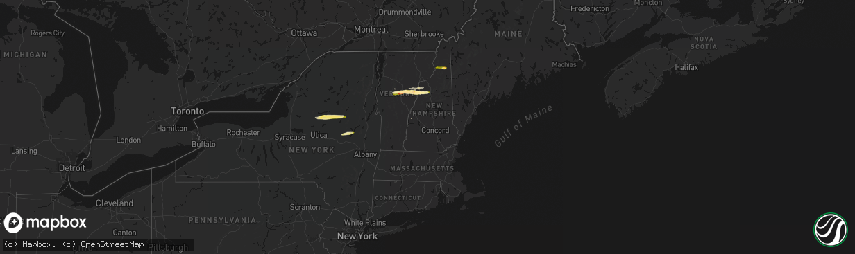
Hail Map in Vermont on April 16, 2026
The weather event in Vermont on April 16, 2026 includes Hail, Wind, and Tornado maps. 11 states and 357 cities were impacted and suffered possible damage. The total estimated number of properties impacted is 3,511.
Hail
Wind
Tornado
3,511
Estimated number of impacted properties by a 1.00" hail or larger1,900
Estimated number of impacted properties by a 1.75" hail or larger0
Estimated number of impacted properties by a 2.50" hail or largerStorm reports in Vermont
Vermont
| Date | Description |
|---|---|
| 04/15/20269:53 PM CDT | Tree down on power lines near intersection of chelsea rd and baptist st. |
| 04/15/20268:40 PM CDT | Corrects previous tstm wnd dmg report time from 3 ene ainsworth state park. Tree down on power lines near intersection of chelsea rd and baptist st. |
| 04/15/20268:35 PM CDT | Power pole down on fairview st. |
| 04/15/20268:30 PM CDT | A local report indicates 1.00 inch wind near 2 NE East Orange |
All States Impacted by Hail Map on April 16, 2026
Cities Impacted by Hail Map on April 16, 2026
- Salem, MO
- Bunker, MO
- Ellington, MO
- Bixby, MO
- Boss, MO
- Greenville, MO
- Caulfield, MO
- Bakersfield, MO
- Lesterville, MO
- Lowndes, MO
- West Plains, MO
- Koshkonong, MO
- Thayer, MO
- Gipsy, MO
- Zalma, MO
- Des Arc, MO
- Patterson, MO
- Mammoth Spring, AR
- Salem, AR
- Sturkie, AR
- Macks Creek, MO
- Couch, MO
- Iberia, MO
- Camp, AR
- Viola, AR
- Marble Hill, MO
- Ravenden, AR
- Myrtle, MO
- Advance, MO
- Warren, OH
- Cortland, OH
- Sturdivant, MO
- Crocker, MO
- Clubb, MO
- Marquand, MO
- Oran, MO
- Pocahontas, AR
- Warm Springs, AR
- Chaffee, MO
- Glenallen, MO
- Brownwood, MO
- Dixon, MO
- Ulman, MO
- Brumley, MO
- Winona, MO
- Patton, MO
- Sedgewickville, MO
- Vienna, OH
- Fowler, OH
- Gatewood, MO
- Fremont, MO
- Doniphan, MO
- Leopold, MO
- Daisy, MO
- Friedheim, MO
- Van Buren, MO
- Perryville, MO
- Benton, MO
- Scott City, MO
- Oak Ridge, MO
- Piedmont, MO
- Altenburg, MO
- Frohna, MO
- Kalamazoo, MI
- Galesburg, MI
- Portage, MI
- Brinktown, MO
- Charleston, MO
- Cairo, IL
- Miller City, IL
- Thebes, IL
- Olive Branch, IL
- Vulcan, MO
- Maynard, AR
- Success, AR
- Ellsinore, MO
- Silva, MO
- Wappapello, MO
- Naylor, MO
- Oxly, MO
- Leasburg, MO
- Cuba, MO
- Corning, AR
- Neelyville, MO
- Bloomfield, MO
- Dexter, MO
- Olean, MO
- Russellville, MO
- McGee, MO
- Vienna, MO
- Datto, AR
- Biggers, AR
- Sikeston, MO
- Bertrand, MO
- Mounds, IL
- Puxico, MO
- Essex, MO
- Barlow, KY
- La Center, KY
- Mound City, IL
- Knobel, AR
- Cunningham, KY
- Bardwell, KY
- Kevil, KY
- Pollard, AR
- Latham, MO
- Qulin, MO
- Annapolis, MO
- Wickliffe, KY
- Paducah, KY
- Melber, KY
- Eldon, MO
- Bell City, MO
- Boaz, KY
- Villa Ridge, IL
- California, MO
- Broseley, MO
- Poplar Bluff, MO
- Hickory, KY
- East Prairie, MO
- Piggott, AR
- West Paducah, KY
- Rector, AR
- Symsonia, KY
- Smithland, KY
- Mill Spring, MO
- Fredericktown, MO
- Calvert City, KY
- Centerville, MO
- Arlington, KY
- Benton, KY
- Mayfield, KY
- Campbell, MO
- Grand Rivers, KY
- Tiline, KY
- Redford, MO
- Fisk, MO
- Clinton, KY
- Brookport, IL
- Ledbetter, KY
- Eugene, MO
- Gilbertsville, KY
- Princeton, KY
- Marion, KY
- Salem, KY
- Kuttawa, KY
- Williamsville, MO
- Marathon, TX
- South Fulton, TN
- Martin, TN
- Fulton, KY
- Providence, KY
- Dawson Springs, KY
- Henley, MO
- Hardin, KY
- Dexter, KY
- Murray, KY
- Almo, KY
- Kirksey, KY
- Dudley, MO
- Fredonia, KY
- Nebo, KY
- Centertown, MO
- Lohman, MO
- Eddyville, KY
- Dresden, TN
- Palmersville, TN
- Woodgate, NY
- Forestport, NY
- Boonville, NY
- Fort Stockton, TX
- Cerulean, KY
- Snyder, TX
- Dryden, TX
- Crofton, KY
- Cadiz, KY
- Lafe, AR
- Hopkinsville, KY
- Gracey, KY
- Saint Charles, KY
- Nortonville, KY
- Pembroke, KY
- Trenton, KY
- Elkton, KY
- Cold Brook, NY
- Hoffmeister, NY
- Sanderson, TX
- Greenway, AR
- Matthews, MO
- Bernie, MO
- Oak Grove, KY
- Clarksville, TN
- Greenville, KY
- Lewisburg, KY
- Belton, KY
- Dunmor, KY
- White Plains, KY
- Guthrie, KY
- Russellville, KY
- Sharon Grove, KY
- Olmstead, KY
- Allensville, KY
- Springfield, TN
- Cedar Hill, TN
- Ashland City, TN
- Pleasant View, TN
- Adairville, KY
- Chapmansboro, TN
- Adams, TN
- Charlotte, TN
- Camden, TN
- Cumberland Furnace, TN
- Westport, TN
- Erin, TN
- Cumberland City, TN
- Holladay, TN
- McEwen, TN
- Cunningham, TN
- Hurricane Mills, TN
- White Bluff, TN
- Southside, TN
- New Johnsonville, TN
- Waverly, TN
- Dickson, TN
- Vanleer, TN
- Indian Mound, TN
- Dover, TN
- Woodlawn, TN
- Palmyra, TN
- Stewart, TN
- Buchanan, TN
- Tennessee Ridge, TN
- Big Rock, TN
- Fort Campbell, KY
- Big Sandy, TN
- Joelton, TN
- Auburn, KY
- Piseco, NY
- Lake Pleasant, NY
- Speculator, NY
- Canalou, MO
- Kennett, MO
- Holcomb, MO
- Franklin, KY
- Cross Plains, TN
- Greenbrier, TN
- Portland, TN
- Orlinda, TN
- Bragg City, MO
- White House, TN
- Goodlettsville, TN
- Parma, MO
- Gibson, MO
- Nashville, TN
- Hayti, MO
- Steele, MO
- Hermitage, TN
- Bethpage, TN
- Whites Creek, TN
- Franklin, TN
- Antioch, TN
- Smyrna, TN
- La Vergne, TN
- Mount Juliet, TN
- Madison, TN
- Castalian Springs, TN
- Hendersonville, TN
- Arrington, TN
- Nolensville, TN
- Lebanon, TN
- Old Hickory, TN
- Cottontown, TN
- Brentwood, TN
- Gallatin, TN
- Caruthersville, MO
- Warren, VT
- Granville, VT
- Bradyville, TN
- Beechgrove, TN
- Auburntown, TN
- Christiana, TN
- Milton, TN
- Gordonsville, TN
- Watertown, TN
- Alexandria, TN
- Readyville, TN
- Woodbury, TN
- Carthage, TN
- Rockvale, TN
- Brush Creek, TN
- Riddleton, TN
- Murfreesboro, TN
- Hickman, TN
- College Grove, TN
- Hartsville, TN
- Liberty, TN
- Lascassas, TN
- Bell Buckle, TN
- Eagleville, TN
- Randolph, VT
- Brookfield, VT
- Williamstown, VT
- Northfield, VT
- Roxbury, VT
- Johnstown, NY
- Gloversville, NY
- Mayfield, NY
- Waitsfield, VT
- Washington, VT
- West Topsham, VT
- Topsham, VT
- Barre, VT
- East Barre, VT
- Graniteville, VT
- Corinth, VT
- Chelsea, VT
- Mcminnville, TN
- Manchester, TN
- Buffalo Valley, TN
- Chestnut Mound, TN
- Lancaster, TN
- Smithville, TN
- Elmwood, TN
- Baxter, TN
- Morrison, TN
- Silver Point, TN
- Dowelltown, TN
- East Corinth, VT
- Newbury, VT
- Wells River, VT
- Bradford, VT
- Pike, NH
- Haverhill, NH
- North Haverhill, NH
- Oakfield, TN
- Jackson, TN
- Alton, MO
- Bath, NH
- South Ryegate, VT
- Woodsville, NH
- Groton, VT
- Milan, NH
- Cornish, NH
- Scotts, MI
- Lisbon, NH
- Caroga Lake, NY
- Broadalbin, NY
- Saint Francis, AR
- Clarkton, MO
- Woodburn, KY
- Westmoreland, TN
- Fancy Farm, KY
- North Stratford, NH
- Groveton, NH
- Northville, NY
- Warrenton, MO
- Troy, MO


