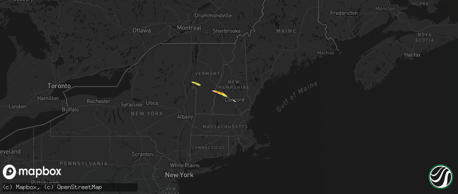
Hail Map in New Hampshire on June 26, 2026
The weather event in New Hampshire on June 26, 2026 includes Hail, Wind, and Tornado maps. 21 states and 392 cities were impacted and suffered possible damage. The total estimated number of properties impacted is 11,763.
Hail
Wind
Tornado
11,763
Estimated number of impacted properties by a 1.00" hail or larger1,442
Estimated number of impacted properties by a 1.75" hail or larger0
Estimated number of impacted properties by a 2.50" hail or largerStorm reports in New Hampshire
New Hampshire
| Date | Description |
|---|---|
| 06/26/20265:45 PM CDT | Social media photos of hail up to 1.25in in auburn. |
| 06/26/20264:54 PM CDT | Hail between 1.75 to 2 in fell for 5 to 6 mins. Cracked windshield and dented car hood. Time estimated by radar. |
| 06/26/20264:40 PM CDT | Ne511 reported a tree down on southington rd. One lane closed during time of report... Time estimated by radar. |
| 06/26/20264:37 PM CDT | Social media photo of 12 to 18 in diameter trees down and partially blocking kearsage mountain rd in warner. Time estimated by radar. |
| 06/26/20264:31 PM CDT | Trees on wires on birch hill rd. Time estimated by radar. |
| 06/26/20264:20 PM CDT | Off duty ems reports downed trees blocking baker hill rd. |
| 06/26/20264:10 PM CDT | Golf ball size hail for 6-7 minutes. Time estimated by radar. |
| 06/26/20264:10 PM CDT | Trees on wires on nh 11 near grandliden rd. Time estimated by radar. |
| 06/26/20264:04 PM CDT | Ping pong size hail on nh 103 in east newport. |
| 06/26/20264:00 PM CDT | Time estimated by radar. |
| 06/26/20263:53 PM CDT | Trees down on wires on hwy 120 near town house rd. Hail accumulated on grassy surfaces. |
| 06/26/20263:44 PM CDT | Facebook photo of hail in garden from a pembroke resident. Time estimated by radar. |
| 06/26/20263:40 PM CDT | Some stones larger than half dollars left dents in a few cars. |
All States Impacted by Hail Map on June 26, 2026
Cities Impacted by Hail Map on June 26, 2026
- Putnam Station, NY
- Orwell, VT
- Fair Haven, VT
- Brandon, VT
- Bomoseen, VT
- Castleton, VT
- Florence, VT
- West Rutland, VT
- Ganado, AZ
- Proctor, VT
- Campton, KY
- Farmington, NM
- Ezel, KY
- Hazel Green, KY
- Arvada, CO
- Broomfield, CO
- Los Lunas, NM
- Elizabeth, CO
- Gallup, NM
- Golden, CO
- Kiowa, CO
- Denver, CO
- Westminster, CO
- Elbert, CO
- Grants, NM
- Bluewater, NM
- Franktown, CO
- Chaffee, MO
- Belen, NM
- Gamerco, NM
- Palm Coast, FL
- Scott City, MO
- Charleston, MO
- Benton, MO
- Fountain, CO
- Fort Myers, FL
- Tohatchi, NM
- Cairo, IL
- Miller City, IL
- Pueblo, CO
- Ashton, ID
- Cornish, NH
- Windsor, VT
- Thebes, IL
- Chugwater, WY
- Bertrand, MO
- Sikeston, MO
- Lehigh Acres, FL
- Bunnell, FL
- Newport, NH
- Cubero, NM
- Wesley Chapel, FL
- Sunapee, NH
- New London, NH
- Newbury, NH
- Bradford, NH
- Lindrith, NM
- Jemez Springs, NM
- Lutz, FL
- Brownsville, VT
- Hawk Springs, WY
- Yoder, WY
- Reading, VT
- Bayfield, CO
- Agate, CO
- South Sutton, NH
- North Sutton, NH
- Warner, NH
- Peyton, CO
- Calhan, CO
- Kingstree, SC
- Thoreau, NM
- Ponderosa, NM
- Land O'Lakes, FL
- Bradley, FL
- Bowling Green, FL
- Mulberry, FL
- Waycross, GA
- Aztec, NM
- Bloomfield, NM
- Ramah, CO
- Fort Davis, TX
- Andrews, SC
- Bartow, FL
- Arcadia, FL
- Durango, CO
- Flora Vista, NM
- Bosque, NM
- Magdalena, NM
- San Acacia, NM
- La Joya, NM
- Cuba, NM
- La Jara, NM
- Counselor, NM
- Miami, TX
- Varney, KY
- Sidney, KY
- Pikeville, KY
- Carl Junction, MO
- Mooreland, OK
- Chester, OK
- Gillette, WY
- Myakka City, FL
- Pena Blanca, NM
- Los Alamos, NM
- Bow, NH
- Contoocook, NH
- Concord, NH
- Ringwood, OK
- Canada, KY
- Enid, OK
- Lusk, WY
- Folsom, NM
- Grenville, NM
- Lyman, NE
- Ona, FL
- Manville, WY
- Avondale, CO
- Gering, NE
- Canadian, TX
- Fairmont, OK
- Kremlin, OK
- Conway, MO
- Wann, OK
- Shawnee, WY
- Billings, OK
- Boone, CO
- Ava, MO
- Limon, CO
- Genoa, CO
- Garber, OK
- Woodward, OK
- Scottsbluff, NE
- Mitchell, NE
- Coffeyville, KS
- S Coffeyville, OK
- Greeley, CO
- Eaton, CO
- Lucerne, CO
- Buffalo, OK
- Fort Supply, OK
- Denton, MT
- Hilger, MT
- Waynoka, OK
- Perry, OK
- Hunter, OK
- Pond Creek, OK
- Kit Carson, CO
- Hugo, CO
- Seibert, CO
- Flagler, CO
- Fowler, CO
- Winifred, MT
- Lucien, OK
- Covington, OK
- Douglas, OK
- Watonga, OK
- Harrison, NE
- Alva, OK
- Karval, CO
- Lamont, OK
- Kenton, OK
- Candia, NH
- Raymond, NH
- Clayton, NM
- Suncook, NH
- Tonkawa, OK
- Gill, CO
- Londonderry, NH
- Seiling, OK
- Hitchcock, OK
- Okeene, OK
- Mobeetie, TX
- Wheeler, TX
- Briscoe, TX
- Vona, CO
- Stratton, CO
- Galeton, CO
- Briggsdale, CO
- Newcastle, WY
- Upton, WY
- Minatare, NE
- Ponca City, OK
- Lenapah, OK
- Pritchett, CO
- Douglas, WY
- Columbus, KS
- Bayard, NE
- Blackwell, OK
- Branchville, SC
- Hennessey, OK
- Loyal, OK
- Kingfisher, OK
- Rocky Ford, CO
- Boise City, OK
- Sheridan, WY
- La Junta, CO
- Bridgeport, NE
- Decker, MT
- Branson, CO
- Angora, NE
- Cheraw, CO
- Nardin, OK
- Haswell, CO
- Felt, OK
- Burlington, CO
- Bethune, CO
- Grover, CO
- Braman, OK
- Hot Springs, SD
- Sundance, WY
- Waukomis, OK
- Statesboro, GA
- Las Animas, CO
- Hooksett, NH
- Morrison, OK
- Stillwater, OK
- Oral, SD
- Newkirk, OK
- Drummond, OK
- Buffalo Gap, SD
- Otter, MT
- Eads, CO
- Beulah, WY
- Carrier, OK
- Ames, OK
- Tucumcari, NM
- San Jon, NM
- Bard, NM
- Bushnell, NE
- Dover, OK
- Lagrange, WY
- Spearfish, SD
- Caney, KS
- Cheyenne Wells, CO
- Fairburn, SD
- Glencoe, OK
- Pine Ridge, SD
- Marshall, OK
- Hill City, SD
- McClave, CO
- Hasty, CO
- Orlando, OK
- Copan, OK
- Nyssa, OR
- Delaware, OK
- Arkansas City, KS
- Hay Springs, NE
- Maple City, KS
- Lamar, CO
- Wiley, CO
- Hermosa, SD
- Harrisburg, NE
- Custer, SD
- Dexter, KS
- Caputa, SD
- Dalhart, TX
- Channing, TX
- Nara Visa, NM
- Hereford, TX
- Adrian, TX
- Logan, NM
- Holly, CO
- Vinita, OK
- Niotaze, KS
- New Underwood, SD
- Crescent, OK
- Mulhall, OK
- Whitewood, SD
- Ripley, OK
- Perkins, OK
- Vega, TX
- Hartley, TX
- Owanka, SD
- Granada, CO
- Arapahoe, CO
- Wasta, SD
- Volborg, MT
- Piedmont, SD
- Nemo, SD
- Baxter Springs, KS
- Tyro, KS
- Box Elder, SD
- Rapid City, SD
- Lead, SD
- Deadwood, SD
- Sturgis, SD
- Black Hawk, SD
- Ellsworth Afb, SD
- Wall, SD
- Coyle, OK
- Putnam, OK
- Taloga, OK
- Custer City, OK
- Butler, OK
- Havana, KS
- Bluejacket, OK
- Caldwell, ID
- Guthrie, OK
- Oakwood, OK
- Syracuse, KS
- Enning, SD
- Texline, TX
- Sedan, NM
- Nampa, ID
- Sedan, KS
- Cedar Vale, KS
- Leedey, OK
- Fay, OK
- Coolidge, KS
- Johnson, KS
- Kendall, KS
- Howes, SD
- Quinn, SD
- White Owl, SD
- Dumas, TX
- Stratford, TX
- Meridian, ID
- Canton, OK
- Moline, KS
- Meno, OK
- Eagle, ID
- Boise, ID
- Garden City, ID
- Meridian, OK
- Mud Butte, SD
- Union Center, SD
- Sunray, TX
- Masterson, TX
- Cactus, TX
- Texhoma, OK
- Keyes, OK
- Omega, OK
- Longdale, OK
- Wellston, OK
- Luther, OK
- Southard, OK
- Thomas, OK
- Welch, OK
- Goltry, OK
- Lahoma, OK
- Helena, OK
- Faith, SD
- Walsh, CO
- Peru, KS
- Kuna, ID
- Kadoka, SD
- Philip, SD
- Cherry Creek, SD
- Milesville, SD
- Gruver, TX
- Goodwell, OK
- Texhoma, TX
- Guymon, OK
- Morse, TX
- Stinnett, TX
- Cashion, OK
- Midland, SD
- Meadow, SD
- Bison, SD
- Dupree, SD
- Borger, TX
- Spearman, TX
- Chandler, OK
- Bison, OK
- Fairview, OK
- Aline, OK
- Earth, TX
- Muleshoe, TX
- Sudan, TX
- Amherst, TX
- Fieldton, TX
- Springlake, TX
- Olton, TX
- Littlefield, TX
- Plainview, TX
- Hale Center, TX
- Okarche, OK
- Calumet, OK
- Greenfield, OK
- Geary, OK
- Davenport, OK
- Perryton, TX
- Pampa, TX
- Hardesty, OK
- Abernathy, TX
- Petersburg, TX
- Anton, TX
- Shallowater, TX
- Stroud, OK
- Lodgepole, SD
- Balko, OK


