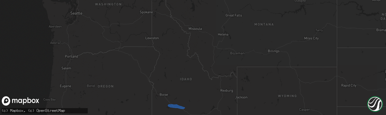
Hail Map in Idaho on December 17, 2025
The weather event in Idaho on December 17, 2025 includes Hail and Wind maps. 1 state and 28 cities were impacted and suffered possible damage. The total estimated number of properties impacted is 0.
Hail
Wind
0
Estimated number of impacted properties by a 1.00" hail or larger0
Estimated number of impacted properties by a 1.75" hail or larger0
Estimated number of impacted properties by a 2.50" hail or largerStorm reports in Idaho
Idaho
| Date | Description |
|---|---|
| 12/17/20251:00 PM CST | Mesonet station pc624 alpon east. |
| 12/17/20251:00 PM CST | Mesonet station pc587 north willow. |
| 12/17/202512:45 PM CST | Measured at the rocky point itd mesonet site. |
| 12/17/202512:40 PM CST | Mesonet station pc506 sheep creek hills. |
| 12/17/202512:15 PM CST | Mesonet station 3004 d4 juniper interchange i-84. |
| 12/17/202512:00 PM CST | Mesonet station prsut paris peak. |
| 12/17/202511:15 AM CST | Power outage to several hundred due to strong winds in the area. |
| 12/17/202511:10 AM CST | Image from social media of large... Mature evergreen tree uprooted and blown onto power lines... Snapping one power line. |
| 12/17/202511:10 AM CST | Large... Mature pine tree blown over... Blocking driveway. |
| 12/17/202511:10 AM CST | Measured near howard mountain at the idaho power mesonet site. |
| 12/17/202511:10 AM CST | Measured at the karen road idaho power mesonet site. |
| 12/17/202511:10 AM CST | Large tree down... Blocking roadway. |
| 12/17/202511:06 AM CST | Several hundred without power due to object on the lines. |
| 12/17/202511:01 AM CST | Asos station kpih pocatello regional airport. |
| 12/17/202511:00 AM CST | A member of the public posted a photo of a large fallen tree over the road... Blocking traffic. |
| 12/17/202511:00 AM CST | Member of |
| 12/17/202511:00 AM CST | A member of the public posted a photo of large rocks blocking the grimes creek pass road from strong thunderstorm winds. |
| 12/17/202511:00 AM CST | Member of the public posted a photo of a tree downed with entangled power lines over grimes pass road. |
| 12/17/202511:00 AM CST | Law enforcement provided photos of multiple trees downed over highway 21. |
| 12/17/202511:00 AM CST | Measured at the arbon valley itd mesonet site. |
| 12/17/202510:55 AM CST | Over 100 downed trees needed to be cleared on landmark road to provide access to yellow pine. |
| 12/17/202510:46 AM CST | Asos station ktwf twin falls. |
| 12/17/202510:45 AM CST | The idaho transportation department has closed i-84 eastbound between i-86 eastbound and milepost 245 due to multiple commercial vehicle rollovers associated with high |
| 12/17/202510:45 AM CST | Mesonet station 2248 d5 coldwater i-86. |
| 12/17/202510:44 AM CST | Mesonet station dehi1 deer haven. |
| 12/17/202510:42 AM CST | A member of the public posted a video of several large trees broken from thunderstorm winds... Blocking a driveway. |
| 12/17/202510:15 AM CST | Mesonet station 8401 d4 - valley interchange. |
| 12/17/202510:06 AM CST | A member of the public posted a photo of a large white elm tree downed by wind from a gust front. |
| 12/17/202510:03 AM CST | Kjer. |
| 12/17/202510:00 AM CST | Multiple photos provided by the public showing downed/snapped trees in and near cascade... Including one leaning on a house. |
| 12/17/202510:00 AM CST | Member of the public posted a photo of two pine trees downed on top of a house. |
| 12/17/202510:00 AM CST | Mesonet station 8408 d4 - jerome butte. |
| 12/17/202510:00 AM CST | Member of the public posted a photo of new roofing ripped off of a house. |
| 12/17/20259:45 AM CST | Mesonet station tgfi1 trail gulch. |
| 12/17/20259:30 AM CST | Asos station ktwf twin falls. |
| 12/17/20259:25 AM CST | Member of the public posted a photo of a downed tree resulting in fence damage. |
| 12/17/20259:10 AM CST | Numerous reports of downed trees and power lines. Several roads closed. Numerous power outages. |
| 12/17/20259:07 AM CST | Awos station kmuo mountain home afb. |
| 12/17/20258:46 AM CST | Mesonet station srfi1 snake river. |
| 12/17/20258:30 AM CST | Member of the public posted a photo of two downed trees. |
| 12/17/20258:30 AM CST | Mesonet station 8442 d4 - jackpot. |
| 12/17/20258:00 AM CST | Downed tree and power line critically injured 2 children waiting for a school bus. |
| 12/17/20257:54 AM CST | A local report indicates 66 MPH wind near Mccall |
All States Impacted by Hail Map on December 17, 2025
Cities Impacted by Hail Map on December 17, 2025
- Mountain Home Afb, ID
- Mountain Home, ID
- Hammett, ID
- Glenns Ferry, ID
- Bruneau, ID
- King Hill, ID
- Bliss, ID
- Hagerman, ID
- Gooding, ID
- Buhl, ID
- Castleford, ID
- American Falls, ID
- Jerome, ID
- Eden, ID
- Paul, ID
- Hazelton, ID
- Shoshone, ID
- Rupert, ID
- Carey, ID
- Aberdeen, ID
- Pocatello, ID
- Firth, ID
- Pingree, ID
- Declo, ID
- Malta, ID
- Rockland, ID
- Springfield, ID
- Dietrich, ID


