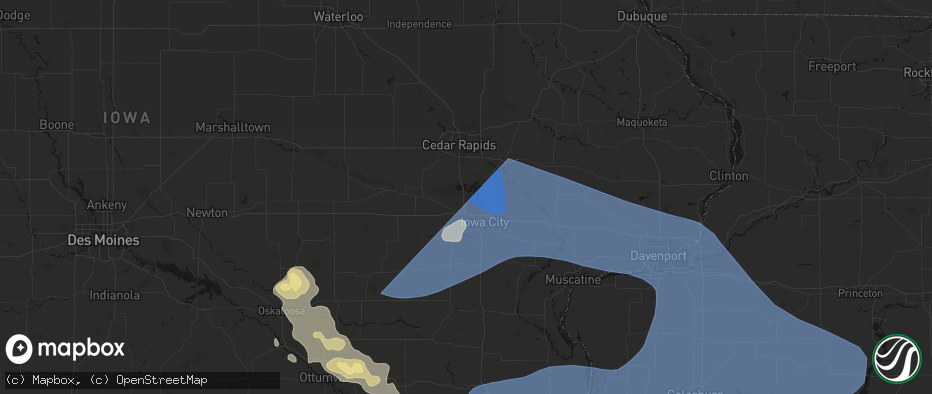
Hail Map in North Liberty, IA on June 17, 2026
The weather event in North Liberty, IA on June 17, 2026 includes Wind, Tornado, and Hail maps. 4 states and 281 cities were impacted and suffered possible damage. The total estimated number of properties impacted is 0.
Wind
Tornado
Hail
0
Estimated number of impacted properties by a 1.00" hail or larger0
Estimated number of impacted properties by a 1.75" hail or larger0
Estimated number of impacted properties by a 2.50" hail or largerStorm reports in North Liberty, IA
North Liberty, IA
| Date | Description |
|---|---|
| 06/17/20267:14 AM CDT | A local report indicates 64 MPH wind near 1 N North Liberty |
| 06/17/20267:11 AM CDT | A local report indicates 70 MPH wind near 2 NW North Liberty |
| 06/17/20267:05 AM CDT | Large tree down with limbs 6 to 8 inches in diameter. |
| 06/17/20267:04 AM CDT | Tree fell and damaged fence on washington ave. |
| 06/17/20267:04 AM CDT | A local report indicates 60 MPH wind near 2 NW North Liberty |
All Cities Impacted by Hail Map on June 17, 2026
- Iowa City, IA
- Oxford, IA
- New Sharon, IA
- Kalona, IA
- Riverside, IA
- Ainsworth, IA
- North Liberty, IA
- West Branch, IA
- West Liberty, IA
- Mount Vernon, IA
- Tiffin, IA
- Lone Tree, IA
- Washington, IA
- Coralville, IA
- West Chester, IA
- Hills, IA
- Wellman, IA
- Ely, IA
- Nichols, IA
- Solon, IA
- Keota, IA
- Harper, IA
- South English, IA
- Parnell, IA
- Williamsburg, IA
- North English, IA
- Lisbon, IA
- Rose Hill, IA
- Oskaloosa, IA
- Barnes City, IA
- Wilton, IA
- Tipton, IA
- Mechanicsville, IA
- Atalissa, IA
- Stockton, IA
- Moscow, IA
- Durant, IA
- Muscatine, IA
- Bennett, IA
- Fremont, IA
- Cedar, IA
- Delta, IA
- Eddyville, IA
- Hedrick, IA
- Ottumwa, IA
- Kirkville, IA
- Niota, IL
- Dallas City, IL
- Stanwood, IA
- Clarence, IA
- Batavia, IA
- Agency, IA
- La Harpe, IL
- Lomax, IL
- Blandinsville, IL
- Dixon, IA
- New Liberty, IA
- Walcott, IA
- Davenport, IA
- Good Hope, IL
- Sciota, IL
- Fairfield, IA
- Eldon, IA
- Libertyville, IA
- Bettendorf, IA
- Eldridge, IA
- Silvis, IL
- East Moline, IL
- Blue Grass, IA
- Coal Valley, IL
- Rock Island, IL
- Moline, IL
- Milan, IL
- Taylor Ridge, IL
- Buffalo, IA
- Lowden, IA
- Donahue, IA
- Princeton, IA
- Wheatland, IA
- Calamus, IA
- Le Claire, IA
- Hampton, IL
- Grand Mound, IA
- Pleasant Valley, IA
- Long Grove, IA
- McCausland, IA
- Montpelier, IA
- Andalusia, IL
- Avon, IL
- Bushnell, IL
- Prairie City, IL
- Roseville, IL
- Macomb, IL
- Mediapolis, IA
- Sperry, IA
- Yarmouth, IA
- Burlington, IA
- Morning Sun, IA
- Oakville, IA
- Little York, IL
- Seaton, IL
- Oquawka, IL
- Monmouth, IL
- Mount Pleasant, IA
- New London, IA
- Mount Union, IA
- Danville, IA
- West Point, IA
- West Burlington, IA
- Middletown, IA
- Wever, IA
- Salem, IA
- Fort Madison, IA
- Gladstone, IL
- Denmark, IA
- Stronghurst, IL
- Carman, IL
- Biggsville, IL
- Aledo, IL
- Reynolds, IL
- Alexis, IL
- Sherrard, IL
- Viola, IL
- Port Byron, IL
- Rapids City, IL
- New Windsor, IL
- Osco, IL
- Colona, IL
- North Henderson, IL
- Carbon Cliff, IL
- Orion, IL
- Woodhull, IL
- Matherville, IL
- Oneida, IL
- Rio, IL
- Lynn Center, IL
- Ophiem, IL
- Alpha, IL
- Galesburg, IL
- Gerlaw, IL
- Kirkwood, IL
- Media, IL
- Henderson, IL
- Wataga, IL
- Cameron, IL
- Smithshire, IL
- Ellisville, IL
- Colchester, IL
- Tennessee, IL
- Raritan, IL
- Plymouth, IL
- Adair, IL
- Industry, IL
- Bardolph, IL
- Kahoka, MO
- Wayland, MO
- Farmington, IA
- Argyle, IA
- Liberty, IL
- Canton, IL
- University Park, IA
- Hillsdale, IL
- Geneseo, IL
- Cambridge, IL
- East Galesburg, IL
- Knoxville, IL
- Andover, IL
- Bradford, IL
- Neponset, IL
- La Fayette, IL
- Annawan, IL
- Sheffield, IL
- Kewanee, IL
- Galva, IL
- Dahinda, IL
- Toulon, IL
- Altona, IL
- Victoria, IL
- Bishop Hill, IL
- Buda, IL
- Atkinson, IL
- Wyoming, IL
- Gilson, IL
- Williamsfield, IL
- Speer, IL
- Laura, IL
- Princeville, IL
- Edelstein, IL
- Brimfield, IL
- Elmwood, IL
- Browning, IL
- Packwood, IA
- Unionville, MO
- Seymour, IA
- Cincinnati, IA
- Warsaw, IL
- Sparland, IL
- Chillicothe, IL
- Henry, IL
- Putnam, IL
- Carthage, IL
- Basco, IL
- Livonia, MO
- Bowen, IL
- Augusta, IL
- Edwards, IL
- Peoria, IL
- Dunlap, IL
- Hanna City, IL
- Morton, IL
- Washington, IL
- Mossville, IL
- Metamora, IL
- East Peoria, IL
- Peoria Heights, IL
- Creve Coeur, IL
- Maquon, IL
- Yates City, IL
- Trivoli, IL
- Toluca, IL
- Lowpoint, IL
- Washburn, IL
- Varna, IL
- Lacon, IL
- Minonk, IL
- Roanoke, IL
- Eureka, IL
- La Rose, IL
- El Paso, IL
- Benson, IL
- Secor, IL
- Hudson, IL
- Deer Creek, IL
- Carlock, IL
- Congerville, IL
- Goodfield, IL
- Lexington, IL
- Chenoa, IL
- Flanagan, IL
- Gridley, IL
- Towanda, IL
- Roodhouse, IL
- La Prairie, IL
- Quincy, IL
- Mendon, IL
- Fairbury, IL
- Colfax, IL
- Pontiac, IL
- Forrest, IL
- Cropsey, IL
- Virden, IL
- Girard, IL
- Loraine, IL
- Camp Point, IL
- Timewell, IL
- Clayton, IL
- Golden, IL
- Huntsville, IL
- Camden, IL
- Mount Sterling, IL
- Littleton, IL
- Rushville, IL
- Frederick, IL
- Farmersville, IL
- Waggoner, IL
- Nokomis, IL
- Raymond, IL
- Witt, IL
- Oconee, IL
- Irving, IL
- Butler, IL
- Hillsboro, IL
- Ramsey, IL
- Ozark, AL
- Delavan, IL
- Green Valley, IL
- San Jose, IL
- Forest City, IL
- Manito, IL
- Topeka, IL
- Coatsburg, IL


