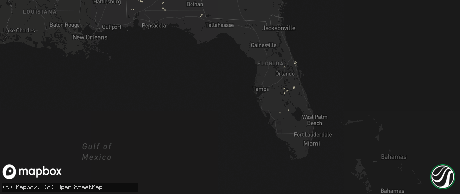
Hail Map in Florida on June 19, 2026
The weather event in Florida on June 19, 2026 includes Hail and Tornado maps. 8 states and 120 cities were impacted and suffered possible damage. The total estimated number of properties impacted is 0.
Hail
Tornado
0
Estimated number of impacted properties by a 1.00" hail or larger0
Estimated number of impacted properties by a 1.75" hail or larger0
Estimated number of impacted properties by a 2.50" hail or largerStorm reports in Florida
Florida
| Date | Description |
|---|---|
| 06/19/20262:38 PM CDT | Leon county emergency manager reported a tree down near the intersection of tram road and artemis way. |
| 06/19/20262:33 PM CDT | Leon county emergency manager reported a tree down near the intersection of march road and alexander street. |
| 06/19/20262:32 PM CDT | Leon county emergency manager reported a tree down near the intersection of e orange ave and s blair stone road. |
| 06/19/20262:30 PM CDT | Jackson county 911 call center reported a tree down along woodbriar drive near marianna. |
| 06/19/20262:30 PM CDT | The washington county 911 call center reported a tree down along new jerusalem road. |
| 06/19/20262:27 PM CDT | Leon county emergency manager reported a tree down near the intersection of old st augustine rd and midyette road. |
| 06/19/20262:17 PM CDT | Leon county emergency manager reported a tree down near the intersection of old st augustine road and williams road. |
| 06/19/20262:10 PM CDT | The washington county 911 call center reported a large tree limb on power lines along church ave in chipley. |
| 06/19/20262:10 PM CDT | The washington county 911 call center reported a tree down along glass road near chipley... Fl. |
| 06/19/20262:07 PM CDT | Leon county emergency manager reported a tree down near the intersection of ansel ferrel road and grenville road. |
| 06/19/20261:59 PM CDT | Leon county emergency manager reported a tree down near the intersection of pedrick road and devonshire road. |
| 06/19/202612:06 PM CDT | A single tree down at each of the following locations: rocky ford road... Dusty miller road... U.s. 90 west of greenville and the city of madison. |
All States Impacted by Hail Map on June 19, 2026
Cities Impacted by Hail Map on June 19, 2026
- Anna, TX
- Eldorado, TX
- San Angelo, TX
- Lone Grove, OK
- Ardmore, OK
- Whitewright, TX
- Girard, TX
- Vancourt, TX
- Comanche, TX
- Farmersville, TX
- Snyder, TX
- Menard, TX
- Miles, TX
- Wall, TX
- Dallas, TX
- Paris, TX
- Paint Rock, TX
- Paducah, TX
- Eola, TX
- Campbell, TX
- Mill Creek, OK
- Greenville, TX
- Arthur City, TX
- Cooper, TX
- Powderly, TX
- Sumner, TX
- Brookston, TX
- De Kalb, TX
- Lake Creek, TX
- Enloe, TX
- Richland Springs, TX
- Pattonville, TX
- Deport, TX
- San Saba, TX
- Clarksville, TX
- Sulphur Bluff, TX
- Brady, TX
- Lohn, TX
- Coleman, TX
- Rochelle, TX
- Gustine, TX
- Avery, TX
- Doole, TX
- Millersview, TX
- Gouldbusk, TX
- Mount Vernon, TX
- Cherokee, TX
- Talpa, TX
- Annona, TX
- Valley Spring, TX
- Llano, TX
- Bend, TX
- Hooks, TX
- Goldthwaite, TX
- Lometa, TX
- Haworth, OK
- Melvin, TX
- New Boston, TX
- Ashdown, AR
- Foreman, AR
- Texarkana, AR
- Sanborn, NY
- Lockport, NY
- Dozier, AL
- Gasport, NY
- Akron, NY
- Sacramento, NM
- Marianna, FL
- Grand Ridge, FL
- Greenwood, FL
- Lake Mary, FL
- North Tonawanda, NY
- Brewton, AL
- Sanford, FL
- Hawley, MN
- Glyndon, MN
- Andalusia, AL
- Baker, FL
- Wing, AL
- Evergreen, AL
- Lake Wales, FL
- Brainerd, MN
- Edgewater, FL
- Oak Hill, FL
- Punta Gorda, FL
- Little River, AL
- Frazee, MN
- New Smyrna Beach, FL
- Chunchula, AL
- Citronelle, AL
- Chester, TX
- Georgetown, MN
- Uriah, AL
- Hillman, MN
- Pierz, MN
- Barnesville, MN
- Felton, MN
- Moorhead, MN
- Las Vegas, NM
- Verndale, MN
- Sebeka, MN
- Onamia, MN
- Staples, MN
- Cloudcroft, NM
- Kenansville, FL
- Stuttgart, AR
- Saint Cloud, FL
- Mescalero, NM
- Motley, MN
- Hondo, NM
- San Patricio, NM
- Pillager, MN
- Indian Lake Estates, FL
- Frostproof, FL
- Wagarville, AL
- Jackson, AL
- Okeechobee, FL
- Ogilvie, MN
- Milaca, MN
- Mora, MN


