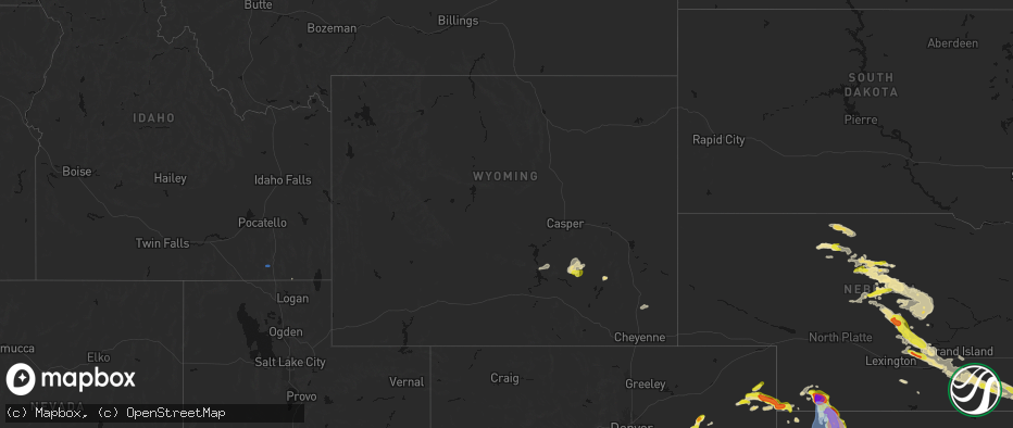
Hail Map in Wyoming on June 20, 2026
The weather event in Wyoming on June 20, 2026 includes Hail and Wind maps. 12 states and 146 cities were impacted and suffered possible damage. The total estimated number of properties impacted is 1.
Hail
Wind
1
Estimated number of impacted properties by a 1.00" hail or larger0
Estimated number of impacted properties by a 1.75" hail or larger0
Estimated number of impacted properties by a 2.50" hail or largerStorm reports in Wyoming
Wyoming
| Date | Description |
|---|---|
| 06/20/20265:00 PM CDT | 64mph gust occurred at the muddy creek station just outside of converse county. It is highly likely that a similar gust was occurring in converse county... But no stati |
| 06/20/20264:56 PM CDT | Mesonet station krec wy28 red canyon |
| 06/20/20264:56 PM CDT | Mesonet station ktmh i-25 twenty mile hill |
| 06/20/20264:50 PM CDT | Mesonet station pc377 scenic dr |
| 06/20/20264:50 PM CDT | Mesonet station pc576 horse ranch creek |
| 06/20/20264:41 PM CDT | Asos station kcpr casper airport |
| 06/20/20264:40 PM CDT | Mesonet station pc457 hidden dome |
| 06/20/20264:22 PM CDT | Mesonet station wy45 us20 natrona |
| 06/20/20264:21 PM CDT | Asos station klnd lander airport |
| 06/20/20264:17 PM CDT | Mesonet station psdw4 pistol draw. |
| 06/20/20263:50 PM CDT | Mesonet station pc633 poston ranch rd |
| 06/20/20263:35 PM CDT | Awos station ktbx boysen peak |
| 06/20/20263:35 PM CDT | Awos station khsg hot springs airport |
| 06/20/20263:29 PM CDT | Asos station krwl 1 ene rawlins. |
| 06/20/20263:20 PM CDT | Mesonet station pc631 stagner |
| 06/20/20263:14 PM CDT | Asos station kriw riverton airport |
| 06/20/20263:00 PM CDT | Mesonet station fw3816 pavillion |
| 06/20/20263:00 PM CDT | Mesonet station sppbt surprise pinnacle |
| 06/20/20261:53 PM CDT | Asos station krks rock springs airport |
| 06/20/20261:20 PM CDT | Mesonet station pc258 half moon lake |
| 06/20/202612:51 PM CDT | Multiple reports... Pictures... And videos of a tall |
All States Impacted by Hail Map on June 20, 2026
Cities Impacted by Hail Map on June 20, 2026
- Loomis, NE
- Bertrand, NE
- Holdrege, NE
- Wilcox, NE
- Dunning, NE
- Broken Bow, NE
- Oconto, NE
- Mason City, NE
- Miller, NE
- Sumner, NE
- Anselmo, NE
- Pleasanton, NE
- Amherst, NE
- Elm Creek, NE
- Merna, NE
- Riverdale, NE
- Kearney, NE
- Callaway, NE
- Ansley, NE
- Gibbon, NE
- Shelton, NE
- Kenesaw, NE
- Wood River, NE
- Juniata, NE
- Hazard, NE
- Litchfield, NE
- Roseland, NE
- Hastings, NE
- Ayr, NE
- Glenvil, NE
- Halsey, NE
- Fairfield, NE
- Arnold, NE
- Ravenna, NE
- Stapleton, NE
- Valentine, NE
- Clay Center, NE
- Deweese, NE
- Mauk, GA
- Butler, GA
- Junction City, GA
- Edgar, NE
- Birmingham, AL
- Leeds, AL
- Brewster, NE
- Davenport, NE
- Doniphan, NE
- Thedford, NE
- Orlando, FL
- Trumbull, NE
- Venus, FL
- Elsmere, NE
- Sterrett, AL
- Vandiver, AL
- Harvard, NE
- Inland, NE
- Johnstown, NE
- Ong, NE
- Ainsworth, NE
- Saronville, NE
- Shickley, NE
- Sutton, NE
- Carleton, NE
- Marshallville, GA
- Bruning, NE
- Belvidere, NE
- Long Pine, NE
- Alexandria, NE
- Lake Placid, FL
- Montezuma, GA
- Boyers, PA
- Harrisville, PA
- Slippery Rock, PA
- Kilgore, NE
- Sebring, FL
- Crookston, NE
- Fairbury, NE
- Grand Island, NE
- Byromville, GA
- Unadilla, GA
- Lorida, FL
- Benkelman, NE
- Fort Pierce, FL
- Palisade, NE
- Wauneta, NE
- Stratton, NE
- Yuma, CO
- Purdum, NE
- Alma, GA
- Deer Trail, CO
- Eckley, CO
- Pineview, GA
- Pinehurst, GA
- Hawkinsville, GA
- Douglas, GA
- Woodrow, CO
- Wray, CO
- Max, NE
- Nicholls, GA
- Jesup, GA
- Snowville, UT
- Palm City, FL
- Hortense, GA
- Trenton, NE
- Lindon, CO
- Atwood, KS
- Hanna, WY
- Otis, CO
- Stuart, FL
- Ludell, KS
- Cheyenne, WY
- Kim, CO
- Taylor, NE
- Herndon, KS
- Lake City, FL
- Geneva, NE
- Strang, NE
- Jupiter, FL
- West Palm Beach, FL
- Haigler, NE
- Lumpkin, GA
- Laurel Hill, FL
- Sterling, MI
- Norris, SD
- Palm Beach Gardens, FL
- Genoa, CO
- Ohiowa, NE
- Culbertson, NE
- Medicine Bow, WY
- Winner, SD
- Lagrange, WY
- Burwell, NE
- Tobias, NE
- Standish, MI
- Arriba, CO
- Omer, MI
- Bennett, CO
- Holyoke, CO
- Loxahatchee, FL
- Wellington, FL
- Grouse Creek, UT
- Lamar, CO
- Sargent, NE
- Pompano Beach, FL
- Daykin, NE
- Malad City, ID


