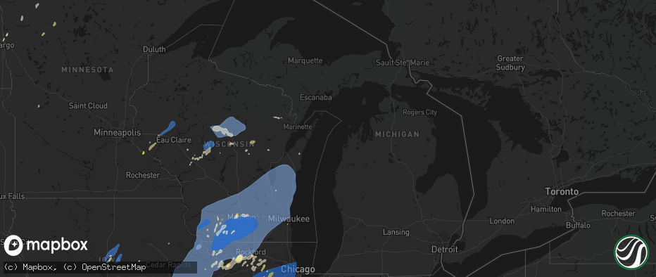
Hail Map in Michigan on June 10, 2026
The weather event in Michigan on June 10, 2026 includes Wind, Hail, and Tornado maps. 18 states and 2,073 cities were impacted and suffered possible damage. The total estimated number of properties impacted is 13,560.
Wind
Hail
Tornado
13,560
Estimated number of impacted properties by a 1.00" hail or larger0
Estimated number of impacted properties by a 1.75" hail or larger0
Estimated number of impacted properties by a 2.50" hail or largerStorm reports in Michigan
Michigan
| Date | Description |
|---|---|
| 06/10/20266:50 PM CDT | Delayed report. Dispatch received several reports of trees and powerlines down in and around the honor area. Time estimated from radar. |
| 06/10/20266:40 PM CDT | Tree across road at the intersection of west sidney and south lake roads. |
| 06/10/20266:39 PM CDT | Multiple trees reported down in the lyons and muir area. |
| 06/10/20266:30 PM CDT | Tree on road at m 57 and bower street. |
| 06/10/20266:30 PM CDT | Several reports of powerlines downed. |
| 06/10/20266:28 PM CDT | Tree across roadway. |
| 06/10/20266:26 PM CDT | Tree on house. |
| 06/10/20266:24 PM CDT | Multiple reports of downed wires across grand rapids. |
| 06/10/20266:16 PM CDT | Large tree trunk snapped. Multiple large power outages in the area. |
| 06/10/20266:11 PM CDT | Tree downed onto a boat trailer 3 miles east of interlochen. Time estimated by radar. |
| 06/10/20266:05 PM CDT | Multiple greenhouses destroyed and multiple trees down across roads. |
| 06/10/20266:05 PM CDT | Tree across road. |
| 06/10/20266:04 PM CDT | 15 to 20 reports of trees and wires down through southeast and southwest grand rapids. |
| 06/10/20266:02 PM CDT | Healthy oak tree trunk at least 1 foot diameter snapped near gun lake. |
| 06/10/20266:02 PM CDT | Tree down blocking patterson road south of 136th. |
| 06/10/20266:00 PM CDT | Trees snapped and uprooted. Time estimated by radar. |
| 06/10/20266:00 PM CDT | Power lines downed. Time estimated by radar. |
| 06/10/20265:59 PM CDT | Tree fell on ford explorer. |
| 06/10/20265:58 PM CDT | Images from across kalamazoo show trees and wires down especially on locust street in vine neighborhood. |
| 06/10/20265:50 PM CDT | Large tree uprooted and damaged roofline of house. Also limbs snapped partly blocking a road near plainwell. |
| 06/10/20265:48 PM CDT | Tree downed. |
| 06/10/20265:45 PM CDT | Report of a tree downed on higgins road near benzonia. Time estimated by radar. |
| 06/10/20265:45 PM CDT | Tree and power lines downed. Time estimated by radar. |
| 06/10/20265:44 PM CDT | Corrects previous tstm wnd dmg report from allegan. Corrects time. Photos of trees down... Damage to homes. |
| 06/10/20265:42 PM CDT | Trees and wires down at lighthouse way and 131st street. Trees and wires down across allegan county. |
| 06/10/20265:41 PM CDT | Trees and wires down. |
| 06/10/20265:41 PM CDT | Mutiple reports of hail between 1 and 1.25 inches. |
| 06/10/20265:40 PM CDT | Tree downed near us-31 and indian hill rd. Time estimated by radar. |
| 06/10/20265:40 PM CDT | Multiple reports of 1 inch hail in dearborn. |
| 06/10/20265:40 PM CDT | Tree across harrisburg road. |
| 06/10/20265:35 PM CDT | Trees and wires down. |
| 06/10/20265:28 PM CDT | Multiple trees down. |
| 06/10/20265:25 PM CDT | Asos station kmkg muskegon county airport. |
| 06/10/20265:13 PM CDT | A local report indicates 60 MPH wind near Watervliet |
| 06/10/20265:03 PM CDT | A local report indicates 63 MPH wind near 1 NW Benton Heights |
| 06/09/20268:47 PM CDT | Road closed at old orchard trail and west shore dr due to downed tree on roadway. |
| 06/09/20268:45 PM CDT | Large tree blown down on plain road... North of shay lake road. |
| 06/09/20268:14 PM CDT | Tree down across part of mount morris rd at washburn rd |
| 06/09/20268:12 PM CDT | Tree down across part of mount morris rd near irish rd. |
| 06/09/20268:05 PM CDT | Asos station klan lansing. |
| 06/09/20267:53 PM CDT | A few trees reported down in saginaw township. |
| 06/09/20267:48 PM CDT | A tree was blown down onto woodstock street near lewis road. |
| 06/09/20267:46 PM CDT | A tree was blown down onto wheeler road. |
| 06/09/20267:46 PM CDT | Scattered trees and wires reported downed across the entire county. |
| 06/09/20267:45 PM CDT | Dozens of trees downed... Particularly in larkin and midland townships. |
| 06/09/20267:45 PM CDT | Large tree reported downed in freeland along with reports of power outages in the area. |
| 06/09/20267:42 PM CDT | Delayed report of tree damage in foster township in ogemaw county. Time estimated from radar. |
| 06/09/20267:37 PM CDT | Straight-line winds knocked down over a dozen trees and power lines... Starting near the intersection of brown and farley roads and extending northeast to the tuscola c |
| 06/09/20267:36 PM CDT | Several large tree limbs down |
| 06/09/20267:31 PM CDT | Delayed report from social media of trees down. Time estimated from radar. |
| 06/09/20267:21 PM CDT | Tree down across the road by laingsburg high school |
| 06/09/20267:15 PM CDT | Power lines downed near emery and reserve rds. |
| 06/09/20267:11 PM CDT | Tree on car at the intersection of south washington avenue and east mt. Hope avenue in lansing... Mi. |
| 06/09/20267:10 PM CDT | Power lines downed on crawford ave. |
| 06/09/20267:10 PM CDT | Tree across roadway. |
| 06/09/20267:07 PM CDT | Comms lines downed. |
| 06/09/20267:07 PM CDT | Tree on house. |
| 06/09/20267:07 PM CDT | At least five trees down... One on a house. |
| 06/09/20267:07 PM CDT | Trees and branches down in the alma area. At least one road blocked by fallen trees. |
| 06/09/20267:04 PM CDT | Multiple large pole barn doors ripped off and launched into field. Some house damage from falling trees occurred just north in perrinton. |
| 06/09/20267:03 PM CDT | Measured on a personal weather station. |
| 06/09/20267:00 PM CDT | Photos of trees down... Damage to homes. |
All States Impacted by Hail Map on June 10, 2026
Cities Impacted by Hail Map on June 10, 2026
- Granton, WI
- Chili, WI
- Dorchester, WI
- Athens, WI
- Stetsonville, WI
- Edgar, WI
- Stratford, WI
- Marshfield, WI
- Neillsville, WI
- Marathon, WI
- Mosinee, WI
- Black River Falls, WI
- Medford, WI
- Land O'Lakes, WI
- Merrillan, WI
- Watersmeet, MI
- Wausau, WI
- Auburndale, WI
- Gallatin, MO
- Jameson, MO
- Pittsville, WI
- Arpin, WI
- Gower, MO
- Greenwood, WI
- Loyal, WI
- Spencer, WI
- Curtiss, WI
- Colby, WI
- Unity, WI
- Owen, WI
- Abbotsford, WI
- Schofield, WI
- Rothschild, WI
- Merrill, WI
- Brokaw, WI
- Aniwa, WI
- Ringle, WI
- Irma, WI
- Gleason, WI
- Antigo, WI
- Tigerton, WI
- Junction City, WI
- Stevens Point, WI
- Amherst Junction, WI
- Chula, MO
- Leopolis, WI
- Caroline, WI
- Marion, WI
- Iola, WI
- Hamilton, MO
- Gresham, WI
- Shawano, WI
- Ogdensburg, WI
- Manawa, WI
- Clintonville, WI
- Wheeling, MO
- Meadville, MO
- Tilleda, WI
- Crivitz, WI
- Embarrass, WI
- Shiocton, WI
- Bonduel, WI
- Pulaski, WI
- Green Castle, MO
- Black Creek, WI
- Seymour, WI
- Woodward, IA
- Ogden, IA
- Boone, IA
- Waupaca, WI
- Amherst, WI
- Nekoosa, WI
- Nevada, IA
- Ames, IA
- Nelsonville, WI
- Bancroft, WI
- Story City, IA
- Gilbert, IA
- Roland, IA
- Ellsworth, IA
- Radcliffe, IA
- McCallsburg, IA
- Hubbard, IA
- Garden City, IA
- Zearing, IA
- Colo, IA
- State Center, IA
- Saint Anthony, IA
- Clemons, IA
- Union, IA
- New Providence, IA
- Scandinavia, WI
- Eldora, IA
- Iowa Falls, IA
- Montour, IA
- Toledo, IA
- Tama, IA
- Mount Pleasant, IA
- Wayland, IA
- Almond, WI
- Ainsworth, IA
- Kewaunee, WI
- Fairfield, IA
- Lockridge, IA
- Brighton, IA
- Crawfordsville, IA
- Winfield, IA
- Olds, IA
- Columbus Junction, IA
- Columbus City, IA
- Conesville, IA
- Algoma, WI
- Clutier, IA
- Craig, MO
- Letts, IA
- Muscatine, IA
- Wapello, IA
- Fruitland, IA
- Fairfax, MO
- Washington, IA
- Riverside, IA
- Kalona, IA
- Wellman, IA
- Lone Tree, IA
- Keota, IA
- Nichols, IA
- Hills, IA
- Iowa City, IA
- West Liberty, IA
- West Branch, IA
- Solon, IA
- Atalissa, IA
- Illinois City, IL
- Moscow, IA
- Tipton, IA
- Wilton, IA
- Cowgill, MO
- Kingston, MO
- Polo, MO
- Cameron, MO
- Kidder, MO
- Breckenridge, MO
- Braymer, MO
- Goodhue, MN
- Lake City, MN
- Red Wing, MN
- Cedar Rapids, IA
- Durant, IA
- Montpelier, IA
- Blue Grass, IA
- Lisbon, IA
- Stockton, IA
- Taylor Ridge, IL
- Walcott, IA
- Buffalo, IA
- Rock Island, IL
- Davenport, IA
- Mount Vernon, IA
- Bennett, IA
- Milan, IL
- Moline, IL
- New Liberty, IA
- Mechanicsville, IA
- Dixon, IA
- Donahue, IA
- Calamus, IA
- Dunkerton, IA
- Jesup, IA
- Waterloo, IA
- Bettendorf, IA
- Clarence, IA
- Stanwood, IA
- Hampton, IL
- Port Byron, IL
- East Moline, IL
- Long Grove, IA
- Rapids City, IL
- Eldridge, IA
- Lowden, IA
- Pleasant Valley, IA
- Wheatland, IA
- Le Claire, IA
- Lost Nation, IA
- Morley, IA
- Anamosa, IA
- Cascade, IA
- Wyoming, IA
- Oxford Junction, IA
- Onslow, IA
- Baldwin, IA
- Olin, IA
- Grand Mound, IA
- Princeton, IA
- Center Junction, IA
- De Witt, IA
- Monmouth, IA
- Monticello, IA
- Delmar, IA
- Maquoketa, IA
- Bernard, IA
- Camanche, IA
- Welton, IA
- Charlotte, IA
- McCausland, IA
- Cordova, IL
- Zwingle, IA
- Elmwood, WI
- Maiden Rock, WI
- Stockholm, WI
- Plum City, WI
- Manchester, IA
- Masonville, IA
- Winthrop, IA
- Appomattox, VA
- La Motte, IA
- Goose Lake, IA
- Fulton, IL
- Clinton, IA
- Andrew, IA
- Bryant, IA
- Low Moor, IA
- Albany, IL
- Spragueville, IA
- Preston, IA
- Bellevue, IA
- Peosta, IA
- Dubuque, IA
- Miles, IA
- East Dubuque, IL
- Arkansaw, WI
- Dundee, IA
- Menomonie, WI
- Eau Galle, WI
- Hazel Green, WI
- Cuba City, WI
- Sabula, IA
- Galena, IL
- Teeds Grove, IA
- Savanna, IL
- Hanover, IL
- Kieler, WI
- Thomson, IL
- Morrison, IL
- Dickeyville, WI
- Platteville, WI
- Potosi, WI
- Elizabeth, IL
- Shullsburg, WI
- Scales Mound, IL
- Benton, WI
- Fargo, ND
- Moorhead, MN
- Mount Carroll, IL
- Stockton, IL
- Lanark, IL
- Belmont, WI
- Apple River, IL
- Pearl City, IL
- Mineral Point, WI
- Darlington, WI
- Georgetown, MN
- Chadwick, IL
- Sterling, IL
- Gratiot, WI
- Clarence, MO
- Colfax, WI
- Bloomer, WI
- New Auburn, WI
- Kent, IL
- Warren, IL
- Rewey, WI
- Lena, IL
- Nora, IL
- Shannon, IL
- Winslow, IL
- Dodgeville, WI
- Blanchardville, WI
- Freeport, IL
- Argyle, WI
- Hollandale, WI
- South Wayne, WI
- Baileyville, IL
- Browntown, WI
- Forreston, IL
- McConnell, IL
- Lancaster, WI
- Newfolden, MN
- Middle River, MN
- Milledgeville, IL
- Mount Hope, WI
- Cairo, MO
- Livingston, WI
- Stitzer, WI
- Fennimore, WI
- Linden, WI
- Montfort, WI
- Cobb, WI
- Highland, WI
- Muscoda, WI
- Woodford, WI
- Monroe, WI
- Orangeville, IL
- Macomb, IL
- Sherrill, IA
- Durango, IA
- Strathcona, MN
- Wannaska, MN
- Badger, MN
- Roseau, MN
- Mount Morris, IL
- Leaf River, IL
- Polo, IL
- German Valley, IL
- Thief River Falls, MN
- Osseo, WI
- Paris, MO
- Shelbina, MO
- Marietta, IL
- Blue River, WI
- Boscobel, WI
- Arena, WI
- Ridgeway, WI
- Avoca, WI
- Dakota, IL
- Lone Rock, WI
- Cedarville, IL
- Barneveld, WI
- Spring Green, WI
- Ridott, IL
- Rockford, IL
- Winnebago, IL
- Pecatonica, IL
- Rock City, IL
- Byron, IL
- North Freedom, WI
- Loganville, WI
- Hillpoint, WI
- Richland Center, WI
- Monticello, WI
- Plain, WI
- Belleville, WI
- Mount Horeb, WI
- Black Earth, WI
- New Glarus, WI
- Blue Mounds, WI
- Durand, IL
- Prairie Du Sac, WI
- Mazomanie, WI
- Brodhead, WI
- Davis, IL
- Sauk City, WI
- Juda, WI
- Gotham, WI
- Cazenovia, WI
- Gary, MN
- Fairchild, WI
- Fertile, MN
- Oregon, IL
- Red Lake Falls, MN
- Alma Center, WI
- Madison, WI
- Verona, WI
- Augusta, WI
- Middleton, WI
- Evansville, WI
- Cross Plains, WI
- Oregon, WI
- Albany, WI
- Orfordville, WI
- Lodi, WI
- Merrimac, WI
- Waunakee, WI
- Dane, WI
- Brooklyn, WI
- Baraboo, WI
- Deforest, WI
- Beloit, WI
- Footville, WI
- Rockton, IL
- Janesville, WI
- Shirland, IL
- South Beloit, IL
- Stoughton, WI
- Mcfarland, WI
- Goodridge, MN
- Melrose, WI
- Hillsboro, WI
- Amboy, IL
- Franklin Grove, IL
- Dixon, IL
- Eldena, IL
- Lenox, IA
- Sharpsburg, IA
- Chana, IL
- Cottage Grove, WI
- Humbird, WI
- Stillman Valley, IL
- Deerfield, WI
- Milton, WI
- Edgerton, WI
- Cambridge, WI
- Bedford, IA
- Rochelle, IL
- Gatzke, MN
- Grygla, MN
- South Boston, VA
- Clearfield, IA
- Sun Prairie, WI
- Monroe Center, IL
- Davis Junction, IL
- Halifax, VA
- Princeville, IL
- Fort Atkinson, WI
- Lake Mills, WI
- Diagonal, IA
- New Hampton, MO
- Bethany, MO
- Waterman, IL
- Steward, IL
- Mcintosh, MN
- Trail, MN
- Fosston, MN
- Esmond, IL
- Malta, IL
- Clare, IL
- Jamesport, MO
- Lindenwood, IL
- Cherry Valley, IL
- Kirkland, IL
- Gully, MN
- Afton, WI
- Windsor, WI
- Marshall, WI
- Waterloo, WI
- Loves Park, IL
- Jefferson, WI
- Clinton, WI
- Whitewater, WI
- Roscoe, IL
- Watertown, WI
- Machesney Park, IL
- Johnson Creek, WI
- Caledonia, IL
- Sharon, WI
- Helenville, WI
- Avalon, WI
- Darien, WI
- Delavan, WI
- Poplar Grove, IL
- Capron, IL
- Belvidere, IL
- Salol, MN
- Dekalb, IL
- Tingley, IA
- Shannon City, IA
- Nelson, VA
- Buffalo Junction, VA
- Murray, IA
- Afton, IA
- Thayer, IA
- Ellston, IA
- Shabbona, IL
- Earlville, IL
- Genoa, IL
- Sycamore, IL
- Kingston, IL
- Cortland, IL
- Maple Park, IL
- Mount Ayr, IA
- Virgilina, VA
- Savannah, MO
- Saint Joseph, MO
- Grant City, MO
- Lee, IL
- Yates City, IL
- Elmwood, IL
- Canton, IL
- Farmington, IL
- Morton, IL
- Mapleton, IL
- East Peoria, IL
- Glasford, IL
- Groveland, IL
- Hanna City, IL
- Creve Coeur, IL
- Trivoli, IL
- Pekin, IL
- Peoria, IL
- Peoria Heights, IL
- Washington, IL
- Brimfield, IL
- Metamora, IL
- Edwards, IL
- Goodfield, IL
- Deer Creek, IL
- Lengby, MN
- Danvers, IL
- Bloomington, IL
- Big Rock, IL
- Hinckley, IL
- Elburn, IL
- Sugar Grove, IL
- Balmorhea, TX
- Naytahwaush, MN
- Mahnomen, MN
- Helena, MO
- Osceola, IA
- Grand River, IA
- Lamoni, IA
- Van Wert, IA
- Winchester, IL
- Murrayville, IL
- Plano, IL
- Weldon, IA
- Hatfield, MO
- Kellerton, IA
- Bolckow, MO
- Rea, MO
- Guilford, MO
- Union Star, MO
- Cosby, MO
- Ridgeway, MO
- Somonauk, IL
- Sandwich, IL
- Hampshire, IL
- Dunlap, IL
- Mossville, IL
- Edelstein, IL
- Chillicothe, IL
- Speer, IL
- Sparland, IL
- Lowpoint, IL
- Eureka, IL
- Granville, IL
- Lacon, IL
- Hennepin, IL
- Magnolia, IL
- Putnam, IL
- Henry, IL
- La Rose, IL
- McNabb, IL
- Washburn, IL
- Roanoke, IL
- Varna, IL
- Toluca, IL
- Rutland, IL
- Secor, IL
- Long Point, IL
- Tonica, IL
- Congerville, IL
- Wenona, IL
- Ransom, IL
- El Paso, IL
- Dana, IL
- Ancona, IL
- Lostant, IL
- Grand Ridge, IL
- Minonk, IL
- Benson, IL
- Streator, IL
- Leonore, IL
- Cornell, IL
- Flanagan, IL
- Seneca, IL
- Blackstone, IL
- Ottawa, IL
- Oglesby, IL
- Gridley, IL
- Pontiac, IL
- Mendota, IL
- La Moille, IL
- Paw Paw, IL
- Compton, IL
- Sublette, IL
- Moberly, MO
- King City, MO
- Stanberry, MO
- Bristol, IL
- Yorkville, IL
- Aurora, IL
- Montgomery, IL
- Cainsville, MO
- Chariton, IA
- Lucas, IA
- Woodburn, IA
- Madison, MO
- Clark, MO
- Newark, IL
- Amity, MO
- Mooseheart, IL
- Batavia, IL
- Geneva, IL
- North Aurora, IL
- Bagley, MN
- Princeton, MO
- Jacksonville, IL
- Elgin, IL
- Fort Davis, TX
- Eden, WI
- Clarksdale, MO
- Sheridan, IL
- Leland, IL
- Utica, IL
- Peru, IL
- Cedar Point, IL
- Wedron, IL
- Serena, IL
- Marseilles, IL
- Maysville, MO
- Waubun, MN
- Ponsford, MN
- Decatur, IA
- Leon, IA
- Holliday, MO
- Oak Creek, WI
- McLean, IL
- Waynesville, IL
- Denver, MO
- Warrenville, IL
- Saint Charles, IL
- West Chicago, IL
- Oswego, IL
- Winfield, IL
- Plainfield, IL
- Naperville, IL
- Carol Stream, IL
- Gardner, IL
- Dwight, IL
- Derby, IA
- Odell, IL
- Mequon, WI
- Milwaukee, WI
- Plainfield, WI
- Darlington, MO
- Albany, MO
- Gentry, MO
- Graymont, IL
- Coal City, IL
- Elwood, IL
- Channahon, IL
- Millbrook, IL
- Minooka, IL
- Mazon, IL
- Kinsman, IL
- Wilmington, IL
- Braidwood, IL
- Braceville, IL
- Millington, IL
- Morris, IL
- Verona, IL
- Lombard, IL
- Chicago, IL
- Lisle, IL
- Homer Glen, IL
- Lincolnwood, IL
- Des Plaines, IL
- Stone Park, IL
- Evanston, IL
- Glendale Heights, IL
- Wheaton, IL
- Western Springs, IL
- Park Ridge, IL
- Oak Park, IL
- Broadview, IL
- Hines, IL
- Palos Park, IL
- Maywood, IL
- Willow Springs, IL
- Franklin Park, IL
- Lyons, IL
- Bensenville, IL
- Lockport, IL
- Justice, IL
- Brookfield, IL
- Romeoville, IL
- River Forest, IL
- La Grange Park, IL
- Clarendon Hills, IL
- Orland Park, IL
- Westmont, IL
- Berwyn, IL
- Bridgeview, IL
- River Grove, IL
- Skokie, IL
- Hillside, IL
- Manhattan, IL
- Westchester, IL
- Addison, IL
- Woodridge, IL
- Villa Park, IL
- Elmwood Park, IL
- Harwood Heights, IL
- Shorewood, IL
- Summit Argo, IL
- Hinsdale, IL
- Forest Park, IL
- Darien, IL
- Bloomingdale, IL
- Bolingbrook, IL
- Riverside, IL
- Cicero, IL
- Oak Brook, IL
- Glen Ellyn, IL
- Joliet, IL
- Wood Dale, IL
- New Lenox, IL
- Schiller Park, IL
- Niles, IL
- Bellwood, IL
- Melrose Park, IL
- Crest Hill, IL
- Willowbrook, IL
- Elmhurst, IL
- Lemont, IL
- Berkeley, IL
- Downers Grove, IL
- La Grange, IL
- Hickory Hills, IL
- Mokena, IL
- Itasca, IL
- Hanover Park, IL
- Russell, IA
- Humeston, IA
- Martinsville, MO
- Pattonsburg, MO
- Weatherby, MO
- Emington, IL
- Cabery, IL
- Bussey, IA
- Gilman City, MO
- Garden Grove, IA
- Monroe City, MO
- Stoutsville, MO
- Omro, WI
- Markesan, WI
- Eldorado, WI
- Clyman, WI
- Friesland, WI
- Rosendale, WI
- Morrisonville, WI
- Columbus, WI
- Waupun, WI
- Lowell, WI
- Oshkosh, WI
- Brandon, WI
- Pickett, WI
- Rio, WI
- Fox Lake, WI
- Arlington, WI
- Horicon, WI
- Juneau, WI
- Fairwater, WI
- Ripon, WI
- Beaver Dam, WI
- Randolph, WI
- Fall River, WI
- Burnett, WI
- Doylestown, WI
- Poynette, WI
- Reeseville, WI
- Cambria, WI
- Blue Island, IL
- Evergreen Park, IL
- Palos Heights, IL
- Oak Lawn, IL
- Frankfort, IL
- Tinley Park, IL
- Chicago Ridge, IL
- Robbins, IL
- Hometown, IL
- Oak Forest, IL
- Crestwood, IL
- Midlothian, IL
- Burbank, IL
- Country Club Hills, IL
- Markham, IL
- Palos Hills, IL
- Worth, IL
- Alsip, IL
- Kingston, WI
- Montello, WI
- Dalton, WI
- Berlin, WI
- Pardeeville, WI
- Marquette, WI
- Green Lake, WI
- Portage, WI
- Princeton, WI
- Wyocena, WI
- Lovilia, IA
- Rock Springs, WI
- Wisconsin Dells, WI
- Reedsburg, WI
- Malone, WI
- Fond Du Lac, WI
- Oakfield, WI
- Hustisford, WI
- Dousman, WI
- Elkhart Lake, WI
- New Holstein, WI
- Lebanon, WI
- Theresa, WI
- West Bend, WI
- Lomira, WI
- Saint Cloud, WI
- Hilbert, WI
- Palmyra, WI
- Chilton, WI
- Rubicon, WI
- Ashippun, WI
- Neosho, WI
- Kiel, WI
- Allenton, WI
- Campbellsport, WI
- Kewaskum, WI
- Reedsville, WI
- Hartford, WI
- Potter, WI
- Van Dyne, WI
- Elkhorn, WI
- Iron Ridge, WI
- Sullivan, WI
- Stockbridge, WI
- Glenbeulah, WI
- Brownsville, WI
- Brillion, WI
- Ixonia, WI
- Mayville, WI
- Oconomowoc, WI
- Collins, WI
- Mount Calvary, WI
- Menasha, WI
- Forest Junction, WI
- Sherwood, WI
- Greenleaf, WI
- Neenah, WI
- Melrose, IA
- Corydon, IA
- Pecos, TX
- Hamilton, IA
- Shevlin, MN
- Eagleville, MO
- Hancock, MN
- Cyrus, MN
- Starbuck, MN
- Solway, MN
- Unionville, MO
- Lucerne, MO
- Saint Nazianz, WI
- Delafield, WI
- Eagle, WI
- Cascade, WI
- Hartland, WI
- Elm Grove, WI
- Saukville, WI
- Sheboygan Falls, WI
- Wales, WI
- Burlington, WI
- Menomonee Falls, WI
- Sussex, WI
- Lannon, WI
- Grafton, WI
- Muskego, WI
- Cedarburg, WI
- Slinger, WI
- Colgate, WI
- Brookfield, WI
- Jackson, WI
- Pewaukee, WI
- New Berlin, WI
- Random Lake, WI
- Butler, WI
- Adell, WI
- Belgium, WI
- Mukwonago, WI
- Valders, WI
- Okauchee, WI
- North Prairie, WI
- Waldo, WI
- East Troy, WI
- Nashotah, WI
- Big Bend, WI
- Walworth, WI
- Germantown, WI
- Richfield, WI
- Plymouth, WI
- Hubertus, WI
- Fredonia, WI
- Waukesha, WI
- Coffey, MO
- Altamont, MO
- McFall, MO
- Waterford, WI
- Oostburg, WI
- Cleveland, WI
- Port Washington, WI
- Cedar Grove, WI
- Hales Corners, WI
- Kohler, WI
- Newton, WI
- Whitelaw, WI
- Sheboygan, WI
- Manitowoc, WI
- Sturgeon Lake, MN
- Moose Lake, MN
- Clinton, IL
- Pella, IA
- Bemidji, MN
- Boyceville, WI
- Pollock, MO
- Powersville, MO
- Wisconsin Rapids, WI
- Rudolph, WI
- Custer, WI
- Rosholt, WI
- Wittenberg, WI
- South English, IA
- Webster, IA
- Dewitt, IL
- Menahga, MN
- Durand, WI
- Byron, MN
- Davis City, IA
- Blythedale, MO
- Courtenay, ND
- Buchanan, ND
- Millerton, IA
- Harper, IA
- Glenwood, MN
- Lowry, MN
- Rochester, MN
- Lineville, IA
- Sebeka, MN
- Kelliher, MN
- Hines, MN
- Tenstrike, MN
- Waskish, MN
- Bluffton, MN
- Deer Creek, MN
- Wadena, MN
- Trenton, MO
- Winston, MO
- Pepin, WI
- Bowler, WI
- North English, IA
- Park Rapids, MN
- Van Horn, TX
- Albia, IA
- Illiopolis, IL
- New York Mills, MN
- New Sharon, IA
- Henning, MN
- Verndale, MN
- Blackduck, MN
- Villard, MN
- Floodwood, MN
- Montezuma, IA
- Eyota, MN
- Mystic, IA
- Ottumwa, IA
- Latham, IL
- Warrensburg, IL
- Niantic, IL
- Morrisonville, IL
- Harvel, IL
- Hedrick, IA
- Spickard, MO
- Butler, IL
- Litchfield, IL
- Birnamwood, WI
- Alexandria, MN
- Osakis, MN
- Sauk Centre, MN
- West Union, MN
- Grey Eagle, MN
- Long Prairie, MN
- Big Falls, MN
- Raymond, IL
- Moravia, IA
- Elgin, MN
- Richland, IA
- Ollie, IA
- Galt, MO
- Laredo, MO
- Packwood, IA
- Nokomis, IL
- Exline, IA
- Moulton, IA
- Burtrum, MN
- Posen, IL
- Thornton, IL
- Gary, IN
- Whiting, IN
- Dolton, IL
- Harvey, IL
- Lansing, IL
- Riverdale, IL
- Hammond, IN
- South Holland, IL
- Hazel Crest, IL
- Calumet City, IL
- East Chicago, IN
- Matteson, IL
- Homewood, IL
- Westville, IN
- Valparaiso, IN
- Wanatah, IN
- Union Mills, IN
- Swanville, MN
- La Porte, IN
- Hanna, IN
- Hamlet, IN
- Kingsford Heights, IN
- Atlanta, MO
- Petersburg, ND
- Humphreys, MO
- Guthrie Center, IA
- Pomeroy, OH
- Langsville, OH
- Rutland, OH
- Staples, MN
- Hibbing, MN
- Stewartville, MN
- Racine, MN
- Spring Valley, MN
- Casey, IA
- Meadowlands, MN
- Milan, MO
- Browning, MO
- Sodus, MI
- Coloma, MI
- Watervliet, MI
- Covert, MI
- Saint Joseph, MI
- Stevensville, MI
- Benton Harbor, MI
- Eau Claire, MI
- South Haven, MI
- Hartford, MI
- Grand Junction, MI
- Lawrence, MI
- Bangor, MI
- Fennville, MI
- Pullman, MI
- Douglas, MI
- Holland, MI
- Saugatuck, MI
- Hamilton, MI
- Macatawa, MI
- Northome, MN
- Forest Lake, MN
- Stacy, MN
- Wyoming, MN
- Bloomfield, IA
- Dearborn, MI
- Dearborn Heights, MI
- White Cloud, KS
- Westpoint, IN
- Menlo, IA
- Cedar, MN
- Bouton, IA
- Minburn, IA
- Alma, WI
- Oregon, MO
- Maitland, MO
- Graham, MO
- Stuart, IA
- Independence, WI
- Dallas Center, IA
- Winona, MN
- Green City, MO
- Chatfield, MN
- Wykoff, MN
- La Belle, MO
- Knox City, MO
- Barnard, MO
- Chisago City, MN
- Middleton, MI
- Larimore, ND
- Taylor, MI
- Mount Airy, NC
- Houston, MN
- Lafayette, IN
- Salina, KS
- Novelty, MO
- Edina, MO
- Udell, IA
- Mondovi, WI
- Detroit, MI
- Mound City, MO
- Monroeville, OH
- Norwalk, OH
- Dexter, IA
- Tolono, IL
- Philo, IL
- Plano, IA
- Fremont, IA
- Holyoke, MN
- Lindstrom, MN
- Shafer, MN
- Center City, MN
- Dresser, WI
- Taylors Falls, MN
- Saint Croix Falls, WI
- Downing, MO
- Leonardville, KS
- Green, KS
- Bena, MN
- Sidney, IL
- Fontanelle, IA
- Greenfield, IA
- Cincinnati, IA
- Adel, IA
- Winigan, MO
- Grimes, IA
- Adair, IA
- North Branch, MN
- Randolph, KS
- Ithaca, MI
- Centerville, IA
- Seymour, IA
- Hugo, MN
- Aitkin, MN
- Maryville, MO
- Skidmore, MO
- Harris, MN
- Bennington, KS
- New Cambria, KS
- Wellington, OH
- New London, OH
- Solomon, KS
- Longford, KS
- Clay Center, KS
- Carleton, MI
- Redfield, IA
- Osage, MN
- Centuria, WI
- Mercer, MO
- Lewistown, MO
- Allen Park, MI
- Inkster, MI
- Highland Park, MI
- Hamtramck, MI
- Trempealeau, WI
- Dakota, MN
- Galesville, WI
- Fountain, MN
- Earlham, IA
- Side Lake, MN
- New Boston, MO
- Purdin, MO
- Nevis, MN
- Lanesboro, MN
- Wakefield, KS
- Cook, MN
- Great Bend, KS
- Milltown, WI
- Luck, WI
- Williamstown, MO
- Kahoka, MO
- Angora, MN
- Granger, IA
- De Soto, IA
- Anita, IA
- Conception Junction, MO
- Effie, MN
- Novinger, MO
- Ellinwood, KS
- Holmen, WI
- Onalaska, WI
- Scandia, MN
- Marine On Saint Croix, MN
- Hiawatha, KS
- Melvindale, MI
- Worth, MO
- Rockwell, IA
- Redding, IA
- Deer River, MN
- Peterson, MN
- Conception, MO
- Kirksville, MO
- Tescott, KS
- Newark, MO
- Saint Patrick, MO
- Shelbyville, MO
- Bethel, MO
- Leonard, MO
- Rosendale, MO
- Roseville, MI
- Warren, MI
- Olsburg, KS
- Delphi, IN
- Palmer, IL
- Orr, MN
- Hixton, WI
- Bovey, MN
- Wadsworth, OH
- Abilene, KS
- Claflin, KS
- Bushton, KS
- Littlefork, MN
- Bigfork, MN
- Tamarack, MN
- La Crosse, WI
- Mcgregor, MN
- Balsam Lake, WI
- Amery, WI
- Fraser, MI
- Mindoro, WI
- Belding, MI
- Ettrick, WI
- West Des Moines, IA
- Onamia, MN
- Cohasset, MN
- Urbandale, IA
- Rulo, NE
- Collins, OH
- Fountain City, WI
- Hudson, KS
- Dayton, IA
- Waukee, IA
- Arcadia, WI
- Van Meter, IA
- Cumming, IA
- Allegan, MI
- Bloomingdale, MI
- Hopkins, MI
- Zeeland, MI
- North Judson, IN
- Knox, IN
- La Crosse, IN
- San Pierre, IN
- Wheatfield, IN
- Kouts, IN
- New Richmond, WI
- Webster City, IA
- Huron, OH
- Berlin Heights, OH
- Vermilion, OH
- Ravenwood, MO
- Kettle River, MN
- Doylestown, OH
- Barberton, OH
- Harris, MO
- Newtown, MO
- West Salem, WI
- Rushford, MN
- Plymouth, IN
- Grovertown, IN
- Walkerton, IN
- Des Moines, IA
- Norwalk, IA
- Talmage, KS
- Comstock, WI
- Turtle Lake, WI
- Lyons, KS
- Geneseo, KS
- Chase, KS
- Manhattan, KS
- McGrath, MN
- Finlayson, MN
- Willow River, MN
- Macon, MO
- Pilot Mound, IA
- Stratford, IA
- Hurdland, MO
- Wright, MN
- La Plata, MO
- Ewing, MO
- Brashear, MO
- Gibbs, MO
- Wakeman, OH
- Stanton, MI
- Edmore, MI
- Clear Lake, WI
- Warba, MN
- Askov, MN
- North Liberty, IN
- Lakeville, IN
- Dougherty, IA
- Sheffield, IA
- Bremen, IN
- Raymond, KS
- Almena, WI
- Cumberland, WI
- Sandstone, MN
- Stanhope, IA
- Jewell, IA
- Kamrar, IA
- Saint Johns, MI
- Enterprise, KS
- Marble Rock, IA
- Greene, IA
- Deer Park, WI
- Floyd, IA
- Rudd, IA
- Cromwell, MN
- Allerton, IA
- Forest City, MO
- Clyde, MO
- Parnell, MO
- Osage, IA
- Monticello, MO
- Marble, MN
- Calumet, MN
- Medina, OH
- Ashley, MI
- Lagrange, OH
- Rock Falls, IL
- Frankfort, KS
- Glenwood City, WI
- Barron, WI
- Little River, KS
- Sterling, KS
- Alden, KS
- Brookville, KS
- Canton, MO
- Rutledge, MO
- Kerrick, MN
- Elyria, OH
- Saint George, KS
- Chapman, KS
- Amherst, OH
- Bruno, MN
- Harmon, IL
- Ellsworth, KS
- Tomah, WI
- Blairsburg, IA
- Star Prairie, WI
- Clayton, WI
- Prairie Farm, WI
- Centralia, KS
- Vermillion, KS
- Akron, OH
- Sheridan, MO
- Nashwauk, MN
- Newton, IA
- Colfax, IA
- Prairie City, IA
- Williams, IA
- Litchfield, OH
- Grafton, OH
- Riceville, IA
- Pengilly, MN
- Caledonia, MN
- Westmoreland, KS
- Wamego, KS
- Wyaconda, MO
- Orient, IA
- Oberlin, OH
- Marcell, MN
- Kipton, OH
- Jacobson, MN
- Orchard, IA
- Rice Lake, WI
- Cameron, WI
- Windom, KS
- Macksburg, IA
- Pleasantville, IA
- Swan, IA
- Alden, IA
- Lorain, OH
- Seneca, KS
- Woodbine, KS
- Camp Douglas, WI
- Fillmore, MO
- Munger, MI
- Bay City, MI
- Saginaw, MI
- Lorimor, IA
- Winterset, IA
- Greenbush, MN
- New Market, IA
- Sheffield Lake, OH
- Morrill, KS
- Belvue, KS
- Junction City, KS
- Gypsum, KS
- Paxico, KS
- Carlton, MN
- Amazonia, MO
- Greentop, MO
- Reese, MI
- Fairgrove, MI
- Uniontown, OH
- Booneville, IA
- Sabetha, KS
- Milford, KS
- Clarksville, IA
- Hutchinson, KS
- Inman, KS
- Herington, KS
- Hope, KS
- Saint Charles, MN
- Queen City, MO
- Baring, MO
- Cleveland, OH
- Dover, MN
- Frazee, MN
- North Canton, OH
- Plainfield, IA
- Waverly, IA
- Linden, MI
- South Elgin, IL
- Worthington, MO
- Ackley, IA
- Altura, MN
- White City, KS
- New Lisbon, WI
- Necedah, WI
- Aplington, IA
- Dumont, IA
- Kesley, IA
- Arbela, MO
- Memphis, MO
- Warsaw, IL
- Mcpherson, KS
- Blockton, IA
- Allison, IA
- Fenton, MI
- Luray, MO
- Eastlake, OH
- Wickliffe, OH
- Euclid, OH
- Willoughby, OH
- Alma, KS
- Sutter, IL
- Ottertail, MN
- Plover, WI
- Silvis, IL
- Carbon Cliff, IL
- Colona, IL
- Erie, IL
- Chardon, OH
- Mentor, OH
- Hillsdale, IL
- Fenton, IL
- Huntsburg, OH
- Montville, OH
- Painesville, OH
- Windsor, OH
- Geneseo, IL
- Madison, OH
- Thompson, OH
- Prophetstown, IL
- Hooppole, IL
- Topeka, KS
- Maple Hill, KS
- Rome, OH
- Rock Creek, OH
- Geneva, OH
- Atkinson, IL
- Annawan, IL
- Mineral, IL
- Tampico, IL
- Sheffield, IL
- New Bedford, IL
- Walnut, IL
- Princeton, IL
- Manlius, IL
- Wyanet, IL
- Ohio, IL
- Hinckley, OH
- Gorin, MO
- Riley, KS
- Fort Riley, KS
- Orwell, OH
- Ferryville, WI
- Oelwein, IA
- Fairbank, IA
- Sumner, IA
- Westgate, IA
- Readlyn, IA
- Oran, IA
- Austinburg, OH
- Benton, IA
- Wayland, MO
- Viroqua, WI
- Alexandria, MO
- Tampa, KS
- Ramona, KS
- Eskridge, KS
- Jal, NM
- Conneaut, OH
- Ashtabula, OH
- North Kingsville, OH
- Richfield, OH
- Wilsey, KS
- Jefferson, OH
- Ipava, IL
- Lost Springs, KS
- Burdick, KS
- Maynard, IA
- Blair, WI
- Whitehall, WI
- Basco, IL
- Carthage, IL
- Soldiers Grove, WI
- Council Grove, KS
- Good Hope, IL
- Blandinsville, IL
- Sciota, IL
- Plymouth, IL
- West Springfield, PA
- East Springfield, PA
- Kingsville, OH
- Burlington Junction, MO
- Pickering, MO
- Cornell, WI
- Lewistown, IL
- Sutton, WV
- Lincolnville, KS
- Hopkins, MO
- Avon, IL
- Bushnell, IL
- Bardolph, IL
- Adair, IL
- Prairie City, IL
- Table Grove, IL
- Smithfield, IL
- Stanley, WI
- Thorp, WI
- Tennessee, IL
- Colchester, IL
- Strong City, KS
- Cuba, IL
- Prairie Du Chien, WI
- La Crescent, MN
- La Grange, MO
- Jamestown, PA
- Hartstown, PA
- Buhler, KS
- Cooperstown, ND
- Hannaford, ND
- Emporia, KS
- Conneaut Lake, PA
- Atlantic, PA
- Havana, IL
- Lisbon, OH
- Lublin, WI
- Cottonwood Falls, KS
- Topeka, IL
- Woodman, WI
- Liverpool, IL
- Linneus, MO
- Erie, PA
- Harborcreek, PA
- North East, PA
- Cochranton, PA
- Nickerson, KS
- South Hutchinson, KS
- Livonia, MO
- Ripley, NY
- Titusville, PA
- Easton, IL
- Bath, IL
- Glenwood, MO
- Rochester, PA
- New Brighton, PA
- Ethel, MO
- Elmer, MO
- Brookfield, MO
- Westfield, NY
- Zelienople, PA
- Evans City, PA
- Cranberry Township, PA
- Burrton, KS
- Moundridge, KS
- Kilbourne, IL
- Bucklin, MO
- New Cambria, MO
- Callao, MO
- San Jose, IL
- New Holland, IL
- Halstead, KS
- Butler, PA
- Mason City, IL
- Williamsville, IL
- Middletown, IL
- Lincoln, IL
- Mount Pulaski, IL
- Greenview, IL
- Beason, IL
- Sherman, IL
- Riverton, IL
- Cantrall, IL
- Athens, IL
- Elkhart, IL
- Petersburg, IL
- Buffalo, IL
- Springfield, IL
- Hesston, KS
- Newton, KS
- Sedgwick, KS
- Stanford, IL
- Templeton, PA
- North Newton, KS
- Atlanta, IL
- Kittanning, PA
- New Bethlehem, PA
- Dawson, IL
- Mechanicsburg, IL
- Mount Auburn, IL
- Decatur, IL
- Rochester, IL
- Pleasant Plains, IL
- Chestnut, IL
- Stonington, IL
- Macon, IL
- Harristown, IL
- Forsyth, IL
- Boody, IL
- Moweaqua, IL
- Maroa, IL
- Argenta, IL
- Blue Mound, IL
- Kenney, IL
- Oreana, IL
- Edinburg, IL
- Cisco, IL
- Taylorville, IL
- Hunnewell, MO
- Emden, MO
- Dayton, PA
- Weldon, IL
- Lane, IL
- Monticello, IL
- De Land, IL
- Mt Zion, IL
- Bondville, IL
- Cerro Gordo, IL
- Pesotum, IL
- Gays, IL
- La Place, IL
- Villa Grove, IL
- Ivesdale, IL
- Mansfield, IL
- Sadorus, IL
- Dalton City, IL
- Arcola, IL
- Sullivan, IL
- Milmine, IL
- Tuscola, IL
- Bement, IL
- Champaign, IL
- Saint Joseph, IL
- Atwood, IL
- Urbana, IL
- Hammond, IL
- Savoy, IL
- Windsor, IL
- Lovington, IL
- Arthur, IL
- Humboldt, IL
- White Heath, IL
- Bethany, IL
- Mattoon, IL
- Seymour, IL
- Findlay, IL
- Palmyra, MO
- Hannibal, MO
- Farmersville, IL
- Hull, IL
- New London, MO
- West Lafayette, IN
- Maywood, NE
- Moorefield, NE
- Curtis, NE
- Eustis, NE
- Cozad, NE
- Farnam, NE
- Elwood, NE
- Lexington, NE
- Overton, NE
- Kearney, NE
- Gibbon, NE
- Shelton, NE
- Wood River, NE
- Alda, NE
- Doniphan, NE
- Bertrand, NE
- Aurora, NE
- Giltner, NE
- Odessa, NE
- Elm Creek, NE
- Smithfield, NE
- Riverdale, NE
- Ravenna, NE
- Pleasanton, NE
- Hastings, NE
- Phillips, NE
- Amherst, NE
- Grand Island, NE
- Holdrege, NE
- Loomis, NE
- Henderson, NE
- Sutton, NE
- Hampton, NE
- Trumbull, NE
- Roseland, NE
- Juniata, NE
- Bradshaw, NE
- McCool Junction, NE
- Fairmont, NE
- York, NE
- Maxwell, NE
- Waco, NE
- Harvard, NE
- Axtell, NE
- Funk, NE
- Cairo, NE
- Benedict, NE
- Kenesaw, NE
- Marquette, NE
- Polk, NE
- Chapman, NE
- Minden, NE
- Utica, NE
- Beaver Crossing, NE
- Seward, NE
- Gresham, NE
- Saronville, NE
- Ulysses, NE
- Bee, NE
- Staplehurst, NE
- Heartwell, NE
- Grafton, NE
- Shelby, NE
- Stromsburg, NE
- Surprise, NE
- Friend, NE
- Milford, NE
- Dorchester, NE
- Martell, NE
- Crete, NE
- Garland, NE
- Raymond, NE
- Malcolm, NE
- Pleasant Dale, NE
- Holstein, NE
- Exeter, NE
- Valparaiso, NE
- Lincoln, NE
- Hallam, NE
- Ayr, NE
- Denton, NE
- Roca, NE
- Panama, NE
- Bennet, NE
- Sprague, NE
- Cordova, NE
- Goehner, NE
- Walton, NE
- Hickman, NE
- Inland, NE
- David City, NE
- Brainard, NE
- Syracuse, NE
- Douglas, NE
- Palmyra, NE
- Lathrop, MO
- Turney, MO
- Eagle, NE
- Adams, NE
- Unadilla, NE
- Otoe, NE
- Burr, NE
- Firth, NE
- Alvo, NE
- Davey, NE
- Glenvil, NE
- Ceresco, NE
- Waverly, NE
- Dunbar, NE
- Dwight, NE
- Nebraska City, NE
- Greenwood, NE
- Wahoo, NE
- Rock Port, MO
- Avoca, NE
- Peru, NE
- Hamburg, IA
- Auburn, NE
- Brock, NE
- Northboro, IA
- Shenandoah, IA
- Coin, IA
- Union, NE
- Nehawka, NE
- Sidney, IA
- Weeping Water, NE
- Percival, IA
- Thurman, IA
- Miller, NE
- Riverton, IA
- Westboro, MO
- Farragut, IA
- Watson, MO
- Tabor, IA
- Elmwood, NE
- Randolph, IA
- South Bend, NE
- Springfield, NE
- Ashland, NE
- Murdock, NE
- Gretna, NE
- Louisville, NE
- Pacific Junction, IA
- Glenwood, IA
- Essex, IA
- Clarinda, IA
- Yorktown, IA
- Manley, NE
- Malvern, IA
- Imogene, IA
- Cedar Creek, NE
- Plattsmouth, NE
- Murray, NE
- Gravity, IA
- Ithaca, NE
- Papillion, NE
- Bellevue, NE
- Council Bluffs, IA
- Silver City, IA
- Henderson, IA
- Hastings, IA
- Emerson, IA
- Villisca, IA
- Red Oak, IA
- Corning, IA
- Nodaway, IA
- Stanton, IA
- Elliott, IA
- Prescott, IA
- Treynor, IA
- Mineola, IA
- Hancock, IA
- Carson, IA
- Oakland, IA
- Macedonia, IA
- Atlantic, IA
- Cumberland, IA
- Elk Horn, IA
- Avoca, IA
- Exira, IA
- Marne, IA
- Lewis, IA
- Walnut, IA
- Brayton, IA
- Griswold, IA
- Grant, IA
- Harlan, IA
- Kimballton, IA
- Shelby, IA
- Wiota, IA
- Massena, IA
- Carbon, IA
- Bridgewater, IA
- Audubon, IA
- Hamlin, IA
- Creston, IA
- Cromwell, IA
- Braddyville, IA
- College Springs, IA
- Shambaugh, IA
- Blanchard, IA
- Bayard, IA
- Coon Rapids, IA
- Irwin, IA
- Kirkman, IA
- Clearmont, MO
- Elmo, MO
- Lehigh, IA
- Tarkio, MO
- Panora, IA
- Bagley, IA
- Yale, IA
- Jefferson, IA
- Peru, IA
- Kenosha, WI
- Mount Prospect, IL
- Carpentersville, IL
- Wauconda, IL
- Palatine, IL
- Kenilworth, IL
- Waukegan, IL
- Morton Grove, IL
- Streamwood, IL
- Schaumburg, IL
- Northbrook, IL
- Fontana, WI
- Lake Zurich, IL
- Rolling Meadows, IL
- Prospect Heights, IL
- Lake Villa, IL
- Ashton, IL
- Mundelein, IL
- Gilberts, IL
- Zion, IL
- Glenview, IL
- Mchenry, IL
- Richmond, IL
- Wheeling, IL
- Trevor, WI
- West Brooklyn, IL
- Williams Bay, WI
- Harvard, IL
- Lake In The Hills, IL
- Algonquin, IL
- Flossmoor, IL
- Wilmot, WI
- Glencoe, IL
- Golf, IL
- Elk Grove Village, IL
- Ingleside, IL
- Lake Geneva, WI
- Vernon Hills, IL
- Arlington Heights, IL
- Pleasant Prairie, WI
- Hoffman Estates, IL
- Highwood, IL
- Island Lake, IL
- Crystal Lake, IL
- Holcomb, IL
- Winnetka, IL
- Wasco, IL
- Barrington, IL
- Libertyville, IL
- Ringwood, IL
- Bristol, WI
- Winthrop Harbor, IL
- Grayslake, IL
- Burlington, IL
- Union, IL
- Lake Forest, IL
- Marengo, IL
- Genoa City, WI
- Lake Bluff, IL
- Buffalo Grove, IL
- Wonder Lake, IL
- Antioch, IL
- Silver Lake, WI
- Wilmette, IL
- Cary, IL
- Union Grove, WI
- Deerfield, IL
- Great Lakes, IL
- Round Lake, IL
- Lincolnshire, IL
- North Chicago, IL
- Dundee, IL
- Woodstock, IL
- Highland Park, IL
- Twin Lakes, WI
- Medinah, IL
- Roselle, IL
- Garden Prairie, IL
- Wayne, IL
- Woosung, IL
- Salem, WI
- Fox River Grove, IL
- Hebron, IL
- Huntley, IL
- Bartlett, IL
- Wadsworth, IL
- Spring Grove, IL
- Fox Lake, IL
- Gurnee, IL
- Peotone, IL
- South Wilmington, IL
- Griffith, IN
- Grant Park, IL
- Crete, IL
- Lake Station, IN
- University Park, IL
- Highland, IN
- Chicago Heights, IL
- Merrillville, IN
- Lowell, IN
- Essex, IL
- Crown Point, IN
- Beecher, IL
- Park Forest, IL
- Cedar Lake, IN
- Manteno, IL
- Schererville, IN
- Kankakee, IL
- Steger, IL
- Dyer, IN
- Bonfield, IL
- Munster, IN
- Reddick, IL
- Monee, IL
- Bourbonnais, IL
- Saint John, IN
- Glenwood, IL
- Richton Park, IL
- Olympia Fields, IL
- Deer Grove, IL
- Bradley, IL
- Momence, IL
- Neshkoro, WI
- Endeavor, WI
- Larsen, WI
- Butte Des Morts, WI
- Winneconne, WI
- Greenville, WI
- Appleton, WI
- Hortonville, WI
- Redgranite, WI
- Kaukauna, WI
- Combined Locks, WI
- Little Chute, WI
- Kimberly, WI
- Wrightstown, WI
- Culver, IN
- Mill Creek, IN
- Goshen, IN
- Elkhart, IN
- Tippecanoe, IN
- Nappanee, IN
- Argos, IN
- Boone Grove, IN
- Pierceton, IN
- Monterey, IN
- Etna Green, IN
- Middlebury, IN
- Mishawaka, IN
- Atwood, IN
- Hobart, IN
- Portage, IN
- Wakarusa, IN
- Thayer, IN
- North Webster, IN
- Larwill, IN
- Chesterton, IN
- Columbia City, IN
- Albion, IN
- Kimmell, IN
- Bourbon, IN
- Warsaw, IN
- Schneider, IN
- New Paris, IN
- South Bend, IN
- Osceola, IN
- Leesburg, IN
- Demotte, IN
- Shipshewana, IN
- Cromwell, IN
- Millersburg, IN
- Lake Village, IN
- Winona Lake, IN
- Wawaka, IN
- Topeka, IN
- Hebron, IN
- Milford, IN
- Ligonier, IN
- Shelby, IN
- Syracuse, IN
- Chenoa, IL
- Mentone, IN
- Rochester, IN
- Winamac, IN
- Ora, IN
- Medaryville, IN
- Michigan City, IN
- Beverly Shores, IN
- Rolling Prairie, IN
- New Carlisle, IN
- Norris, IL
- Kingston Mines, IL
- Mogadore, OH
- Hartville, OH


