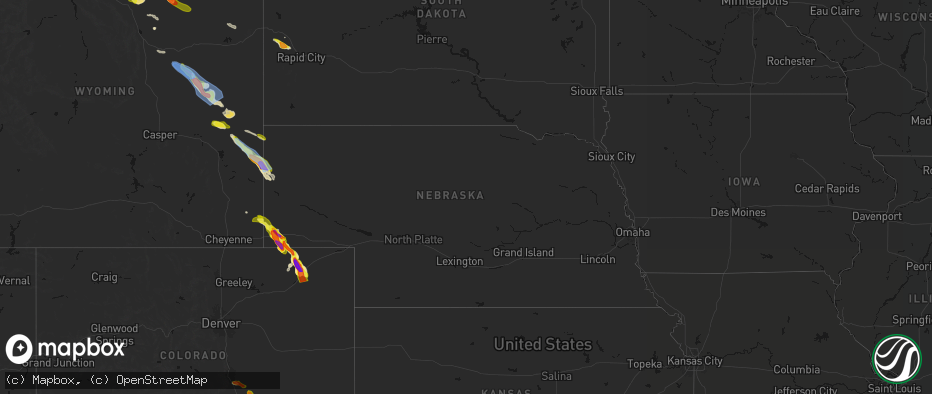
Hail Map in Nebraska on June 22, 2026
The weather event in Nebraska on June 22, 2026 includes Hail, Tornado, and Wind maps. 21 states and 419 cities were impacted and suffered possible damage. The total estimated number of properties impacted is 19,393.
Hail
Tornado
Wind
19,393
Estimated number of impacted properties by a 1.00" hail or larger16,402
Estimated number of impacted properties by a 1.75" hail or larger22,683
Estimated number of impacted properties by a 2.50" hail or largerStorm reports in Nebraska
Nebraska
| Date | Description |
|---|---|
| 06/22/20266:56 PM CDT | Media reported baseballs in downtown scottsbluff. |
| 06/22/20266:54 PM CDT | Estimated based off radar imagery. |
| 06/22/20266:53 PM CDT | A local report indicates 2.50 inch wind near Scottsbluff |
| 06/22/20266:51 PM CDT | Near scottsbluff national monument. |
| 06/22/20266:49 PM CDT | A local report indicates 1.75 inch wind near 1 NE Scottsbluff |
| 06/22/20266:47 PM CDT | Up326 reported. Also had social media report of 70 mph gust. |
| 06/22/20266:43 PM CDT | Reports of tennis ball sized hail on sunflower road. |
| 06/22/20266:43 PM CDT | A local report indicates 59 MPH wind near 4 W Terrytown |
| 06/22/20266:01 PM CDT | Quarters covering the ground. |
| 06/22/20265:05 PM CDT | Trained spotter reported 2 inch hail falling out of core on hwy 71. |
| 06/22/20264:28 PM CDT | A local report indicates 1.75 inch wind near 14 SE Kimball |
| 06/22/20264:13 PM CDT | A local report indicates 1.50 inch wind near 9 S Kimball |
| 06/22/20264:13 PM CDT | Report from mping: half dollar |
| 06/22/20264:05 PM CDT | [landspout] reports of two concurrent landspouts. Confirmed via livestream and pictures on social media. |
| 06/22/20264:03 PM CDT | Picture report via social media from a meteorologist and trained spotter. |
| 06/22/20264:01 PM CDT | [landspout] landspout over an open field. |
| 06/22/20264:00 PM CDT | Report from mping: quarter |
| 06/22/20264:00 PM CDT | A local report indicates 1.00 inch wind near Kimball |
| 06/22/20263:52 PM CDT | Car windows busted. |
| 06/22/20263:44 PM CDT | Corrects previous hail report from 2 w kimball. Reports of 1-2 inches of hail on the ground. |
| 06/22/20263:24 PM CDT | A local report indicates 1.75 inch wind near 6 NW Kimball |
| 06/21/20268:10 PM CDT | Received via spotter network. |
| 06/21/20267:58 PM CDT | Trained spotter found a 2 inch hail stone west of dalton after the storm moved through. Time estimated based on radar. |
| 06/21/20267:51 PM CDT | Trained spotter reported ping pong to golf ball sized hail. |
| 06/21/20267:32 PM CDT | A local report indicates 1.50 inch wind near 5 WSW Redington |
| 06/21/20267:20 PM CDT | A local report indicates 2.50 inch wind near 10 SW Mcgrew |
| 06/21/20267:11 PM CDT | Majority were golf balls. A few tennis balls observed. |
| 06/21/20267:04 PM CDT | A local report indicates 2.00 inch wind near 4 S Gering |
All States Impacted by Hail Map on June 22, 2026
Cities Impacted by Hail Map on June 22, 2026
- Bighorn, MT
- Lagrange, WY
- Riverside, NJ
- Beverly, NJ
- Willingboro, NJ
- Riverton, NJ
- Burlington, NJ
- Bordentown, NJ
- Mount Holly, NJ
- Moorestown, NJ
- Palm City, FL
- Port Saint Lucie, FL
- Columbus, NJ
- Chesterfield, NJ
- Wrightstown, NJ
- Florence, NJ
- Allentown, NJ
- Trenton, NJ
- Buffalo, WY
- Palmyra, NJ
- Philadelphia, PA
- Cream Ridge, NJ
- Myakka City, FL
- Parrish, FL
- Newton, GA
- Jobstown, NJ
- Albin, WY
- Clearmont, WY
- Stanley, VA
- Shenandoah, VA
- Moultrie, GA
- Birney, MT
- Fort Stockton, TX
- Shawnee, WY
- Douglas, WY
- Bushnell, NE
- Kimball, NE
- Bowling Green, FL
- Ona, FL
- Lost Springs, WY
- Pine Bluffs, WY
- Harrisburg, NE
- Lusk, WY
- Decker, MT
- Marathon, TX
- Ardmore, AL
- Toney, AL
- Elkmont, AL
- Athens, AL
- Troy, AL
- Harrison, NE
- Gillette, WY
- Otter, MT
- Banks, AL
- Harvest, AL
- Manville, WY
- Huntsville, AL
- Meridianville, AL
- Ochopee, FL
- Manassas, VA
- Clifton, VA
- Fountain, CO
- Colorado Springs, CO
- Hazel Green, AL
- Nashville, GA
- Arcadia, FL
- Labelle, FL
- New Market, AL
- Louisville, AL
- Midway, AL
- Clayton, AL
- Arvada, WY
- Huntland, TN
- Burke, VA
- Fairfax Station, VA
- Fairfax, VA
- Lehigh Acres, FL
- Immokalee, FL
- Venus, FL
- Elora, TN
- Flintville, TN
- Gurley, AL
- Princeton, AL
- Estillfork, AL
- Scottsboro, AL
- Recluse, WY
- Dix, NE
- Padroni, CO
- Peetz, CO
- Wright, WY
- Moore Haven, FL
- Jackson, GA
- Griffin, GA
- Fackler, AL
- Stevenson, AL
- Sherwood, TN
- South Pittsburg, TN
- Hollywood, AL
- Bridgeport, AL
- Flat Rock, AL
- Glenmoore, PA
- Downingtown, PA
- Chester Springs, PA
- Clewiston, FL
- Devils Tower, WY
- Kaycee, WY
- Jay Em, WY
- Ider, AL
- Pisgah, AL
- Trenton, GA
- Rising Fawn, GA
- Jasper, TN
- Bryant, AL
- Guild, TN
- Higdon, AL
- Torrington, WY
- Fort Myers, FL
- Moorcroft, WY
- Pennsauken, NJ
- Centreville, VA
- Honey Brook, PA
- Elverson, PA
- Union Grove, NC
- Hamptonville, NC
- Wildwood, GA
- Crane, TX
- Sundance, WY
- Bridgeport, NJ
- Lodge Grass, MT
- Levittown, PA
- Fairless Hills, PA
- Morrisville, PA
- Langhorne, PA
- Swedesboro, NJ
- Gibbstown, NJ
- Ridley Park, PA
- Crum Lynne, PA
- Harmony, NC
- New Raymer, CO
- Sterling, CO
- Iliff, CO
- Chattanooga, TN
- Ooltewah, TN
- Rossville, GA
- Ringgold, GA
- Flintstone, GA
- Whiteside, TN
- Lookout Mountain, TN
- Lookout Mountain, GA
- Fort Oglethorpe, GA
- Chickamauga, GA
- Whitwell, TN
- Bristol, PA
- Mickleton, NJ
- Mullica Hill, NJ
- Clarksboro, NJ
- Winston Salem, NC
- Danbury, NC
- Boone, CO
- Lead, SD
- Deadwood, SD
- Sturgis, SD
- Wyola, MT
- McDonald, TN
- Cohutta, GA
- Harrison, TN
- Apison, TN
- Cleveland, TN
- Queenstown, MD
- Lake Wales, FL
- Sheridan, WY
- Nemo, SD
- Crandall, GA
- Dalton, GA
- Old Fort, TN
- Piedmont, SD
- Shady Side, MD
- Stevensville, MD
- Churchton, MD
- Easton, MD
- Claiborne, MD
- Wye Mills, MD
- Grasonville, MD
- Fleming, CO
- McCamey, TX
- Haines City, FL
- Lance Creek, WY
- Merino, CO
- Pemberton, NJ
- Browns Mills, NJ
- Midkiff, TX
- Midland, TX
- Saint Michaels, MD
- Atwood, CO
- Queen Anne, MD
- Cordova, MD
- Mcdaniel, MD
- Odessa, TX
- Frostproof, FL
- Williamstown, NJ
- Hammonton, NJ
- Sicklerville, NJ
- Glenburn, ND
- Deering, ND
- Reliance, TN
- Benton, TN
- Ocoee, TN
- Charleston, TN
- Cisco, GA
- Copperhill, TN
- Fowler, CO
- Akron, CO
- Otis, CO
- Mitchell, NE
- Kenansville, FL
- River Ranch, FL
- Black Hawk, SD
- Hillsboro, MD
- Denton, MD
- Wittman, MD
- Morrill, NE
- Ridgely, MD
- Scottsbluff, NE
- Rapid City, SD
- Snyder, CO
- Gering, NE
- Minatare, NE
- Bayard, NE
- Mcgrew, NE
- Melbeta, NE
- Olney Springs, CO
- Manzanola, CO
- Rocky Ford, CO
- Ordway, CO
- Kim, CO
- Box Elder, SD
- La Junta, CO
- Dalton, NE
- Bridgeport, NE
- Potter, NE
- Yuma, CO
- Broadwater, NE
- Gurley, NE
- Cope, CO
- Joes, CO
- Anton, CO
- Trinidad, CO
- Rozet, WY
- Upton, WY
- Williamsburg, VA
- Las Animas, CO
- Hayes, VA
- Gloucester, VA
- Lodgepole, NE
- Sidney, NE
- Newcastle, WY
- Seibert, CO
- Vona, CO
- Flagler, CO
- Yorktown, VA
- Newport News, VA
- Chunky, MS
- Enterprise, MS
- Kirk, CO
- Stratton, CO
- Seaford, VA
- Osage, WY
- Homer, LA
- Bethune, CO
- Stonewall, MS
- Custer, SD
- Hill City, SD
- Quitman, MS
- Downsville, LA
- Strong, AR
- Spearsville, LA
- Edgemont, SD
- Bastrop, LA
- Farmerville, LA
- Calhoun, LA
- Pringle, SD
- Burlington, CO
- Bonita, LA
- West Monroe, LA
- Fairburn, SD
- Buffalo Gap, SD
- Hot Springs, SD
- Crossett, AR
- Cheyenne Wells, CO
- Buffalo, SD
- Oral, SD
- Pine Ridge, SD
- Oglala, SD
- Manderson, SD
- Wounded Knee, SD
- Pattonville, TX
- Blossom, TX
- Deport, TX
- Batesland, SD
- Gordon, NE
- Rushville, NE
- El Dorado, AR
- Annona, TX
- Avery, TX
- Mayersville, MS
- Whitney, NE
- Rolling Fork, MS
- Yazoo City, MS
- Holly Bluff, MS
- Ruston, LA
- Louise, MS
- Fouke, AR
- Mangum, OK
- Clarksville, TX
- Allen, SD
- Lewisville, AR
- Ravenna, TX
- Choudrant, LA
- Magnolia, AR
- Ivanhoe, TX
- Hendrix, OK
- Bonham, TX
- Martin, SD
- Emerson, AR
- Detroit, TX
- Bernice, LA
- Wellington, TX
- Maud, TX
- Duke, OK
- Dubach, LA
- Eros, LA
- Arcadia, LA
- Simsboro, LA
- Garland City, AR
- Bogata, TX
- Childress, TX
- Bradley, AR
- Hope, AR
- Eldorado, OK
- Chatham, LA
- Chadron, NE
- Butler, AL
- Sweet Water, AL
- Haynesville, LA
- Stamps, AR
- Arapahoe, CO
- Plain Dealing, LA
- Doddridge, AR
- Buckner, AR
- Rodessa, LA
- Waldo, AR
- Okaton, SD
- White River, SD
- Weskan, KS
- Murdo, SD
- Douglassville, TX
- Ida, LA
- Benton, LA
- Atlanta, TX
- Sharon Springs, KS
- Tribune, KS
- Plains, KS
- Meade, KS
- Ideal, SD
- Bivins, TX
- Crawford, NE
- Leoti, KS
- Marsland, NE
- Minden, LA
- Doyline, LA
- Princeton, LA
- Haughton, LA
- Winner, SD
- Fowler, KS
- Marietta, TX
- Marienthal, KS
- Hay Springs, NE
- Burke, SD
- Laverne, OK
- Elm Grove, LA
- Balko, OK
- Deerfield, KS
- Follett, TX
- Alliance, NE
- Lakin, KS
- Paris, TX
- Gate, OK
- Forgan, OK
- Holcomb, KS
- Ellsworth, NE
- Garden City, KS
- New Boston, TX
- Hooks, TX
- Texarkana, TX
- Shattuck, OK
- Benkelman, NE
- Bingham, NE
- Lakeside, NE
- Wauneta, NE
- De Kalb, TX
- Enders, NE
- Imperial, NE
- Max, NE
- Sublette, KS
- Stratton, NE
- Hugo, OK
- Ashdown, AR
- Boswell, OK
- Ashby, NE
- Oshkosh, NE
- Ulysses, KS
- Gage, OK
- Satanta, KS
- Idabel, OK
- Hyannis, NE
- Palisade, NE
- Arnett, OK
- Oakley, KS
- Simms, TX


