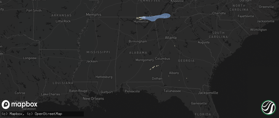
Hail Map in Alabama on June 22, 2026
The weather event in Alabama on June 22, 2026 includes Hail, Tornado, and Wind maps. 21 states and 419 cities were impacted and suffered possible damage. The total estimated number of properties impacted is 0.
Hail
Tornado
Wind
0
Estimated number of impacted properties by a 1.00" hail or larger0
Estimated number of impacted properties by a 1.75" hail or larger0
Estimated number of impacted properties by a 2.50" hail or largerStorm reports in Alabama
Alabama
| Date | Description |
|---|---|
| 06/22/20265:14 PM CDT | Tree down at the intersection of hwy 40 and hwy 75 in dutton. |
| 06/22/20264:54 PM CDT | Tree down along county road 1142 in bryant. |
| 06/22/20264:54 PM CDT | Tree down along al hwy 73 near tn state line. |
| 06/22/20264:52 PM CDT | Trees on power lines along county road 309 in bryant. |
| 06/22/20264:48 PM CDT | Tree down at the intersection of cr 98 and cr 78. |
| 06/22/20264:46 PM CDT | Tee down in roadway at intersection of cr 33 and cr 32. |
| 06/22/20264:42 PM CDT | Multiple trees down south of stevenson on highway 117 between captain john snodgrass bridge and the raccoon creek management area. |
| 06/22/20264:39 PM CDT | Tree down on trailer... With unknown injuries. |
| 06/22/20264:39 PM CDT | Numerous trees and power lines down along crow mountain. |
| 06/22/20264:35 PM CDT | Power poles leaning across roadway. |
| 06/22/20264:32 PM CDT | Tree down along highway 169 in fackler. |
| 06/22/20264:22 PM CDT | Trees down completely blocking road. |
| 06/22/20264:18 PM CDT | Tree down blocking road along cr 175 and cr 9 in estillfork. |
| 06/22/20264:04 PM CDT | Powerlines down. |
| 06/22/20264:04 PM CDT | Powerlines down. |
| 06/22/20264:03 PM CDT | Large tree branches down. |
| 06/22/20264:00 PM CDT | A tree was blown over onto a power line along county road 110. |
| 06/22/20263:58 PM CDT | Powerlines down. |
| 06/22/20263:57 PM CDT | Trees down near intersection of moores mill and riverside dr. |
| 06/22/20263:57 PM CDT | Tree down at intersection of 3rd st and grayson st. |
| 06/22/20263:56 PM CDT | Powerlines down. |
| 06/22/20263:56 PM CDT | Tree down near moores mill fire station on moores mill rd. |
| 06/22/20263:53 PM CDT | Powerlines down. |
| 06/22/20263:53 PM CDT | Tree down. |
| 06/22/20263:51 PM CDT | Powerlines down. |
| 06/22/20263:40 PM CDT | Tree and powerlines down. |
| 06/22/20263:35 PM CDT | Tree down - i65 southbound... Just south of buccees. |
| 06/22/20263:28 PM CDT | Tree down at the intersection of s. Clinton st and lee st. Time estimated by radar. |
| 06/22/20263:03 PM CDT | Tree down on the road near county road 50 and 51. Time estimated from radar. |
| 06/22/20262:56 PM CDT | Tree down blocking both lanes on county road 76 near the intersection of cr 55... Cr 51... And cr 76. Time estimated from radar. |
| 06/22/20262:54 PM CDT | Trees down on power lines on county road 77 at guffey road. |
| 06/22/20262:54 PM CDT | Tree down on county road 78 at cr 346. |
| 06/22/20262:40 PM CDT | Trees down on power line on cr 493. |
| 06/22/20262:27 PM CDT | Tree down on county road 2 west of county road 4. Time estimated from radar. |
| 06/21/202611:44 PM CDT | Reports of trees down at the rest area on highway 231. |
| 06/21/202611:36 PM CDT | A large tree fell on a home and entrapped a resident on delmar drive. The resident was not injured and was evacuated from the home by first responders. |
| 06/21/202611:36 PM CDT | Multiple reports of trees down... Including trees on homes across northern portions of the city of montgomery... Primarily north of atlanta hwy. Streets where trees fel |
| 06/21/202611:36 PM CDT | Montgomery co sheriff reports multiple power poles downed on atlanta highway near county downs road. Atlanta highway is also impassible due to debris and powerlines on |
| 06/21/202611:31 PM CDT | A building was flipped onto the railroad tracks on court street... Near the city of montgomery fire training center and fire station. Efforts were ongoing to clear the |
| 06/21/202611:23 PM CDT | Multiple reports of trees down on county rd 23 north of elmore. |
All States Impacted by Hail Map on June 22, 2026
Cities Impacted by Hail Map on June 22, 2026
- Bighorn, MT
- Lagrange, WY
- Riverside, NJ
- Beverly, NJ
- Willingboro, NJ
- Riverton, NJ
- Burlington, NJ
- Bordentown, NJ
- Mount Holly, NJ
- Moorestown, NJ
- Palm City, FL
- Port Saint Lucie, FL
- Columbus, NJ
- Chesterfield, NJ
- Wrightstown, NJ
- Florence, NJ
- Allentown, NJ
- Trenton, NJ
- Buffalo, WY
- Palmyra, NJ
- Philadelphia, PA
- Cream Ridge, NJ
- Myakka City, FL
- Parrish, FL
- Newton, GA
- Jobstown, NJ
- Albin, WY
- Clearmont, WY
- Stanley, VA
- Shenandoah, VA
- Moultrie, GA
- Birney, MT
- Fort Stockton, TX
- Shawnee, WY
- Douglas, WY
- Bushnell, NE
- Kimball, NE
- Bowling Green, FL
- Ona, FL
- Lost Springs, WY
- Pine Bluffs, WY
- Harrisburg, NE
- Lusk, WY
- Decker, MT
- Marathon, TX
- Ardmore, AL
- Toney, AL
- Elkmont, AL
- Athens, AL
- Troy, AL
- Harrison, NE
- Gillette, WY
- Otter, MT
- Banks, AL
- Harvest, AL
- Manville, WY
- Huntsville, AL
- Meridianville, AL
- Ochopee, FL
- Manassas, VA
- Clifton, VA
- Fountain, CO
- Colorado Springs, CO
- Hazel Green, AL
- Nashville, GA
- Arcadia, FL
- Labelle, FL
- New Market, AL
- Louisville, AL
- Midway, AL
- Clayton, AL
- Arvada, WY
- Huntland, TN
- Burke, VA
- Fairfax Station, VA
- Fairfax, VA
- Lehigh Acres, FL
- Immokalee, FL
- Venus, FL
- Elora, TN
- Flintville, TN
- Gurley, AL
- Princeton, AL
- Estillfork, AL
- Scottsboro, AL
- Recluse, WY
- Dix, NE
- Padroni, CO
- Peetz, CO
- Wright, WY
- Moore Haven, FL
- Jackson, GA
- Griffin, GA
- Fackler, AL
- Stevenson, AL
- Sherwood, TN
- South Pittsburg, TN
- Hollywood, AL
- Bridgeport, AL
- Flat Rock, AL
- Glenmoore, PA
- Downingtown, PA
- Chester Springs, PA
- Clewiston, FL
- Devils Tower, WY
- Kaycee, WY
- Jay Em, WY
- Ider, AL
- Pisgah, AL
- Trenton, GA
- Rising Fawn, GA
- Jasper, TN
- Bryant, AL
- Guild, TN
- Higdon, AL
- Torrington, WY
- Fort Myers, FL
- Moorcroft, WY
- Pennsauken, NJ
- Centreville, VA
- Honey Brook, PA
- Elverson, PA
- Union Grove, NC
- Hamptonville, NC
- Wildwood, GA
- Crane, TX
- Sundance, WY
- Bridgeport, NJ
- Lodge Grass, MT
- Levittown, PA
- Fairless Hills, PA
- Morrisville, PA
- Langhorne, PA
- Swedesboro, NJ
- Gibbstown, NJ
- Ridley Park, PA
- Crum Lynne, PA
- Harmony, NC
- New Raymer, CO
- Sterling, CO
- Iliff, CO
- Chattanooga, TN
- Ooltewah, TN
- Rossville, GA
- Ringgold, GA
- Flintstone, GA
- Whiteside, TN
- Lookout Mountain, TN
- Lookout Mountain, GA
- Fort Oglethorpe, GA
- Chickamauga, GA
- Whitwell, TN
- Bristol, PA
- Mickleton, NJ
- Mullica Hill, NJ
- Clarksboro, NJ
- Winston Salem, NC
- Danbury, NC
- Boone, CO
- Lead, SD
- Deadwood, SD
- Sturgis, SD
- Wyola, MT
- McDonald, TN
- Cohutta, GA
- Harrison, TN
- Apison, TN
- Cleveland, TN
- Queenstown, MD
- Lake Wales, FL
- Sheridan, WY
- Nemo, SD
- Crandall, GA
- Dalton, GA
- Old Fort, TN
- Piedmont, SD
- Shady Side, MD
- Stevensville, MD
- Churchton, MD
- Easton, MD
- Claiborne, MD
- Wye Mills, MD
- Grasonville, MD
- Fleming, CO
- McCamey, TX
- Haines City, FL
- Lance Creek, WY
- Merino, CO
- Pemberton, NJ
- Browns Mills, NJ
- Midkiff, TX
- Midland, TX
- Saint Michaels, MD
- Atwood, CO
- Queen Anne, MD
- Cordova, MD
- Mcdaniel, MD
- Odessa, TX
- Frostproof, FL
- Williamstown, NJ
- Hammonton, NJ
- Sicklerville, NJ
- Glenburn, ND
- Deering, ND
- Reliance, TN
- Benton, TN
- Ocoee, TN
- Charleston, TN
- Cisco, GA
- Copperhill, TN
- Fowler, CO
- Akron, CO
- Otis, CO
- Mitchell, NE
- Kenansville, FL
- River Ranch, FL
- Black Hawk, SD
- Hillsboro, MD
- Denton, MD
- Wittman, MD
- Morrill, NE
- Ridgely, MD
- Scottsbluff, NE
- Rapid City, SD
- Snyder, CO
- Gering, NE
- Minatare, NE
- Bayard, NE
- Mcgrew, NE
- Melbeta, NE
- Olney Springs, CO
- Manzanola, CO
- Rocky Ford, CO
- Ordway, CO
- Kim, CO
- Box Elder, SD
- La Junta, CO
- Dalton, NE
- Bridgeport, NE
- Potter, NE
- Yuma, CO
- Broadwater, NE
- Gurley, NE
- Cope, CO
- Joes, CO
- Anton, CO
- Trinidad, CO
- Rozet, WY
- Upton, WY
- Williamsburg, VA
- Las Animas, CO
- Hayes, VA
- Gloucester, VA
- Lodgepole, NE
- Sidney, NE
- Newcastle, WY
- Seibert, CO
- Vona, CO
- Flagler, CO
- Yorktown, VA
- Newport News, VA
- Chunky, MS
- Enterprise, MS
- Kirk, CO
- Stratton, CO
- Seaford, VA
- Osage, WY
- Homer, LA
- Bethune, CO
- Stonewall, MS
- Custer, SD
- Hill City, SD
- Quitman, MS
- Downsville, LA
- Strong, AR
- Spearsville, LA
- Edgemont, SD
- Bastrop, LA
- Farmerville, LA
- Calhoun, LA
- Pringle, SD
- Burlington, CO
- Bonita, LA
- West Monroe, LA
- Fairburn, SD
- Buffalo Gap, SD
- Hot Springs, SD
- Crossett, AR
- Cheyenne Wells, CO
- Buffalo, SD
- Oral, SD
- Pine Ridge, SD
- Oglala, SD
- Manderson, SD
- Wounded Knee, SD
- Pattonville, TX
- Blossom, TX
- Deport, TX
- Batesland, SD
- Gordon, NE
- Rushville, NE
- El Dorado, AR
- Annona, TX
- Avery, TX
- Mayersville, MS
- Whitney, NE
- Rolling Fork, MS
- Yazoo City, MS
- Holly Bluff, MS
- Ruston, LA
- Louise, MS
- Fouke, AR
- Mangum, OK
- Clarksville, TX
- Allen, SD
- Lewisville, AR
- Ravenna, TX
- Choudrant, LA
- Magnolia, AR
- Ivanhoe, TX
- Hendrix, OK
- Bonham, TX
- Martin, SD
- Emerson, AR
- Detroit, TX
- Bernice, LA
- Wellington, TX
- Maud, TX
- Duke, OK
- Dubach, LA
- Eros, LA
- Arcadia, LA
- Simsboro, LA
- Garland City, AR
- Bogata, TX
- Childress, TX
- Bradley, AR
- Hope, AR
- Eldorado, OK
- Chatham, LA
- Chadron, NE
- Butler, AL
- Sweet Water, AL
- Haynesville, LA
- Stamps, AR
- Arapahoe, CO
- Plain Dealing, LA
- Doddridge, AR
- Buckner, AR
- Rodessa, LA
- Waldo, AR
- Okaton, SD
- White River, SD
- Weskan, KS
- Murdo, SD
- Douglassville, TX
- Ida, LA
- Benton, LA
- Atlanta, TX
- Sharon Springs, KS
- Tribune, KS
- Plains, KS
- Meade, KS
- Ideal, SD
- Bivins, TX
- Crawford, NE
- Leoti, KS
- Marsland, NE
- Minden, LA
- Doyline, LA
- Princeton, LA
- Haughton, LA
- Winner, SD
- Fowler, KS
- Marietta, TX
- Marienthal, KS
- Hay Springs, NE
- Burke, SD
- Laverne, OK
- Elm Grove, LA
- Balko, OK
- Deerfield, KS
- Follett, TX
- Alliance, NE
- Lakin, KS
- Paris, TX
- Gate, OK
- Forgan, OK
- Holcomb, KS
- Ellsworth, NE
- Garden City, KS
- New Boston, TX
- Hooks, TX
- Texarkana, TX
- Shattuck, OK
- Benkelman, NE
- Bingham, NE
- Lakeside, NE
- Wauneta, NE
- De Kalb, TX
- Enders, NE
- Imperial, NE
- Max, NE
- Sublette, KS
- Stratton, NE
- Hugo, OK
- Ashdown, AR
- Boswell, OK
- Ashby, NE
- Oshkosh, NE
- Ulysses, KS
- Gage, OK
- Satanta, KS
- Idabel, OK
- Hyannis, NE
- Palisade, NE
- Arnett, OK
- Oakley, KS
- Simms, TX


