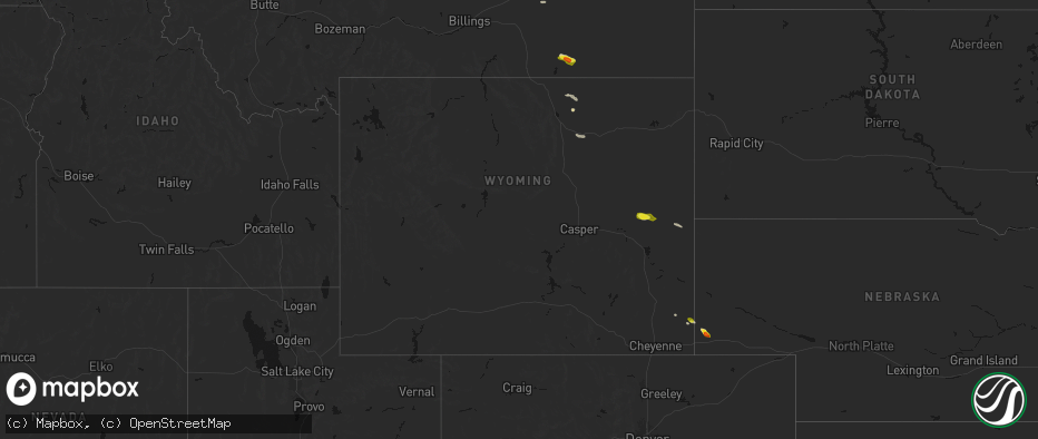
Hail Map in Wyoming on June 22, 2026
The weather event in Wyoming on June 22, 2026 includes Hail, Tornado, and Wind maps. 21 states and 419 cities were impacted and suffered possible damage. The total estimated number of properties impacted is 8,964.
Hail
Tornado
Wind
8,964
Estimated number of impacted properties by a 1.00" hail or larger3,711
Estimated number of impacted properties by a 1.75" hail or larger20
Estimated number of impacted properties by a 2.50" hail or largerStorm reports in Wyoming
Wyoming
| Date | Description |
|---|---|
| 06/22/20265:36 PM CDT | Broken windshields reported. |
| 06/22/20265:17 PM CDT | Reports of ping-pong ball sized hail covering the ground in the wake of the storm. |
| 06/22/20265:09 PM CDT | A local report indicates 67 MPH wind near 17 SSE Wright |
| 06/22/20264:47 PM CDT | A local report indicates 1.00 inch wind near 8 SSE Lusk |
| 06/22/20264:25 PM CDT | A local report indicates 1.50 inch wind near Wright |
| 06/22/20264:23 PM CDT | Reported along highway 387. Emergency manager reports no damage in wright. |
| 06/22/20264:18 PM CDT | A local report indicates 1.00 inch wind near 4 W Lusk |
| 06/22/20264:03 PM CDT | Photos taken along highway 50 relayed from the public by emergency management. Intermittant tornado touchdowns now span 235 pm to 303 pm on this storm. Most photos show |
| 06/22/20263:55 PM CDT | Powder river energy corporation reports structural damage and 13 power poles snapped off due to confirmed tornado. Time estimated. |
| 06/22/20263:48 PM CDT | Reports of several intermittant touchdowns from local emergency management and fire service officials with visual rotation continuing in between. Additional photo recie |
| 06/22/20263:47 PM CDT | A local report indicates 1.00 inch wind near 10 N Van Tassell |
| 06/22/20263:44 PM CDT | A local report indicates 81 MPH wind near 10 WNW Savageton |
| 06/22/20263:35 PM CDT | Photo and video received. |
| 06/22/20262:39 PM CDT | A local report indicates 1.00 inch wind near 6 NNW Albin |
| 06/21/20269:30 PM CDT | Falling now. |
| 06/21/20268:55 PM CDT | Largest stones quarter size. Time estimated based on radar. |
| 06/21/20268:46 PM CDT | Mesonet station wy18 halleck ridge |
| 06/21/20268:41 PM CDT | Most stones were nickels and dimes... Largest were quarters. Very strong winds also reported... But no tree damage observed at residence. Time estimated based on radar. |
| 06/21/20268:16 PM CDT | Mesonet station wy15 14.5 e sinclair |
| 06/21/20268:13 PM CDT | Video via social media. Time estimated. |
| 06/21/20268:10 PM CDT | Photo of hail of at least quarter size received via social media. Time estimated based on radar. |
| 06/21/20268:07 PM CDT | Arrived at location around 735 pm mdt to find golf ball sized hail up to two inch hail still laying on the ground. Time of hail estimated by radar. |
| 06/21/20268:03 PM CDT | No damage or significant wind reported with the hail. Time estimated based on radar. |
| 06/21/20268:01 PM CDT | Measured on a personal weather station. |
| 06/21/20268:01 PM CDT | A local report indicates 1.00 inch wind near 6 N Dwtn Gillette |
| 06/21/20268:01 PM CDT | A local report indicates 60 MPH wind near 6 N Dwtn Gillette |
| 06/21/20267:58 PM CDT | A local report indicates 66 MPH wind near 5 NNW Dwtn Gillette |
| 06/21/20267:49 PM CDT | At rawhide mine. Hail briefly covered the ground. Time estimated based on radar. |
| 06/21/20267:45 PM CDT | Asos station krwl 1 ene rawlins. |
| 06/21/20267:00 PM CDT | A local report indicates 1.50 inch wind near 1 E Leiter |
All States Impacted by Hail Map on June 22, 2026
Cities Impacted by Hail Map on June 22, 2026
- Bighorn, MT
- Lagrange, WY
- Riverside, NJ
- Beverly, NJ
- Willingboro, NJ
- Riverton, NJ
- Burlington, NJ
- Bordentown, NJ
- Mount Holly, NJ
- Moorestown, NJ
- Palm City, FL
- Port Saint Lucie, FL
- Columbus, NJ
- Chesterfield, NJ
- Wrightstown, NJ
- Florence, NJ
- Allentown, NJ
- Trenton, NJ
- Buffalo, WY
- Palmyra, NJ
- Philadelphia, PA
- Cream Ridge, NJ
- Myakka City, FL
- Parrish, FL
- Newton, GA
- Jobstown, NJ
- Albin, WY
- Clearmont, WY
- Stanley, VA
- Shenandoah, VA
- Moultrie, GA
- Birney, MT
- Fort Stockton, TX
- Shawnee, WY
- Douglas, WY
- Bushnell, NE
- Kimball, NE
- Bowling Green, FL
- Ona, FL
- Lost Springs, WY
- Pine Bluffs, WY
- Harrisburg, NE
- Lusk, WY
- Decker, MT
- Marathon, TX
- Ardmore, AL
- Toney, AL
- Elkmont, AL
- Athens, AL
- Troy, AL
- Harrison, NE
- Gillette, WY
- Otter, MT
- Banks, AL
- Harvest, AL
- Manville, WY
- Huntsville, AL
- Meridianville, AL
- Ochopee, FL
- Manassas, VA
- Clifton, VA
- Fountain, CO
- Colorado Springs, CO
- Hazel Green, AL
- Nashville, GA
- Arcadia, FL
- Labelle, FL
- New Market, AL
- Louisville, AL
- Midway, AL
- Clayton, AL
- Arvada, WY
- Huntland, TN
- Burke, VA
- Fairfax Station, VA
- Fairfax, VA
- Lehigh Acres, FL
- Immokalee, FL
- Venus, FL
- Elora, TN
- Flintville, TN
- Gurley, AL
- Princeton, AL
- Estillfork, AL
- Scottsboro, AL
- Recluse, WY
- Dix, NE
- Padroni, CO
- Peetz, CO
- Wright, WY
- Moore Haven, FL
- Jackson, GA
- Griffin, GA
- Fackler, AL
- Stevenson, AL
- Sherwood, TN
- South Pittsburg, TN
- Hollywood, AL
- Bridgeport, AL
- Flat Rock, AL
- Glenmoore, PA
- Downingtown, PA
- Chester Springs, PA
- Clewiston, FL
- Devils Tower, WY
- Kaycee, WY
- Jay Em, WY
- Ider, AL
- Pisgah, AL
- Trenton, GA
- Rising Fawn, GA
- Jasper, TN
- Bryant, AL
- Guild, TN
- Higdon, AL
- Torrington, WY
- Fort Myers, FL
- Moorcroft, WY
- Pennsauken, NJ
- Centreville, VA
- Honey Brook, PA
- Elverson, PA
- Union Grove, NC
- Hamptonville, NC
- Wildwood, GA
- Crane, TX
- Sundance, WY
- Bridgeport, NJ
- Lodge Grass, MT
- Levittown, PA
- Fairless Hills, PA
- Morrisville, PA
- Langhorne, PA
- Swedesboro, NJ
- Gibbstown, NJ
- Ridley Park, PA
- Crum Lynne, PA
- Harmony, NC
- New Raymer, CO
- Sterling, CO
- Iliff, CO
- Chattanooga, TN
- Ooltewah, TN
- Rossville, GA
- Ringgold, GA
- Flintstone, GA
- Whiteside, TN
- Lookout Mountain, TN
- Lookout Mountain, GA
- Fort Oglethorpe, GA
- Chickamauga, GA
- Whitwell, TN
- Bristol, PA
- Mickleton, NJ
- Mullica Hill, NJ
- Clarksboro, NJ
- Winston Salem, NC
- Danbury, NC
- Boone, CO
- Lead, SD
- Deadwood, SD
- Sturgis, SD
- Wyola, MT
- McDonald, TN
- Cohutta, GA
- Harrison, TN
- Apison, TN
- Cleveland, TN
- Queenstown, MD
- Lake Wales, FL
- Sheridan, WY
- Nemo, SD
- Crandall, GA
- Dalton, GA
- Old Fort, TN
- Piedmont, SD
- Shady Side, MD
- Stevensville, MD
- Churchton, MD
- Easton, MD
- Claiborne, MD
- Wye Mills, MD
- Grasonville, MD
- Fleming, CO
- McCamey, TX
- Haines City, FL
- Lance Creek, WY
- Merino, CO
- Pemberton, NJ
- Browns Mills, NJ
- Midkiff, TX
- Midland, TX
- Saint Michaels, MD
- Atwood, CO
- Queen Anne, MD
- Cordova, MD
- Mcdaniel, MD
- Odessa, TX
- Frostproof, FL
- Williamstown, NJ
- Hammonton, NJ
- Sicklerville, NJ
- Glenburn, ND
- Deering, ND
- Reliance, TN
- Benton, TN
- Ocoee, TN
- Charleston, TN
- Cisco, GA
- Copperhill, TN
- Fowler, CO
- Akron, CO
- Otis, CO
- Mitchell, NE
- Kenansville, FL
- River Ranch, FL
- Black Hawk, SD
- Hillsboro, MD
- Denton, MD
- Wittman, MD
- Morrill, NE
- Ridgely, MD
- Scottsbluff, NE
- Rapid City, SD
- Snyder, CO
- Gering, NE
- Minatare, NE
- Bayard, NE
- Mcgrew, NE
- Melbeta, NE
- Olney Springs, CO
- Manzanola, CO
- Rocky Ford, CO
- Ordway, CO
- Kim, CO
- Box Elder, SD
- La Junta, CO
- Dalton, NE
- Bridgeport, NE
- Potter, NE
- Yuma, CO
- Broadwater, NE
- Gurley, NE
- Cope, CO
- Joes, CO
- Anton, CO
- Trinidad, CO
- Rozet, WY
- Upton, WY
- Williamsburg, VA
- Las Animas, CO
- Hayes, VA
- Gloucester, VA
- Lodgepole, NE
- Sidney, NE
- Newcastle, WY
- Seibert, CO
- Vona, CO
- Flagler, CO
- Yorktown, VA
- Newport News, VA
- Chunky, MS
- Enterprise, MS
- Kirk, CO
- Stratton, CO
- Seaford, VA
- Osage, WY
- Homer, LA
- Bethune, CO
- Stonewall, MS
- Custer, SD
- Hill City, SD
- Quitman, MS
- Downsville, LA
- Strong, AR
- Spearsville, LA
- Edgemont, SD
- Bastrop, LA
- Farmerville, LA
- Calhoun, LA
- Pringle, SD
- Burlington, CO
- Bonita, LA
- West Monroe, LA
- Fairburn, SD
- Buffalo Gap, SD
- Hot Springs, SD
- Crossett, AR
- Cheyenne Wells, CO
- Buffalo, SD
- Oral, SD
- Pine Ridge, SD
- Oglala, SD
- Manderson, SD
- Wounded Knee, SD
- Pattonville, TX
- Blossom, TX
- Deport, TX
- Batesland, SD
- Gordon, NE
- Rushville, NE
- El Dorado, AR
- Annona, TX
- Avery, TX
- Mayersville, MS
- Whitney, NE
- Rolling Fork, MS
- Yazoo City, MS
- Holly Bluff, MS
- Ruston, LA
- Louise, MS
- Fouke, AR
- Mangum, OK
- Clarksville, TX
- Allen, SD
- Lewisville, AR
- Ravenna, TX
- Choudrant, LA
- Magnolia, AR
- Ivanhoe, TX
- Hendrix, OK
- Bonham, TX
- Martin, SD
- Emerson, AR
- Detroit, TX
- Bernice, LA
- Wellington, TX
- Maud, TX
- Duke, OK
- Dubach, LA
- Eros, LA
- Arcadia, LA
- Simsboro, LA
- Garland City, AR
- Bogata, TX
- Childress, TX
- Bradley, AR
- Hope, AR
- Eldorado, OK
- Chatham, LA
- Chadron, NE
- Butler, AL
- Sweet Water, AL
- Haynesville, LA
- Stamps, AR
- Arapahoe, CO
- Plain Dealing, LA
- Doddridge, AR
- Buckner, AR
- Rodessa, LA
- Waldo, AR
- Okaton, SD
- White River, SD
- Weskan, KS
- Murdo, SD
- Douglassville, TX
- Ida, LA
- Benton, LA
- Atlanta, TX
- Sharon Springs, KS
- Tribune, KS
- Plains, KS
- Meade, KS
- Ideal, SD
- Bivins, TX
- Crawford, NE
- Leoti, KS
- Marsland, NE
- Minden, LA
- Doyline, LA
- Princeton, LA
- Haughton, LA
- Winner, SD
- Fowler, KS
- Marietta, TX
- Marienthal, KS
- Hay Springs, NE
- Burke, SD
- Laverne, OK
- Elm Grove, LA
- Balko, OK
- Deerfield, KS
- Follett, TX
- Alliance, NE
- Lakin, KS
- Paris, TX
- Gate, OK
- Forgan, OK
- Holcomb, KS
- Ellsworth, NE
- Garden City, KS
- New Boston, TX
- Hooks, TX
- Texarkana, TX
- Shattuck, OK
- Benkelman, NE
- Bingham, NE
- Lakeside, NE
- Wauneta, NE
- De Kalb, TX
- Enders, NE
- Imperial, NE
- Max, NE
- Sublette, KS
- Stratton, NE
- Hugo, OK
- Ashdown, AR
- Boswell, OK
- Ashby, NE
- Oshkosh, NE
- Ulysses, KS
- Gage, OK
- Satanta, KS
- Idabel, OK
- Hyannis, NE
- Palisade, NE
- Arnett, OK
- Oakley, KS
- Simms, TX


