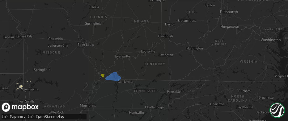
Hail Map in Kentucky on June 8, 2026
The weather event in Kentucky on June 8, 2026 includes Hail and Wind maps. 12 states and 544 cities were impacted and suffered possible damage. The total estimated number of properties impacted is 2,344.
Hail
Wind
2,344
Estimated number of impacted properties by a 1.00" hail or larger0
Estimated number of impacted properties by a 1.75" hail or larger0
Estimated number of impacted properties by a 2.50" hail or largerStorm reports in Kentucky
Kentucky
| Date | Description |
|---|---|
| 06/08/20266:10 PM CDT | A large section of a tree was downed by thunderstorm winds. |
| 06/08/20266:10 PM CDT | Several trees down in and around barlow. |
| 06/08/20266:09 PM CDT | Large tree limbs downed in barlow. |
| 06/07/20268:32 PM CDT | Large tree down on over the road. |
| 06/07/20268:28 PM CDT | Tree down on mcelrath rd. |
| 06/07/20268:08 PM CDT | Tree down in kirksey... Reported via social media. |
| 06/07/20268:04 PM CDT | Trees over at least a half dozen roads in the eastern part of the county. |
| 06/07/20267:42 PM CDT | Numerous reports of tree and powerline damage in and around mayfield. |
| 06/07/20267:40 PM CDT | State eoc relayed a report of significant roof damage to a home in mayfield. |
| 06/07/20267:39 PM CDT | Spotter estimated wind gust of 60+ mph in hickory. |
| 06/07/20267:32 PM CDT | Large tree limb down... Damaging siding to a home. |
| 06/07/20267:32 PM CDT | Corrects previous tstm wnd dmg report from symsonia. Damage to siding at a mobile home in symsonia off of ky-534. |
| 06/07/20267:26 PM CDT | Trees down onto ky-849 in dogwood. |
All States Impacted by Hail Map on June 8, 2026
Cities Impacted by Hail Map on June 8, 2026
- Wallace, NE
- Arnold, NE
- North Platte, NE
- Madrid, NE
- Stapleton, NE
- Maxwell, NE
- Strang, OK
- Vinita, OK
- Spavinaw, OK
- Elsie, NE
- Grant, NE
- Colcord, OK
- Eucha, OK
- Jay, OK
- Rose, OK
- Kansas, OK
- Brady, NE
- Twin Oaks, OK
- Watts, OK
- Kismet, KS
- Tahlequah, OK
- Locust Grove, OK
- Oaks, OK
- Peggs, OK
- Gothenburg, NE
- Cozad, NE
- Hulbert, OK
- Lexington, NE
- Oconto, NE
- Callaway, NE
- Eddyville, NE
- Noel, MO
- Pineville, MO
- Sumner, NE
- Rocky Comfort, MO
- Miller, NE
- Exeter, MO
- Washburn, MO
- Pleasanton, NE
- Amherst, NE
- Mason City, NE
- Seligman, MO
- Wauneta, NE
- Sutherland, NE
- Hayes Center, NE
- Maywood, NE
- Curtis, NE
- Wheatland, WY
- Wilsonville, NE
- Eustis, NE
- Moorefield, NE
- Lebanon, NE
- Hendley, NE
- Wellfleet, NE
- Beaver City, NE
- Bartley, NE
- Arapahoe, NE
- Edison, NE
- Yoder, WY
- Holbrook, NE
- Oxford, NE
- Golden, CO
- Wheat Ridge, CO
- Arvada, CO
- Rush, CO
- Cambridge, NE
- Culbertson, NE
- Orleans, NE
- Stamford, NE
- Broomfield, CO
- Hugo, CO
- Sedalia, CO
- Matheson, CO
- Denver, CO
- Englewood, CO
- Castle Rock, CO
- Parker, CO
- Commerce City, CO
- Booker, TX
- Ramah, CO
- Evergreen, CO
- Alma, NE
- Westminster, CO
- Long Island, KS
- Franktown, CO
- Levelland, TX
- Portland, AR
- Keyes, OK
- Follett, TX
- Thornton, CO
- Elizabeth, CO
- Republican City, NE
- Phillipsburg, KS
- Naponee, NE
- Parkdale, AR
- Kress, TX
- Goodwell, OK
- Brighton, CO
- Fort Lupton, CO
- Aurora, CO
- Kiowa, CO
- Hudson, CO
- Bennett, CO
- Watkins, CO
- Pecos, TX
- Karval, CO
- Lenora, KS
- Wray, CO
- Idalia, CO
- Saint Francis, KS
- Kit Carson, CO
- Wild Horse, CO
- Strasburg, CO
- Alton, KS
- Gaylord, KS
- Logan, KS
- Stockton, KS
- Bogue, KS
- Chugwater, WY
- Silverton, TX
- Portis, KS
- Downs, KS
- Deer Trail, CO
- Agra, KS
- Bloomington, NE
- Weldona, CO
- Fort Morgan, CO
- Byers, CO
- Glade, KS
- Agate, CO
- Clarendon, TX
- Almena, KS
- Roggen, CO
- Wiggins, CO
- Perryton, TX
- Kirwin, KS
- Kensington, KS
- Bardwell, KY
- Cheyenne, WY
- Cedar, KS
- Canadian, TX
- Wickliffe, KY
- Lubbock, TX
- Arlington, KY
- Cunningham, KY
- Fancy Farm, KY
- Esbon, KS
- Snyder, CO
- Brush, CO
- Hillrose, CO
- Keenesburg, CO
- Bayard, NE
- Minatare, NE
- Woodrow, CO
- Shallowater, TX
- Limon, CO
- Akron, CO
- Veteran, WY
- Gering, NE
- Scottsbluff, NE
- Cawker City, KS
- Glen Elder, KS
- Osborne, KS
- Merino, CO
- Woodston, KS
- Plainville, KS
- Parks, NE
- Haigler, NE
- Genoa, CO
- Arriba, CO
- Natoma, KS
- Angora, NE
- Waldo, KS
- Sterling, CO
- Mankato, KS
- Lagrange, WY
- Tipton, KS
- Beloit, KS
- Hunter, KS
- Ropesville, TX
- Darrouzett, TX
- Simla, CO
- Paradise, KS
- Lebanon, KS
- Hawk Springs, WY
- Sylvan Grove, KS
- Lucas, KS
- Luray, KS
- Meadow, TX
- Otis, CO
- Flagler, CO
- Lyman, NE
- Barnard, KS
- Lincoln, KS
- Dorrance, KS
- New Cambria, KS
- Salina, KS
- Tescott, KS
- Hardesty, OK
- Iliff, CO
- Balko, OK
- Crook, CO
- Minneapolis, KS
- Torrington, WY
- Wilson, KS
- Ellsworth, KS
- Simpson, KS
- Bunker Hill, KS
- Chappell, NE
- Yuma, CO
- Russell, KS
- Hickory, KY
- Mayfield, KY
- Kuttawa, KY
- Symsonia, KY
- Farmington, KY
- Gilbertsville, KY
- Wingo, KY
- Princeton, KY
- Kirksey, KY
- Grand Rivers, KY
- Dexter, KY
- Murray, KY
- Benton, KY
- Eddyville, KY
- Sedalia, KY
- Almo, KY
- Calvert City, KY
- Hardin, KY
- Cadiz, KY
- New Concord, KY
- Glasco, KS
- Delphos, KS
- Lorraine, KS
- Beverly, KS
- Seibert, CO
- Joes, CO
- Carlos, MN
- Miltona, MN
- Eagle Bend, MN
- Bennington, KS
- Amherst, CO
- Eckley, CO
- Paoli, CO
- Julesburg, CO
- Sedgwick, CO
- Haxtun, CO
- Ovid, CO
- Holyoke, CO
- Fleming, CO
- Padroni, CO
- Atwood, CO
- Peetz, CO
- Big Springs, NE
- Lodgepole, NE
- Vona, CO
- Solomon, KS
- Kanopolis, KS
- Stratton, CO
- Dover, TN
- Herndon, KY
- Big Rock, TN
- Bumpus Mills, TN
- Abilene, KS
- Brookville, KS
- Geneseo, KS
- Marquette, KS
- Whiteface, TX
- Lindsborg, KS
- Falun, KS
- Bethune, CO
- Kirk, CO
- Champion, NE
- Benkelman, NE
- Venango, NE
- Imperial, NE
- Burlington, CO
- Assaria, KS
- Gypsum, KS
- Alliance, NE
- Longford, KS
- Galva, KS
- Mcpherson, KS
- Hope, KS
- Roxbury, KS
- Durham, KS
- Canton, KS
- Tampa, KS
- Enders, NE
- Lehigh, KS
- Ellsworth, NE
- Little River, KS
- Lyons, KS
- Ramona, KS
- Herington, KS
- Moundridge, KS
- Hillsboro, KS
- Burdick, KS
- Walton, KS
- Lincolnville, KS
- Goessel, KS
- Lost Springs, KS
- Hesston, KS
- North Newton, KS
- Marion, KS
- Newton, KS
- Peabody, KS
- Halstead, KS
- Palisade, NE
- Dickens, NE
- Kanorado, KS
- Wakefield, KS
- Bridgeport, NE
- Goodland, KS
- Chapman, KS
- Woodbine, KS
- Enterprise, KS
- Junction City, KS
- White City, KS
- Whitewater, KS
- Sedgwick, KS
- Valley Center, KS
- Florence, KS
- Wichita, KS
- Benton, KS
- Elbing, KS
- Hershey, NE
- Windom, KS
- Manhattan, KS
- Riley, KS
- Talmage, KS
- Miltonvale, KS
- Clay Center, KS
- Fort Riley, KS
- Milford, KS
- Dwight, KS
- Ogden, KS
- Saint George, KS
- Alta Vista, KS
- Alma, KS
- Wamego, KS
- Greenwich, KS
- Kechi, KS
- Potwin, KS
- Cedar Point, KS
- Burns, KS
- Elmdale, KS
- Council Grove, KS
- Cottonwood Falls, KS
- Wilsey, KS
- Strong City, KS
- Edson, KS
- Towanda, KS
- Rose Hill, KS
- Leon, KS
- Cassoday, KS
- Augusta, KS
- Matfield Green, KS
- Emporia, KS
- Derby, KS
- Douglass, KS
- Rosalia, KS
- El Dorado, KS
- Andover, KS
- Americus, KS
- Allen, KS
- McFarland, KS
- Eskridge, KS
- Paxico, KS
- Belvue, KS
- Maple Hill, KS
- Saint Marys, KS
- Admire, KS
- Reading, KS
- Eureka, KS
- Olpe, KS
- Brewster, KS
- Rossville, KS
- Topeka, KS
- Wakarusa, KS
- Burlingame, KS
- Auburn, KS
- Harveyville, KS
- Carbondale, KS
- Vernon, CO
- Scranton, KS
- Osage City, KS
- Neosho Rapids, KS
- Hartford, KS
- Hamilton, KS
- Madison, KS
- Beaumont, KS
- Latham, KS
- Piedmont, KS
- Silver Lake, KS
- Lebo, KS
- Levant, KS
- Lyndon, KS
- Berryton, KS
- Vassar, KS
- Quenemo, KS
- Waverly, KS
- Burlington, KS
- Melvern, KS
- Neosho Falls, KS
- Virgil, KS
- Severy, KS
- Toronto, KS
- Yates Center, KS
- Le Roy, KS
- Gridley, KS
- Neal, KS
- Delia, KS
- Tecumseh, KS
- Meriden, KS
- Overbrook, KS
- Grantville, KS
- Fall River, KS
- Piqua, KS
- Westphalia, KS
- Oskaloosa, KS
- Perry, KS
- Lecompton, KS
- Ozawkie, KS
- Pomona, KS
- Lawrence, KS
- Ottawa, KS
- McLouth, KS
- Tonganoxie, KS
- Williamsburg, KS
- Baldwin City, KS
- De Soto, KS
- Gardner, KS
- Eudora, KS
- Wellsville, KS
- Olathe, KS
- Basehor, KS
- Welda, KS
- Richmond, KS
- Bonner Springs, KS
- Rantoul, KS
- Edgerton, KS
- Linwood, KS
- Colony, KS
- Garnett, KS
- Kansas City, KS
- Princeton, KS
- Lenexa, KS
- Shawnee, KS
- Paola, KS
- Spring Hill, KS
- Centerville, KS
- La Cygne, KS
- Mound City, KS
- Lane, KS
- Blue Mound, KS
- Greeley, KS
- Fontana, KS
- Osawatomie, KS
- New Century, KS
- Parker, KS
- Kincaid, KS
- Ellis, KS
- Mission, KS
- Louisburg, KS
- Stilwell, KS
- Overland Park, KS
- Prairie Village, KS
- Bucyrus, KS
- Leawood, KS
- Belton, MO
- Kansas City, MO
- Cleveland, MO
- Drexel, MO
- Pleasanton, KS
- Grandview, MO
- Peculiar, MO
- Freeman, MO
- Amsterdam, MO
- Adrian, MO
- Butler, MO
- Archie, MO
- Lees Summit, MO
- Raymore, MO
- Greenwood, MO
- Pleasant Hill, MO
- Harrisonville, MO
- La Harpe, KS
- Iola, KS
- Humboldt, KS
- Hays, KS
- Erie, KS
- Savonburg, KS
- Elsmore, KS
- Moran, KS
- Victoria, KS
- Uniontown, KS
- Gorham, KS
- Strasburg, MO
- East Lynne, MO
- Holden, MO
- Warrensburg, MO
- Chilhowee, MO
- Garden City, MO
- Creighton, MO
- Lone Jack, MO
- Grain Valley, MO
- Clinton, MO
- Urich, MO
- Leeton, MO
- Kingsville, MO
- Blairstown, MO
- Centerview, MO
- Calhoun, MO
- Jewell, KS
- Randall, KS
- Windsor, MO
- Knob Noster, MO
- Jamestown, KS
- New Raymer, CO
- Concordia, KS
- Aurora, KS
- Osceola, MO
- Lowry City, MO
- Collins, MO
- Briggsdale, CO
- Leonardville, KS
- Stoneham, CO
- Detroit Lakes, MN
- Penokee, KS
- Grover, CO
- Olsburg, KS
- Westmoreland, KS
- Bronson, KS
- Sidney, NE
- Winger, MN
- Bejou, MN
- Fertile, MN
- Ponemah, MN
- Brookport, IL
- Golconda, IL
- Lone Tree, CO
- Boaz, KY
- Paducah, KY


