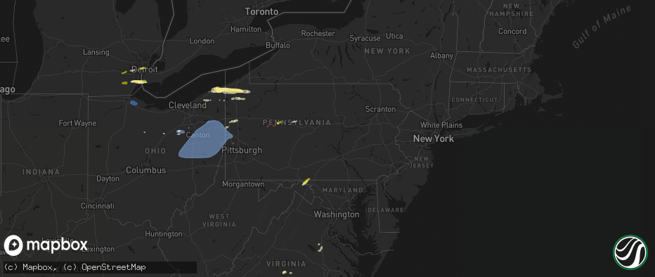
Hail Map in Pennsylvania on June 14, 2026
The weather event in Pennsylvania on June 14, 2026 includes Hail, Wind, and Tornado maps. 12 states and 249 cities were impacted and suffered possible damage. The total estimated number of properties impacted is 7,205.
Hail
Wind
Tornado
7,205
Estimated number of impacted properties by a 1.00" hail or larger0
Estimated number of impacted properties by a 1.75" hail or larger0
Estimated number of impacted properties by a 2.50" hail or largerStorm reports in Pennsylvania
Pennsylvania
| Date | Description |
|---|---|
| 06/14/20264:44 PM CDT | Down trees and damage to an above ground pool. |
| 06/14/20264:40 PM CDT | Tree down on house in warren pa. |
| 06/14/20264:40 PM CDT | Trees and wires down on 301 west street. |
| 06/14/20264:40 PM CDT | Down trees. |
| 06/14/20264:25 PM CDT | Trees down near intersection of route 127 and jimmy lane. |
| 06/14/20264:25 PM CDT | Trees and wires down near intersection of pa route 27 and selkirk road. |
| 06/14/20264:11 PM CDT | Down trees. |
| 06/14/20264:05 PM CDT | Down trees. |
| 06/14/20264:03 PM CDT | Tree blocking roadway on watson highway. |
| 06/14/20263:56 PM CDT | Multiple trees down. |
| 06/14/20263:41 PM CDT | A local report indicates 1.25 inch wind near Cambridge Springs |
| 06/14/20263:41 PM CDT | Report of trees down on state route 301 north of anita. Likely tornado damage. Time estimated from radar. |
| 06/14/20263:37 PM CDT | Report of a tornado on the ground near steves lane in ringgold township. |
| 06/14/20263:33 PM CDT | A local report indicates 60 MPH wind near Union City |
| 06/14/20263:27 PM CDT | 2 large trees down north of sagertown blocking route 19. |
| 06/14/20263:23 PM CDT | Lots of tree limbs down in the area. |
| 06/14/20263:22 PM CDT | Corrects previous tornado report from 2 sw worthville. Report of a tornado on the ground near steves lane in ringgold township. |
All States Impacted by Hail Map on June 14, 2026
Cities Impacted by Hail Map on June 14, 2026
- Ann Arbor, MI
- Ypsilanti, MI
- Dearborn, MI
- Detroit, MI
- Dundee, MI
- Milan, MI
- Maybee, MI
- Carleton, MI
- South Rockwood, MI
- Newport, MI
- Rockwood, MI
- Wayne, MI
- Westland, MI
- Walhalla, SC
- Tamassee, SC
- Salem, SC
- Six Mile, SC
- Sunset, SC
- Pickens, SC
- Canton, MI
- Inkster, MI
- Garden City, MI
- Galivants Ferry, SC
- Millbury, OH
- Curtice, OH
- Northwood, OH
- Genoa, OH
- Clay Center, OH
- Graytown, OH
- Martin, OH
- Woodville, OH
- Elmore, OH
- Jacksonville, NC
- Jesup, GA
- Maysville, NC
- Georgetown, SC
- Murrells Inlet, SC
- Myrtle Beach, SC
- Bucyrus, OH
- Van Horn, TX
- Bowersville, GA
- Canon, GA
- Geneva, OH
- Sedona, AZ
- Mansfield, OH
- Ashland, OH
- Holly Ridge, NC
- Ashtabula, OH
- Austinburg, OH
- Jefferson, OH
- Bainbridge, GA
- Climax, GA
- Belhaven, NC
- Aurora, NC
- Wooster, OH
- Whigham, GA
- Scranton, NC
- Blounts Creek, NC
- Montville, OH
- Chardon, OH
- Madison, OH
- Orrville, OH
- Sterling, OH
- Burbank, OH
- Smithville, OH
- Creswell, NC
- Windsor, OH
- Rome, OH
- Bath, NC
- Conneaut, OH
- Kingsville, OH
- Springboro, PA
- Albion, PA
- Pierpont, OH
- West Springfield, PA
- Live Oak, FL
- Columbia, NC
- Edinboro, PA
- Conneautville, PA
- Clinton, OH
- Pinetown, NC
- Willard, NC
- Burgaw, NC
- Andover, OH
- Dorset, OH
- Ringgold, PA
- Timblin, PA
- Punxsutawney, PA
- Goldsmith, TX
- Notrees, TX
- Clinton, NC
- Cambridge Springs, PA
- Venango, PA
- Linesville, PA
- Saegertown, PA
- Dillwyn, VA
- Melbourne, FL
- Anita, PA
- Reynoldsville, PA
- Meadville, PA
- Waterford, PA
- Conneaut Lake, PA
- Winslow, AZ
- Union City, PA
- Kenansville, FL
- Du Bois, PA
- Centerville, PA
- Williams, AZ
- Guys Mills, PA
- Sykesville, PA
- Spartansburg, PA
- Wagener, SC
- Enon Valley, PA
- New Castle, PA
- Bessemer, PA
- New Wilmington, PA
- Volant, PA
- Odessa, TX
- Mercer, PA
- Grove City, PA
- Clearfield, PA
- Claxton, GA
- Collins, GA
- Rio Rancho, NM
- Metter, GA
- Cobbtown, GA
- Rootstown, OH
- North Lima, OH
- Lake Milton, OH
- Newton Falls, OH
- Wilmot, OH
- Amsterdam, OH
- Wellsville, OH
- New Philadelphia, OH
- Beloit, OH
- Mineral City, OH
- Magnolia, OH
- Navarre, OH
- Alliance, OH
- Millersburg, OH
- Hanoverton, OH
- Waynesburg, OH
- Stone Creek, OH
- Baltic, OH
- Lowellville, OH
- Sebring, OH
- Newcomerstown, OH
- Bolivar, OH
- Canton, OH
- East Sparta, OH
- Beaver, PA
- Bloomingdale, OH
- Fresno, OH
- Negley, OH
- Somerdale, OH
- Stratton, OH
- Brewster, OH
- Salem, OH
- Strasburg, OH
- Minerva, OH
- Scio, OH
- Hopedale, OH
- Mechanicstown, OH
- Dover, OH
- East Liverpool, OH
- Louisville, OH
- Leetonia, OH
- East Springfield, OH
- West Lafayette, OH
- Kensington, OH
- Struthers, OH
- Gnadenhutten, OH
- Freeport, OH
- Salineville, OH
- Jewett, OH
- North Benton, OH
- Lisbon, OH
- Beach City, OH
- Homeworth, OH
- North Jackson, OH
- Tuscarawas, OH
- Sandyville, OH
- Youngstown, OH
- Hammondsville, OH
- Wampum, PA
- Dundee, OH
- East Rochester, OH
- Coshocton, OH
- New Manchester, WV
- Diamond, OH
- Warsaw, OH
- Beaver Falls, PA
- Damascus, OH
- East Canton, OH
- Washingtonville, OH
- Georgetown, PA
- Midland, PA
- Malvern, OH
- New Springfield, OH
- Bowerston, OH
- Deerfield, OH
- Massillon, OH
- Paris, OH
- Petersburg, OH
- Hartville, OH
- Cadiz, OH
- Leesville, OH
- Chester, WV
- Richmond, OH
- Limaville, OH
- Warren, OH
- Zoar, OH
- Robertsville, OH
- Uhrichsville, OH
- Berlin Center, OH
- Carrollton, OH
- Canfield, OH
- Irondale, OH
- Middlebranch, OH
- New Middletown, OH
- Dennison, OH
- Newell, WV
- New Cumberland, WV
- Sherrodsville, OH
- Summitville, OH
- Toronto, OH
- Sugarcreek, OH
- Dellroy, OH
- Empire, OH
- Bergholz, OH
- North Canton, OH
- Industry, PA
- East Palestine, OH
- New Galilee, PA
- Tippecanoe, OH
- New Waterford, OH
- Steubenville, OH
- Port Washington, OH
- New Brighton, PA
- Columbiana, OH
- Darlington, PA
- Rochester, PA
- Rogers, OH
- Atwater, OH
- Midvale, OH
- Appomattox, VA
- Frenchville, PA
- Farmville, VA
- Lorida, FL


